Maine State Route 212
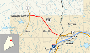
State Route 212 (SR 212) is part of Maine's highway system, running from SR 11 in Moro Plantation to U.S. Route 2 (US 2) in Smyrna (within the community of Smyrna Mills), where a local road continues to serve the town of Oakfield. The route also provides access to the town of Merrill.[2] SR 212 is 10.26 miles (16.51 km) long.
| ||||
|---|---|---|---|---|
 | ||||
| Route information | ||||
| Maintained by MaineDOT | ||||
| Length | 10.26 mi[1] (16.51 km) | |||
| Major junctions | ||||
| West end | ||||
| East end | ||||
| Location | ||||
| Counties | Aroostook | |||
| Highway system | ||||
| ||||

Major junctions
The entire route is in Aroostook County.
| Location | mi[1] | km | Destinations | Notes | |
|---|---|---|---|---|---|
| Moro Plantation | 0.00 | 0.00 | |||
| Smyrna | 10.26 | 16.51 | |||
| 1.000 mi = 1.609 km; 1.000 km = 0.621 mi | |||||
See also

References
- "Maine DOT Map Viewer". Maine Office of GIS. Retrieved September 1, 2017.
- Google (September 1, 2017). "Maine State Route 212" (Map). Google Maps. Google. Retrieved September 1, 2017.
External links
This article is issued from Wikipedia. The text is licensed under Creative Commons - Attribution - Sharealike. Additional terms may apply for the media files.