Madrid metropolitan area
The Madrid metropolitan area is a monocentric metropolitan area in the centre of the Iberian peninsula, around the city of Madrid, Spain. It is not related to any sort of administrative delimitation, and thus, its limits are ambiguous.
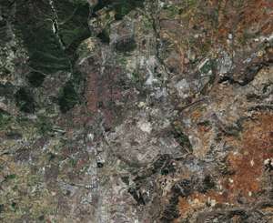
According to Populationdata.net it has an estimated 2017 population of 6,321,398 people[1] and covers an area of 5,335.97 square kilometres (2,060.23 sq mi). It is considered the largest metropolitan area in Spain, the 3rd largest in the European Union and the 54th largest in the world.[2][3][4][5]
As with many metropolitan areas of similar size, two distinct zones of urbanisation can be distinguished:
- Inner ring (primera corona): Alcorcón, Leganés, Getafe, Móstoles, Fuenlabrada, Coslada, Alcobendas, Pozuelo de Alarcón, San Fernando de Henares
- Outer ring (segunda corona): Villaviciosa de Odón, Parla, Pinto, Valdemoro, Rivas-Vaciamadrid, Torrejón de Ardoz, Alcalá de Henares, San Sebastián de los Reyes, Tres Cantos, Las Rozas de Madrid, Majadahonda, Boadilla del Monte
The largest suburbs are to the south, and in general along the main routes leading out of Madrid.
The GDP of the metropolitan area of Madrid was estimated to be 189 billion euros in 2009 and represents over 90% of the GDP of the region of Madrid.[6] The GDP per capita was 37,758 euros in the metropolitan area while it reached 30,453 euros for the Madrid region.
Demographics
| Rank | Municipality | Population (2019)[7] | Area km² |
|---|---|---|---|
| 1 | Madrid | 3,266,126 | 604.3 |
| 2 | Móstoles | 209,184 | 45 |
| 3 | Alcalá de Henares | 195,649 | 88 |
| 4 | Fuenlabrada | 193,700 | 39.1 |
| 5 | Leganés | 189,861 | 43.1 |
| 6 | Getafe | 183,374 | 78.7 |
| 7 | Alcorcón | 170,514 | 33.7 |
| 8 | Torrejón de Ardoz | 131,376 | 32.6 |
| 9 | Parla | 130,124 | 24.4 |
| 10 | Alcobendas | 117,040 | 45 |
| 11 | Las Rozas de Madrid | 95,814 | 58.3 |
| 12 | San Sebastián de los Reyes | 89,276 | 58.7 |
| 13 | Rivas-Vaciamadrid | 88,150 | 67.4 |
| 14 | Pozuelo de Alarcón | 86,422 | 43.2 |
| 15 | Coslada | 81,661 | 12 |
| 16 | Valdemoro | 75,983 | 64.5 |
| 17 | Majadahonda | 71,826 | 38.5 |
| 18 | Arganda del Rey | 55,389 | 79.7 |
| 19 | Boadilla del Monte | 54,570 | 47.2 |
| 20 | Pinto | 52,526 | 62.2 |
| 21 | Colmenar Viejo | 50,752 | 182.6 |
| 22 | Tres Cantos | 47,722 | 38 |
| 23 | San Fernando de Henares | 39,431 | 38.8 |
| 24 | Arroyomolinos | 31,396 | 20.7 |
| 25 | Navalcarnero | 29,298 | 100.2 |
| 26 | Villaviciosa de Odón | 27,835 | 68.1 |
| 27 | Paracuellos de Jarama | 25,269 | 17 |
| 28 | Ciempozuelos | 24,592 | 49.6 |
| 29 | Mejorada del Campo | 23,274 | 17.2 |
See also
References
- (in Spanish) AUDES5 project.
- PopulationData.net – Spain
- "World Urban Areas: Population & Density" (PDF). Demographia. Retrieved 2008-08-10.
- Eurostat, Urban Audit database Archived 2011-04-06 at the Wayback Machine, accessed on 2009-03-12. Data for 2004.
- Thomas Brinkoff, Principal Agglomerations of the World, accessed on 2009-03-12. Data for 2009-01-01.
- United Nations Department of Economic and Social Affairs, World Urbanisation Prospects (2007 revision), (United Nations, 2008), Table A.12. Data for 2007.
- (in Spanish)http://www.madrid.org/iestadis/fijas/estructu/economicas/contabilidad/descarga/ipibmt1.xls
- "Cifras oficiales de población resultantes de la revisión del Padrón municipal a 1 de enero". Instituto Nacional de Estadistica. Retrieved March 30, 2020.
| Authority control |
|
|---|