Mackenzie Mountains
The Mackenzie Mountains are a Canadian mountain range forming part of the Yukon-Northwest Territories boundary between the Liard and Peel rivers. The range is named in honour of Canada's second prime minister, Alexander Mackenzie.[1] Nahanni National Park Reserve and Nááts'ihch'oh National Park Reserve are in the Mackenzie Mountains.
| Mackenzie Mountains | |
|---|---|
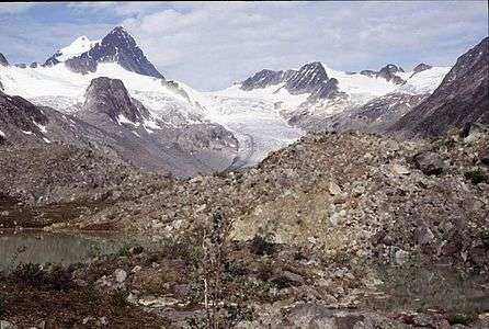 Keele Peak, 2005 | |
| Highest point | |
| Peak | Keele Peak |
| Elevation | 2,972 m (9,751 ft) |
| Coordinates | 63°25′53″N 130°19′26″W |
| Geography | |
| Country | Canada |
| Territories | Yukon and Northwest Territories |
| Range coordinates | 64°N 128°W |
The mining town of Tungsten, site of the Cantung Mine, is in the Mackenzie Mountains. Only two roads lead into the Mackenzie Mountains, both in Yukon: the Nahanni Range Road leading to the townsite of Tungsten and the Canol Road leading to the Macmillan Pass.
The highest mountain in this range is Keele Peak at 2,972 m (9,751 ft). The second-highest mountain is Mount Nirvana. It is, at 2,773 m (9,098 ft), the highest mountain in the Northwest Territories.
The Silurian fish family Archipelepididae has been described from specimens found in the Mackenzie Mountains.[2]
References
- Mackenzie Mountains
- Soehn, K. L., Märss, T., Caldwell, M. W. & Wilson, M. V. H., 2001: New and biostratigraphically useful thelodonts from the Silurian of the Mackenzie Mountains, Northwest Territories, Canada. Journal of Vertebrate Paleontology, 21: 651-659
Further reading
- Aitken, J. D. (1991). The Ice Brook Formation and post-Rapitan, Late Proterozoic glaciation, Mackenzie Mountains, Northwest Territories. [Ottawa]: Energy, Mines and Resources Canada. ISBN 0-660-13838-7
- EXCELeration Corp. (2000). Benefits of outfitted hunting in the NWT Mackenzie mountains. Calgary: EXCELeration Corp.
- Hanke, G. F., Wilson, M. V., & Lindoe, L. A. (2001). New species of Silurian acanthodians from the Mackenzie Mountains, Canada. Canadian Journal of Earth Sciences. 38 (11), 1517.
- James, N., Narbonne, G., & Kyser, T. (2001). Late Neoproterozoic cap carbonates: Mackenzie Mountains, northwestern Canada: precipitation and global glacial meltdown. Canadian Journal of Earth Sciences. 38, 1229–1262.
- Keele, J. (1910). A reconnaissance across the Mackenzie mountains on the Pelly, Ross, and Gravel rivers, Yukon, and North West territories. Ottawa: Government printing bureau.
- Latour, Paul B. A Survey of Dall's Sheep in Zone E/1-1, Northern Mackenzie Mountains. Norman Wells, NWT: Dept. of Renewable Resources, Govt. of the Northwest Territories, 1992.
- Miller, S. J., Barichello, N., & Tait, D. E. N. (1982). The grizzly bears of the Mackenzie Mountains, Northwest Territories. Yellowknife, N.W.T.: N.W.T. Wildlife Service.
- Morrow, D. W., & Cook, D. G. (1987). The Prairie Creek Embayment and Lower Paleozoic strata of the southern Mackenzie Mountains. Ottawa, Canada: Energy, Mines and Resources Canada. ISBN 0-660-12516-1
- Porsild, A. E. (1940). The Alpine flora of the east slope of Mackenzie mountains, Northwest territories. Ottawa: E. Cloutier, Printer to the King.
External links
| Wikimedia Commons has media related to Mackenzie Mountains. |
- Climate change in the Mackenzie Mountains (1995), Liang, L, Kershaw, G.P. Climate Research
- Mountain goat survey, Flat River area, Western Mackenzie Mountains (2004). Artier, N.C.L. Dept of Resources, Wildlife, and Economic Development, Gov't of the NWT.