Lugano-Paradiso railway station
Lugano-Paradiso is a railway station in the municipality of Paradiso in the Swiss canton of Ticino. The station is on the Gotthard railway of the Swiss Federal Railways, between Lugano and Chiasso.[1][2]
Lugano-Paradiso | |||||||||||
|---|---|---|---|---|---|---|---|---|---|---|---|
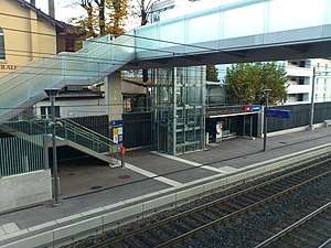 The north side (Chiasso bound) of Lugano-Paradiso station. | |||||||||||
| Location | Paradiso, Ticino, Switzerland | ||||||||||
| Coordinates | 45°59′21″N 08°56′47″E | ||||||||||
| Elevation | 302 m (991 ft) AMSL | ||||||||||
| Owned by | Swiss Federal Railways | ||||||||||
| Operated by | Treni Regionali Ticino Lombardia (TILO) | ||||||||||
| Line(s) | Gotthard | ||||||||||
| Distance | 182.8 km (113.6 mi) from Immensee[1] | ||||||||||
| Connections | Monte San Salvatore funicular Trasporti Pubblici Luganesi bus AutoPostale bus | ||||||||||
| History | |||||||||||
| Opened | December 6, 1874 | ||||||||||
| Electrified | February 6, 1922 | ||||||||||
| Services | |||||||||||
| |||||||||||
| Location | |||||||||||
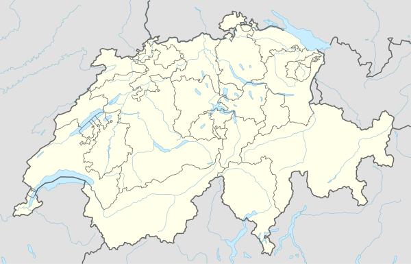 Lugano-Paradiso railway station (Switzerland) | |||||||||||
Service
The station is served by the following passenger trains:[3]
| Operator | Train Type | Route | Typical Frequency | Notes |
|---|---|---|---|---|
| Treni Regionali Ticino Lombardia | S10 | Biasca - Castione-Arbedo - Bellinzona - Giubiasco - Rivera-Bironico - Mezzovico - Taverne-Torricella - Lamone-Cadempino - Lugano - Lugano-Paradiso - Melide - Maroggia-Melano - Capolago-Riva San Vitale - Mendrisio - Balerna - Chiasso - Como San Giovanni - Albate-Camerlata | 2 per hour; 1 per hour beyond Castione-Arbedo and Chiasso | A few trains extend to Airolo and Milan |
The Monte San Salvatore funicular crosses above Lugano-Paradiso railway station on a bridge. Its lower terminal is some 350 metres (1,150 ft) walk to the north of the station.[4]
Urban bus route 1 of the Trasporti Pubblici Luganesi (TPL) serves a stop on the south side of the station, as do regional buses of the AutoPostale to Agnuzzo, Bissone, Carabietta and Morcote. TPL urban routes 1 and 2 also serve the Paradiso Gerreta stop some 500 metres (1,600 ft) to the north of the station at Paradiso Gerreta.[4]
Gallery
 The south side
 A TiLo FLIRT train in the station, and a car of the funicular passing overhead.
References
- Eisenbahnatlas Schweiz. Verlag Schweers + Wall GmbH. 2012. p. 59. ISBN 978-3-89494-130-7.
- map.geo.admin.ch (Map). Swiss Confederation. Retrieved 2012-07-17.
- "Airolo–Chiasso–Albate-Camerlata" (PDF). Ufficio federale dei trasporti. Retrieved 2013-02-15.
- "Schema di rete - Trasporti pubblici" [Network diagram - Public transport] (in Italian). Canton of Ticino. Archived from the original on 2012-10-30. Retrieved 2012-09-19.
External links
