Loch Benachally
Loch Benachally is a large shallow freshwater reservoir that is located close to the Forest of Clunie in Perth and Kinross, Scotland.[1] [2]
| Loch Benachally | |
|---|---|
 The summit of Spurn Hill looking south by south-east to Loch Benachally in the distance. | |
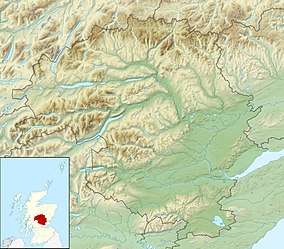 Loch Benachally Location in Perth and Kinross | |
| Location | NO071502 |
| Coordinates | 56.635°N 3.516°W |
| Type | freshwater reservoir |
| Primary outflows | Benachally Burn |
| Max. length | 1.641 km (1.020 mi)[1] |
| Max. width | 0.74 km (0.46 mi)[1] |
| Surface area | 173 ha (430 acres)[2] |
| Average depth | 24.93 ft (7.60 m)[1] |
| Max. depth | 63.97 ft (19.50 m)[1] |
| Water volume | 179,777,998 cu ft (5,090,746.0 m3)[1] |
| Shore length1 | 4 km (2.5 mi) [2] |
| Surface elevation | 308 m (1,010 ft)[2] |
| Max. temperature | 57.2 °F (14.0 °C) |
| Min. temperature | 48.8 °F (9.3 °C) |
| Islands | 0 |
| 1 Shore length is not a well-defined measure. | |
The reservoir is operated by Scottish Water.[3]
Iron Age villages
Directly south-east of the reservoir are the remains of an Iron Age hut circle settlement and field system, centred on NO08354982, that can clearly be seen from an aerial view.[4] The settlement consisted of a line of 6 hut circles connected by a common baulk, with a isolated hut about 37 metres (121 ft) to the east.[4] The huts range from 13 metres (43 ft) down to 8.3 metres (27 ft) between wall centres. Some huts have stone enclosures.[4] The field system of the Iron Age settlement has been visibly preserved down the ages and is marked with the remains of lynchets, walls and heaps of cleared stone.[4] As the huts are in a straight line, they resemble a street. The conspicuousness of the "street" is enhanced by a wall which runs parallel to the row of houses, 15 metres (49 ft) to the south.[4]
To the east-north-east of the Loch Benachally directly from the dam at the very south of the loch, is another Iron Age hut circle settlement and field system.[4] Here as well, the field system is easily recognisable.[4] The hut circle settlement follows a north-west to south-east orientation and is a larger settlement with 12 hut circles.[4] The huts measure from 11.3 metres (37 ft) down to 3.7 metres (12 ft) between wall centres.[4] There are two fields—a large field to the north and west of the hut circle group, and a small field to the south.[4]
References
- John, Murray; Lawrence, Pullar. Bathymetrical Survey of the Fresh-Water Lochs of Scotland, 1897–1909 Lochs of the Tay Basin Volume II – Loch Benachally Reservoir. National Library of Scotland. p. 121. Retrieved 14 June 2020.

- "Benachally". Centre for Ecology and Hydrology. Scotland and Northern Ireland Forum for Environmental Research (SNIFFER). Retrieved 14 June 2020.
- "Benachally, Loch". Gazetteer for Scotland. Retrieved 19 June 2020.
- "Loch Benachally". Canmore. National Record of the Historic Environment. Retrieved 20 June 2020.