Llanbedr, Crickhowell
Llanbedr is a small village 2 miles (3.2 km) northeast of Crickhowell in the county of Powys in south Wales. It lies above the river known as the Grwyne Fechan just above its confluence with the Grwyne Fawr in the southern reaches of the Black Mountains range. The village lies within the shadow of Table Mountain, an outlying spur of Pen Cerrig-calch on which is perched the Iron Age hill fort of Crug Hywel.[1]
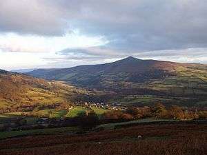
Llanbedr from the west, with the Sugar Loaf in the background
The church of St Peter is a grade II* listed building.
References
- Ordnance Survey Explorer map OL13 'Brecon Beacons National Park: eastern area'
This article is issued from Wikipedia. The text is licensed under Creative Commons - Attribution - Sharealike. Additional terms may apply for the media files.