Littlefork, Minnesota
Littlefork is a city in Koochiching County, Minnesota, United States. The population was 647 at the 2010 census.[6]
Littlefork | |
|---|---|
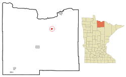 Location of the city of Littlefork within Koochiching County, Minnesota | |
| Coordinates: 48°23′52″N 93°33′25″W | |
| Country | United States |
| State | Minnesota |
| County | Koochiching |
| Area | |
| • Total | 1.19 sq mi (3.08 km2) |
| • Land | 1.19 sq mi (3.08 km2) |
| • Water | 0.00 sq mi (0.00 km2) |
| Elevation | 1,115 ft (340 m) |
| Population | |
| • Total | 647 |
| • Estimate (2018)[3] | 605 |
| • Density | 512.61/sq mi (197.86/km2) |
| Time zone | UTC-6 (Central (CST)) |
| • Summer (DST) | UTC-5 (CDT) |
| ZIP code | 56653 |
| Area code(s) | 218 |
| FIPS code | 27-37592[4] |
| GNIS feature ID | 0646969[5] |
| Website | www.cityoflittlefork.com |
U.S. Highway 71 and State Highways 65 and 217 are three of the main routes in Littlefork.
History
A post office called Littlefork has been in operation since 1902.[7] The city was named for the nearby Little Fork River.
Geography
According to the United States Census Bureau, the city has a total area of 1.19 square miles (3.08 km2), all of it land.[8]
Demographics
| Historical population | |||
|---|---|---|---|
| Census | Pop. | %± | |
| 1910 | 104 | — | |
| 1920 | 397 | 281.7% | |
| 1930 | 474 | 19.4% | |
| 1940 | 608 | 28.3% | |
| 1950 | 671 | 10.4% | |
| 1960 | 805 | 20.0% | |
| 1970 | 824 | 2.4% | |
| 1980 | 918 | 11.4% | |
| 1990 | 838 | −8.7% | |
| 2000 | 680 | −18.9% | |
| 2010 | 647 | −4.9% | |
| Est. 2018 | 605 | [3] | −6.5% |
| U.S. Decennial Census[9] | |||
2010 census
As of the census[2] of 2010, there were 647 people, 258 households, and 154 families living in the city. The population density was 543.7 inhabitants per square mile (209.9/km2). There were 296 housing units at an average density of 248.7 per square mile (96.0/km2). The racial makeup of the city was 99.1% White, 0.2% African American, 0.3% Native American, 0.2% from other races, and 0.3% from two or more races. Hispanic or Latino of any race were 0.6% of the population.
There were 258 households of which 24.0% had children under the age of 18 living with them, 49.2% were married couples living together, 7.4% had a female householder with no husband present, 3.1% had a male householder with no wife present, and 40.3% were non-families. 33.3% of all households were made up of individuals and 19.4% had someone living alone who was 65 years of age or older. The average household size was 2.33 and the average family size was 3.04.
The median age in the city was 47.3 years. 23% of residents were under the age of 18; 5.7% were between the ages of 18 and 24; 18.6% were from 25 to 44; 28.8% were from 45 to 64; and 23.8% were 65 years of age or older. The gender makeup of the city was 45.7% male and 54.3% female.
2000 census
As of the census[4] of 2000, there were 680 people, 268 households, and 177 families living in the city. The population density was 577.1 people per square mile (222.5/km²). There were 302 housing units at an average density of 256.3 per square mile (98.8/km²). The racial makeup of the city was 99.41% white, and 0.59% from two or more races. Hispanic or Latino of any race were 0.74% of the population.
There were 268 households out of which 31.3% had children under the age of 18 living with them, 54.9% were married couples living together, 7.5% had a female householder with no husband present, and 33.6% were non-families. 30.6% of all households were made up of individuals and 17.9% had someone living alone who was 65 years of age or older. The average household size was 2.37 and the average family size was 2.97.
In the city, the population was spread out with 25.0% under the age of 18, 5.3% from 18 to 24, 23.1% from 25 to 44, 23.5% from 45 to 64, and 23.1% who were 65 years of age or older. The median age was 43 years. For every 100 females, there were 89.4 males. For every 100 females age 18 and over, there were 88.9 males.
The median income for a household in the city was $37,917, and the median income for a family was $51,417. Males had a median income of $40,000 versus $25,313 for females. The per capita income for the city was $18,532. About 4.8% of families and 8.7% of the population were below the poverty line, including 9.8% of those under age 18 and 14.7% of those age 65 or over.
Notable people
- Tim Babcock, Governor of Montana, was born in Littlefork.[10]
References
- "2017 U.S. Gazetteer Files". United States Census Bureau. Retrieved Jan 3, 2019.
- "U.S. Census website". United States Census Bureau. Retrieved 2012-11-13.
- "Population and Housing Unit Estimates". Retrieved March 9, 2020.
- "U.S. Census website". United States Census Bureau. Retrieved 2008-01-31.
- "US Board on Geographic Names". United States Geological Survey. 2007-10-25. Retrieved 2008-01-31.
- "2010 Census Redistricting Data (Public Law 94-171) Summary File". American FactFinder. U.S. Census Bureau, 2010 Census. Retrieved 23 April 2011.
- "Koochiching County". Jim Forte Postal History. Retrieved 17 July 2015.
- "US Gazetteer files 2010". United States Census Bureau. Archived from the original on 2012-07-02. Retrieved 2012-11-13.
- "Census of Population and Housing". Census.gov. Retrieved June 4, 2015.
- Former Governors of Montana Archived 2012-08-20 at the Wayback Machine
External links
Municipalities and communities of Koochiching County, Minnesota, United States | ||
|---|---|---|
| Cities | 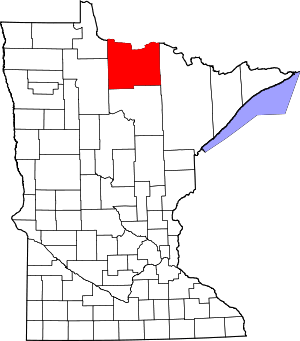 Map of Minnesota highlighting Koochiching County | |
| Unorganized territories | ||
| Unincorporated communities | ||
| Indian reservations | ||
| Ghost towns | ||
| Footnotes | ‡This populated place also has portions in an adjacent county or counties | |
| Authority control |
|
|---|