Listed buildings in New Mills
New Mills is a civil parish in High Peak, Derbyshire. It contains 65 listed buildings, which are designated by Historic England and recorded in the National Heritage List for England. Of these, one (Torr Vale Mill) is listed at Grade II*; the rest are at Grade II. Hague Bridge and Borderstone/Hope Cottage have two listings, as they span parish boundaries.
List of buildings
| Name | Location | Completed | Date listed | Geo-coordinates | Designation | Image | Ref. |
|---|---|---|---|---|---|---|---|
| No. 31 | Batemill Road | 18th century | 19 September 1977 | 53°22′35″N 1°59′32″W | Grade II | 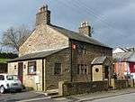 No. 31 | [1] |
| Ladyshawe House | Bridge Street | Mid-18th century | 19 September 1977 | 53°22′22″N 1°59′46″W | Grade II | 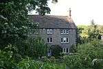 Ladyshawe House | [2] |
| Former barn to Number 44 (Ladyshawe House) | Bridge Street | Dated 1759 | 19 September 1977 | 53°22′21″N 1°59′46″W | Grade II | .JPG) Former barn to Number 44 (Ladyshawe House) | [3] |
| Borderstone, that part in Marple | Brook Bottom | Early–mid-19th century | 17 February 1978 | 53°22′29″N 2°01′22″W | Grade II |  Borderstone, that part in Marple | [4] |
| Fox Inn | Brook Bottom | 18th century | 19 September 1977 | 53°22′28″N 2°01′23″W | Grade II | 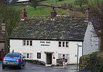 Fox Inn | [5] |
| Cottage adjoining rear of Fox Inn | Brook Bottom | 18th or early 19th century | 19 September 1977 | 53°22′28″N 2°01′23″W | Grade II | 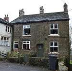 Cottage adjoining rear of Fox Inn | [6] |
| Fox Cottage and cottage adjoining | Brook Bottom | 18th century | 19 September 1977 | 53°22′28″N 2°01′24″W | Grade II | 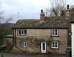 Fox Cottage and cottage adjoining | [7] |
| Gilbodygate Farmhouse | Brook Bottom | 18th century | 19 September 1977 | 53°22′27″N 2°01′23″W | Grade II | 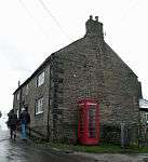 Gilbodygate Farmhouse | [8] |
| Hope Cottage | Brook Bottom | 18th century | 19 September 1977 | 53°22′29″N 2°01′22″W | Grade II | Hope Cottage | [9] |
| Rivelin | Brook Bottom | 18th century | 17 February 1978 | 53°22′29″N 2°01′22″W | Grade II |  Rivelin | [10] |
| Tara Cottage | Brook Bottom | Early 18th century | 11 October 1985 | 53°22′29″N 2°01′21″W | Grade II |  Tara Cottage | [11] |
| Footbridge at New Mills Station | New Mills Newtown railway station, Buxton Road | Mid-19th century | 19 September 1977 | 53°21′34″N 2°00′30″W | Grade II | 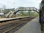 Footbridge at New Mills Station | [12] |
| Peak Forest Canal overbridge on Peak Forest Canal near Buxton Road | Peak Forest Canal, Buxton Road | Early–mid-19th century | 19 September 1977 | 53°21′27″N 2°00′01″W | Grade II | 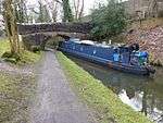 Peak Forest Canal overbridge on Peak Forest Canal near Buxton Road | [13] |
| Church of St George | Church Road | 1897–98 | 2 November 1955 | 53°21′57″N 1°59′39″W | Grade II | 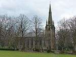 Church of St George | [14] |
| The New Mills School | Church Lane | 1912 | 15 June 2009 | 53°22′01″N 1°59′46″W | Grade II | 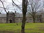 The New Mills School | [15] |
| Eaves Knoll Farmhouse and attached farm building | Eaves Knoll Road | 17th century origins | 19 September 1977 | 53°22′17″N 2°00′28″W | Grade II | 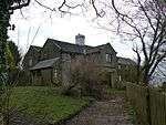 Eaves Knoll Farmhouse and attached farm building | [16] |
| Hague Fold Farmhouse | Hague Bar | Probably 17th century | 19 September 1977 | 53°22′14″N 2°01′12″W | Grade II | 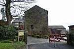 Hague Fold Farmhouse | [17] |
| Lower Hague Fold Farmhouse | Hague Bar | 17th century | 19 September 1977 | 53°22′14″N 2°01′15″W | Grade II | 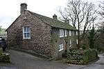 Lower Hague Fold Farmhouse | [18] |
| Nos 34 and 36 (former bank building and attached boundary wall) | High Street/Church View | Dated 1862 | 18 May 1990 | 53°22′04″N 2°00′03″W | Grade II | 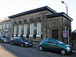 Nos 34 and 36 (former bank building and attached boundary wall) | [19] |
| No. 66 | High Street | 18th century | 19 September 1977 | 53°22′07″N 2°00′00″W | Grade II | 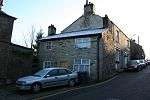 No. 66 | [20] |
| Nos. 109 and 111 | High Street | 18th century | 19 September 1977 | 53°22′13″N 1°59′56″W | Grade II | 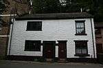 Nos. 109 and 111 | [21] |
| No. 117 [aka The Drunkard's Reform] | High Street | Mid-19th century | 19 September 1977 | 53°22′14″N 1°59′55″W | Grade II | 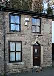 No. 117 [aka The Drunkard's Reform | [22] |
| The Bridge | High Street | Medieval | 19 September 1977 | 53°22′11″N 1°59′55″W | Grade II | 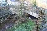 The Bridge | [23] |
| The George Hotel [former] | High Street | Early 19th century | 19 September 1977 | 53°22′08″N 2°00′00″W | Grade II | 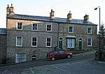 The George Hotel [former] | [24] |
| K6 Telephone Kiosk | High Street | Designed 1935 | 14 January 1993 | 53°22′02″N 2°00′06″W | Grade II | 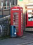 K6 Telephone Kiosk | [25] |
| New Mills Free Church | High Street | 1844 | 19 September 1977 | 53°22′09″N 1°59′57″W | Grade II | 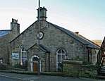 New Mills Free Church | [26] |
| Stone wall with plaque in car park to the north of the Mason's Arms public house | High Street | Early 19th century | 19 September 1977 | 53°22′08″N 2°00′01″W | Grade II | 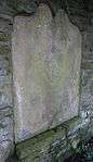 Stone wall with plaque in car park to the north of the Mason's Arms public house | [27] |
| Blake Hall and attached farm building | Ladygate Road | 17th century | 19 September 1977 | 53°23′17″N 1°59′42″W | Grade II | 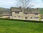 Blake Hall and attached farm building | [28] |
| Briergrove Farmhouse | Ladygate Road | 18th century | 19 September 1977 | 53°23′21″N 1°59′52″W | Grade II | 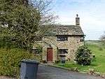 Briergrove Farmhouse | [29] |
| Farm buildings to Briergrove Farmhouse | Ladygate Road | 18th century | 19 September 1977 | 53°23′21″N 1°59′50″W | Grade II |  Farm buildings to Briergrove Farmhouse | [30] |
| Carr Nook Farmhouse | Ladygate Road | 18th century | 19 September 1977 | 53°23′18″N 1°59′47″W | Grade II | 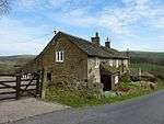 Carr Nook Farmhouse | [31] |
| Beard Hall Farmhouse | Laneside Road, Low Leighton | Probably 16th-century origins | 19 September 1977 | 53°21′33″N 1°59′18″W | Grade II | 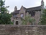 Beard Hall Farmhouse | [32] |
| Barn at Beard Hall Farm | Laneside Road, Low Leighton | 17th or early 18th century | 19 September 1977 | 53°21′35″N 1°59′20″W | Grade II | 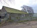 Barn at Beard Hall Farm | [33] |
| Nos. 3 and 5 | Laneside Road, Low Leighton | 18th century | 19 September 1977 | 53°22′01″N 1°59′17″W | Grade II | 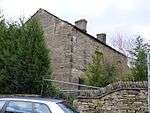 Nos. 3 and 5 | [34] |
| Howcroft | off Laneside Road, Low Leighton | Probably 18th century | 19 September 1977 | 53°21′27″N 1°58′52″W | Grade II | 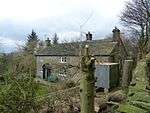 Howcroft | [35] |
| Laneside Farmhouse | Laneside Road, Low Leighton | Early 19th century and earlier | 19 September 1977 | 53°21′54″N 1°59′09″W | Grade II | 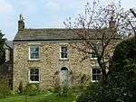 Laneside Farmhouse | [36] |
| Ollersett Hall Farmhouse | Laneside Road, Low Leighton | Dated 1629 | 19 September 1977 | 53°22′01″N 1°58′58″W | Grade II | 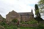 Ollersett Hall Farmhouse | [37] |
| Farm buildings to Ollersett Hall Farm | Laneside Road, Low Leighton | 17th or early 18th century | 19 September 1977 | 53°22′01″N 1°59′00″W | Grade II | 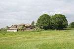 Farm buildings to Ollersett Hall Farm | [38] |
| Friend's Meeting House | Low Leighton Road, Low Leighton | Dated 1717 | 19 September 1977 | 53°22′02″N 1°59′22″W | Grade II | 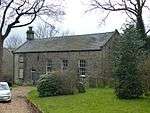 Friend's Meeting House | [39] |
| The Hare And Hounds Hotel | Low Leighton Road, Low Leighton | Early 19th century | 19 September 1977 | 53°22′02″N 1°59′19″W | Grade II | 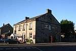 The Hare And Hounds Hotel | [40] |
| The Cruck Barn | Mousley Bottom | Possibly medieval | 10 April 1975 | 53°21′51″N 2°00′35″W | Grade II | 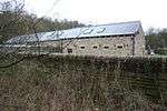 The Cruck Barn | [41] |
| Cross base | Primrose Lane, Mellor Moor | Medieval | 11 October 1985 | 53°23′03″N 2°00′46″W | Grade II | .JPG) Cross base | [42] |
| Torr Top Cottages | Rock Street | Mid-18th century | 18 May 1990 | 53°21′56″N 2°00′02″W | Grade II | 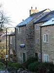 Torr Top Cottages | [43] |
| Anderton House | Chapel Street, Rowarth | Dated 1797 | 19 September 1977 | 53°24′01″N 1°58′56″W | Grade II | 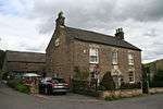 Anderton House | [44] |
| Former barn to Anderton House | Chapel Street, Rowarth | Late 18th century | 19 September 1977 | 53°24′02″N 1°58′56″W | Grade II |  Former barn to Anderton House | [45] |
| Barn at Hollins Farm | Hollinsmoor Road, Rowarth | Mid- to late 18th century | 8 October 1993 | 53°23′53″N 1°59′33″W | Grade II | 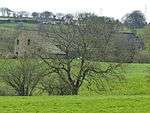 Barn at Hollins Farm | [46] |
| Little Mill Inn | Hollinsmoor Road, Rowarth | Dated 1781 | 19 September 1977 | 53°23′51″N 1°59′07″W | Grade II | 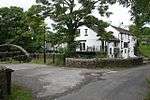 Little Mill Inn | [47] |
| Almshouses and Church of St James the Less | Spring Bank Road | 1880 | 2 November 1955 | 53°22′12″N 2°00′02″W | Grade II | 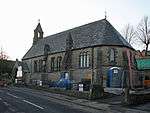 Almshouses and Church of St James the Less | [48] |
| Highlee Hall | St Mary's Road | Mid-19th century | 19 September 1977 | 53°21′58″N 2°00′24″W | Grade II | 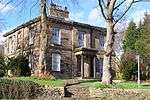 Highlee Hall | [49] |
| Storehouse (formerly carriage house to Highlee Hall) | St Mary's Road | Mid-19th century | 19 September 1977 | 53°22′00″N 2°00′23″W | Grade II | %2C_New_Mills.JPG) Storehouse (formerly carriage house to Highlee Hall) | [50] |
| Nos. 67 and 69 | Thornsett | 18th century | 19 September 1977 | 53°22′47″N 1°59′03″W | Grade II | 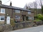 Nos. 67 and 69 | [51] |
| Aspenshaw Hall | Thornsett Brows | 1727 | 19 September 1977 | 53°23′15″N 1°58′58″W | Grade II | 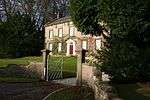 Aspenshaw Hall | [52] |
| Thornsett Fields Farmhouse | Thornsett Brows | 17th century | 19 September 1977 | 53°23′35″N 1°59′07″W | Grade II | 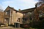 Thornsett Fields Farmhouse | [53] |
| Barn to Thornsett Fields Farmhouse | Thornsett Brows | 18th century | 19 September 1977 | 53°23′34″N 1°59′08″W | Grade II | 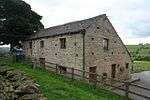 Barn to Thornsett Fields Farmhouse | [54] |
| Thornsett Hey Farmhouse | Thornsett Road | C17 with earlier C16 core, plus C19 alterations and additions | 7 April 1988 | 53°22′45″N 1°59′08″W | Grade II | 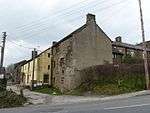 Thornsett Hey Farmhouse | [55] |
| Torr Vale Mill, attached weir, sluice gates, watercourse walls, headrace arches, retaining walls and steps | The Torrs | c.1790 and later | 23 February 1998 | 53°21′54″N 2°00′10″W | Grade II* | 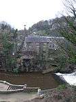 Torr Vale Mill, attached weir, sluice gates, watercourse walls, headrace arches, retaining walls and steps | [56] |
| K6 Telephone Kiosk | Union Road | Designed 1935 | 14 January 1993 | 53°21′54″N 2°00′06″W | Grade II | 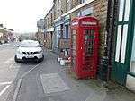 K6 Telephone Kiosk | [57] |
| Hague Bridge | Waterside Road | Early 19th century | 17 November 1983 | 53°21′56″N 2°01′25″W | Grade II | 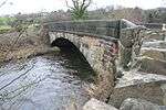 Hague Bridge | [58] |
| Hague Bridge | Waterside Road, River Goyt | Early 19th century | 28 August 1998 | 53°21′56″N 2°01′25″W | Grade II | Hague Bridge | [59] |
| Bower House | Whitle | 17th or early 18th century | 19 September 1977 | 53°22′39″N 2°00′09″W | Grade II | 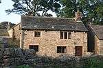 Bower House | [60] |
| Three barns to Bower House Farm | Whitle | 17th and 18th century | 19 September 1977 | 53°22′37″N 2°00′09″W | Grade II | 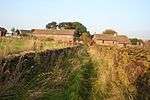 Three barns to Bower House Farm | [61] |
| Fold House | Whitle | 18th century | 19 September 1977 | 53°22′37″N 2°00′08″W | Grade II | 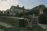 Fold House | [62] |
| Hill Top Cottage | Whitle | 17th century | 19 September 1977 | 53°22′37″N 2°00′08″W | Grade II | 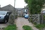 Hill Top Cottage | [63] |
| Sentry Cottage | Whitle | 1666 | 19 September 1977 | 53°22′39″N 2°00′08″W | Grade II | 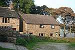 Sentry Cottage | [64] |
| Whitle Cottage | Whitle | 17th century | 19 September 1977 | 53°22′37″N 2°00′07″W | Grade II |  Whitle Cottage | [65] |
| Farmhouse and attached farm buildings (occupied by D Stafford) [Whitle Farm] | Whitle | 18th century | 19 September 1977 | 53°22′40″N 2°00′08″W | Grade II | 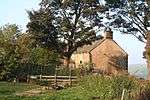 Farmhouse and attached farm buildings (occupied by D Stafford) [Whitle Farm] | [66] |
| Barn at Whitle Farm (occupied by D Stafford) | Whitle | 1671 | 19 September 1977 | 53°22′40″N 2°00′06″W | Grade II | 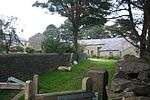 Barn at Whitle Farm (occupied by D Stafford) | [67] |
See also
- Grade I listed buildings in Derbyshire
- Grade II* listed buildings in Amber Valley
- Grade II* listed buildings in Bolsover (district)
- Grade II* listed buildings in Chesterfield
- Grade II* listed buildings in Derby
- Grade II* listed buildings in Derbyshire Dales
- Grade II* listed buildings in Erewash
- Grade II* listed buildings in High Peak
- Grade II* listed buildings in North East Derbyshire
- Grade II* listed buildings in South Derbyshire
References
- Historic England. "31, Batemill Road (Grade II) (1088132)". National Heritage List for England. Retrieved 31 January 2015.
- Historic England. "Ladyshawe House (Grade II) (1088133)". National Heritage List for England. Retrieved 31 January 2015.
- Historic England. "Former barn to Number 44 (Ladyshawe House) (Grade II) (1088134)". National Heritage List for England. Retrieved 31 January 2015.
- Historic England. "Borderstone, that part in Marple (Grade II) (1260307)". National Heritage List for England. Retrieved 31 January 2015.
- Historic England. "Fox Inn (Grade II) (1088136)". National Heritage List for England. Retrieved 31 January 2015.
- Historic England. "Cottage adjoining rear of Fox Inn (Grade II) (1088137)". National Heritage List for England. Retrieved 31 January 2015.
- Historic England. "Fox Cottage and cottage adjoining (Grade II) (1088138)". National Heritage List for England. Retrieved 31 January 2015.
- Historic England. "Gilbodygate Farmhouse (Grade II) (1088135)". National Heritage List for England. Retrieved 31 January 2015.
- Historic England. "Hope Cottage (Grade II) (1334753)". National Heritage List for England. Retrieved 31 January 2015.
- Historic England. "Rivelin (Grade II) (1241860)". National Heritage List for England. Retrieved 31 January 2015.
- Historic England. "Details from listed building database (1241859)". National Heritage List for England. Retrieved 31 January 2015.
- Historic England. "Footbridge at New Mills Station (Grade II) (1088139)". National Heritage List for England. Retrieved 31 January 2015.
- Historic England. "Peak Forest Canal overbridge on Peak Forest Canal near Buxton Road (Grade II) (1088122)". National Heritage List for England. Retrieved 31 January 2015.
- Historic England. "Details from listed building database (1088140)". National Heritage List for England. Retrieved 31 January 2015.
- Historic England. "The New Mills School (Grade II) (1393319)". National Heritage List for England. Retrieved 31 January 2015.
- Historic England. "Eaves Knoll Farmhouse and attached farm building (Grade II) (1039939)". National Heritage List for England. Retrieved 27 January 2015.
- Historic England. "Hague Fold Farmhouse (Grade II) (1088103)". National Heritage List for England. Retrieved 27 January 2015.
- Historic England. "Lower Hague Fold Farmhouse (Grade II) (1334769)". National Heritage List for England. Retrieved 31 January 2015.
- Historic England. "34 and 36 (former bank building and attached boundary wall) (1263554)". National Heritage List for England. Retrieved 31 January 2015.
- Historic England. "66, High Street (Grade II) (1334770)". National Heritage List for England. Retrieved 31 January 2015.
- Historic England. "109 and 111, High Street (Grade II) (1088106)". National Heritage List for England. Retrieved 28 January 2015.
- Historic England. "117, High Street (Grade II) (1088116)". National Heritage List for England. Retrieved 28 January 2015.
- Historic England. "The Bridge (Grade II) (1088105)". National Heritage List for England. Retrieved 28 January 2015.
- Historic England. "The George Hotel (Grade II) (1088104)". National Heritage List for England. Retrieved 28 January 2015.
- Historic England. "K6 Telephone Kiosk (Grade II) (1249856)". National Heritage List for England. Retrieved 31 January 2015.
- Historic England. "New Mills Free Church (Grade II) (1334771)". National Heritage List for England. Retrieved 31 January 2015.
- Historic England. "Stone wall with plaque in car park to the north of the Mason's Arms public house (Grade II) (1334772)". National Heritage List for England. Retrieved 31 January 2015.
- Historic England. "Blake Hall and attached farm building (Grade II) (1334774)". National Heritage List for England. Retrieved 31 January 2015.
- Historic England. "Briergrove Farmhouse (Grade II) (1039883)". National Heritage List for England. Retrieved 27 January 2015.
- Historic England. "Farm buildings to Briergrove Farmhouse (Grade II) (1088117)". National Heritage List for England. Retrieved 29 January 2015.
- Historic England. "Carr Nook Farmhouse (Grade II) (1039885)". National Heritage List for England. Retrieved 27 January 2015.
- Historic England. "Beard Hall Farmhouse (Grade II) (1372100)". National Heritage List for England. Retrieved 31 January 2015.
- Historic England. "Barn at Beard Hall Farm (Grade II) (1334775)". National Heritage List for England. Retrieved 31 January 2015.
- Historic England. "3 and 5, Laneside Road (1039888)". National Heritage List for England. Retrieved 27 January 2015.
- Historic England. "Howcroft (Grade II) (1088120)". National Heritage List for England. Retrieved 29 January 2015.
- Historic England. "Laneside Farmhouse (Grade II) (1088119)". National Heritage List for England. Retrieved 29 January 2015.
- Historic England. "Ollersett Hall Farmhouse (Grade II) (1088118)". National Heritage List for England. Retrieved 29 January 2015.
- Historic England. "Farm buildings to Ollersett Hall Farm (Grade II) (1039893)". National Heritage List for England. Retrieved 27 January 2015.
- Historic England. "Friend's Meeting House (Grade II) (1372101)". National Heritage List for England. Retrieved 31 January 2015.
- Historic England. "The Hare And Hounds Hotel (Grade II) (1088121)". National Heritage List for England. Retrieved 29 January 2015.
- Historic England. "The Cruck Barn (Grade II) (1372123)". National Heritage List for England. Retrieved 31 January 2015.
- Historic England. "Cross base (Grade II) (1260017)". National Heritage List for England. Retrieved 31 January 2015.
- Historic England. "Torr Top Cottages (Grade II) (1088089)". National Heritage List for England. Retrieved 27 January 2015.
- Historic England. "Anderton House (Grade II) (1334754)". National Heritage List for England. Retrieved 31 January 2015.
- Historic England. "Former barn to Anderton House (Grade II) (1039937)". National Heritage List for England. Retrieved 27 January 2015.
- Historic England. "Barn at Hollins Farm (Grade II) (1249823)". National Heritage List for England. Retrieved 31 January 2015.
- Historic England. "Little Mill Inn (Grade II) (1334773)". National Heritage List for England. Retrieved 31 January 2015.
- Historic England. "Almshouses and Church of St James The Less (Grade II) (1039875)". National Heritage List for England. Retrieved 27 January 2015.
- Historic England. "Highlee Hall (Grade II) (1039873)". National Heritage List for England. Retrieved 27 January 2015.
- Historic England. "Storehouse (formerly carriage house to Highlee Hall) (Grade II) (1088123)". National Heritage List for England. Retrieved 31 January 2015.
- Historic England. "67 and 69, Thornsett (Grade II) (1088125)". National Heritage List for England. Retrieved 31 January 2015.
- Historic England. "Aspenshaw Hall (Grade II) (1054706)". National Heritage List for England. Retrieved 27 January 2015.
- Historic England. "Thornsett Fields Farmhouse (Grade II) (1088126)". National Heritage List for England. Retrieved 31 January 2015.
- Historic England. "Barn to Thornset (sic) Fields Farmhouse (Grade II) (1054707)". National Heritage List for England. Retrieved 27 January 2015.
- Historic England. "Details from listed building database (1247181)". National Heritage List for England. Retrieved 31 January 2015.
- Historic England. "Torr Vale Mill, attached weir, sluice gates, watercourse walls, headrace arches, retaining walls and steps (Grade II*) (1119721)". National Heritage List for England. Retrieved 31 January 2015.
- Historic England. "K6 Telephone Kiosk (Grade II) (1263542)". National Heritage List for England. Retrieved 31 January 2015.
- Historic England. "Hague Bridge (Grade II) (1231805)". National Heritage List for England. Retrieved 31 January 2015.
- Historic England. "Hague Bridge (Grade II) (1376201)". National Heritage List for England. Retrieved 31 January 2015.
- Historic England. "Bower House (Grade II) (1088127)". National Heritage List for England. Retrieved 31 January 2015.
- Historic England. "Three barns to Bower House Farm (Grade II) (1088129)". National Heritage List for England. Retrieved 31 January 2015.
- Historic England. "Fold House (Grade II) (1054710)". National Heritage List for England. Retrieved 27 January 2015.
- Historic England. "Hill Top Cottage (Grade II) (1334776)". National Heritage List for England. Retrieved 31 January 2015.
- Historic England. "Sentry Cottage (Grade II) (1054708)". National Heritage List for England. Retrieved 27 January 2015.
- Historic England. "Whitle Cottage (Grade II) (1088128)". National Heritage List for England. Retrieved 31 January 2015.
- Historic England. "Farmhouse and attached farm buildings (occupied by D Stafford) (Grade II) (1334777)". National Heritage List for England. Retrieved 31 January 2015.
- Historic England. "Barn at Whitle Farm (occupied by D Stafford) (Grade II) (1054715)". National Heritage List for England. Retrieved 27 January 2015.
This article is issued from Wikipedia. The text is licensed under Creative Commons - Attribution - Sharealike. Additional terms may apply for the media files.