List of listed buildings in Millport, North Ayrshire
List
| Name | Location | Date Listed | Grid Ref. [note 1] | Geo-coordinates | Notes | LB Number [note 2] | Image |
|---|---|---|---|---|---|---|---|
| Devenport Place 14-25 (Odd And Even Numbers) | 55°45′18″N 4°55′06″W | Category C(S) | 37839 |  | |||
| Kelburn Street, Nos. 10, 11, 12 And 13 | 55°45′17″N 4°55′07″W | Category C(S) | 37840 |  | |||
| Kelburn Street, Nos. 8 And 9 | 55°45′17″N 4°55′08″W | Category C(S) | 37841 |  | |||
| Nos. 12-28 Crighton Street (Even Numbers) | 55°44′59″N 4°56′08″W | Category B | 37831 |  | |||
| Nos. 4, 6, 8 And 10 Cardiff Street | 55°45′05″N 4°56′01″W | Category C(S) | 37832 | | |||
| Nos. 1-7 Clyde Street | 55°45′02″N 4°55′59″W | Category C(S) | 37833 | | |||
| Kelburn Street, Nos. 6 And 7 | 55°45′16″N 4°55′09″W | Category C(S) | 37842 |  | |||
| Episcopal Cathedral With Collegiate Buildings And Cloister | 55°45′20″N 4°55′28″W | Category A | 37824 |  | |||
| Strahoun Bute Terrace | 55°45′09″N 4°56′01″W | Category C(S) | 37838 | | |||
| The Garrison, Including Walled Garden And Entrance Gateways | 55°45′13″N 4°55′37″W | Category B | 37825 | 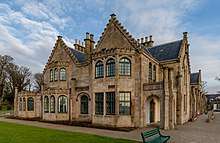 | |||
| Old Harbour | 55°45′07″N 4°55′43″W | Category B | 37826 | | |||
| Springfield, Bute Terrace | 55°45′12″N 4°55′55″W | Category B | 37836 |  | |||
| Seaview, Bute Terrace | 55°45′13″N 4°55′53″W | Category C(S) | 37837 |  | |||
| 9, 10 Marine Parade, Eastwood | 55°45′19″N 4°54′49″W | Category B | 37843 |  | |||
| Kirkton House | 55°45′19″N 4°56′19″W | Category B | 37829 | | |||
| Bute Terrace, Former United Presbyterian Manse | 55°45′16″N 4°55′51″W | Category C(S) | 37823 |  | |||
| Old Graveyard, Kirkton | 55°45′17″N 4°56′15″W | Category B | 37827 | | |||
| Millburn House | 55°45′05″N 4°56′08″W | Category B | 37830 | | |||
| No. 9 Quayhead | 55°45′03″N 4°55′58″W | Category B | 37834 | | |||
| Fairlie Bank, Bute Terrace | 55°45′11″N 4°55′56″W | Category C(S) | 37835 |  | |||
| Mid-Kirkton | 55°45′16″N 4°56′13″W | Category B | 37828 | |
Key
The scheme for classifying buildings in Scotland is:
- Category A: "buildings of national or international importance, either architectural or historic; or fine, little-altered examples of some particular period, style or building type."[1]
- Category B: "buildings of regional or more than local importance; or major examples of some particular period, style or building type, which may have been altered."[1]
- Category C: "buildings of local importance; lesser examples of any period, style, or building type, as originally constructed or moderately altered; and simple traditional buildings which group well with other listed buildings."[1]
In March 2016 there were 47,288 listed buildings in Scotland. Of these, 8 per cent were Category A, and 50 per cent were Category B, with the rest listed at Category C.[2]
Notes
- Sometimes known as OSGB36, the grid reference (where provided) is based on the British national grid reference system used by the Ordnance Survey.
• "Guide to National Grid". Ordnance Survey. Retrieved 12 December 2007.
• "Get-a-map". Ordnance Survey. Retrieved 17 December 2007. - Historic Environment Scotland assign a unique alphanumeric identifier to each designated site in Scotland, for listed buildings this always begins with "LB", for example "LB12345".
References
- All entries, addresses and coordinates are based on data from Historic Scotland. This data falls under the Open Government Licence
- "What is Listing?". Historic Environment Scotland. Retrieved 29 May 2018.
- Scotland's Historic Environment Audit 2016 (PDF). Historic Environment Scotland and the Built Environment Forum Scotland. pp. 15–16. Retrieved 29 May 2018.
This article is issued from Wikipedia. The text is licensed under Creative Commons - Attribution - Sharealike. Additional terms may apply for the media files.