List of listed buildings in Lossiemouth, Moray
List
| Name | Location | Date Listed | Grid Ref. [note 1] | Geo-coordinates | Notes | LB Number [note 2] | Image |
|---|---|---|---|---|---|---|---|
| Coulardbank Road, The Wardens And The Leas (Former General Assembly Schools) And Garden Walls | 57°42′59″N 3°17′28″W | Category B | 37604 |  | |||
| Seatown, K6 Telephone Kiosk | 57°43′00″N 3°16′52″W | Category B | 37615 | | |||
| 15 And 16 Clifton Road | 57°43′10″N 3°16′57″W | Category B | 37593 | | |||
| 22, 24A Clifton Road | 57°43′08″N 3°17′00″W | Category C(S) | 37595 | | |||
| 79, 81 Clifton Road | 57°43′01″N 3°17′18″W | Category C(S) | 37600 | | |||
| The Courlard (Inn) (Formerly Couldardbank House), Garden Wall And Gatepiers | 57°42′46″N 3°18′08″W | Category B | 37601 | | |||
| Covesea Skerries Lighthouse, Keepers' Cottages And Steading | 57°43′25″N 3°20′15″W | Category A | 37605 | | |||
| 17 Moray Street, The Hillocks | 57°42′51″N 3°17′18″W | Category B | 37608 | | |||
| 5 Clifton Road | 57°43′12″N 3°16′53″W | Category C(S) | 37592 | | |||
| Clifton Road, Rock House Hotel (Formerly Rock Cottage) | 57°43′00″N 3°17′23″W | Category B | 37598 | | |||
| 1 Gregory Place | 57°42′59″N 3°17′03″W | Category B | 37606 | | |||
| Pitgaveny Street, Harbour Master's Offices, Lossiemouth Fisheries Museum And Associated Warehouses | 57°43′23″N 3°16′48″W | Category A | 37609 | 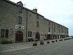 | |||
| Prospect Terrace, Craigmount (Formerly Denmark Cottage) | 57°43′13″N 3°17′00″W | Category B | 37610 | | |||
| Seatown Bridge Over Spynie Canal | 57°43′02″N 3°16′57″W | Category B | 37613 | | |||
| 20 Clifton Road | 57°43′08″N 3°17′00″W | Category B | 37594 | | |||
| Gregory Place, Market Cross | 57°43′00″N 3°17′04″W | Category B | 37607 | | |||
| St Gerardine's Road, St Gerardine's High Church Of Scotland, Column, Enclosing Walls And Gatepiers | 57°43′06″N 3°17′23″W | Category B | 37611 | | |||
| 1, 2 Seatown Road And Garden Walls | 57°43′03″N 3°17′01″W | Category C(S) | 37612 | | |||
| Coulardbank Road, Mansefield And Garden Walls (Former Free Church Manse) | 57°42′58″N 3°17′32″W | Category B | 37602 | | |||
| Coulardbank Road, Newtown Cottage | 57°42′57″N 3°17′30″W | Category C(S) | 37603 | | |||
| 24 Clifton Road | 57°43′08″N 3°17′00″W | Category B | 37596 | | |||
| 62 Clifton Road, The Deanery, Garden Walls And Gatepiers | 57°43′03″N 3°17′16″W | Category C(S) | 37597 | | |||
| 33 Clifton Road, Lossiemouth House | 57°43′05″N 3°17′06″W | Category B | 37599 | | |||
| Stotfield Road, Blucairn And Sundial | 57°43′02″N 3°18′06″W | Category C(S) | 37614 | |
Key
The scheme for classifying buildings in Scotland is:
- Category A: "buildings of national or international importance, either architectural or historic; or fine, little-altered examples of some particular period, style or building type."[1]
- Category B: "buildings of regional or more than local importance; or major examples of some particular period, style or building type, which may have been altered."[1]
- Category C: "buildings of local importance; lesser examples of any period, style, or building type, as originally constructed or moderately altered; and simple traditional buildings which group well with other listed buildings."[1]
In March 2016 there were 47,288 listed buildings in Scotland. Of these, 8 per cent were Category A, and 50 per cent were Category B, with the rest listed at Category C.[2]
See also
Notes
- Sometimes known as OSGB36, the grid reference (where provided) is based on the British national grid reference system used by the Ordnance Survey.
• "Guide to National Grid". Ordnance Survey. Retrieved 2007-12-12.
• "Get-a-map". Ordnance Survey. Retrieved 2007-12-17. - Historic Environment Scotland assign a unique alphanumeric identifier to each designated site in Scotland, for listed buildings this always begins with "LB", for example "LB12345".
References
- All entries, addresses and coordinates are based on data from Historic Scotland. This data falls under the Open Government Licence
- "What is Listing?". Historic Environment Scotland. Retrieved 29 May 2018.
- Scotland's Historic Environment Audit 2016 (PDF). Historic Environment Scotland and the Built Environment Forum Scotland. pp. 15–16. Retrieved 29 May 2018.
This article is issued from Wikipedia. The text is licensed under Creative Commons - Attribution - Sharealike. Additional terms may apply for the media files.