List of listed buildings in Kilbride, North Ayrshire
List
| Name | Location | Date Listed | Grid Ref. [note 1] | Geo-coordinates | Notes | LB Number [note 2] | Image |
|---|---|---|---|---|---|---|---|
| Brodick, 1-8 (Inclusive Nos) Alma Terrace | 55°34′32″N 5°08′43″W | Category B | 13412 |  | |||
| Brodick, Ormidale Hotel, Including Converted Stable Offices And Gatepiers | 55°34′30″N 5°09′19″W | Category C(S) | 13424 | | |||
| Corrie, Free Church, Including Gatepiers And Boundary Wall | 55°38′22″N 5°08′21″W | Category B | 13436 | | |||
| Lamlash, Piers And Slipway | 55°32′05″N 5°07′26″W | Category B | 13449 | | |||
| Lamlash, Sea Gate, Part Of Former Steamer Pier Complex | 55°32′10″N 5°07′22″W | Category C(S) | 13450 | | |||
| Lamlash 1-27 (Inclusive Nos) Hamilton Terrace Including Garden Enclosures | 55°32′00″N 5°07′44″W | Category A | 13234 |  | |||
| Lamlash 1A-24A (Inclusive Nos )Hamilton Terrace | 55°32′02″N 5°07′44″W | Category B | 13235 | | |||
| Isle Of Arran, Corrie, Corrie Hotel | 55°38′35″N 5°08′22″W | Category B | 12883 | | |||
| Isle Of Arran, Whiting Bay, Arnhall, Including Stable Block | 55°29′38″N 5°05′43″W | Category B | 12887 | | |||
| Brodick Castle Estate, Walled Garden, Terraces, Garden Gates, Sundial And Commemorative Gates | 55°35′38″N 5°08′56″W | Category A | 7508 |  | |||
| Isle Of Arran, Brodick, Rosa Bridge, Road Bridge Over Rosa Burn | 55°35′05″N 5°09′55″W | Category B | 6781 | | |||
| Brodick, Invercloy, Invercloy House | 55°34′39″N 5°08′56″W | Category C(S) | 13420 | | |||
| Brodick, Invercloy, Wooleys Bakers | 55°34′38″N 5°08′53″W | Category B | 13422 | | |||
| Brodick, Rosaburn, Arran Heritage Museum, Former School, Including Telephone Kiosk | 55°35′01″N 5°09′41″W | Category B | 13428 | | |||
| Lamlash, Former Pier House And Clock Tower | 55°32′11″N 5°07′22″W | Category B | 13439 | | |||
| Lamlash, Monamore Bridge, Millhouse | 55°31′27″N 5°08′18″W | Category C(S) | 13448 | | |||
| Isle Of Arran, Lamlash, Bellhaven, (Next To Parish Church) | 55°31′56″N 5°07′47″W | Category C(S) | 12885 | | |||
| Brodick Castle Estate, South Gates | 55°35′07″N 5°09′53″W | Category C(S) | 51788 | | |||
| Brodick, Strabane, Including Stablecourt And Outbuilding | 55°35′10″N 5°09′32″W | Category B | 13434 | | |||
| Lamlash, Lamlash And Kilbride Parish Church, Church Hall | 55°31′56″N 5°07′49″W | Category B | 13447 | | |||
| Brodick, Cladoch | 55°35′31″N 5°09′25″W | Category B | 11730 | | |||
| The Bay Hotel, Lamlash | 55°32′15″N 5°07′28″W | Category C(S) | 7511 | | |||
| Brodick, Douglas Row, Douglas Place | 55°34′49″N 5°09′37″W | Category B | 7512 | | |||
| Isle Of Arran, Whiting Bay, Silverbank | 55°29′02″N 5°05′41″W | Category C(S) | 6791 | | |||
| Isle Of Arran, Whiting Bay, Stewart Memorial Church | 55°30′01″N 5°05′35″W | Category B | 6792 |  | |||
| Isle Of Arran, Whiting Bay, Auchencairn, Rose Cottage | 55°30′18″N 5°06′08″W | Category B | 6773 | | |||
| Isle Of Arran, Whiting Bay, Burlington House (Hotel), Including House To Rear, Gatepiers And Boundary Walls | 55°29′50″N 5°05′40″W | Category C(S) | 6774 | | |||
| Isle Of Arran, Brodick, Carrick Lodge, (Former Manse) | 55°34′21″N 5°08′18″W | Category C(S) | 6779 | | |||
| Isle Of Arran, Brodick, Rosa Bridge, Drinking Fountain | 55°35′03″N 5°09′58″W | Category C(S) | 6780 | | |||
| Isle Of Arran, Corrie, Craegard, Including Cottage/Stable/Slaughterhouse And Boundary Wall | 55°37′58″N 5°08′17″W | Category B | 6783 | | |||
| Brodick, Near Glensburig Bridge, Arran Estates, (Former Manse) | 55°35′07″N 5°10′05″W | Category B | 13416 | | |||
| Brodick, Invercloy, Pharmacy (Former Post Office), Including Gates And Railings | 55°34′38″N 5°09′04″W | Category C(S) | 13421 | | |||
| Brodick, Rosaburn, Arran Heritage Museum, Rosaburn House | 55°35′00″N 5°09′39″W | Category B | 13429 | | |||
| Brodick, War Memorial, Including Railings | 55°34′39″N 5°09′14″W | Category C(S) | 13435 | | |||
| Lamlash, Glenkiln Farmhouse, Including Adjoining Cottages | 55°31′34″N 5°08′41″W | Category C(S) | 13440 | | |||
| Lamlash, Whitehouse Lodge | 55°31′55″N 5°07′47″W | Category C(S) | 13451 | | |||
| Corrie Harbour | 55°38′39″N 5°08′22″W | Category C(S) | 7487 | | |||
| Cromla House, Corrie | 55°38′30″N 5°08′23″W | Category C(S) | 7504 | | |||
| High Corrie, Seaview And Bothy, Langstane, Nia-Roo, Goatfell Cottage, The Bothy, Burnbank, Finlay's Cottage, Mclellan's Cottage | 55°38′02″N 5°08′35″W | Category B | 7505 | | |||
| Monument To Duke Of Hamilton In Front Of School, Brodick | 55°34′54″N 5°09′31″W | Category B | 7506 | | |||
| Kilmichael House | 55°34′03″N 5°10′10″W | Category B | 7510 | | |||
| Isle Of Arran, Whiting Bay, Stewart Memorial Church, War Memorial | 55°30′00″N 5°05′36″W | Category C(S) | 6788 | | |||
| Brodick Castle Estate, Main Gates And Entrance Drive | 55°35′39″N 5°08′45″W | Category B | 51787 | | |||
| Mid-Sannox | 55°39′55″N 5°09′35″W | Category B | 13651 | | |||
| The Lodge, Lochranza | 55°42′19″N 5°16′57″W | Category C(S) | 13652 | | |||
| Brodick, Arran Library And Brodick Hall | 55°34′40″N 5°09′09″W | Category B | 13413 | | |||
| Brodick, Brodick Old Quay | 55°35′31″N 5°09′01″W | Category B | 13414 | | |||
| Brodick, Invercloy, Bank Of Scotland, Including Bank House And Boundary Wall | 55°34′39″N 5°09′02″W | Category C(S) | 13418 | | |||
| Brodick, Invercloy, The Brodick Bazaar | 55°34′38″N 5°08′55″W | Category C(S) | 13419 | | |||
| Brodick, Invercloy, Shop And Flat Adjoining Wooleys Bakers | 55°34′38″N 5°08′53″W | Category B | 13423 | | |||
| Brodick, Roman Catholic Church | 55°34′31″N 5°08′28″W | Category C(S) | 13427 | | |||
| Corrie, Heathfield | 55°38′21″N 5°08′24″W | Category C(S) | 13437 | | |||
| Lamlash 'Crafts Made In Arran' Shop | 55°32′07″N 5°07′30″W | Category B | 13310 | | |||
| Lamlash, Park Road, Dalgorm Including Boundary Wall | 55°31′59″N 5°07′52″W | Category B | 13236 | | |||
| Lamlash, Former St George's Uf Church | 55°32′23″N 5°07′13″W | Category B | 12994 | | |||
| Isle Of Arran, Corrie, Villa To North Of Corrie Hotel, Including Boundary Wall And Gatepiers | 55°38′37″N 5°08′22″W | Category B | 12884 | | |||
| Brodick Castle Estate, Ice House | 55°35′34″N 5°09′17″W | Category C(S) | 6775 | | |||
| Isle Of Arran, Brodick, Rosaburn, Greyholme | 55°34′57″N 5°09′28″W | Category B | 6782 | | |||
| Isle Of Arran, Whiting Bay, Invermay Hotel, Including Gatepiers And Boundary Walls | 55°29′50″N 5°05′40″W | Category C(S) | 6786 | | |||
| Brodick Castle Estate, Bavarian Summerhouse | 55°35′34″N 5°08′56″W | Category A | 47599 | 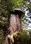 | |||
| Brodick Castle Estate, Sylvania | 55°35′31″N 5°09′29″W | Category C(S) | 51789 | | |||
| Brodick, Parish Church, Including Church Hall And Railings | 55°34′35″N 5°09′23″W | Category B | 13425 | | |||
| Brodick, Primary School | 55°34′55″N 5°09′33″W | Category B | 13426 |  | |||
| Brodick, Rosaburn, Arran Heritage Museum, Cottage | 55°35′00″N 5°09′39″W | Category C(S) | 13431 | | |||
| Lamlash, Park Road, Rose Cottage (Formerly Nurses Cottage) Including Boundary Wall | 55°31′59″N 5°07′51″W | Category B | 13237 | | |||
| Kilbride Chapel And Graveyard | 55°32′39″N 5°07′14″W | Category B | 7484 | | |||
| Isle Of Arran, Whiting Bay, Stewart Memorial Church, Manse | 55°30′01″N 5°05′34″W | Category C(S) | 6793 | | |||
| Isle Of Arran, Whiting Bay, Arnhall Lodge | 55°29′36″N 5°05′41″W | Category C(S) | 6772 | | |||
| Brodick Castle Estate, The Nursery (Lower Walled Garden), Gardener's Cottage And Ancillary Buildings Attached To Nursery Walls | 55°35′30″N 5°09′17″W | Category C(S) | 6777 | | |||
| Brodick Castle Estate, Cnocan Burn Road Bridge | 55°35′37″N 5°09′58″W | Category B | 6778 | | |||
| Isle Of Arran, Whiting Bay, Cameronia Hotel, Including Gatepiers And Boundary Walls | 55°29′49″N 5°05′40″W | Category C(S) | 6784 | | |||
| Isle Of Arran, Whiting Bay, Grange House (Hotel), Including Boundary Walls | 55°29′46″N 5°05′39″W | Category B | 6785 | | |||
| Isle Of Arran, Whiting Bay, Former Parish Church | 55°29′42″N 5°05′39″W | Category C(S) | 6787 | | |||
| Isle Of Arran, Whiting Bay, Village Hall | 55°29′23″N 5°05′47″W | Category C(S) | 6789 | | |||
| Lamlash, The Lookout, Including Boundary Walls, Gatepiers And Railings | 55°32′08″N 5°07′32″W | Category C(S) | 49200 | | |||
| Lamlash, Lamlash Community Centre | 55°31′51″N 5°08′05″W | Category C(S) | 49536 | | |||
| Brodick, Near Glensburig Bridge, Graveyard | 55°35′02″N 5°10′11″W | Category C(S) | 13417 | | |||
| Brodick, Rosaburn, Arran Heritage Museum, Roadside Cottage | 55°35′00″N 5°09′39″W | Category B | 13430 | | |||
| Lamlash, Lamlash And Kilbride Parish Church, Including Cross And Baptismal Font, Former Closet, Boundary Wall, Piers And Railings | 55°31′56″N 5°07′48″W | Category A | 13441 | | |||
| Corrie Church | 55°38′48″N 5°08′32″W | Category B | 7485 | | |||
| Congregational Chapel, Sannox | 55°39′48″N 5°09′17″W | Category B | 7486 | | |||
| Brodick Castle Estate, Castle Cottage And Greenhyde Cottage | 55°35′42″N 5°09′08″W | Category C(S) | 6795 | | |||
| Brodick, Douglas Hotel | 55°34′33″N 5°08′29″W | Category C(S) | 13415 | | |||
| Brodick, Rosaburn, Arran Heritage Museum, Stable | 55°35′00″N 5°09′39″W | Category C(S) | 13432 | | |||
| Brodick, Royal Bank Of Scotland | 55°34′37″N 5°08′50″W | Category C(S) | 13433 | | |||
| Lamlash, Former Manse Of St George's United Free Church, Including Boundary Wall | 55°32′24″N 5°07′12″W | Category B | 13438 | | |||
| Isle Of Arran, Lamlash, Seafield, Including Boundary Walls And Gateposts | 55°32′31″N 5°06′59″W | Category B | 12886 | | |||
| Brodick Castle Estate, Brodick Castle | 55°35′38″N 5°09′03″W | Category A | 7507 |  | |||
| Isle Of Arran, Whiting Bay, St Columba's | 55°29′40″N 5°05′40″W | Category B | 6790 | | |||
| Brodick Estate, The Kennels Including House And Outbuildings | 55°35′38″N 5°09′49″W | Category B | 6776 | |
Key
The scheme for classifying buildings in Scotland is:
- Category A: "buildings of national or international importance, either architectural or historic; or fine, little-altered examples of some particular period, style or building type."[1]
- Category B: "buildings of regional or more than local importance; or major examples of some particular period, style or building type, which may have been altered."[1]
- Category C: "buildings of local importance; lesser examples of any period, style, or building type, as originally constructed or moderately altered; and simple traditional buildings which group well with other listed buildings."[1]
In March 2016 there were 47,288 listed buildings in Scotland. Of these, 8 per cent were Category A, and 50 per cent were Category B, with the rest listed at Category C.[2]
Notes
- Sometimes known as OSGB36, the grid reference (where provided) is based on the British national grid reference system used by the Ordnance Survey.
• "Guide to National Grid". Ordnance Survey. Retrieved 2007-12-12.
• "Get-a-map". Ordnance Survey. Retrieved 2007-12-17. - Historic Environment Scotland assign a unique alphanumeric identifier to each designated site in Scotland, for listed buildings this always begins with "LB", for example "LB12345".
References
- All entries, addresses and coordinates are based on data from Historic Scotland. This data falls under the Open Government Licence
- "What is Listing?". Historic Environment Scotland. Retrieved 29 May 2018.
- Scotland's Historic Environment Audit 2016 (PDF). Historic Environment Scotland and the Built Environment Forum Scotland. pp. 15–16. Retrieved 29 May 2018.
This article is issued from Wikipedia. The text is licensed under Creative Commons - Attribution - Sharealike. Additional terms may apply for the media files.