List of listed buildings in Edinburgh/7
List
| Name | Location | Date Listed | Grid Ref. [note 1] | Geo-coordinates | Notes | LB Number [note 2] | Image |
|---|---|---|---|---|---|---|---|
| 2 Dewar Place, Scottish Power Offices, Formerly Central Electricity Lighting Station Including Boundary Walls, Gates And Gatepiers | 55°56′48″N 3°12′39″W | Category B | 47721 |  | |||
| 266-270 (Even Nos) Morrison Street | 55°56′47″N 3°12′57″W | Category C(S) | 47727 | | |||
| West Terrace (Next To Rosebery Memorial Wall), Drinking Fountain, Garden, Wall And Railings | 55°59′25″N 3°23′48″W | Category B | 47795 | | |||
| 7-25 (Odd Nos) Forrest Road | 55°56′46″N 3°11′29″W | Category C(S) | 47863 | | |||
| 73-75 (Odd Nos) Grassmarket | 55°56′51″N 3°11′41″W | Category B | 47870 | | |||
| 20-30 (Even Nos) Grindlay Street | 55°56′48″N 3°12′16″W | Category C(S) | 47880 | | |||
| 32-42 (Even Nos) Grindlay Street | 55°56′48″N 3°12′18″W | Category C(S) | 47881 | | |||
| 1-11 (Inclusive Nos) Portsburgh Square, West Port | 55°56′48″N 3°11′56″W | Category C(S) | 47896 | | |||
| 5, 6 And 7 Bristo Place | 55°56′47″N 3°11′25″W | Category B | 48210 | | |||
| Edinburgh Castle, Palace Block | 55°56′53″N 3°11′58″W | Category A | 48226 | | |||
| Edinburgh Castle Esplanade, 78Th Highlanders Memorial | 55°56′56″N 3°11′49″W | Category B | 48238 | .jpg) | |||
| Edinburgh Castle Esplanade, Scottish Horse Memorial | 55°56′56″N 3°11′51″W | Category C(S) | 48239 | 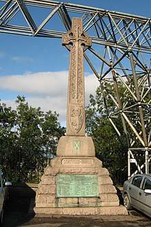 | |||
| 20-26 (Even Nos) Forrest Road | 55°56′45″N 3°11′27″W | Category C(S) | 48242 | | |||
| West Princes Street Gardens, Robert Louis Stevenson Memorial | 55°57′00″N 3°12′08″W | Category A | 48255 |  | |||
| 1 - 12 (Inclusive Nos) Regent Terrace Mews And 13 - 22 (Inclusive Nos) Royal Terrace Mews And Shared Cobbled Lane | 55°57′21″N 3°10′31″W | Category B | 48383 | | |||
| 23 - 42 (Inclusive Nos) Carlton Terrace Mews Including Shared Cobbled Courtyard And Lane | 55°57′23″N 3°10′30″W | Category B | 48384 | | |||
| Comely Bank Road, St Stephen's Church (Church Of Scotland) And Hall | 55°57′36″N 3°13′07″W | Category C(S) | 48534 | | |||
| Niddrie Mains Road, Thistle Foundation, 1-11 (Inclusive Nos), 14-18 (Inclusive Nos) Queen's Walk, 1-19 Chapel Court And 1-23 (Inclusive Nos) West Court And Covered Walkways | 55°55′50″N 3°07′58″W | Category B | 48687 | | |||
| Corstorphine Road, Milestone On N Side | 55°56′39″N 3°15′24″W | Category C(S) | 48885 | | |||
| 1-7 (Inclusive Nos) Magdala Mews | 55°56′53″N 3°13′21″W | Category C(S) | 48893 | | |||
| 15-25 (Odd Nos) Murrayfield Avenue, Including Boundary Walls | 55°56′52″N 3°14′15″W | Category C(S) | 48895 | | |||
| 2-60 (Even Nos) Murrayfield Ave, Including Boundary Walls | 55°56′48″N 3°14′14″W | Category C(S) | 48897 | | |||
| 31 And 33 Ravelston Dykes Road | 55°57′08″N 3°15′22″W | Category C(S) | 48904 | | |||
| 9 Rosebery Crescent, Including Railings | 55°56′48″N 3°13′09″W | Category C(S) | 48909 | | |||
| Roseburn Terrace/ Street, Car Showrooms | 55°56′43″N 3°14′00″W | Category C(S) | 48912 | | |||
| 6 Wester Coates Gardens, Including Boundary Walls | 55°56′54″N 3°13′45″W | Category C(S) | 48918 | | |||
| 2 And 3 Abercorn Gardens With Boundary Wall | 55°57′18″N 3°08′25″W | Category B | 49040 | | |||
| 3 And 4 Northfield Gardens | 55°56′58″N 3°08′16″W | Category B | 49044 | | |||
| 2-12 (Even Numbers) Restalrig Road South, 1-21 (Odd Numbers) Portobello Road, 1-16 (Inclusive Numbers) Piershill Square West, 1-14 (Inclusive Numbers) Piershill Square East With Boundary Walls And Railings | 55°57′21″N 3°08′57″W | Category C(S) | 49047 | | |||
| 34 And 34A Cockburn Street | 55°57′02″N 3°11′22″W | Category B | 49064 | | |||
| 9-13 (Inclusive Nos) Market Street, St Christopher's Hotel | 55°57′03″N 3°11′25″W | Category B | 49065 | | |||
| 27, 28 And 29 Gayfield Square Including Railings | 55°57′33″N 3°11′06″W | Category A | 49149 | | |||
| 30, 31 And 32 Gayfield Square Including Railings | 55°57′33″N 3°11′05″W | Category A | 49150 | | |||
| 21 Union Street Including Boundary Wall And Railings | 55°57′30″N 3°11′10″W | Category B | 49155 | | |||
| 4-25 (Inclusive Nos) Eglinton Crescent, Including Railings | 55°56′56″N 3°13′14″W | Category B | 49188 | | |||
| Royal Botanic Garden, Inverleith Row, Head Gardener's Cottage At East Gate | 55°57′53″N 3°12′15″W | Category C(S) | 49215 | | |||
| Royal Botanic Garden, Arboretum Place, Inverleith Row, Inverleith Terrace And Inverleith Place, Boundary Walls, Gatepiers, Railings And Gates | 55°57′53″N 3°12′14″W | Category C(S) | 49217 | | |||
| Niddrie Mains Road, Richmond Craigmillar Church (Church Of Scotland) And Hall With Boundary Wall And Railings And Gates | 55°55′58″N 3°07′45″W | Category C(S) | 49460 | | |||
| 23 And 23A Holyrood Park, St Leondard's Lodge | 55°56′30″N 3°10′19″W | Category C(S) | 49512 | | |||
| Holyrood Park, Wells O' Wearie Cottage | 55°56′20″N 3°09′51″W | Category C(S) | 49515 | | |||
| Crewe Road South, 1, 2, And 3 Avenue Villas With Boundary Wall And Railings | 55°57′33″N 3°13′36″W | Category C(S) | 49516 | | |||
| 40-60 (Even Nos) Kingston Avenue, Upper Craigend Cottages With Boundary Walls | 55°55′12″N 3°08′54″W | Category C(S) | 49517 | | |||
| 100 The Wisp, Edmonstone House East Gates And Lodge | 55°55′06″N 3°06′56″W | Category B | 49519 | | |||
| Colinton Road, Merchiston Castle School, Walled Garden And Store | 55°54′34″N 3°15′10″W | Category B | 49556 | | |||
| Colinton Road, Merchiston Castle School, Ha-Ha And Steps Leading To Colinton Castle | 55°54′38″N 3°15′17″W | Category C(S) | 49557 | | |||
| 66 And 68 Dreghorn Loan, Laverockdale House With Garden Pavilion, Boundary Wall, Gatepiers And Garden Terrace | 55°54′09″N 3°15′05″W | Category A | 49562 | | |||
| Redford Road, Dreghorn Barracks, Comprising Guard House, Barrack Block, Band Block, And Battalion Headquarters | 55°54′12″N 3°14′24″W | Category C(S) | 49566 | | |||
| 7 And 9 Woodhall Road, Ringlewood And Ledgrianach, With Boundary Walls | 55°54′25″N 3°15′23″W | Category C(S) | 49574 | | |||
| 31 Woodhall Road, Colthwaite, With Boundary Wall And Gates | 55°54′21″N 3°15′31″W | Category C(S) | 49575 | | |||
| 34 Woodhall Road, West Colinton Cottage, With Boundary Wall | 55°54′19″N 3°15′37″W | Category C(S) | 49576 | | |||
| Fettes College, War Memorial | 55°57′50″N 3°13′31″W | Category B | 49632 | | |||
| Dean Path, Vr Letter Box | 55°57′09″N 3°13′06″W | Category B | 49694 | | |||
| 2, 3, 4 Carlton Terrace Including Railings And Boundary Walls | 55°57′21″N 3°10′27″W | Category A | 49746 | | |||
| 6 Carlton Terrace Including Railings And Boundary Walls | 55°57′22″N 3°10′25″W | Category A | 49748 | | |||
| 11 Carlton Terrace Including Railings And Boundary Walls | 55°57′23″N 3°10′25″W | Category A | 49753 | | |||
| 18 Carlton Terrace Including Railings And Boundary Walls | 55°57′24″N 3°10′30″W | Category A | 49760 |  | |||
| 40-44 Montgomery Street And 42 Brunswick Street | 55°57′33″N 3°10′50″W | Category C(S) | 49762 | | |||
| 1-18 (Inclusive Nos) Montgomery Street Lane | 55°57′32″N 3°10′57″W | Category C(S) | 49764 | | |||
| 5 Regent Terrace Including Railings And Boundary Walls | 55°57′16″N 3°10′40″W | Category A | 49768 |  | |||
| 13 Regent Terrace, Including Railings And Boundary Walls | 55°57′17″N 3°10′37″W | Category A | 49776 | 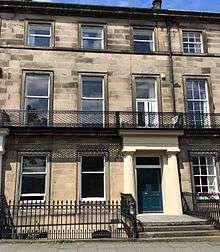 | |||
| 18 Regent Terrace Including Railings And Boundary Walls | 55°57′18″N 3°10′35″W | Category A | 49781 | 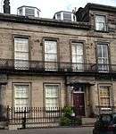 | |||
| 20 Regent Terrace Including Railings And Boundary Walls | 55°57′18″N 3°10′34″W | Category A | 49783 | 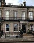 | |||
| 25 Regent Terrace, Including Railings And Boundary Walls | 55°57′19″N 3°10′32″W | Category A | 49790 | 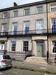 | |||
| 28 Regent Terrace, Including Railings And Boundary Walls | 55°57′20″N 3°10′31″W | Category A | 49793 |  | |||
| 30 Regent Terrace Including Railings And Boundary Walls | 55°57′20″N 3°10′30″W | Category A | 49795 |  | |||
| 33 Regent Terrace Including Railings And Boundary Walls | 55°57′20″N 3°10′28″W | Category A | 49798 |  | |||
| 4 Royal Terrace Including Railings And Boundary Walls | 55°57′24″N 3°10′50″W | Category A | 49802 | | |||
| 10 Royal Terrace Including Railings And Boundary Walls | 55°57′24″N 3°10′47″W | Category A | 49808 | | |||
| 11 And 12 Royal Terrace, Including Railings And Boundary Walls | 55°57′24″N 3°10′46″W | Category A | 49809 | | |||
| 14 Royal Terrace Including Railings And Boundary Walls | 55°57′24″N 3°10′45″W | Category A | 49811 | | |||
| 37 Royal Terrace Including Railings And Boundary Walls | 55°57′24″N 3°10′33″W | Category A | 49829 | | |||
| 41 Inverleith Gardens, Inverleith Parish Church And Boundary Wall | 55°58′14″N 3°12′50″W | Category C(S) | 50116 | | |||
| 35-57 (Odd Nos) Morton Street | 55°56′51″N 3°05′56″W | Category C(S) | 27113 | | |||
| 77 Belford Road, St Andrews Church (Roman Catholic), Including Boundary Walls | 55°57′10″N 3°13′35″W | Category C(S) | 50186 | | |||
| Glenogle Road, Glenogle Park (The Colonies), 1-30 (Inclusive) Avondale Place | 55°57′41″N 3°12′27″W | Category B | 50514 | | |||
| Glenogle Road, Glenogle Park (The Colonies), 1-30 (Inclusive) Balmoral Place | 55°57′41″N 3°12′32″W | Category B | 50515 | | |||
| Glenogle Road, Glenogle Park (The Colonies), 1-32 (Inclusive) Bell Place | 55°57′41″N 3°12′24″W | Category B | 50516 | | |||
| Glenogle Road, Glenogle Park (The Colonies), 1-30 (Inclusive) Collins Place | 55°57′41″N 3°12′34″W | Category B | 50517 | | |||
| Glenogle Road, Glenogle Park (The Colonies), 1-30 (Inclusive) Colville Place | 55°57′42″N 3°12′36″W | Category B | 50518 | | |||
| Glenogle Road, Glenogle Park (The Colonies), 1-30 (Inclusive) Dunrobin Place | 55°57′41″N 3°12′30″W | Category B | 50519 | | |||
| Glenogle Road, Glenogle Park (The Colonies), 1-8 (Inclusive) Glenogle Place | 55°57′42″N 3°12′21″W | Category B | 50521 | | |||
| Glenogle Road, Glenogle Park (The Colonies), 1-33 (Inclusive) Hugh Miller Place | 55°57′40″N 3°12′39″W | Category B | 50523 | | |||
| Glenogle Road, Glenogle Park (The Colonies), 1-30 (Inclusive) Kemp Place | 55°57′42″N 3°12′25″W | Category B | 50524 | | |||
| Glenogle Road, Glenogle Park (The Colonies), 1-40 (Inclusive) Reid Terrace And 1-8 (Inclusive) Bridge Place | 55°57′39″N 3°12′40″W | Category B | 50525 | | |||
| Glenogle Road, Glenogle Park (The Colonies), 1-30 (Inclusive) Teviotdale Place | 55°57′42″N 3°12′29″W | Category B | 50527 | | |||
| Torduff Road, Torduff Reservoir Filtering Cistern | 55°53′47″N 3°16′02″W | Category C(S) | 50528 | | |||
| 1-17 (Inclusive Nos) Tron Square (Lower And Upper) | 55°56′57″N 3°11′18″W | Category B | 50778 | | |||
| Shore Road, Port Edgar, West Pier | 55°59′38″N 3°24′49″W | Category C(S) | 50857 | | |||
| Belhaven Place, Gatepiers And Railings Formerly To Morningside Cemetery | 55°55′30″N 3°12′43″W | Category C(S) | 50969 | | |||
| Shore Road, Port Edgar, Former Barracks / Naval Hospital Including Officers Ward, Ward Blocks, Admin Block, Recreation Rooms, Air Raid Shelter, Latrine, Victualling Store, Guard Room And Boiler House | 55°59′36″N 3°25′04″W | Category B | 50988 | | |||
| 1-15 (Inclusive Nos) Saxe Coburg Place Including Boundary Walls And Railings And Retaining Wall And Railings To Central Communal Garden | 55°57′36″N 3°12′30″W | Category A | 29763 | | |||
| 12 East London Street, British Telecom, Waverley Telephone Exchange Including Boundary Walls And Ancillary Building | 55°57′36″N 3°11′17″W | Category B | 51018 | | |||
| Canongate, 1 And 2 Chessel's Court (W Block) | 55°57′03″N 3°10′59″W | Category A | 51171 | | |||
| 65-71 (Odd Nos) And 97-103 (Odd Nos) Canongate Including 1-3 (Inclusive Nos) Brown's Close | 55°57′07″N 3°10′41″W | Category B | 51172 | | |||
| 242-244 (Even Nos) Canongate, (Chessel's Court N Block) | 55°57′02″N 3°10′59″W | Category B | 51173 | | |||
| 12, 13 Belford Mews | 55°57′06″N 3°13′10″W | Category C(S) | 51338 | | |||
| 6, 8 Shandwick Place | 55°57′01″N 3°12′32″W | Category C(S) | 51342 | | |||
| 1-8 (Consecutive Numbers) Belford Mews | 55°57′06″N 3°13′12″W | Category B | 51343 |  | |||
| 69 Dean Path, Former Dean Cemetery Gate Lodge, Including Boundary Walls | 55°57′17″N 3°13′19″W | Category C(S) | 51394 | | |||
| 2-6 (Inclusive Nos) North Bank Street And Wardrop's Court, Blackie House | 55°57′00″N 3°11′36″W | Category A | 51522 | | |||
| 1-63 (Inclusive Nos) Claremont Court Including Lockup Garages | 55°57′53″N 3°11′24″W | Category C(S) | 51772 | | |||
| 1-16 (Inclusive Nos) Salvesen Crescent, Including Boundary Walls And Gatepiers | 55°58′31″N 3°15′31″W | Category B | 45601 | | |||
| Drummond Place, Police Box | 55°57′30″N 3°11′47″W | Category B | 45479 | | |||
| 2B Jamaica Street, Pindi's Restaurant And Bar | 55°57′21″N 3°12′10″W | Category C(S) | 45503 | | |||
| 1-8 Baberton Mains, Including Boundary Walls And Gatepiers | 55°54′43″N 3°17′47″W | Category B | 45416 | | |||
| Riccarton Mains, Including Stable Block, Cottage And Cattle Shed | 55°54′43″N 3°18′39″W | Category C(S) | 45426 | | |||
| Dalmeny House, Boundary Wall | 55°59′05″N 3°21′35″W | Category B | 45436 | | |||
| 88 Fountainbridge, 1- 8 Chalmers Buildings | 55°56′39″N 3°12′27″W | Category C(S) | 44932 | | |||
| 76 Clermiston , Road, Hillwood, Including Boundary Walls, Gatepiers, Gates And Lanterns | 55°56′53″N 3°16′46″W | Category C(S) | 44747 | | |||
| 134 Corstorphine Road, Edinburgh Zoo (Royal Zoological Society Of Scotland) Pair Of Toilets Flanking West Lodge Complex | 55°56′42″N 3°16′19″W | Category C(S) | 44752 | | |||
| 30 Old Kirk Road, Including Boundary Walls, Gatepiers And Gates | 55°56′41″N 3°16′32″W | Category B | 44754 | | |||
| 3 And 5A-G Loaning Road, Former Factory Complex | 55°57′34″N 3°08′55″W | Category C(S) | 44626 | | |||
| 12 And 13 South Gray Street, Including Boundary Walls And Pedestrian Gates | 55°56′03″N 3°10′34″W | Category B | 44256 | | |||
| 12 And 13 Ventnor Terrace, Including Railings | 55°55′54″N 3°10′10″W | Category C(S) | 44438 | | |||
| 50, 50A And 52 Craigmillar Park, Including Boundary Walls | 55°55′40″N 3°10′07″W | Category C(S) | 44209 | | |||
| 17-21 (Odd Nos) Crawfurd Road, Including Boundary Walls | 55°55′52″N 3°10′06″W | Category C(S) | 44211 | | |||
| 10 Mayfield Gardens, Including Boundary Walls | 55°55′57″N 3°10′25″W | Category C(S) | 44225 | | |||
| 19 And 20 Meadow Place Including Boundary Walls | 55°56′20″N 3°11′34″W | Category B | 43848 |  | |||
| Queen Street, 2 York Buildings | 55°57′21″N 3°11′38″W | Category B | 43887 | | |||
| 4 And 5 Riverside And 6 Cramond Village | 55°58′47″N 3°18′03″W | Category B | 43937 | | |||
| 10 Gamekeeper's Road, Lauderdale, Including Boundary Wall And Gatepiers | 55°58′21″N 3°17′48″W | Category C(S) | 43939 | | |||
| 181, 181A And 183 Whitehouse Road, Royal Burgess Golf Club House Including Union House, Store, Boundary Wall And Gatepiers | 55°57′44″N 3°18′21″W | Category B | 43941 | | |||
| 90 And 92 Trafalgar Lane; Eh6 4Dq | 55°58′25″N 3°11′16″W | Category C(S) | 43678 | | |||
| 1-4 (Inclusive Nos) Craighall Bank Including Boundary Wall | 55°58′33″N 3°11′45″W | Category C(S) | 43688 | | |||
| 6 Fishmarket Square And 1 Pier Place | 55°58′51″N 3°11′42″W | Category C(S) | 43695 | | |||
| 7 And 8 Fishmarket Square | 55°58′50″N 3°11′41″W | Category C(S) | 43696 | | |||
| 14-20 (Even Nos) Great Michael Rise | 55°58′46″N 3°11′31″W | Category B | 43701 | | |||
| 24-38 (Even Nos) Newhaven Main Street | 55°58′50″N 3°11′39″W | Category C(S) | 43706 | | |||
| 46 Newhaven Main Street | 55°58′50″N 3°11′47″W | Category C(S) | 43708 | | |||
| 46 Park Road, Newhaven, Including Gatepiers And Gate | 55°58′46″N 3°11′50″W | Category C(S) | 43721 | | |||
| Newcraighall Road, Craigmillar Arts Centre, Former St Andrew's Church, Including Gatepiers And Boundary Walls | 55°55′58″N 3°06′17″W | Category B | 43571 | | |||
| Newcraighall Road, Niddrie Cottages | 55°56′00″N 3°06′12″W | Category C(S) | 43572 | | |||
| 24 Hill Street | 55°57′12″N 3°12′11″W | Category A | 43305 | | |||
| 106 Princes Street | 55°57′06″N 3°12′04″W | Category B | 43324 | | |||
| 66 Rose Street, Hanover Buildings (John Menzies Plc) | 55°57′09″N 3°11′54″W | Category B | 43337 | | |||
| 172-176 (Even Nos) Rose Street | 55°57′05″N 3°12′15″W | Category B | 43340 | | |||
| 42 And 44 Rose Street North Lane | 55°57′10″N 3°11′57″W | Category C(S) | 43345 | | |||
| 108 And 110 Rose Street North Lane | 55°57′07″N 3°12′15″W | Category C(S) | 43346 | | |||
| 6 And 7 St Andrew Square And 7-19 South St David Street | 55°57′12″N 3°11′36″W | Category B | 43348 | | |||
| 5-17 (Odd Nos) West Register Street | 55°57′13″N 3°11′25″W | Category C(S) | 43365 | | |||
| 20 Young Street, Cambridge Bar | 55°57′10″N 3°12′21″W | Category A | 43369 | | |||
| 1 And 3 Claverhouse Drive With Boundary Walls | 55°55′01″N 3°09′13″W | Category C(S) | 43234 | | |||
| Gilmerton, 49-51 Drum Street, The Royal Bank Of Scotland | 55°54′19″N 3°07′55″W | Category C(S) | 43256 | | |||
| Gilmerton, 6 Ravenscroft Street, Gilmerton Parish Church With Boundary Walls And Gatepiers | 55°54′18″N 3°07′59″W | Category C(S) | 43259 | | |||
| Gilmerton, 41 Ravenscroft Street | 55°54′15″N 3°08′01″W | Category C(S) | 43260 | | |||
| Gilmerton Road, The George And Agnes Murray Home With Sundial, Stable Court, Lodge And Gatepiers | 55°54′32″N 3°08′26″W | Category B | 43262 | | |||
| 23 Castle Street | 55°57′07″N 3°12′10″W | Category B | 43280 | | |||
| 30-32 (Even Nos) Frederick Street | 55°57′09″N 3°12′02″W | Category B | 43283 | | |||
| 87 George Street And 15 Hill Street Lane South | 55°57′11″N 3°12′07″W | Category A | 43287 | | |||
| 3-9 (Odd Nos) Hanover Street | 55°57′09″N 3°11′47″W | Category B | 43291 | |
Key
The scheme for classifying buildings in Scotland is:
- Category A: "buildings of national or international importance, either architectural or historic; or fine, little-altered examples of some particular period, style or building type."[1]
- Category B: "buildings of regional or more than local importance; or major examples of some particular period, style or building type, which may have been altered."[1]
- Category C: "buildings of local importance; lesser examples of any period, style, or building type, as originally constructed or moderately altered; and simple traditional buildings which group well with other listed buildings."[1]
In March 2016 there were 47,288 listed buildings in Scotland. Of these, 8 per cent were Category A, and 50 per cent were Category B, with the rest listed at Category C.[2]
Notes
- Sometimes known as OSGB36, the grid reference (where provided) is based on the British national grid reference system used by the Ordnance Survey.
• "Guide to National Grid". Ordnance Survey. Retrieved 12 December 2007.
• "Get-a-map". Ordnance Survey. Retrieved 17 December 2007. - Historic Environment Scotland assign a unique alphanumeric identifier to each designated site in Scotland, for listed buildings this always begins with "LB", for example "LB12345".
References
- All entries, addresses and coordinates are based on data from Historic Scotland. This data falls under the Open Government Licence
- "What is Listing?". Historic Environment Scotland. Retrieved 29 May 2018.
- Scotland's Historic Environment Audit 2016 (PDF). Historic Environment Scotland and the Built Environment Forum Scotland. pp. 15–16. Retrieved 29 May 2018.
This article is issued from Wikipedia. The text is licensed under Creative Commons - Attribution - Sharealike. Additional terms may apply for the media files.