List of listed buildings in Edinburgh/5
List
| Name | Location | Date Listed | Grid Ref. [note 1] | Geo-coordinates | Notes | LB Number [note 2] | Image |
|---|---|---|---|---|---|---|---|
| University Of Edinburgh Former George Watson's Ladies College George Square Excluding 4-Storey Eastern Addition Of 1902 | 55°56′40″N 3°11′19″W | Category B | 28002 |  | |||
| Heriot Place And Vennel, Bastion Of Flodden Wall, And Telfer Wall (Section) | 55°56′46″N 3°11′49″W | Category A | 28006 |  | |||
| Colinton Road, Redford Cavalry Barracks With Officer's Mess, Balaclava House, Guard House, Gates, Gatepiers, Sergeant's Mess, Former Band Block, Education Block, Former Stables, Stores And Other Ancillary Buildings | 55°54′50″N 3°14′25″W | Category B | 28009 | | |||
| Edinburgh Castle, Batteries, Including Argyle, Dury's, Forewall, Half-Moon, And Western Defences | 55°56′54″N 3°11′56″W | Category A | 28010 | | |||
| Edinburgh Castle, 2 K6 Telephone Kiosks At Gatehouse | 55°56′54″N 3°11′56″W | Category B | 28012 | | |||
| Craigmillar Castle Road Craigmillar Castle Dairy | 55°55′33″N 3°08′20″W | Category B | 28017 | | |||
| Liberton Drive, Liberton Tower | 55°54′52″N 3°10′39″W | Category A | 28021 | | |||
| Holyroodhouse, Palace Of Holyroodhouse Including Gates, Gatepiers, Boundary Walls And Railings | 55°57′10″N 3°10′20″W | Category A | 28022 | 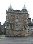 | |||
| Holyroodhouse, Gatehouse And Former Guard Rooms | 55°57′09″N 3°10′26″W | Category B | 28025 | 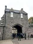 | |||
| 31, 33 Brunstane Road South, Brunstane House | 55°56′24″N 3°05′38″W | Category A | 28034 | | |||
| Greenbank Crescent, Braidburn Valley Gatepiers Including Gates And Railings | 55°55′09″N 3°12′47″W | Category C(S) | 27918 | | |||
| 1, 2 And 3 Wellington Place And Railings | 55°58′16″N 3°10′11″W | Category B | 27921 | | |||
| 8-11 (Inclusive Nos) Wellington Place With Boundary Walls And Railings | 55°58′17″N 3°10′10″W | Category B | 27923 | | |||
| Dalkeith Road, Newington (Echobank) Cemetery, Including 222 Dalkeith Road (Lodge), Vaults, Gates, Gatepiers And Boundary Walls | 55°55′56″N 3°09′59″W | Category B | 27933 | | |||
| Brae Park Road, Cramond Old Bridge | 55°57′55″N 3°18′58″W | Category A | 27940 | | |||
| George Iv Bridge With Railings | 55°56′54″N 3°11′31″W | Category A | 27942 | | |||
| 73 Belford Road, Dean Gallery, (Former Dean Orphanage), Including Lodges, Terrace, Boundary Walls, Steps And Gates | 55°57′07″N 3°13′27″W | Category A | 27969 | %2C_73_Belford_Road%2C_Edinburgh_(side_view).jpg) | |||
| Edinburgh Academy 48 Henderson Row | 55°57′39″N 3°12′16″W | Category A | 27973 |  | |||
| Lauriston Place, George Heriot's School, Examination Hall | 55°56′44″N 3°11′44″W | Category B | 27978 | | |||
| Lauriston Place, George Heriot's School, Main Building | 55°56′45″N 3°11′41″W | Category A | 27980 | 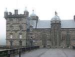 | |||
| Union Canal, Bridge No 18 (Near Clifton Hall) | 55°55′14″N 3°25′47″W | Category B | 27827 | | |||
| 99 New Kirkgate, Trinity House With Boundary Walls, Gates, Gatepiers And Railings | 55°58′20″N 3°10′17″W | Category A | 27834 | | |||
| 30 Pilrig House Close, Pilrig House | 55°58′10″N 3°10′53″W | Category A | 27841 | | |||
| 3 And 5 Pilrig Street With Boundary Walls And Railings | 55°57′52″N 3°10′43″W | Category B | 27845 | | |||
| 11 And 13 Pilrig Street With Boundary Walls And Railings | 55°57′53″N 3°10′45″W | Category B | 27848 | | |||
| William Gladstone Memorial Coates Crescent And Shandwick Place | 55°56′55″N 3°12′44″W | Category A | 27856 | 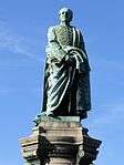 | |||
| West Princes Street Gardens, Thomas Guthrie Monument | 55°57′03″N 3°12′10″W | Category B | 27858 |  | |||
| 61 Queen Charlotte Street With Boundary Walls, Gates And Railings | 55°58′24″N 3°09′57″W | Category B | 27867 | | |||
| 28-42 (Even Nos) Queen Charlotte Street And 94 Constitution Street And 1 Queen Charlotte Lane | 55°58′25″N 3°10′07″W | Category B | 27871 | | |||
| 46 Queen Charlotte Street | 55°58′24″N 3°10′04″W | Category C(S) | 27875 | | |||
| Princes Street, Monument To Duke Of Wellington | 55°57′13″N 3°11′21″W | Category A | 27879 | 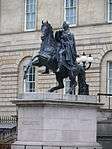 | |||
| East Princes Street Gardens, John Wilson Monument | 55°57′07″N 3°11′42″W | Category A | 27881 |  | |||
| Edinburgh Castle Esplanade, Duke Of York Statue | 55°56′56″N 3°11′52″W | Category B | 27883 |  | |||
| 24-31 (Inclusive Nos) Shore, Former Ship Hotel | 55°58′36″N 3°10′09″W | Category C(S) | 27889 | | |||
| St Bernard's Well, Off St Bernard's Bridge, Including Stair, Walls, Railings And Plaque | 55°57′19″N 3°12′41″W | Category A | 27905 |  | |||
| 16 Tower Street | 55°58′36″N 3°09′59″W | Category B | 27913 | | |||
| Ratho Village, 73 And 75 (Odd Nos) Main Street And Boundary Wall | 55°55′17″N 3°22′50″W | Category C(S) | 27745 | | |||
| Regent Road, St Andrew's House Including Boundary Wall, Lamp Standards And Gates | 55°57′13″N 3°11′02″W | Category A | 27756 |  | |||
| Ratho Village, 40 Main Street, Fernbank And Boundary Wall | 55°55′20″N 3°22′44″W | Category C(S) | 27757 | | |||
| 7 West Brighton Crescent | 55°57′04″N 3°07′09″W | Category B | 27758 | | |||
| 334, 336C-340 And 346A Leith Walk With Railings And Lamp Standards | 55°57′52″N 3°10′40″W | Category C(S) | 27763 | | |||
| 6-9 (Inclusive Nos) Links Gardens And 1 Links Gardens Lane | 55°58′18″N 3°09′43″W | Category B | 27771 | | |||
| Ratho Village, 58-60 (Even Nos), Main Street | 55°55′19″N 3°22′49″W | Category B | 27777 | | |||
| 5 And 6 (Inclusive Nos) Maritime Street | 55°58′28″N 3°10′09″W | Category B | 27791 | | |||
| Brassfounders' Pillar, Nicolson Square | 55°56′46″N 3°11′07″W | Category B | 27797 | 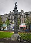 | |||
| Regent Road, Burns Monument Including Boundary Wall And Railings | 55°57′12″N 3°10′42″W | Category A | 27801 |  | |||
| Union Canal, Jawbridge, Bridge No 13 | 55°55′02″N 3°20′32″W | Category B | 27810 | | |||
| 9-23 (Odd Nos) Nile Grove With Boundary Walls And Gatepiers | 55°55′35″N 3°12′24″W | Category B | 27660 | | |||
| 26 Leith Walk With Boundary Walls And Railings | 55°58′13″N 3°10′22″W | Category B | 27667 | | |||
| 29-39 (Odd Nos) Nile Grove With Boundary Walls And Gatepiers | 55°55′35″N 3°12′21″W | Category B | 27668 | | |||
| Ratho Park Ice House | 55°55′29″N 3°21′40″W | Category C(S) | 27670 | | |||
| 3 Rosefield Place | 55°57′06″N 3°07′03″W | Category C(S) | 27681 | | |||
| Mound Place And Castlehill, New College And Assembly Hall, With Railings, Gates, Gatepiers And Lamp Standards | 55°56′58″N 3°11′43″W | Category A | 27689 | 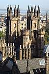 | |||
| 7 Rosefield Place | 55°57′07″N 3°07′03″W | Category C(S) | 27691 | | |||
| 68-76 (Even Nos) Leith Walk | 55°58′10″N 3°10′23″W | Category B | 27692 | | |||
| 234-242 (Even Nos) Leith Walk, Former Victoria India Rubber Mills Buildings | 55°58′00″N 3°10′32″W | Category B | 27712 | | |||
| Ratho Village, 18 Baird Road, Clearence Cottage And Boundary Wall | 55°55′23″N 3°22′41″W | Category B | 27725 | | |||
| 3 Morningside Place | 55°55′50″N 3°12′38″W | Category C(S) | 27728 | | |||
| Craig House, Napier University, Craighouse Road And Morningside Drive | 55°55′17″N 3°13′36″W | Category A | 27736 | | |||
| 26-40 (Even Nos) Kirk Street | 55°58′15″N 3°10′27″W | Category C(S) | 27580 | | |||
| 10, 12, 14 Morningside Road And 3-19 (Odd Nos) Colinton Road | 55°56′02″N 3°12′38″W | Category B | 27581 | | |||
| 44 And 46 Kirk Street | 55°58′13″N 3°10′28″W | Category B | 27585 | | |||
| 18 Morningside Road, Morningside Baptist Church (Former Free Church) With Church Halls And Offices | 55°56′01″N 3°12′38″W | Category B | 27586 | | |||
| Newliston House, Dovecot | 55°56′47″N 3°25′25″W | Category B | 27593 | | |||
| Leith Docks, Alexandra Dry Dock | 55°58′45″N 3°10′09″W | Category B | 27595 | | |||
| Newliston House, East Lodge With Gatepiers And Walls | 55°56′45″N 3°24′54″W | Category B | 27599 | | |||
| 24 Regent Street | 55°57′11″N 3°06′44″W | Category C(S) | 27600 | | |||
| Leith Docks, Alexandra Dry Dock Hydraulic Station | 55°58′45″N 3°10′11″W | Category B | 27601 | | |||
| Leith Docks, Edinburgh Dock And Swing Bridge | 55°58′42″N 3°09′45″W | Category B | 27606 | | |||
| Newliston House, Inner Lodge | 55°56′46″N 3°25′21″W | Category C(S) | 27609 | | |||
| 30 And 31 Chambers Street, Former Edinburgh Dental Hospital And School | 55°56′51″N 3°11′28″W | Category B | 27622 | .jpg) | |||
| Newbattle Terrace, Police Box | 55°55′51″N 3°12′33″W | Category B | 27630 | | |||
| Ransfield Road, Trefoil Centre (Formerly Kirklands Lodge) With Garden Walls Gateway And Freestanding Column | 55°55′17″N 3°20′07″W | Category B | 27642 | | |||
| Leith Docks, Victoria Swing Bridge | 55°58′44″N 3°10′12″W | Category B | 27644 | | |||
| 18 Newbattle Terrace, Dominion Cinema | 55°55′50″N 3°12′31″W | Category B | 27650 | | |||
| 1, 1A Nile Grove, Morningside Braid Church (C Of S) With Church Halls | 55°55′36″N 3°12′30″W | Category B | 27655 | | |||
| 100-118 Great Junction Street (Formerly John Crabbie And Co) | 55°58′22″N 3°10′28″W | Category B | 27501 | | |||
| York Place And 8 Broughton Street, St Paul's And St George's (Scottish Episcopal) Church, Including Lamp And Railings | 55°57′24″N 3°11′19″W | Category A | 27509 | 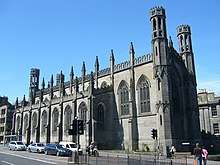 | |||
| 61-79 (Odd Nos) Morningside Park | 55°55′46″N 3°12′49″W | Category B | 27518 | | |||
| Ferry Road, St Serf's Church (Church Of Scotland), With Boundary Wall, Gates And Gatepiers | 55°58′19″N 3°12′19″W | Category B | 27522 | 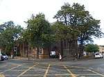 | |||
| Kirkliston Village, Newliston Road, Breast Mill House, Outbuildings And Boundary Walls | 55°56′55″N 3°24′22″W | Category B | 27523 | | |||
| 22 John's Lane | 55°58′23″N 3°10′03″W | Category C(S) | 27530 | | |||
| Morningside Road, Bore Stone | 55°55′52″N 3°12′35″W | Category C(S) | 27536 | | |||
| 3-10 (Inclusive Nos) John's Place With Boundary Walls And Railings | 55°58′23″N 3°10′01″W | Category B | 27540 | | |||
| 33A-39 (Odd Nos) Morningside Road | 55°55′57″N 3°12′35″W | Category B | 27551 | | |||
| Lin's Mill And House | 55°55′17″N 3°25′57″W | Category C(S) | 27553 | | |||
| Archers' Hall, Buccleuch Street | 55°56′32″N 3°11′04″W | Category B | 27562 | | |||
| 43 And 45 Regent Street | 55°57′13″N 3°06′39″W | Category C(S) | 27564 | | |||
| 8-20 (Even Nos) Kirk Street | 55°58′15″N 3°10′23″W | Category C(S) | 27577 | | |||
| Kirkliston Village, High Street, Kirkliston Parish Church With Watch House And Graveyard, Walls And Gatepiers | 55°57′16″N 3°24′12″W | Category A | 27457 | 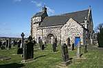 | |||
| 8, 9 And 10 Jordan Lane | 55°55′38″N 3°12′26″W | Category C(S) | 27465 | | |||
| 5A-5C Kirkgate, St Mary's (South Leith Parish) Church (C Of S) With Graveyard, Walls, Gates And Railings | 55°58′19″N 3°10′14″W | Category A | 27466 | 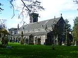 | |||
| 164-172 (Even Nos) Portobello High Street | 55°57′10″N 3°06′50″W | Category C(S) | 27472 | | |||
| 125-143 (Odd Nos) Great Junction Street | 55°58′21″N 3°10′31″W | Category C(S) | 27478 | | |||
| Kirkliston Village, 15 High Street | 55°57′15″N 3°24′04″W | Category C(S) | 27481 | | |||
| 210-240 (Even Nos) Portobello High Street And 1 Marlborough Street | 55°57′09″N 3°06′44″W | Category C(S) | 27486 | | |||
| 15 Jordan Lane | 55°55′38″N 3°12′21″W | Category B | 27488 | | |||
| 242-252 (Even Nos) Portobello High Street; 2-6 (Even Nos) Marlborough Street | 55°57′08″N 3°06′39″W | Category B | 27491 | | |||
| Kirkliston Village, 21 And 23 (Odd Nos), High Street | 55°57′15″N 3°24′06″W | Category C(S) | 27494 | | |||
| 254-284 (Even Nos) Portobello High Street, 1A Bellfield Lane | 55°57′07″N 3°06′34″W | Category C(S) | 27495 | | |||
| 48, 50 Great Junction Street And 2 Henderson Street | 55°58′17″N 3°10′23″W | Category B | 27496 | | |||
| 5 South Gray's Close, St Patrick's Roman Catholic Church | 55°56′59″N 3°11′04″W | Category B | 27498 | | |||
| 125 Moira Terrace, Portobello Road | 55°57′27″N 3°07′47″W | Category C(S) | 27378 | | |||
| High Street And Parliament Square, St Giles (High) Kirk | 55°56′58″N 3°11′27″W | Category A | 27381 | .jpg) | |||
| 127 Moira Terrace, Portobello Road, Wilson Memorial Church (Portobello United Free Church) | 55°57′26″N 3°07′45″W | Category B | 27385 | | |||
| 134-138 (Even Nos) Constitution Street | 55°58′20″N 3°10′10″W | Category B | 27386 | | |||
| 1-5 (Odd Nos) Duke Street And 1 And 2 Newkirkgate | 55°58′15″N 3°10′18″W | Category C(S) | 27399 | | |||
| 5, 5A, 7 And 7A South Fort Street With Front Steps And Railings; Eh6 4Dl | 55°58′28″N 3°11′00″W | Category B | 27408 | | |||
| 195 And 197 Portobello High Street | 55°57′08″N 3°06′49″W | Category C(S) | 27411 | | |||
| 203 And 205 Portobello High Street | 55°57′08″N 3°06′48″W | Category B | 27424 | | |||
| Castle Terrace, St Mark's Church (Unitarian), Including Railings And Lamp Standards | 55°56′55″N 3°12′20″W | Category B | 27434 | | |||
| Polwarth Crescent And Yeaman Place Walker Bridge | 55°56′19″N 3°13′06″W | Category C(S) | 27293 | | |||
| 2 Gillsland Road South | 55°55′49″N 3°13′14″W | Category B | 27296 | | |||
| St John's Road And 1 Kaimes Road, St Anne's Parish Church, Including Boundary Walls, Postbox, Gatepiers, Gates, Railings And Street Light | 55°56′32″N 3°16′24″W | Category A | 27297 | 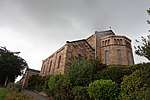 | |||
| Gogar Station Road, Kellerstain House | 55°55′43″N 3°19′59″W | Category B | 27299 | | |||
| 29-35 Odd Nos Polwarth Crescent And 3 Temple Park Crescent | 55°56′17″N 3°13′06″W | Category C(S) | 27300 | | |||
| 143 Grange Loan Astley Ainslie Hospital, Canaan House | 55°55′47″N 3°11′56″W | Category B | 27303 | | |||
| St Bernard's Church (C Of S) Saxe - Coburg (Formerly West Claremont) Street | 55°57′37″N 3°12′24″W | Category B | 27311 | | |||
| Gogar Station Road, Millburn Policies, South Lodge Walls And Gatepiers | 55°55′45″N 3°19′33″W | Category B | 27313 | | |||
| Hatton Estate, S Terrace Wall With Pavilions And Bath-House | 55°54′15″N 3°23′43″W | Category A | 27334 | | |||
| 16-22 (Even Nos) Marlborough Street | 55°57′10″N 3°06′38″W | Category B | 27336 | | |||
| 86-90 (Even Nos) Constitution Street | 55°58′26″N 3°10′05″W | Category B | 27337 | | |||
| Hatton Estate, East Avenue Gates | 55°54′22″N 3°22′43″W | Category A | 27341 | | |||
| 39 And 39A Portland Street With Front Walls, Steps And Railings; Eh6 4Bb | 55°58′38″N 3°10′57″W | Category C(S) | 27347 | | |||
| 28 And 28A Polwarth Terrace | 55°56′06″N 3°13′22″W | Category C(S) | 27349 | | |||
| 28-30A (Even Nos) Marlborough Street | 55°57′11″N 3°06′36″W | Category B | 27350 | | |||
| 96 -104 (Even Nos) Constitution Street And 3, 3A Queen Charlotte Lane | 55°58′24″N 3°10′06″W | Category B | 27351 | | |||
| 41 (Bf & Gf) And 43 Portland Street With Front Walls, Steps And Railings; Eh6 4Bb | 55°58′38″N 3°10′57″W | Category C(S) | 27354 | | |||
| 44 Polwarth Terrace With Boundary Wall And Gatepiers | 55°56′00″N 3°13′27″W | Category B | 27356 | | |||
| 12 Palmerston Place, Palmerston Place Church Including Wall And Railings | 55°56′51″N 3°12′58″W | Category B | 27220 |  | |||
| 16 And 18 Pittville Street | 55°57′09″N 3°06′20″W | Category C(S) | 27223 | | |||
| 7 And 8 East Brighton Crescent | 55°57′02″N 3°06′57″W | Category B | 27225 | | |||
| 87 And 89 Colinton Road | 55°55′48″N 3°13′20″W | Category C(S) | 27227 | | |||
| 9 And 10 East Brighton Crescent | 55°57′02″N 3°06′59″W | Category B | 27232 | | |||
| 93 And 95 Colinton Road, Brizlee, With Boundary Walls And Gatepiers | 55°55′47″N 3°13′23″W | Category B | 27234 | | |||
| 287 Portobello High Street And St Mark's Place, St Mark's Episcopal Church, Including Gates, Gatepiers And Boundary Walls | 55°57′04″N 3°06′31″W | Category B | 27245 | | |||
| 8 Eden Lane, Harmony House, With Boundary Walls | 55°55′49″N 3°12′15″W | Category B | 27249 | | |||
| 7 Restalrig Road South, Restalrig Parish Church, Church Of Scotland, Including St Triduana's Aisle, Graveyard, Gatehouse And Boundary Walls | 55°57′28″N 3°08′58″W | Category A | 27250 |  | |||
| 11 And 12 Glasgow Road, Middle Norton | 55°56′16″N 3°22′08″W | Category C(S) | 27260 | | |||
| 44 Newhaven Main Street | 55°58′50″N 3°11′48″W | Category C(S) | 27275 | | |||
| 10 Napier Road Lammerburn With Boundary Wall And Gatepiers | 55°56′00″N 3°12′58″W | Category A | 27279 | | |||
| 2 And 2A Forbes Road, The Lodge, With Former Gig House And Cosvhmsn's House, Boundary Walls And Gatepiers | 55°56′05″N 3°12′28″W | Category B | 27282 | | |||
| 46 And 48 Brighton Place, 1A West Brighton Crescent | 55°57′03″N 3°07′06″W | Category B | 27154 | | |||
| 45-53 (Odd Nos) Constitution Street | 55°58′29″N 3°10′00″W | Category B | 27155 | | |||
| Malleny Estate, Scott Burial Vault | 55°53′11″N 3°20′06″W | Category C(S) | 27162 | | |||
| 55 Constitution Street With Boundary Walls And Railings | 55°58′28″N 3°10′01″W | Category B | 27164 | | |||
| 21-33 (Odd Nos) Colinton Road | 55°56′01″N 3°12′40″W | Category B | 27165 | | |||
| 7, 7A And 9 (Odd Nos) Craighall Road, Newhaven Church Of Scotland Including Hall, Vestry, Gatepiers And Railings And 7 Craighall Road, Old Schoolhouse | 55°58′47″N 3°11′49″W | Category B | 27167 | | |||
| Malleny House With Walled Garden, Bothy, Ironwork, Gates, Gatepiers, Green Cottage And Stables | 55°53′09″N 3°20′15″W | Category A | 27172 | | |||
| 29 Pittville Street | 55°57′08″N 3°06′24″W | Category C(S) | 27179 | |
Key
The scheme for classifying buildings in Scotland is:
- Category A: "buildings of national or international importance, either architectural or historic; or fine, little-altered examples of some particular period, style or building type."[1]
- Category B: "buildings of regional or more than local importance; or major examples of some particular period, style or building type, which may have been altered."[1]
- Category C: "buildings of local importance; lesser examples of any period, style, or building type, as originally constructed or moderately altered; and simple traditional buildings which group well with other listed buildings."[1]
In March 2016 there were 47,288 listed buildings in Scotland. Of these, 8 per cent were Category A, and 50 per cent were Category B, with the rest listed at Category C.[2]
Notes
- Sometimes known as OSGB36, the grid reference (where provided) is based on the British national grid reference system used by the Ordnance Survey.
• "Guide to National Grid". Ordnance Survey. Retrieved 12 December 2007.
• "Get-a-map". Ordnance Survey. Retrieved 17 December 2007. - Historic Environment Scotland assign a unique alphanumeric identifier to each designated site in Scotland, for listed buildings this always begins with "LB", for example "LB12345".
References
- All entries, addresses and coordinates are based on data from Historic Scotland. This data falls under the Open Government Licence
- "What is Listing?". Historic Environment Scotland. Retrieved 29 May 2018.
- Scotland's Historic Environment Audit 2016 (PDF). Historic Environment Scotland and the Built Environment Forum Scotland. pp. 15–16. Retrieved 29 May 2018.
This article is issued from Wikipedia. The text is licensed under Creative Commons - Attribution - Sharealike. Additional terms may apply for the media files.