List of listed buildings in Edinburgh/4
List
| Name | Location | Date Listed | Grid Ref. [note 1] | Geo-coordinates | Notes | LB Number [note 2] | Image |
|---|---|---|---|---|---|---|---|
| 15-17A (Odd Nos) Dundas Street, Including Railings | 55°57′24″N 3°11′55″W | Category B | 28704 |  | |||
| 79-85 (Odd Nos) Dundas Street And 34B Cumberland Street, Including Railings | 55°57′32″N 3°11′59″W | Category B | 28711 | | |||
| 22 And 22A Dundas Street, And 37 Northumberland Street, Including Railings | 55°57′25″N 3°11′58″W | Category B | 28716 | | |||
| 1-7 (Odd Nos) Dundonald Street, And 1 And 3 Cumberland Street, Including Railings And Lamp | 55°57′32″N 3°11′50″W | Category A | 28723 | | |||
| Dean Street 33-41 And 1 Raeburn Street | 55°57′30″N 3°12′44″W | Category B | 28641 | | |||
| Dean Terrace 2-6A | 55°57′28″N 3°12′34″W | Category A | 28642 | | |||
| Dean Terrace 7-10A | 55°57′27″N 3°12′36″W | Category B | 28643 | | |||
| Dean Terrace 11-15A And 1, 1A Carlton Street | 55°57′27″N 3°12′37″W | Category A | 28644 | | |||
| Dean Terrace 16-21 And 2 Carlton Street And 1 Danube Street | 55°57′24″N 3°12′41″W | Category A | 28645 |  | |||
| Dean Terrace Upper 1-6 | 55°57′22″N 3°12′42″W | Category A | 28647 | 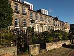 | |||
| 1-9C (Inclusive Nos) Doune Terrace, Including Railings And Lamp, With 8-11 (Inclusive Nos) Gloucester Square | 55°57′21″N 3°12′28″W | Category A | 28659 | | |||
| 1-10 (Inclusive Nos) Drummond Place, And 70-76 (Even Nos) Dublin Street And 31 And 31A Nelson Street, Including Railings And Lamps With Dublin Meuse | 55°57′29″N 3°11′40″W | Category A | 28665 | | |||
| 21-30 (Inclusive Nos) Drummond Place, And 2 And 2A-D Scotland Street And 2-6 (Even Nos) Dundonald Street(Includes 1,2,3,13 And 14 West Scotland Street Lane), Including Railings And Lamps | 55°57′33″N 3°11′43″W | Category A | 28668 | | |||
| 37-42 (Inclusive Nos) Drummond Place, And 77 Dublin Street And 1-3A (Odd Nos) London Street, Including Railings And Lamps With 2 And 3 Dublin Street Lane North | 55°57′31″N 3°11′36″W | Category A | 28670 | | |||
| 1, 2, 3, Riverside And 10,11,12,13,14 And 15 Cramond Village | 55°58′48″N 3°18′02″W | Category A | 28606 | | |||
| 16 Cramond Glebe Road, Cramond Manse Including Former Stables, Boundary Wall, Gatepiers And Gates | 55°58′39″N 3°17′58″W | Category B | 28608 | | |||
| 59-73 (Odd Nos) Cumberland Street, Including Railings | 55°57′29″N 3°12′06″W | Category B | 28611 | | |||
| 4-34A (Even Nos) Cumberland Street And 1-12B Cumberland Street Lane North East, Including Railings | 55°57′32″N 3°11′55″W | Category B | 28613 | | |||
| 79 Dalkeith Road Including Boundary Walls And Pedestrian Gates | 55°56′12″N 3°10′13″W | Category B | 28617 | | |||
| 81 Dalkeith Road Including Boundary Walls And Pedestrian Gates | 55°56′12″N 3°10′12″W | Category C(S) | 28618 | | |||
| 78 And 80 Dalkeith Road, Including Boundary Walls And Piers | 55°56′13″N 3°10′17″W | Category B | 28626 | | |||
| Danube Street 3-23 | 55°57′25″N 3°12′43″W | Category A | 28630 | 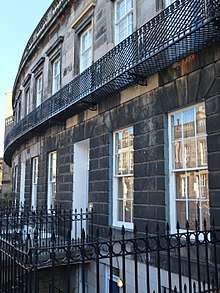 | |||
| Danube Street 4-34A | 55°57′23″N 3°12′43″W | Category A | 28631 | 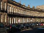 | |||
| 1-11 (Odd Nos) Darnaway Street, And 1-4 (Inclusive Nos) Gloucester Lane, Including Railings And Lamps | 55°57′17″N 3°12′25″W | Category A | 28632 | | |||
| Dean Path, 1-25 Dean Path Buildings | 55°57′09″N 3°13′05″W | Category B | 28634 |  | |||
| Dean Street 11-31 | 55°57′31″N 3°12′41″W | Category B | 28640 | | |||
| 1-11 (Inclusive Numbers) Coates Crescent, 2 Stafford Street, 1 Walker Street, Including Railings | 55°56′57″N 3°12′41″W | Category A | 28563 | 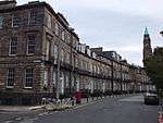 | |||
| 1-31 (Odd Nos) Coates Gardens, Including Railings | 55°56′49″N 3°13′19″W | Category B | 28565 | | |||
| 33-43 (Odd Nos) Coates Gardens, Including Railings | 55°56′51″N 3°13′19″W | Category B | 28566 | | |||
| 2-40 (Even Nos) Coates Gardens, Including Railings | 55°56′49″N 3°13′17″W | Category B | 28567 | | |||
| 9 Cockburn Street | 55°57′03″N 3°11′27″W | Category B | 28571 | | |||
| 19 And 21 Cockburn Street | 55°57′03″N 3°11′25″W | Category B | 28574 | | |||
| 1, 3, 5, 7 Coltbridge Terrace, Including Boundary Walls | 55°56′50″N 3°14′10″W | Category B | 28581 | | |||
| Comely Bank 4-23 | 55°57′34″N 3°13′16″W | Category B | 28583 | | |||
| Cowgate, Gateway At East Of St Patrick's Roman Catholic Church | 55°56′58″N 3°11′02″W | Category C(S) | 28593 | | |||
| 1-15 (Odd Nos) Cowgatehead | 55°56′52″N 3°11′37″W | Category C(S) | 28598 | | |||
| 7-21 (Inclusive Nos) Claremont Crescent | 55°57′50″N 3°11′30″W | Category A | 28524 | | |||
| 2-24 (Even Nos) East Claremont Street Including Boundary Walls And Railings | 55°57′39″N 3°11′33″W | Category B | 28535 | | |||
| Clarendon Crescent 1-22 And 1, 1A Oxford Terrace | 55°57′15″N 3°12′52″W | Category A | 28544 | | |||
| Clerk Street 46-66, And 3-5 Montague Street And 1-3 Rankeillor Street | 55°56′32″N 3°10′54″W | Category B | 28549 | | |||
| Clerk Street South, 11-29 | 55°56′28″N 3°10′51″W | Category C(S) | 28550 | | |||
| Clerk Street South 12-32 And 18 Hope Park Terrace | 55°56′26″N 3°10′52″W | Category C(S) | 28555 | | |||
| Clerk Street South, 44-74 | 55°56′24″N 3°10′50″W | Category C(S) | 28556 | | |||
| Causeway, The Ian's Hill House Duddingston | 55°56′34″N 3°08′46″W | Category B | 28493 | | |||
| 32 Chambers Street, Bank Of Scotland | 55°56′50″N 3°11′28″W | Category B | 28497 | | |||
| 12-17 (Inclusive Nos) Charlotte Square With 10-18 (Even Nos) Randolph Lane, Railings, Lamp Standards And Boundary Walls | 55°57′07″N 3°12′34″W | Category A | 28503 |  | |||
| 18-23 (Inclusive Nos) Charlotte Square With Railings, Lamp Standards And Boundary Walls | 55°57′04″N 3°12′33″W | Category A | 28504 |  | |||
| 40-46 (Inclusive Nos) Charlotte Square And 143 George Street With Railings And Lamp Standards | 55°57′08″N 3°12′23″W | Category A | 28507 |  | |||
| 1 North Charlotte Street With Railings And Boundary Walls | 55°57′10″N 3°12′24″W | Category A | 28508 | | |||
| 15 South Charlotte Street With Railings And Lamp Standard | 55°57′04″N 3°12′21″W | Category A | 28515 |  | |||
| 3-21 (Odd Numbers) Chester Street | 55°57′00″N 3°12′59″W | Category B | 28517 | | |||
| 23-35 (Odd Numbers) Chester Street | 55°56′59″N 3°13′03″W | Category B | 28518 |  | |||
| Cheyne Street 1-31 (Odd Nos) And 43, 45, 47 Dean Street | 55°57′30″N 3°12′45″W | Category B | 28520 | | |||
| 95 Canongate, 4 Reid' Court (Russell House) | 55°57′08″N 3°10′39″W | Category B | 28430 | | |||
| 297 And 299 Canongate, 2 Jeffrey Street And 1 Cranston Street | 55°57′03″N 3°11′03″W | Category B | 28439 |  | |||
| 82 And 84 Canongate, (Nisbet Of Dirleton's House) | 55°57′07″N 3°10′37″W | Category B | 28441 |  | |||
| 174 Canongate, Moray House Including Gates, Gatepiers, Porters Lodge And Summerhouse | 55°57′04″N 3°10′50″W | Category A | 28449 |  | |||
| Canongate, Moray House, Garden Gateway | 55°57′01″N 3°10′49″W | Category B | 28450 |  | |||
| 176-184 (Even Nos) Canongate St John's Land | 55°57′03″N 3°10′52″W | Category C(S) | 28451 | | |||
| Canongate, 3, 4, 5, 6 And 6B Chessel's Court (S Block) Including St Saviour's Child Garden | 55°57′01″N 3°10′59″W | Category A | 28454 | %2C_Edinburgh.jpg) | |||
| Carlton Street 3-13 | 55°57′26″N 3°12′38″W | Category A | 28457 | | |||
| 1 Carlton Terrace Including Railings And Boundary Walls | 55°57′22″N 3°10′25″W | Category A | 28460 |  | |||
| 15-19 (Odd Nos) Castle Street With Railings | 55°57′06″N 3°12′10″W | Category B | 28462 | | |||
| 21 And 21A Castle Street With Railings | 55°57′08″N 3°12′11″W | Category B | 28463 | | |||
| 63-69 (Odd Nos) North Castle Street And 59 Queen Street With Railings | 55°57′13″N 3°12′14″W | Category A | 28468 | | |||
| 8-12 (Inclusive Nos) Castle Terrace, Including Boundary Wall And Railings | 55°56′54″N 3°12′19″W | Category B | 28483 | | |||
| Buccleuch Place 22, 22A | 55°56′33″N 3°11′16″W | Category B | 28389 | | |||
| Buccleuch Place 23-25 | 55°56′33″N 3°11′16″W | Category B | 28390 |  | |||
| 7-15 (Odd Numbers) Buccleuch Street | 55°56′36″N 3°11′04″W | Category C(S) | 28393 | | |||
| 2,4 Buccleuch Street | 55°56′37″N 3°11′07″W | Category B | 28397 | | |||
| 36-42 Buccleuch Street | 55°56′34″N 3°11′05″W | Category B | 28399 | | |||
| 90,92 Buccleuch Street | 55°56′30″N 3°11′02″W | Category B | 28402 |  | |||
| 1-34 (Inclusive Numbers) Buckingham Terrace, Including Railings And Boundary Walls | 55°57′16″N 3°12′58″W | Category B | 28405 |  | |||
| 35-40 (Inclusive Numbers) Buckingham Terrace, And 10A Belgrave Place, Including Railings | 55°57′17″N 3°13′14″W | Category B | 28406 | | |||
| 24 Calton Hill Including Railings And Boundary Wall | 55°57′16″N 3°11′08″W | Category B | 28409 | | |||
| Canon Street 8 | 55°57′43″N 3°11′55″W | Category C(S) | 28423 | | |||
| 22 And 24 Blacket Place, Including Boundary Walls | 55°56′14″N 3°10′30″W | Category B | 28314 | | |||
| 30 And 32 Blacket Place, Including Boundary Walls | 55°56′12″N 3°10′31″W | Category B | 28316 | | |||
| 34 And 36 Blacket Place, Including Boundary Walls | 55°56′11″N 3°10′31″W | Category B | 28317 | | |||
| 38, 40 And 42 Blacket Place, Including Boundary Walls | 55°56′11″N 3°10′30″W | Category B | 28318 | | |||
| 44 Blacket Place, Including Boundary Walls | 55°56′10″N 3°10′29″W | Category B | 28319 | | |||
| 5-9 (Odd Nos) Blackfriars Street | 55°57′01″N 3°11′10″W | Category B | 28321 | | |||
| 17-25 (Odd Nos) Blair Street | 55°56′57″N 3°11′16″W | Category B | 28331 | | |||
| 1-5 (Inclusive Nos) Blenheim Place Including Railings | 55°57′27″N 3°11′03″W | Category A | 28334 | | |||
| 6-10 (Inclusive Nos) Blenheim Place And 2 And 3 Greenside End Including Railings And Boundary Walls | 55°57′27″N 3°10′59″W | Category A | 28335 | | |||
| Boswall Road St Columba's Hospice, Challenger Lodge (Original House, Garden Walls And Gatepiers) | 55°58′48″N 3°12′46″W | Category B | 28340 | | |||
| Brandon Street 1-16 And 1-7A Eyre Place | 55°57′41″N 3°12′04″W | Category B | 28341 | | |||
| Brandon Terrace 11-28 | 55°57′43″N 3°12′01″W | Category C(S) | 28344 | | |||
| 28-36 (Even Nos) Bread Street, Point Hotel (Former St Cuthbert's Co-Operative Association Ltd) | 55°56′44″N 3°12′13″W | Category A | 28347 |  | |||
| 1-15 (Odd Nos) Broughton Place | 55°57′30″N 3°11′21″W | Category B | 28353 | | |||
| 19 Broughton Place And 15-19 (Odd Nos) Hart Street | 55°57′31″N 3°11′17″W | Category B | 28354 | | |||
| 4-12 (Even Nos) Broughton Place | 55°57′32″N 3°11′22″W | Category A | 28355 | | |||
| 2 East Broughton Place Including Boundary Wall And Railings | 55°57′31″N 3°11′15″W | Category B | 28356 | | |||
| 21-25 (Odd Nos) Broughton Street | 55°57′26″N 3°11′16″W | Category B | 28359 | | |||
| 14-22A (Even Nos) Broughton Street, Including Boundary Wall | 55°57′26″N 3°11′19″W | Category B | 28367 | | |||
| 7-17A (Odd Nos) Brunswick Street Including Railings | 55°57′32″N 3°10′47″W | Category A | 28371 |  | |||
| 15 And 16 North Bank Street, Balustraded Terrace To Front, Including Lamp Standards And Gates | 55°57′00″N 3°11′40″W | Category B | 28267 | | |||
| 9,11,13,15 Barnshot Road, With Boundary Wall And Gates | 55°54′21″N 3°15′21″W | Category C(S) | 28272 | | |||
| 1-8 (Inclusive Nos) Baxter's Place Including Railings | 55°57′27″N 3°11′04″W | Category A | 28279 | 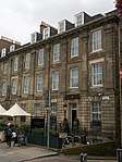 | |||
| 1-21 (Inclusive Numbers) Belgrave Crescent, Including Railings | 55°57′14″N 3°13′01″W | Category B | 28281 | | |||
| 22-25 (Inclusive Numbers) Belgrave Crescent, Including Railings | 55°57′13″N 3°13′11″W | Category B | 28282 | | |||
| 1-10 (Inclusive Numbers) Belgrave Place | 55°57′15″N 3°13′12″W | Category C(S) | 28283 | | |||
| 1-11 (Inclusive Nos) Bellevue Crescent, Including Railings | 55°57′36″N 3°11′34″W | Category A | 28285 | | |||
| 15-27 (Inclusive Nos) Bellevue Crescent, And 5-9 (Odd Nos) Cornwallis Place, Including Railings | 55°57′39″N 3°11′40″W | Category A | 28286 | | |||
| 1-5 (Odd Nos) Bellevue Place Including Boundary Walls And Railings | 55°57′38″N 3°11′32″W | Category B | 28287 | | |||
| 21-35 (Odd Nos) Bellevue Place Including Boundary Walls | 55°57′40″N 3°11′29″W | Category B | 28290 | | |||
| 1-3 (Inclusive Nos) Bellevue Terrace | 55°57′41″N 3°11′35″W | Category A | 28291 | | |||
| 17 Bell's Brae, Hawthornbank Lane, Bell's Brae House | 55°57′08″N 3°13′00″W | Category B | 28294 | | |||
| 6-22 (Even Nos) Barony Street, And 2 Barony Place | 55°57′30″N 3°11′25″W | Category B | 28295 | | |||
| 23 And 25 Blacket Place, Including Boundary Walls | 55°56′08″N 3°10′24″W | Category A | 28306 | | |||
| 6 And 8 Blacket Place, Including Boundary Walls | 55°56′15″N 3°10′25″W | Category B | 28309 | | |||
| 1-11 (Inclusive Nos) Albyn Place, Including Railings, With 2-4 (Inclusive Nos) Wemyss Place Mews | 55°57′13″N 3°12′25″W | Category A | 28234 | | |||
| 6-26 (Even Numbers) Alva Street, Including Railings | 55°57′02″N 3°12′37″W | Category A | 28239 | | |||
| Ann Street 49-51 | 55°57′20″N 3°12′45″W | Category B | 28245 | | |||
| Ann Street 4-14 | 55°57′25″N 3°12′48″W | Category A | 28246 | | |||
| Ann Street 16-42 | 55°57′23″N 3°12′45″W | Category A | 28247 |  | |||
| Ann Street 46-48 | 55°57′22″N 3°12′44″W | Category A | 28249 | | |||
| 1-19 (Inclusive Nos) Annfield | 55°58′47″N 3°11′21″W | Category C(S) | 28256 | | |||
| 7-10 (Inclusive Nos) Antigua Street | 55°57′30″N 3°11′06″W | Category B | 28258 | | |||
| 1-22 (Inclusive Nos) Atholl Crescent, Including Railings, Lamp Standards And 9, 10, 13, 15, 18 And 20 Atholl Crescent Lane | 55°56′52″N 3°12′42″W | Category A | 28260 |  | |||
| 1-13 (Inclusive Nos) Atholl Place And 1 Torphichen Street, Including Railings | 55°56′51″N 3°12′50″W | Category A | 28261 | | |||
| 9 And 10 Swanston Village | 55°53′32″N 3°13′01″W | Category B | 28204 |  | |||
| Abbey Strand, Eastern Building, 'Abbey Sanctuary' | 55°57′10″N 3°10′26″W | Category A | 28207 |  | |||
| 8 And 8A-20 (Inclusive Nos) Abercromby Place, And 1 And 3 Nelson Street, Including Railings And Lamps With Northumberland Place Lane And Dublin Meuse | 55°57′24″N 3°11′45″W | Category A | 28211 | | |||
| 21-34 (Inclusive Nos) Abercromby Place, And 2 Nelson Street And 1 And 1A Dundas Street, Including Coach House(1 Northumberland Street South East Lane), Railings And Lamps With Northumberland Street South East Lane | 55°57′22″N 3°11′54″W | Category A | 28212 | | |||
| 1-15B (Inclusive Nos) Ainslie Place, Including Railings | 55°57′11″N 3°12′40″W | Category A | 28213 | | |||
| 16-20 (Inclusive Nos) Ainslie Place, And 13-14 Glenfinlas Street, Including Railings And Lamps | 55°57′10″N 3°12′37″W | Category A | 28214 | 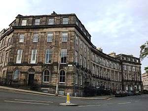 | |||
| 6, 6B Albany Street, Including Railings | 55°57′26″N 3°11′35″W | Category B | 28228 | | |||
| 18-40 (Even Nos) Albany Street, Including Ancillary Structures And Railings | 55°57′26″N 3°11′31″W | Category A | 28230 | | |||
| 42-44 (Even Nos) Albany Street, Including Railings | 55°57′27″N 3°11′26″W | Category A | 28231 | | |||
| 46-54 (Even Nos) Albany Street, Including Railings | 55°57′27″N 3°11′25″W | Category B | 28232 | | |||
| St Catherine's 41, Howdenhall Road | 55°54′12″N 3°09′53″W | Category B | 28121 | | |||
| Howdenhall Road, St Catherine's Gatelodge And Gatepiers | 55°54′08″N 3°09′53″W | Category C(S) | 28123 | | |||
| Gilmerton, The Drum, Steading, Including Cottages, Dovecot, Screen Walls And Gamekeeper's Cottage | 55°54′24″N 3°07′11″W | Category B | 28136 | | |||
| Drylaw House, Wester Drylaw Place And Ferry Road, Dovecot | 55°57′59″N 3°15′08″W | Category C(S) | 28137 | | |||
| Gilmerton Road, Inch Dovecot | 55°55′23″N 3°09′52″W | Category A | 28140 | | |||
| 1 Bell's Mill, Belford Road, Former Bell's Mills Miller's House | 55°57′00″N 3°13′23″W | Category B | 28148 | | |||
| Burdiehouse Limekilns, Near Burdiehouse Mains Farm | 55°53′35″N 3°09′21″W | Category B | 28159 | | |||
| 2, 4 Peffermill Road, Cameron Bank, Including Outbuildings And Boundary Walls | 55°55′47″N 3°09′35″W | Category B | 28163 | | |||
| Liberton Drive, Tower House Stables, With Outbuildings, Gatepiers And Walls | 55°54′52″N 3°10′37″W | Category B | 28187 | | |||
| 5 Caroline Park, Caroline Park House Including Royston House | 55°58′54″N 3°14′28″W | Category A | 28040 | | |||
| Colinton Road, Merchiston Castle School, | 55°54′43″N 3°15′20″W | Category A | 28042 | | |||
| 9 Loaning Road, Craigentinny House Including Boundary Walls With Pavilion End, Gatepiers And Garden Houses | 55°57′36″N 3°08′48″W | Category B | 28047 | | |||
| 35 And 37 Fernielaw Avenue, Fernielaw House With Washhouse, Privy, Boundary Walls And Gatepiers | 55°54′02″N 3°15′51″W | Category B | 28072 | | |||
| Corstorphine High Street, And 1A Orchardfield Avenue, Dower House Including Boundary Walls, Gatepiers And Gates | 55°56′25″N 3°17′02″W | Category B | 28073 | | |||
| Gilmerton, 89 Ravenscroft Street, Gazebo In Gardens | 55°54′06″N 3°08′08″W | Category B | 28075 | | |||
| Inch House - Sundial Glenallan Drive Old Dalkeith Road And Gilmerton Road | 55°55′31″N 3°09′30″W | Category B | 28080 | | |||
| 60 Dreghorn Loan With Outbuilding And Arched Link-Wall | 55°54′10″N 3°15′04″W | Category B | 28085 | | |||
| 5 And 7 Regent Road, Former Royal High School, Including Lodge, Classroom Block, Retaining/ Boundary Walls, Gateposts And Railings | 55°57′12″N 3°10′52″W | Category A | 27987 | 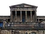 | |||
| Drummond Street, University Of Edinburgh, Geography Department, (Former Surgical Hospital), Including Railings And Lamp Standards | 55°56′54″N 3°11′02″W | Category B | 28000 |  |
Key
The scheme for classifying buildings in Scotland is:
- Category A: "buildings of national or international importance, either architectural or historic; or fine, little-altered examples of some particular period, style or building type."[1]
- Category B: "buildings of regional or more than local importance; or major examples of some particular period, style or building type, which may have been altered."[1]
- Category C: "buildings of local importance; lesser examples of any period, style, or building type, as originally constructed or moderately altered; and simple traditional buildings which group well with other listed buildings."[1]
In March 2016 there were 47,288 listed buildings in Scotland. Of these, 8 per cent were Category A, and 50 per cent were Category B, with the rest listed at Category C.[2]
Notes
- Sometimes known as OSGB36, the grid reference (where provided) is based on the British national grid reference system used by the Ordnance Survey.
• "Guide to National Grid". Ordnance Survey. Retrieved 12 December 2007.
• "Get-a-map". Ordnance Survey. Retrieved 17 December 2007. - Historic Environment Scotland assign a unique alphanumeric identifier to each designated site in Scotland, for listed buildings this always begins with "LB", for example "LB12345".
References
- All entries, addresses and coordinates are based on data from Historic Scotland. This data falls under the Open Government Licence
- "What is Listing?". Historic Environment Scotland. Retrieved 29 May 2018.
- Scotland's Historic Environment Audit 2016 (PDF). Historic Environment Scotland and the Built Environment Forum Scotland. pp. 15–16. Retrieved 29 May 2018.
This article is issued from Wikipedia. The text is licensed under Creative Commons - Attribution - Sharealike. Additional terms may apply for the media files.