List of listed buildings in Edinburgh/33
List
| Name | Location | Date Listed | Grid Ref. [note 1] | Geo-coordinates | Notes | LB Number [note 2] | Image |
|---|---|---|---|---|---|---|---|
| 1-4 (Inclusive Numbers) Abbey Mount And 2 Montrose Terrace | 55°57′23″N 3°10′19″W | Category C(S) | 49048 | 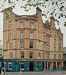 | |||
| 9, 10, 11 And 12 Comely Green Place With Boundary Wall And Railings | 55°57′24″N 3°09′57″W | Category B | 49051 |  | |||
| Napier Road And Spylaw Road, Walls And Gatepiers Of Former Rockville House (1-18 The Limes) | 55°56′00″N 3°13′01″W | Category B | 49358 | | |||
| Holyrood Park, Dumbiedykes Lodge | 55°56′52″N 3°10′40″W | Category C(S) | 49510 | | |||
| Holyrood Park, St Leonard's Fountain | 55°56′31″N 3°10′16″W | Category C(S) | 49514 | | |||
| 65 Bonaly Road, The Cottage (Former Coach House And Stables) At Bonaly Tower, With Garden Statuary | 55°53′50″N 3°15′31″W | Category C(S) | 49548 | | |||
| Colinton Road, Merchiston Castle School, Main School Building | 55°54′43″N 3°15′13″W | Category B | 49558 | | |||
| Colinton Road, Merchiston Castle School, Rogerson House | 55°54′45″N 3°15′11″W | Category B | 49559 | | |||
| 17 Southfield Farm Grove, Southfield Farm | 55°56′42″N 3°07′57″W | Category B | 49626 | | |||
| 7 Carlton Terrace Including Railings And Boundary Walls | 55°57′22″N 3°10′25″W | Category A | 49749 | | |||
| 10 Carlton Terrace Including Railings And Boundary Walls | 55°57′23″N 3°10′25″W | Category A | 49752 | | |||
| 14 Carlton Terrace Including Railings And Boundary Walls | 55°57′24″N 3°10′27″W | Category A | 49756 | 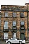 | |||
| 3 Regent Terrace Including Railings And Boundary Walls | 55°57′15″N 3°10′41″W | Category A | 49766 |  | |||
| 4 Regent Terrace Including Railings And Boundary Walls | 55°57′15″N 3°10′40″W | Category A | 49767 | | |||
| 24 Regent Terrace, Including Railings And Boundary Walls | 55°57′19″N 3°10′32″W | Category A | 49787 | 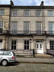 | |||
| 7 Royal Terrace Including Railings And Boundary Walls | 55°57′24″N 3°10′49″W | Category A | 49805 | | |||
| 29 Royal Terrace Including Railings And Boundary Walls | 55°57′24″N 3°10′37″W | Category A | 49820 | 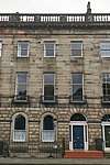 | |||
| 34 Royal Terrace Including Railings And Boundary Walls | 55°57′24″N 3°10′35″W | Category A | 49826 | | |||
| 40 Royal Terrace Including Railings And Boundary Walls | 55°57′24″N 3°10′31″W | Category A | 49832 | 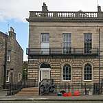 | |||
| 32 George Square, University Of Edinburgh, Arts Faculty, George Square Theatre (Block E) | 55°56′34″N 3°11′17″W | Category B | 50190 | 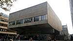 | |||
| 36 George Square, University Of Edinburgh, Arts Faculty, Adam Ferguson (Block D) | 55°56′35″N 3°11′15″W | Category B | 50188 | | |||
| 15, 15B And 15C Dalkeith Road, Scottish Widows Fund And Life Assurance Society Head Office, Including Landscaping, Moat And Boundary Walls | 55°56′25″N 3°10′28″W | Category A | 50213 | | |||
| Shore Road, Port Edgar, Power Station | 55°59′32″N 3°24′37″W | Category C(S) | 50856 | | |||
| Comiston Springs Water House Off Oxgangs Loan And Fox Spring Crescent | 55°54′39″N 3°13′04″W | Category B | 27963 | 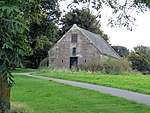 | |||
| Craigleith Road, Royal Victoria Hospital, Administration Block | 55°57′33″N 3°13′54″W | Category B | 51008 | | |||
| 301-319 (Odd Nos) Cowgate And 1 And 2 High School Yards, Including Steps To East | 55°56′56″N 3°11′03″W | Category B | 51174 |  | |||
| 64 Princes Street, British Home Stores | 55°57′09″N 3°11′44″W | Category B | 51249 | | |||
| 8 Sunbury Mews And 3 Sunbury Street | 55°57′05″N 3°13′12″W | Category C(S) | 51344 | | |||
| 42 Pennywell Gardens, Muirhouse St Andrews Parish Church And Halls (Church Of Scotland) | 55°58′21″N 3°15′28″W | Category C(S) | 51748 | |
Key
The scheme for classifying buildings in Scotland is:
- Category A: "buildings of national or international importance, either architectural or historic; or fine, little-altered examples of some particular period, style or building type."[1]
- Category B: "buildings of regional or more than local importance; or major examples of some particular period, style or building type, which may have been altered."[1]
- Category C: "buildings of local importance; lesser examples of any period, style, or building type, as originally constructed or moderately altered; and simple traditional buildings which group well with other listed buildings."[1]
In March 2016 there were 47,288 listed buildings in Scotland. Of these, 8 per cent were Category A, and 50 per cent were Category B, with the rest listed at Category C.[2]
Notes
- Sometimes known as OSGB36, the grid reference (where provided) is based on the British national grid reference system used by the Ordnance Survey.
• "Guide to National Grid". Ordnance Survey. Retrieved 12 December 2007.
• "Get-a-map". Ordnance Survey. Retrieved 17 December 2007. - Historic Environment Scotland assign a unique alphanumeric identifier to each designated site in Scotland, for listed buildings this always begins with "LB", for example "LB12345".
References
- All entries, addresses and coordinates are based on data from Historic Scotland. This data falls under the Open Government Licence
- "What is Listing?". Historic Environment Scotland. Retrieved 29 May 2018.
- Scotland's Historic Environment Audit 2016 (PDF). Historic Environment Scotland and the Built Environment Forum Scotland. pp. 15–16. Retrieved 29 May 2018.
This article is issued from Wikipedia. The text is licensed under Creative Commons - Attribution - Sharealike. Additional terms may apply for the media files.