List of listed buildings in Edinburgh/30
List
| Name | Location | Date Listed | Grid Ref. [note 1] | Geo-coordinates | Notes | LB Number [note 2] | Image |
|---|---|---|---|---|---|---|---|
| Orwell Place, Dalry House With Railings And Lamp Standards | 55°56′35″N 3°13′08″W | Category B | 26962 |  | |||
| 33 Barony Street, Glasite Meeting House | 55°57′28″N 3°11′30″W | Category A | 26973 |  | |||
| 44 Bernard Street | 55°58′34″N 3°10′07″W | Category B | 26982 | | |||
| 20 Bellfield Street | 55°57′09″N 3°06′29″W | Category C(S) | 26992 | | |||
| 14 Ladycroft | 55°53′03″N 3°20′18″W | Category C(S) | 27003 | | |||
| 1 Church Hill, Westgate, With Boundary Walls | 55°55′57″N 3°12′31″W | Category B | 27006 | | |||
| Gorgie Road, Gorgie Parish Church (Formerly Up) | 55°56′17″N 3°13′59″W | Category B | 26863 | | |||
| 18 Colinton Road | 55°55′56″N 3°12′57″W | Category C(S) | 26867 | | |||
| Glenbrook Road, Bankhead House With Walled Garden, Bridge Gates And Railings | 55°52′52″N 3°21′20″W | Category B | 26869 | | |||
| Dock Street (Formerly In Johnstone Street), East Gate Of Leith Citadel | 55°58′37″N 3°10′29″W | Category B | 26902 | | |||
| 44 Harlaw Road, The Glen, Malleny Mill With Mill Lade And Boundary Wall | 55°52′36″N 3°19′31″W | Category C(S) | 26907 | | |||
| 60-66 Bath Street, 25 The Promenade | 55°57′17″N 3°06′39″W | Category B | 26908 | | |||
| 24 Canaan Lane, Goshen Bank Or Goshen House | 55°55′39″N 3°12′26″W | Category C(S) | 26911 | | |||
| Duddingston Parish Church, Loupin-On-Stane, Old Church Lane, Duddingston | 55°56′29″N 3°08′55″W | Category B | 26925 | | |||
| 7 Brunstane Road North, Hamilton Lodge Hotel Including Gatepiers And Boundary Walls | 55°57′04″N 3°06′07″W | Category B | 26802 | | |||
| 18 Brunstane Road North, (Rabbit Hall) Including Boundary Walls | 55°57′03″N 3°06′04″W | Category B | 26814 | | |||
| 5 Elcho Terrace | 55°57′06″N 3°06′19″W | Category C(S) | 26840 | | |||
| Bonnington Sundial | 55°54′24″N 3°25′25″W | Category A | 26853 | | |||
| 2 James Street With Boundary Walls | 55°57′02″N 3°06′14″W | Category C(S) | 26854 | | |||
| 8 And 10 Colinton Road Napier House With Boundary Walls And Gatepiers | 55°56′01″N 3°12′44″W | Category B | 26855 | | |||
| 13, 14 Gladstone Place With Boundary Wall | 55°58′11″N 3°09′31″W | Category C(S) | 26856 | | |||
| 39-47 (Odd Nos) Bernard Street | 55°58′33″N 3°10′09″W | Category B | 26860 | | |||
| Queensferry Road, Buckingham Terrace And 66 Dean Path, Bristo Baptist Church | 55°57′17″N 3°13′17″W | Category B | 26758 | | |||
| 76 Coburg Street, T And Jw Neilson Ltd (Former Stables); Eh6 6Hj | 55°58′33″N 3°10′43″W | Category C(S) | 26760 | | |||
| 198-206 Even Nos Bruntsfield Place And 1 And 3 Montpelier Park | 55°56′09″N 3°12′36″W | Category B | 26763 | | |||
| George Iv Bridge And 11A And 11C Merchant Street, Augustine United Free Church (United Reformed Church) | 55°56′52″N 3°11′28″W | Category B | 26707 | | |||
| 14 Abercorn Terrace St Philip's Parish Church, Including Boundary Walls And Lamp Standards | 55°57′01″N 3°06′10″W | Category B | 26724 | | |||
| 6 Claremont Park, Claremont Park Nursing Home With Boundary Wall, Gatepiers And Lamp Brackets | 55°58′11″N 3°09′23″W | Category B | 26739 | | |||
| Addistoun Dovecot | 55°54′42″N 3°21′17″W | Category A | 26697 | | |||
| Dalmeny Village, 3 Easter Dalmeny | 55°58′57″N 3°22′22″W | Category B | 5529 | | |||
| Dalmeny Village, 9 Main Street, Including Workshop | 55°58′54″N 3°22′25″W | Category C(S) | 5537 | | |||
| Dalmeny Village, 9A Main Street, Post Office | 55°58′54″N 3°22′25″W | Category C(S) | 5538 | | |||
| Dalmeny Village, 5 Wester Dalmeny Farmhouse, Including Gate, Gatepiers And Boundary Walls | 55°58′57″N 3°22′37″W | Category B | 5546 | | |||
| Craigiehall, Stable Court, Including Walls And Gatepiers | 55°57′58″N 3°20′11″W | Category B | 5561 | | |||
| Dalmeny House, Home Farm, Including Gatepiers | 55°58′52″N 3°19′50″W | Category C(S) | 5499 | | |||
| Dalmeny House, Edinburgh Gate Lodge, Including Gatepiers | 55°58′10″N 3°19′24″W | Category B | 5505 | | |||
| Dundas Castle, Ice House | 55°58′19″N 3°25′08″W | Category B | 5516 | | |||
| 4 Marine Drive And 11 West Shore Road, Granton Gasworks No 1 Gasholder | 55°58′49″N 3°14′41″W | Category B | 45793 | | |||
| 22 Frogston Road West, Including Garage | 55°53′59″N 3°11′59″W | Category C(S) | 45838 | | |||
| 12 Swanston Village | 55°53′32″N 3°13′02″W | Category B | 45847 | 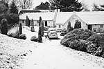 | |||
| 15 Swanston Village | 55°53′33″N 3°13′00″W | Category C(S) | 45849 | | |||
| 105-109 (Odd Nos) Broughton Street | 55°57′32″N 3°11′24″W | Category C(S) | 45934 | | |||
| 9 Randolph Place | 55°57′06″N 3°12′36″W | Category B | 46123 |  | |||
| 63 Bonaly Road, Druim With, Gates And Garden Terrace | 55°53′52″N 3°15′22″W | Category B | 46286 | | |||
| East Trinity Road, Railway Tunnel | 55°58′34″N 3°12′12″W | Category B | 46729 | | |||
| Harewood Road, Craigmillar Primary School | 55°56′07″N 3°07′53″W | Category B | 46973 | | |||
| 21-35 (Odd Nos) Lauriston Place Including Boundary Walls And Railings | 55°56′41″N 3°11′44″W | Category B | 47034 |  | |||
| Fair-A-Far Weir, And Mill Remains | 55°58′26″N 3°18′30″W | Category B | 47281 | | |||
| 19 George Square | 55°56′37″N 3°11′26″W | Category A | 47583 |  | |||
| 183, 185 And 187 Morrison Street | 55°56′46″N 3°12′48″W | Category C(S) | 47726 | | |||
| 30, 31 And 32 Castle Terrace, Including Boundary Wall And Railings | 55°56′49″N 3°12′09″W | Category A | 47855 | 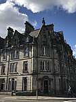 | |||
| 11-15 Cornwall Street, Including Boundary Wall And Railings | 55°56′50″N 3°12′12″W | Category A | 47858 | | |||
| Grassmarket, Covenanters' Memorial, With Boundary Wall, Railings And Gate | 55°56′52″N 3°11′41″W | Category C(S) | 47867 | | |||
| 26 And 28 Lauriston Place, Including Boundary Walls, Railings And Gate | 55°56′42″N 3°11′47″W | Category B | 47889 | 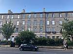 | |||
| 9-15 (Odd Nos) Spittal Street | 55°56′46″N 3°12′13″W | Category C(S) | 47897 | | |||
| 2-10 (Even Nos) Spittal Street And 39-45 (Odd Nos) Bread Street | 55°56′45″N 3°12′11″W | Category C(S) | 47900 | | |||
| 6 Douglas Gardens, Belford Road, Former Belford Church | 55°57′03″N 3°13′13″W | Category B | 48133 |  | |||
| Edinburgh Castle, Lang Stairs | 55°56′56″N 3°12′00″W | Category B | 48221 | | |||
| 83 London Road, Holyrood Abbey Church (Church Of Scotland) | 55°57′25″N 3°10′09″W | Category B | 48539 | | |||
| Henderland Road, St George's School, Lansdowne House Including Gatehouse, Gatepiers And Boundary Wall | 55°56′54″N 3°14′08″W | Category C(S) | 48889 | | |||
| 23 Murrayfield Road, Redcroft, With Boundary Wall | 55°56′52″N 3°14′52″W | Category C(S) | 48899 | | |||
| 43 Murrayfield Road, Clubhouse, Including Boundary Wall And Gatepiers | 55°57′00″N 3°15′04″W | Category C(S) | 48900 | | |||
| 29-39 (Odd Numbers) Montrose Terrace | 55°57′26″N 3°10′16″W | Category B | 49060 | | |||
| 41-49 (Odd Numbers) Montrose Terrace | 55°57′26″N 3°10′14″W | Category B | 49061 | | |||
| 70 Kingston Avenue, Kingston Stables With Boundary Wall, Gatepiers And Entrance Arch | 55°55′11″N 3°08′58″W | Category B | 49539 | | |||
| 13 Kinnear Road, Jeffrey House With Boundary Wall And Gateposts | 55°58′04″N 3°13′05″W | Category B | 49543 | | |||
| 71 Bonaly Road, Lord Cockburn's Bath And "Ruined Chapel" | 55°53′39″N 3°15′41″W | Category B | 49549 | | |||
| 23 And 24 Bridge Road With Raised Pavement And Boundary Wall | 55°54′26″N 3°15′31″W | Category C(S) | 49551 | | |||
| 9 Carlton Terrace Including Railings And Boundary Walls | 55°57′23″N 3°10′25″W | Category A | 49751 | | |||
| 19 Carlton Terrace Including Railings And Boundary Walls | 55°57′24″N 3°10′30″W | Category A | 49761 |  | |||
| 11 Regent Terrace, Including Railings And Boundary Walls | 55°57′17″N 3°10′37″W | Category A | 49774 | 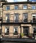 | |||
| 26 Regent Terrace, Including Railings And Boundary Walls | 55°57′19″N 3°10′31″W | Category A | 49791 | 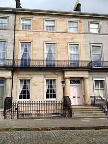 | |||
| 27 Regent Terrace, Including Railings And Boundary Walls | 55°57′19″N 3°10′31″W | Category A | 49792 | 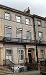 | |||
| 34 Regent Terrace Including Railings And Boundary Walls | 55°57′21″N 3°10′28″W | Category A | 49799 | | |||
| 6 Royal Terrace Including Railings And Boundary Walls | 55°57′24″N 3°10′49″W | Category A | 49804 | | |||
| 25 Royal Terrace Including Railings And Boundary Walls | 55°57′24″N 3°10′40″W | Category A | 49816 |  | |||
| 30 Royal Terrace Including Railings And Boundary Walls | 55°57′24″N 3°10′37″W | Category A | 49821 | | |||
| 35 Royal Terrace Including Railings And Boundary Walls | 55°57′24″N 3°10′34″W | Category A | 49827 | 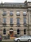 | |||
| 38 Royal Terrace Including Railings And Boundary Walls | 55°57′24″N 3°10′32″W | Category A | 49830 |  | |||
| 14 And 16 Holyrood Road | 55°56′57″N 3°10′57″W | Category C(S) | 50148 | | |||
| Charterhall Road, Police Box | 55°55′34″N 3°11′34″W | Category B | 50880 | | |||
| 70 Belford Road, Former Dean Cemetery Gate Lodge, Including Boundary Walls And Gates | 55°57′03″N 3°13′22″W | Category C(S) | 51393 | | |||
| South Trinity Road, Lamp Standard | 55°58′17″N 3°12′28″W | Category B | 51550 | | |||
| 496 Ferry Road, Former Wardieburn House | 55°58′12″N 3°13′32″W | Category C(S) | 45650 | | |||
| 1 Lufra Bank, Off Granton View, Lufra House Including Boundary Wall | 55°58′44″N 3°13′06″W | Category C(S) | 45657 | | |||
| Queen Street Gardens, Railings And Gates | 55°57′19″N 3°12′01″W | Category B | 45519 | .jpg) | |||
| Gilmore Park And Fountainbridge, Former North British Rubber Company Ltd | 55°56′32″N 3°12′46″W | Category C(S) | 44936 | | |||
| 134 Corstorphine Road, Edinburgh Zoo (Royal Zoological Society Of Scotland) Lodge, Gates And Gatepiers | 55°56′32″N 3°16′10″W | Category B | 44749 | .jpg) | |||
| East Suffolk Road, St Margaret's School (Former Craigmillar Park Free Church), Including Gatepiers And Boundary Walls | 55°55′48″N 3°10′05″W | Category B | 44214 | | |||
| 21 Hallhead Road, Rankine House, Including Gates, Gatepiers And Boundary Walls | 55°55′25″N 3°10′15″W | Category B | 44223 | | |||
| 1 Mayfield Terrace, Including Boundary Walls | 55°56′06″N 3°10′22″W | Category C(S) | 44231 | | |||
| 12 And 12A Grove Street, Including Railings | 55°56′44″N 3°12′47″W | Category B | 44037 | | |||
| 2 Inveralmond Drive | 55°58′13″N 3°18′29″W | Category C(S) | 43940 | | |||
| 13 And 15 Park Road, Newhaven, Including Boundary Wall | 55°58′45″N 3°11′42″W | Category C(S) | 43719 | | |||
| 15 Hill Street | 55°57′13″N 3°12′10″W | Category A | 43298 | | |||
| 36 North West Thistle Street Lane | 55°57′15″N 3°12′02″W | Category C(S) | 43311 | | |||
| 76 And 77 Princes Street And 1 Hanover Street | 55°57′08″N 3°11′47″W | Category B | 43319 | | |||
| Rose Street, Charlotte Street Baptist Chapel | 55°57′04″N 3°12′20″W | Category B | 43329 | | |||
| 162 Rose Street | 55°57′06″N 3°12′09″W | Category C(S) | 43339 | | |||
| 194 Rose Street | 55°57′05″N 3°12′17″W | Category B | 43343 | | |||
| 131 And 133 Rose Street South Lane | 55°57′04″N 3°12′15″W | Category C(S) | 43347 | | |||
| 9 And 10 St Andrew Square | 55°57′12″N 3°11′39″W | Category A | 43349 | | |||
| 47A And 49 Thistle Street And 21 North West Thistle Street Lane | 55°57′15″N 3°11′58″W | Category B | 43359 | | |||
| 59 And 61 Thistle Street | 55°57′14″N 3°12′00″W | Category B | 43361 | | |||
| 50-52 (Even Nos) Thistle Street | 55°57′14″N 3°11′57″W | Category B | 43363 | | |||
| 15 Young Street And 24 Young Street Lane North | 55°57′11″N 3°12′20″W | Category A | 43366 | | |||
| Alnwickhill Road And 1-4B (Inclusive Nos) Stanedykehead, Alnwickhill House With Gatepiers And Boundary Walls | 55°54′32″N 3°10′09″W | Category B | 43233 | | |||
| 74 Liberton Gardens, Alnwickhill Reservoir, Former Superintendent's House With Gates And Gatepiers | 55°54′21″N 3°09′57″W | Category C(S) | 43247 | | |||
| Gilmerton, 83 Drum Street | 55°54′17″N 3°07′50″W | Category C(S) | 43257 | | |||
| Gilmerton, 89 Ravenscroft Street | 55°54′07″N 3°08′10″W | Category C(S) | 43261 | | |||
| Newhaven Road, Victoria Park, Edward Vii Statue, Gatepiers And Quadrant Railings | 55°58′31″N 3°11′27″W | Category B | 43279 | | |||
| 25-29 (Odd Nos) And 29A Castle Street | 55°57′08″N 3°12′11″W | Category B | 43281 | | |||
| 48, 48A Frederick Street | 55°57′13″N 3°12′04″W | Category B | 43284 | | |||
| 297 Dalkeith Road, Including Gatepiers | 55°55′51″N 3°09′46″W | Category C(S) | 43150 | | |||
| 7 Upper Gray Street, St Columba's Rc Church Including Boundary Walls | 55°56′12″N 3°10′43″W | Category B | 43173 | | |||
| 44 And 45 Water Street | 55°58′28″N 3°10′11″W | Category B | 43176 | | |||
| 8 High Street And 1 Gote Lane, Stag Head Hotel | 55°59′26″N 3°23′49″W | Category B | 40375 | | |||
| 29/1 - 29/4 And 29/7 Hopetoun Road And 5 And 6 The Loan, Plewlands House | 55°59′26″N 3°23′52″W | Category A | 40389 |  | |||
| 2 Hopetoun Road, 4 Bellstane | 55°59′27″N 3°23′51″W | Category B | 40390 | | |||
| Hopetoun Road, Inchgarvie House (Flats A-L) | 55°59′32″N 3°25′17″W | Category C(S) | 40392 | | |||
| 1 Mid Terrace | 55°59′23″N 3°23′43″W | Category B | 40395 | | |||
| 1-6 (Inclusive Numbers) Mid Terrace, Wall And Railings | 55°59′24″N 3°23′44″W | Category B | 40399 | | |||
| Stoneycroft Road From The Loan To Rear Of 11 East Terrace, Railway Embankment | 55°59′20″N 3°23′42″W | Category C(S) | 40400 | | |||
| 40 Shore Road, Flotilla Club, (Now Sheltered Accommodation) | 55°59′30″N 3°24′10″W | Category B | 40412 | | |||
| 10A And 10B East Terrace | 55°59′22″N 3°23′37″W | Category B | 40341 | | |||
| 16 East Terrace And Camperdown | 55°59′23″N 3°23′40″W | Category B | 40346 | | |||
| 17 East Terrace, Inchcolm (In Close To Rear Of 18 East Terrace) | 55°59′22″N 3°23′41″W | Category B | 40349 | | |||
| 2 Newhalls Road, Hawes Inn | 55°59′25″N 3°23′06″W | Category B | 40354 | | |||
| 2 And 3 Newhalls Road, The Two Bridges Hotel | 55°59′23″N 3°23′15″W | Category B | 40357 | | |||
| 1 And 3 Edinburgh Road | 55°59′23″N 3°23′34″W | Category C(S) | 40358 | | |||
| 23 Edinburgh Road, Seals Craig Hotel | 55°59′24″N 3°23′32″W | Category C(S) | 40362 |  | |||
| Forth Bridge | 55°59′54″N 3°23′15″W | Category A | 40370 |  | |||
| 27 South Oswald Road Carrington House Including Gatepiers And Gates | 55°55′42″N 3°11′41″W | Category B | 30591 | | |||
| 12-14 (Inclusive Nos) Warrender Park Crescent | 55°56′18″N 3°12′06″W | Category B | 30612 | | |||
| 61-63 (Odd Nos) Warrender Park Road | 55°56′19″N 3°11′48″W | Category B | 30623 | | |||
| 65 Warrender Park Road | 55°56′19″N 3°11′49″W | Category B | 30624 | | |||
| 141-145 (Odd Nos) Warrender Park Road | 55°56′15″N 3°12′07″W | Category B | 30639 | | |||
| 25-26 Warrender Park Terrace And 1 Spottiswoode Street | 55°56′21″N 3°11′54″W | Category B | 30653 | | |||
| 33-35 (Inclusive Nos) Warrender Park Terrace | 55°56′20″N 3°11′58″W | Category B | 30657 | | |||
| 10 Greenhill Gardens | 55°56′08″N 3°12′19″W | Category B | 30514 | | |||
| 43 Marchmont Crescent | 55°56′14″N 3°11′38″W | Category B | 30537 | | |||
| Marchmont Rd & Marchmont Cres Napier Univ Annexe Formerly Marchmont Road School | 55°56′13″N 3°11′39″W | Category B | 30538 | 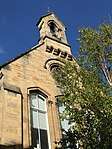 | |||
| 11 Marchmont Road | 55°56′21″N 3°11′41″W | Category B | 30540 | | |||
| 59 Marchmont Road | 55°56′14″N 3°11′39″W | Category B | 30550 | | |||
| 52-56 (Even Nos) Marchmont Road | 55°56′15″N 3°11′42″W | Category B | 30560 | | |||
| 9 Marchmont Street | 55°56′18″N 3°12′01″W | Category B | 30573 | | |||
| 23 Mortonhall Road Including Boundary Walls And Steps | 55°55′39″N 3°11′31″W | Category B | 30576 | | |||
| 33 Mortonhall Road With Lamp Posts Boundary Walls And Gates And Railings | 55°55′38″N 3°11′40″W | Category A | 30578 | | |||
| 2 Roseneath Terrace And 28-30 (Inclusive Nos) Argyle Place | 55°56′19″N 3°11′30″W | Category B | 30468 | 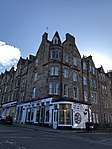 | |||
| 4-8 (Even Nos) Roseneath Terrace | 55°56′19″N 3°11′31″W | Category B | 30469 |  |
Key
The scheme for classifying buildings in Scotland is:
- Category A: "buildings of national or international importance, either architectural or historic; or fine, little-altered examples of some particular period, style or building type."[1]
- Category B: "buildings of regional or more than local importance; or major examples of some particular period, style or building type, which may have been altered."[1]
- Category C: "buildings of local importance; lesser examples of any period, style, or building type, as originally constructed or moderately altered; and simple traditional buildings which group well with other listed buildings."[1]
In March 2016 there were 47,288 listed buildings in Scotland. Of these, 8 per cent were Category A, and 50 per cent were Category B, with the rest listed at Category C.[2]
Notes
- Sometimes known as OSGB36, the grid reference (where provided) is based on the British national grid reference system used by the Ordnance Survey.
• "Guide to National Grid". Ordnance Survey. Retrieved 12 December 2007.
• "Get-a-map". Ordnance Survey. Retrieved 17 December 2007. - Historic Environment Scotland assign a unique alphanumeric identifier to each designated site in Scotland, for listed buildings this always begins with "LB", for example "LB12345".
References
- All entries, addresses and coordinates are based on data from Historic Scotland. This data falls under the Open Government Licence
- "What is Listing?". Historic Environment Scotland. Retrieved 29 May 2018.
- Scotland's Historic Environment Audit 2016 (PDF). Historic Environment Scotland and the Built Environment Forum Scotland. pp. 15–16. Retrieved 29 May 2018.
This article is issued from Wikipedia. The text is licensed under Creative Commons - Attribution - Sharealike. Additional terms may apply for the media files.