List of listed buildings in Edinburgh/3
List
| Name | Location | Date Listed | Grid Ref. [note 1] | Geo-coordinates | Notes | LB Number [note 2] | Image |
|---|---|---|---|---|---|---|---|
| 22 Minto Street, Including Boundary Walls And Pier | 55°56′05″N 3°10′28″W | Category B | 29352 |  | |||
| 24-30A (Inclusive Nos) Minto Street Including Boundary Walls | 55°56′03″N 3°10′27″W | Category B | 29354 | | |||
| 45 And 46 Minto Street, Including Boundary Walls, Gatepiers And Pedestrian Gates | 55°56′11″N 3°10′38″W | Category B | 29360 |  | |||
| 1-18A (Inclusive Nos) Moray Place, And 10 Doune Terrace, Including Railings And Lamps, With 1-7 (Inclusive Nos) Gloucester Square, And 5-10A (Inclusive Nos) Gloucester Lane | 55°57′19″N 3°12′26″W | Category A | 29368 | 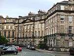 | |||
| 37-43 (Inclusive Nos) Moray Place, Including Railings And Lamps | 55°57′14″N 3°12′29″W | Category A | 29370 | 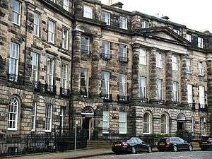 | |||
| 44-50A (Inclusive Nos) Moray Place, Including Railings And Lamps, With 6 And 7 Wemyss Place Mews | 55°57′14″N 3°12′27″W | Category A | 29371 | | |||
| 91-107 (Odd Nos) Morrison Street | 55°56′45″N 3°12′36″W | Category B | 29374 | | |||
| 10-32 (Even Nos) Morrison Street | 55°56′45″N 3°12′22″W | Category C(S) | 29376 | | |||
| 252-264 (Even Nos) Morrison Street, Including Railings | 55°56′47″N 3°12′56″W | Category C(S) | 29378 | | |||
| 1-15 (Odd Nos) And 2-16 (Even Nos) Mayville Gardens With 10 And 11 Laverockbank Road | 55°58′41″N 3°12′03″W | Category B | 29315 |  | |||
| 1-41 (Odd Numbers) Melville Street, 1-6 (Inclusive) Melville Place, Including Railings And Arched Lamp Holders | 55°57′04″N 3°12′41″W | Category A | 29324 |  | |||
| 47-61 (Odd Numbers) Melville Street, 33 Manor Place, Including Railings And Arched Lamp Holders | 55°56′56″N 3°12′53″W | Category A | 29325 | 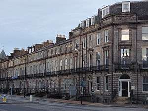 | |||
| 28-40(Even Numbers) Melville Street, 32 Stafford Street Including Railings And Arched Lamp Holders | 55°57′00″N 3°12′46″W | Category A | 29327 | 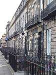 | |||
| 11 And 12 Minto Street, Including Boundary Walls, Gatepiers, Carriage And Pedestrian Gates | 55°56′10″N 3°10′34″W | Category C(S) | 29344 | | |||
| 60 Newhaven Main Street | 55°58′50″N 3°11′50″W | Category C(S) | 29280 | | |||
| 2 And 3 Lamb's Court | 55°58′50″N 3°11′44″W | Category C(S) | 29282 | | |||
| 22 Newhaven Main Street | 55°58′50″N 3°11′38″W | Category C(S) | 29283 | | |||
| 1 And 2 Great Michael Close | 55°58′49″N 3°11′38″W | Category C(S) | 29284 | | |||
| 10 And 12 Newhaven Main Street | 55°58′49″N 3°11′36″W | Category B | 29285 | | |||
| 272-278 (Even Nos) Morrison Street And 11-14 (Inclusive Nos) West Maitland Street | 55°56′47″N 3°12′58″W | Category B | 29291 | | |||
| 35-47 (Odd Numbers) Manor Place, Including Railings | 55°56′57″N 3°12′56″W | Category A | 29298 | 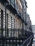 | |||
| 47A-61 (Odd Numbers) Manor Place, 11A Rothesay Place | 55°57′02″N 3°13′03″W | Category B | 29299 | | |||
| 4-24 (Even Numbers) Manor Place Including Railings | 55°56′52″N 3°12′52″W | Category B | 29300 | | |||
| 31-37 (Odd Nos) Marshall Street And 23 Nicolson Square | 55°56′45″N 3°11′11″W | Category B | 29304 | | |||
| Mary's Place, 7-12 | 55°57′33″N 3°12′51″W | Category B | 29308 | | |||
| 5-10 (Inclusive Nos) West Mayfield, Including Boundary Walls | 55°56′01″N 3°10′33″W | Category B | 29311 | | |||
| 1-19 (Odd Nos) Mayfield Gardens, 1 East Mayfield And 1 Peel Terrace, Including Boundary Walls | 55°56′00″N 3°10′24″W | Category B | 29313 | | |||
| 27-35 (Odd Nos) Leith Street | 55°57′15″N 3°11′16″W | Category B | 29252 | | |||
| Lennox Street 3-15 | 55°57′19″N 3°12′49″W | Category B | 29254 | | |||
| Lennox Street 17-23 | 55°57′21″N 3°12′52″W | Category B | 29255 | | |||
| Lennox Street 2-22 | 55°57′20″N 3°12′47″W | Category B | 29256 | | |||
| 12-21 (Inclusive Nos) Leopold Place And 1-3A (Odd Nos) Windsor Street Including Railings | 55°57′29″N 3°10′53″W | Category A | 29258 | | |||
| 1-41 (Odd Nos) London Street, Including Railings And Lamps | 55°57′31″N 3°11′35″W | Category A | 29260 | | |||
| 2-36 (Even Nos) London Street, Including Railings And Lamps | 55°57′33″N 3°11′32″W | Category A | 29261 | | |||
| 42-54 (Inclusive Nos) London Street, Including Railings | 55°57′33″N 3°11′28″W | Category A | 29262 | | |||
| 18 East London Street, Gayfield House Including Boundary Walls And Gatepiers | 55°57′37″N 3°11′15″W | Category A | 29263 | | |||
| 95-103 (Odd Nos) Lothian Road | 55°56′47″N 3°12′19″W | Category C(S) | 29268 | | |||
| Lutton Place 1-19 And 49 South Clerk Street | 55°56′25″N 3°10′46″W | Category B | 29273 | 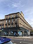 | |||
| 3-22 (Inclusive Numbers) Lynedoch Place, Including Railings And Arched Lampholders | 55°57′06″N 3°12′47″W | Category A | 29275 |  | |||
| 1-10 (Inclusive Nos) Magdala Crescent And 45 Coates Gardens, Including Boundary Walls | 55°56′48″N 3°13′23″W | Category B | 29276 | | |||
| 11-24 (Inclusive Nos) Magdala Crescent, 1A Douglas Crescent, 31 Eglinton Crescent And 10-12 (Even Nos) Magdala Mews, Including Railings And Boundary Wall | 55°56′52″N 3°13′24″W | Category B | 29277 | | |||
| 1-7 (Inclusive Nos) Kew Terrace, Including Boundary Walls | 55°56′43″N 3°13′50″W | Category C(S) | 29200 | | |||
| Lanark Road 491 Torduff, Now Lorimer House, Juniper Green | 55°54′17″N 3°16′46″W | Category C(S) | 29203 | | |||
| Lanark Road, 500 Castlebank, Juniper Green | 55°54′18″N 3°16′57″W | Category C(S) | 29207 | | |||
| 1-9 (Inclusive Nos) Lansdowne Crescent, Including Railings | 55°56′52″N 3°13′02″W | Category B | 29211 | | |||
| 12-21 (Inclusive Nos) Lansdowne Crescent Including Railings | 55°56′49″N 3°13′09″W | Category B | 29212 | | |||
| 37 Lauriston Place And 1 Archibald Place, Including Boundary Wall And Railings | 55°56′41″N 3°11′45″W | Category B | 29216 | | |||
| 8 Lauriston Place, Including Boundary Wall, Gate And Railings | 55°56′42″N 3°11′44″W | Category B | 29217 | 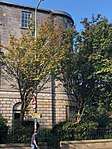 | |||
| 1 And 2 Laverockbank Road, With Boundary Wall, Gates And Railings | 55°58′37″N 3°12′02″W | Category A | 29220 | | |||
| 3 And 4 Laverockbank Road, With Boundary Wall | 55°58′38″N 3°12′02″W | Category B | 29221 | | |||
| 8 And 9 Laverockbank Road, With Boundary Wall | 55°58′39″N 3°12′02″W | Category B | 29223 | | |||
| 17 Laverockbank Road, Starbank House, With Fountain, Boundary Walls, Gatepiers, Railings, Gates And Gateposts | 55°58′45″N 3°12′03″W | Category B | 29224 |  | |||
| 453-463 Lawnmarket, Including Wardrop's Court And 2 Lady Stair's Close | 55°56′58″N 3°11′36″W | Category B | 29229 |  | |||
| 513-521 (Odd Nos) Lawnmarket, Milne's Court, Including Edward Salveson Hall And Philip Henman Hall | 55°56′57″N 3°11′40″W | Category A | 29237 |  | |||
| 302-310 (Even Nos) Lawnmarket, Including Buchanan's Close And Brodie's Close | 55°56′57″N 3°11′35″W | Category A | 29239 | | |||
| 1-3A (Inclusive Numbers) Learmonth Terrace, Including Railings | 55°57′21″N 3°13′00″W | Category B | 29245 | | |||
| 9-24 (Inclusive Numbers) Learmonth Terrace, Including Railings | 55°57′20″N 3°13′05″W | Category B | 29247 | | |||
| 9 And 10 Hunter Square And 107 And 108 South Bridge | 55°56′59″N 3°11′15″W | Category B | 29125 |  | |||
| 26-30 (Even Nos) India Street, Including Railings And Lamps | 55°57′21″N 3°12′22″W | Category A | 29137 | | |||
| 54-60 (Even Nos) India Street And 34-37 (Consecutive Nos) North West Circus Place, Including Railings And Lamp | 55°57′25″N 3°12′25″W | Category A | 29144 | | |||
| Inverleith Gardens 9-21 | 55°58′15″N 3°12′39″W | Category B | 29145 | | |||
| Inverleith Place 1-11 | 55°58′06″N 3°12′25″W | Category B | 29147 | | |||
| Inverleith Place 32 | 55°58′03″N 3°12′39″W | Category B | 29152 | | |||
| Inverleith Row, 16 And 16A | 55°57′58″N 3°12′16″W | Category B | 29162 | | |||
| Inverleith Row, 25 And 26 | 55°58′03″N 3°12′21″W | Category B | 29169 | | |||
| Inverleith Row, 44 And 45 | 55°58′10″N 3°12′28″W | Category B | 29178 | | |||
| Inverleith Row 50, 51 | 55°58′12″N 3°12′29″W | Category C(S) | 29180 | | |||
| Inverleith Row, 56 And 57 | 55°58′13″N 3°12′31″W | Category B | 29183 | | |||
| Inverleith Terrace, 3-6 | 55°57′50″N 3°12′09″W | Category C(S) | 29184 | | |||
| Inverleith Terrace, 9-15 | 55°57′49″N 3°11′15″W | Category B | 29186 | | |||
| 1-13 (Inclusive Nos) Johnston Terrace And Victoria Terrace | 55°56′55″N 3°11′40″W | Category C(S) | 29193 | | |||
| Hill Place 6-11 | 55°56′47″N 3°11′02″W | Category B | 29077 | | |||
| 1-10 (Inclusive) Hill Square And 16, 17 And 18 Hill Place Including Wall And Railings | 55°56′48″N 3°11′04″W | Category B | 29078 | | |||
| 2 And 4 Hill Street | 55°57′12″N 3°12′07″W | Category A | 29083 | | |||
| 1-7A (Inclusive Nos) Hillside Crescent And 2-2A Brunswick Street, Including Railings | 55°57′29″N 3°10′51″W | Category A | 29084 |  | |||
| 15 Hillside Crescent And 30 And 32 Hillside Street | 55°57′30″N 3°10′43″W | Category B | 29086 | | |||
| Hope Park Square 1-5 | 55°56′31″N 3°11′11″W | Category B | 29095 | 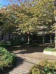 | |||
| 5-32 (Inclusive Nos) Howard Place, With Boundary Walls, Railings, Lamp Fittings And Gates | 55°57′50″N 3°12′05″W | Category A | 29103 | | |||
| Howden Street 2-24 And 74-84 East Crosscauseway Fisher's Buildings | 55°56′38″N 3°10′55″W | Category B | 29105 | | |||
| 11 And 13 Howe Street, Including Railings | 55°57′21″N 3°12′06″W | Category A | 29109 | | |||
| 32-38 (Even Nos) Howe Street, Including Railings | 55°57′23″N 3°12′10″W | Category A | 29121 | | |||
| 1-19 (Inclusive Nos) Heriot Row, And 2 Dundas Street, And 1, 1A, 1B And 1C Howe Street, Including Railings And Lamps With Northumberland Street South West Lane (Nos 5, 6, 7, 8, 8B, 9, 9B, 11, 11A, 11B, 12, 18, 22, 26 And 27) | 55°57′22″N 3°12′00″W | Category A | 29025 | | |||
| 20-42 (Inclusive Nos) Heriot Row, And 2 Howe Street, 1-3 (Odd Nos) India Street, Including Railings And Lamps With Jamaica Street South Lane | 55°57′18″N 3°12′18″W | Category A | 29026 | | |||
| 97-105 (Odd Nos) High Street, 'Heave Awa' House', And 4 Paisley Close (Block To Rear) | 55°57′02″N 3°11′10″W | Category B | 29038 |  | |||
| 14 High Street, 5-11 (Odd Nos) Tweddale Court (Including Former Tweddale House And 9-11 Fountain Close) | 55°57′01″N 3°11′04″W | Category B | 29057 | | |||
| 52 And 54 High Street | 55°57′01″N 3°11′09″W | Category B | 29063 | | |||
| 1-11(Inclusive Nos) Hailes Street, Including Boundary Walls And Railings | 55°56′30″N 3°12′18″W | Category B | 28987 | | |||
| 73-77 (Odd Nos) Hanover Street With Railings | 55°57′14″N 3°11′50″W | Category B | 29000 | | |||
| 79-89 (Odd Nos) Hanover Street | 55°57′15″N 3°11′50″W | Category A | 29001 | | |||
| 91-99 (Odd Nos) Hanover Street With Railings | 55°57′16″N 3°11′51″W | Category B | 29002 | | |||
| 113-123 (Odd Nos, Including 117A) Hanover Street And 16A Queen Street With Railings | 55°57′17″N 3°11′51″W | Category A | 29004 | | |||
| 68-82 (Even Nos) Hanover Street, Incorporating Hobart House (No 80) | 55°57′14″N 3°11′52″W | Category C(S) | 29009 | | |||
| 92-102 (Even Nos) Hanover Street With Railings | 55°57′16″N 3°11′53″W | Category B | 29013 | | |||
| 15-29 (Inclusive Numbers) Hawthornbank Lane, Hawthorn Buildings | 55°57′06″N 3°13′01″W | Category B | 29020 |  | |||
| Henderson Row, 2-28 And 162-168 Dundas Street And 2-4 Perth Street | 55°57′38″N 3°12′07″W | Category B | 29021 | | |||
| 44-86 (Even Nos) Great King Street And 52 And 54 Dundas Street, Including Railings And Lamps With 1, 12, 14 South West Cumberland Street Lane Including Walls And 2 St Vincent Street | 55°57′29″N 3°12′00″W | Category A | 28965 | | |||
| 2-6 (Even Nos) Great Stuart Street, Including Railings And Lamps | 55°57′13″N 3°12′33″W | Category A | 28968 | | |||
| 8-20 (Even Nos) Great Stuart Street, Including Railings, With 13 Randolph Lane | 55°57′08″N 3°12′40″W | Category A | 28969 | | |||
| Greenbank Drive, 2-8 (Even Nos) And 11-57 (Odd Nos) The Steils And 35,37 And 39 Mid Steils | 55°55′02″N 3°13′39″W | Category B | 28970 | | |||
| 1-21 (Inclusive Nos) Grosvenor Crescent, Including Railings | 55°56′53″N 3°13′06″W | Category B | 28974 | | |||
| 2-24 (Even Nos) Grosvenor Street, Including Railings | 55°56′48″N 3°13′02″W | Category B | 28978 | | |||
| 7-15 (Odd Nos) Gloucester Place, Including Railings And Lamps | 55°57′23″N 3°12′26″W | Category A | 28925 | | |||
| 4-14 (Even Nos) Gloucester Place, Including Railings And Lamps | 55°57′24″N 3°12′28″W | Category A | 28926 | | |||
| 37-41 (Odd Nos) Grassmarket | 55°56′50″N 3°11′46″W | Category B | 28935 |  | |||
| 4-10 (Even Nos) Grassmarket, Including Former Church And Fragment Of Flodden Wall | 55°56′50″N 3°11′51″W | Category B | 28936 |  | |||
| 60-64 (Even Nos) Grassmarket | 55°56′52″N 3°11′45″W | Category B | 28939 |  | |||
| 9 And 9A South Gray Street And 11 West Mayfield, Including Boundary Walls | 55°56′01″N 3°10′35″W | Category B | 28949 | | |||
| 31 And 33 Upper Gray Street, Including Boundary Walls | 55°56′09″N 3°10′41″W | Category B | 28956 | | |||
| 30-34 (Even Nos) Upper Gray Street | 55°56′09″N 3°10′43″W | Category B | 28959 | | |||
| 36 And 38 Upper Gray Street | 55°56′09″N 3°10′43″W | Category B | 28960 | | |||
| 3-41 (Odd Nos) Great King Street And 39-43 (Odd Nos) Dundas Street, Including Railings And Lamps | 55°57′28″N 3°11′52″W | Category A | 28962 | | |||
| 45-89 (Odd Nos) Great King Street And 39 And 39A Howe Street And 38-50 (Even N0S) Dundas Street Including Railings And Lamps With 1A, 3, 5 And Gifford Mews, Northumberland Street North West Lane | 55°57′27″N 3°12′00″W | Category A | 28963 | | |||
| 3-27 (Inclusive Nos) Glencairn Crescent And 42-44 (Even Nos) Coates Gardens, Including Railings | 55°56′52″N 3°13′15″W | Category B | 28921 | | |||
| 93 George Street | 55°57′10″N 3°12′09″W | Category B | 28848 | | |||
| 95 And 95A George Street, Refuge Building | 55°57′10″N 3°12′09″W | Category B | 28849 | | |||
| 18 And 20 George Street | 55°57′12″N 3°11′47″W | Category B | 28863 | | |||
| 134-138 (Even Nos) George Street, Roxburghe Hotel, With Railings (Formerly 134-142) | 55°57′06″N 3°12′21″W | Category B | 28887 | | |||
| 27-30 (Inclusive Nos) George Iv Bridge And 27 Candlemaker Row | 55°56′50″N 3°11′30″W | Category B | 28890 | | |||
| 32 And 34 George Iv Bridge And 21 And 23 Candlemaker Row, With Retaining Wall And Railings | 55°56′50″N 3°11′30″W | Category B | 28891 | | |||
| 14 Gillespie Road, Roxobel, With Boundary Walls | 55°54′26″N 3°15′46″W | Category C(S) | 28898 | | |||
| 2-6 (Inclusive Nos) Gillespie Street, Including Boundary Walls | 55°56′28″N 3°12′26″W | Category C(S) | 28901 | | |||
| 8-24 (Even Nos) Gilmore Place Including Boundary Walls And Railings | 55°56′30″N 3°12′22″W | Category B | 28910 | | |||
| 1, 1A And 2 Glencairn Crescent And 50 Palmerston Place, Including Railings | 55°56′56″N 3°13′08″W | Category B | 28920 |  | |||
| 4-10 (Even Nos) Forth Street And Hart Street Lane With Boundary Walls | 55°57′28″N 3°11′18″W | Category B | 28774 | | |||
| 9-15 (Odd Nos) Frederick Street | 55°57′08″N 3°11′58″W | Category B | 28780 | | |||
| 8, 8B And 9 Gayfield Square Including Railings | 55°57′34″N 3°11′12″W | Category B | 28804 | | |||
| 24, 25 And 26 Gayfield Square Including Railings | 55°57′34″N 3°11′07″W | Category A | 28807 | | |||
| George Square 18 | 55°56′38″N 3°11′26″W | Category A | 28810 |  | |||
| George Square 21 | 55°56′37″N 3°11′26″W | Category A | 28813 |  | |||
| George Square 28 | 55°56′34″N 3°11′25″W | Category A | 28821 | | |||
| 29 And 31 George Street And 69 Hanover Street, Clydesdale Bank With Railings | 55°57′14″N 3°11′49″W | Category A | 28831 | | |||
| 33 And 35 George Street And 60-66 (Even Nos) Hanover Street With Railings | 55°57′13″N 3°11′51″W | Category B | 28832 | | |||
| 39 And 41 George Street | 55°57′13″N 3°11′54″W | Category B | 28834 | | |||
| 57-61 (Odd Nos) George Street And 39-41A South West Thistle Street Lane | 55°57′13″N 3°11′58″W | Category B | 28840 | | |||
| 65 George Street, Phillips, And 43-45 South West Thistle Street Lane | 55°57′12″N 3°12′00″W | Category B | 28842 | | |||
| 1, 2 And 3 Eglinton Crescent And 52 Palmerston Place, Including Railings | 55°56′58″N 3°13′09″W | Category B | 28728 | | |||
| 26-30 (Inclusive Nos) Eglinton Crescent, Including Railings | 55°56′52″N 3°13′22″W | Category B | 28730 | | |||
| 2 Ellersly Road, Innerwick, Including Coach House | 55°56′51″N 3°14′49″W | Category B | 28733 | | |||
| Eton Terrace 1-13 | 55°57′15″N 3°12′51″W | Category A | 28737 | | |||
| Eyre Crescent 1-29 And 21-23 Eyre Place | 55°57′41″N 3°12′01″W | Category C(S) | 28739 | | |||
| 200 And 202 Ferry Road Including Piers And Boundary Walls | 55°58′26″N 3°11′30″W | Category B | 28748 | | |||
| 1-12 (Inclusive Nos) Fettes Row, And 99-103 (Odd Nos) Dundas Street, Including Railings And Lamps With 13 North East Cumberland Street Lane Including Wall | 55°57′33″N 3°11′58″W | Category B | 28754 | | |||
| 1-11 (Odd Nos) Forres Street, Including Railings | 55°57′14″N 3°12′27″W | Category A | 28768 |  | |||
| 41A-45 (Odd Nos) Broughton Street And 1 Forth Street | 55°57′28″N 3°11′11″W | Category A | 28772 | | |||
| 47-53 (Odd Nos) Broughton Street And 2 Forth Street | 55°57′28″N 3°11′18″W | Category B | 28773 | | |||
| 2-22 (Inclusive Nos) Drummond Street And 2-6 (Even Nos) Nicolson Street | 55°56′50″N 3°11′09″W | Category B | 28671 | | |||
| 1-14 (Inclusive Numbers) Drumsheugh Gardens, 29 Walker Street, Including Railings | 55°57′03″N 3°12′49″W | Category B | 28674 | | |||
| 13 And 15 Dublin Street, Including Railings | 55°57′23″N 3°11′34″W | Category B | 28680 | | |||
| Duddingston Road West, Craigmillar Brewery | 55°56′04″N 3°08′34″W | Category B | 28699 | | |||
| 1-9 (Inclusive Nos) Duncan Street And 39 Minto Street, Including Boundary Walls And Railings | 55°56′08″N 3°10′37″W | Category B | 28700 | 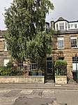 |
Key
The scheme for classifying buildings in Scotland is:
- Category A: "buildings of national or international importance, either architectural or historic; or fine, little-altered examples of some particular period, style or building type."[1]
- Category B: "buildings of regional or more than local importance; or major examples of some particular period, style or building type, which may have been altered."[1]
- Category C: "buildings of local importance; lesser examples of any period, style, or building type, as originally constructed or moderately altered; and simple traditional buildings which group well with other listed buildings."[1]
In March 2016 there were 47,288 listed buildings in Scotland. Of these, 8 per cent were Category A, and 50 per cent were Category B, with the rest listed at Category C.[2]
Notes
- Sometimes known as OSGB36, the grid reference (where provided) is based on the British national grid reference system used by the Ordnance Survey.
• "Guide to National Grid". Ordnance Survey. Retrieved 12 December 2007.
• "Get-a-map". Ordnance Survey. Retrieved 17 December 2007. - Historic Environment Scotland assign a unique alphanumeric identifier to each designated site in Scotland, for listed buildings this always begins with "LB", for example "LB12345".
References
- All entries, addresses and coordinates are based on data from Historic Scotland. This data falls under the Open Government Licence
- "What is Listing?". Historic Environment Scotland. Retrieved 29 May 2018.
- Scotland's Historic Environment Audit 2016 (PDF). Historic Environment Scotland and the Built Environment Forum Scotland. pp. 15–16. Retrieved 29 May 2018.
This article is issued from Wikipedia. The text is licensed under Creative Commons - Attribution - Sharealike. Additional terms may apply for the media files.