List of listed buildings in Edinburgh/28
List
| Name | Location | Date Listed | Grid Ref. [note 1] | Geo-coordinates | Notes | LB Number [note 2] | Image |
|---|---|---|---|---|---|---|---|
| 20-24 (Even Nos) Warrender Park Road | 55°56′17″N 3°11′33″W | Category B | 30490 |  | |||
| 5-9 (Inclusive Nos)Alvanley Terrace | 55°56′16″N 3°12′11″W | Category B | 30495 |  | |||
| 27 Lauder Road, Kenneth Mackenzie House With Gatepiers And Boundary Walls | 55°56′05″N 3°11′11″W | Category B | 30405 | | |||
| 29 Lauder Road With Conservatory And Gatepiers | 55°56′06″N 3°11′11″W | Category B | 30406 | | |||
| 46 Lauder Road | 55°56′13″N 3°11′19″W | Category C(S) | 30419 | | |||
| 48 And 48A Lauder Road | 55°56′14″N 3°11′19″W | Category C(S) | 30420 | | |||
| 29 Mansionhouse Road, Pepper | 55°56′06″N 3°11′21″W | Category B | 30423 | | |||
| 33 Mansionhouse Road | 55°56′05″N 3°11′19″W | Category C(S) | 30425 | | |||
| 43 Mansionhouse Road | 55°56′01″N 3°11′17″W | Category B | 30427 | | |||
| 32-36 And 38-42 (Even Nos) Marchmont Crescent | 55°56′15″N 3°11′34″W | Category B | 30433 |  | |||
| 74-78 Marchmont Crescent | 55°56′12″N 3°11′36″W | Category B | 30439 |  | |||
| 77-81 (Odd Nos) Marchmont Road | 55°56′10″N 3°11′38″W | Category B | 30443 |  | |||
| 97 Lanark Road, Former Lodge | 55°55′13″N 3°15′12″W | Category C(S) | 30321 | | |||
| Albion Place, Lockhart Memorial Church, With Hall, Boundary Walls And Railings | 55°57′42″N 3°10′01″W | Category B | 30324 | | |||
| 35-39 (Inclusive Nos) Argyle Place | 55°56′21″N 3°11′30″W | Category B | 30340 | 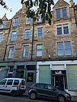 | |||
| 40-43 (Inclusive Nos) Argyle Place | 55°56′22″N 3°11′30″W | Category B | 30341 |  | |||
| 57 Dick Place | 55°55′59″N 3°11′31″W | Category C(S) | 30355 | | |||
| 6 Dick Place, St Margaret's Nursing Home | 55°56′04″N 3°10′56″W | Category B | 30359 | 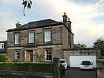 | |||
| 38 Dick Place, Grange Park House, Formerly Egremont | 55°55′57″N 3°11′22″W | Category A | 30365 | | |||
| 1 And 3 Barnshot Road, With Boundary Wall And Gates | 55°54′23″N 3°15′22″W | Category C(S) | 30224 | | |||
| 35-43 (Odd Nos) Causewayside, Garage | 55°56′19″N 3°10′53″W | Category B | 30227 |  | |||
| Cowgate, Near The Pleasance, Police Box | 55°56′57″N 3°11′02″W | Category B | 30240 |  | |||
| Drumsheugh Gardens At Queensferry Road, Police Box | 55°57′05″N 3°12′47″W | Category B | 30242 | | |||
| 13-17 (Odd Nos) Murrayfield Drive, Balnagowan, Including Boundary Walls, Gatepiers And Gates | 55°56′50″N 3°14′41″W | Category A | 30251 |  | |||
| Cammo Road, Cammo Estate, Walled Garden, Gate Piers, Out Buildings & Bee- Boles (Off Cammo Walk) | 55°57′20″N 3°19′31″W | Category C(S) | 30261 | | |||
| Cammo Road, Cammo Estate, Bridge Including Quadrant Walls, And Estate Boundary Walls | 55°57′35″N 3°19′07″W | Category B | 30262 | | |||
| 78 The Pleasance | 55°56′51″N 3°10′55″W | Category C(S) | 30144 | | |||
| Roseburn Cliff, 1-3 (Inclusive Nos) George Pape's Widows' Cottages | 55°56′45″N 3°14′06″W | Category C(S) | 30152 | | |||
| 28 St Andrew Square With Balustrading, Scottish Equitable | 55°57′19″N 3°11′35″W | Category A | 30160 | 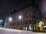 | |||
| 89-95 (Odd Nos) Shandwick Place | 55°56′56″N 3°12′37″W | Category C(S) | 30178 | | |||
| 22-30 (Even Numbers) Shandwick Place | 55°57′00″N 3°12′34″W | Category C(S) | 30181 | | |||
| 30 York Road. Woodbine Cottage, With Boundary Wall | 55°58′43″N 3°12′12″W | Category B | 30197 | | |||
| 1A Duddingston Park, Former Janitor`S House | 55°56′56″N 3°07′10″W | Category C(S) | 30208 | | |||
| 24 (Heritage Museum) And 25 (Restaurant) Pier Place, Newhaven Fishmarket | 55°58′55″N 3°11′41″W | Category B | 30221 | | |||
| Carrington Road, Fettes College, Carrington House | 55°57′43″N 3°13′37″W | Category B | 30222 | | |||
| Craiglockhart Dell East Grotto | 55°55′09″N 3°15′01″W | Category B | 30056 | | |||
| 28 And 30 Broughton Street | 55°57′28″N 3°11′22″W | Category B | 30068 | | |||
| Cluny Gardens 1 Royal Bank Of Scotland | 55°55′30″N 3°12′32″W | Category B | 30078 | | |||
| 41-45 (Odd Nos) Cockburn Street | 55°57′03″N 3°11′22″W | Category B | 30081 | | |||
| 59-63 (Odd Nos) Cockburn Street | 55°57′03″N 3°11′20″W | Category B | 30084 | | |||
| 2 And 4 Cockburn Street And 18-21 (Inclusive Nos) Market Street, Including Former Boiler House Adjoining To Rear And Former Printing Works And Offices To E Of Advocate's Close | 55°57′02″N 3°11′30″W | Category B | 30085 | | |||
| 42-46 (Even Nos) Cockburn Street | 55°57′02″N 3°11′20″W | Category B | 30091 |  | |||
| 48 Cockburn Street | 55°57′01″N 3°11′20″W | Category B | 30092 |  | |||
| 50 Cockburn Street | 55°57′01″N 3°11′19″W | Category B | 30093 | | |||
| 174 Granton Road And 2 Wardie Crescent, Grantons Including Gatepiers And Boundary Wall | 55°58′41″N 3°13′01″W | Category B | 30111 | | |||
| 41-47 (Odd Nos) Lothian Street | 55°56′47″N 3°11′21″W | Category B | 30136 | | |||
| 53-55 (Odd Nos) York Place, Including Railings | 55°57′23″N 3°11′19″W | Category A | 29971 | | |||
| 5 York Road, With Boundary Wall And Gatepiers | 55°58′35″N 3°12′11″W | Category B | 29995 | | |||
| James Craig Walk And Princes Street, General Register House Sasine Office | 55°57′16″N 3°11′22″W | Category B | 30026 | | |||
| 18-22 (Even Nos) Greenside Place, The Playhouse Theatre | 55°57′24″N 3°11′05″W | Category A | 30029 | 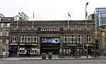 | |||
| 7-8 Chambers Street, Former Police Training School | 55°56′54″N 3°11′15″W | Category C(S) | 30030 | | |||
| 1 Lauriston Place, Royal Infirmary Forecourt, Statue Of George Ii | 55°56′41″N 3°11′35″W | Category A | 30033 | | |||
| 94-96 (Even Nos) West Bow | 55°56′54″N 3°11′40″W | Category B | 29908 | | |||
| 5 West Coates, Including Boundary Walls, Obelisk And Gate Piers | 55°56′46″N 3°13′47″W | Category B | 29921 | | |||
| 1 West Harbour Road, Former Bonded Warehouse | 55°58′52″N 3°13′31″W | Category B | 29924 | | |||
| 22 West Harbour Road, Northern Lighthouse Board Engineering, Storage And Testing Facility, Including Outhouses | 55°58′54″N 3°13′45″W | Category C(S) | 29925 | | |||
| 126 Duddingston Road With Boundary Wall And Railings | 55°56′45″N 3°08′07″W | Category B | 29936 |  | |||
| 29 Woodhall Road, Capelaw With Retaining Boundary Wall, Steps, Gate, And Garage | 55°54′22″N 3°15′31″W | Category C(S) | 29949 | | |||
| 33 Woodhall Road, Torwood With Boundary Wall And Gate | 55°54′20″N 3°15′33″W | Category C(S) | 29950 | | |||
| 6 Woodhall Road With Boundary Wall | 55°54′25″N 3°15′28″W | Category C(S) | 29955 | | |||
| 7 York Place, Including Railings | 55°57′21″N 3°11′31″W | Category A | 29960 | | |||
| 110-112 (Consecutive Nos) Lower Granton Road, East Cottages | 55°58′48″N 3°13′00″W | Category C(S) | 29886 | | |||
| 89 West Bow | 55°56′54″N 3°11′41″W | Category A | 29903 | | |||
| 101 And 103 West Bow | 55°56′53″N 3°11′41″W | Category A | 29906 | | |||
| Starbank Road, 1 And 2, And 6-8 Craighall Road, Newhaven | 55°58′49″N 3°11′54″W | Category B | 29832 | | |||
| 25 And 25A-C Thistle Street And 2 North West Thistle Street Lane | 55°57′15″N 3°11′54″W | Category B | 29837 | | |||
| 1 - 5 (Inclusive Nos) Trinity Crescent | 55°58′48″N 3°12′21″W | Category C(S) | 29851 | | |||
| 31 And 31A Trinity Crescent With Railings | 55°58′47″N 3°12′13″W | Category C(S) | 29856 | | |||
| 70, 72 And 74 Trinity Road, Including Boundary Walls And Gatepiers | 55°58′33″N 3°12′27″W | Category C(S) | 29857 | | |||
| 104 Viewforth, Kellyden, Including Boundary Walls | 55°56′20″N 3°12′38″W | Category B | 29875 | | |||
| St Leonard's Bank 12 Gibraltar-House | 55°56′34″N 3°10′36″W | Category B | 29730 | | |||
| St Patrick Square 24-25 | 55°56′34″N 3°11′00″W | Category B | 29736 | | |||
| 6 St Patrick Street And 21 East Crosscauseway | 55°56′37″N 3°11′00″W | Category C(S) | 29741 | | |||
| 41-45 (Odd Nos) Salisbury Road, Salisbury Hotel, Including Boundary Walls | 55°56′16″N 3°10′38″W | Category B | 29757 | | |||
| 15-19A (Odd Nos) Scotland Street, Including Railings | 55°57′36″N 3°11′41″W | Category B | 29774 | | |||
| 25-27A (Odd Nos) Scotland Street, Including Railings | 55°57′37″N 3°11′41″W | Category B | 29776 | | |||
| 3 Rustic Cottages With Boundary Wall | 55°54′29″N 3°15′11″W | Category B | 29683 | | |||
| 1 Rutland Place, And 1 And 3 Rutland Street, Rutland Hotel And Bar, Including Railings And Lamp Standard | 55°57′00″N 3°12′28″W | Category A | 29685 | | |||
| 36 St Andrew Square, Dundas House, Royal Bank Of Scotland Head Office, With Associated Additions, Walls, Gatepiers, Gates, Railings And Lamp Standards | 55°57′16″N 3°11′27″W | Category A | 29705 |  | |||
| 4-16 (Even Nos) Roxburgh Street Including Wall And Railings | 55°56′52″N 3°11′01″W | Category B | 29676 | | |||
| 125, 127 And 127A Rose Street | 55°57′07″N 3°12′08″W | Category B | 29645 | | |||
| 35-37 (Inclusive Nos) Queen Street With Railings | 55°57′16″N 3°12′02″W | Category A | 29552 | | |||
| 78 And 78A Queen Street With Railings | 55°57′12″N 3°12′24″W | Category A | 29573 | | |||
| 35-41 (Odd Numbers) Raeburn Place | 55°57′32″N 3°12′43″W | Category C(S) | 29583 | | |||
| Raeburn Street, 11 And 12 | 55°57′32″N 3°12′45″W | Category B | 29592 | | |||
| 3 Ramsay Lane, Former Tolbooth Parish School | 55°56′57″N 3°11′45″W | Category C(S) | 29597 |  | |||
| 134 Princes Street, And 1 And 3 South Charlotte Street | 55°57′03″N 3°12′20″W | Category B | 29521 | | |||
| 135 And 136 Princes Street And 2-8 (Even Nos) South Charlotte Street, Charlotte House | 55°57′03″N 3°12′23″W | Category B | 29522 | | |||
| 142 And 143 Princes Street, Royal Bank Of Scotland | 55°57′02″N 3°12′26″W | Category B | 29523 | | |||
| Quality Street 7, 9 Davidson's Mains, Bourtree Bank | 55°57′48″N 3°16′24″W | Category B | 29526 | | |||
| 15 Queen Street With Railings | 55°57′18″N 3°11′51″W | Category B | 29539 | | |||
| Nicolson Street West 23-33 | 55°56′41″N 3°11′07″W | Category C(S) | 29435 | | |||
| Nicolson Street West, 55-57 And 14, 16 Chapel Street | 55°56′40″N 3°11′09″W | Category B | 29437 | | |||
| Nicolson Street West, 24-30 | 55°56′41″N 3°11′06″W | Category B | 29439 | | |||
| 70 Northumberland Street, Including Railings And Lamp | 55°57′23″N 3°12′06″W | Category A | 29459 | | |||
| Old Church Lane, 14, Lochside House, Duddingston | 55°56′30″N 3°08′51″W | Category B | 29466 | | |||
| 24-28 (Even Nos) Nelson Street, Including Railings And Lamps | 55°57′28″N 3°11′47″W | Category A | 29392 | | |||
| 184 Newhaven Road, Ramsay House, Including Coach House, Gatepiers, Boundary Wall | 55°58′37″N 3°11′32″W | Category B | 29397 | | |||
| 232 Newhaven Road, Jessfield House | 55°58′44″N 3°11′34″W | Category B | 29402 | | |||
| 37-41 (Odd Nos) Nicolson Street | 55°56′47″N 3°11′09″W | Category B | 29416 | | |||
| Nicolson Street, 124-132 | 55°56′39″N 3°11′00″W | Category B | 29429 | | |||
| Nicolson Street West, 11-15 | 55°56′42″N 3°11′06″W | Category B | 29433 | | |||
| 5 And 7 Middleby Street, Including Boundary Walls And Pedestrian Gates | 55°56′05″N 3°10′34″W | Category B | 29332 | | |||
| 3 Minto Street, Including Boundary Walls And Pedestrian Gates | 55°56′14″N 3°10′38″W | Category B | 29338 | | |||
| 4 Minto Street, Including Boundary Walls | 55°56′13″N 3°10′37″W | Category B | 29339 | | |||
| 1, 2, 3 And 4 Peacock Court | 55°58′50″N 3°11′36″W | Category C(S) | 29286 | | |||
| 43-47 (Odd Nos) Newhaven Main Street | 55°58′49″N 3°11′51″W | Category C(S) | 29289 | | |||
| 2-4A (Inclusive Nos) West Mayfield And 31 And 31A Minto Street, Including Boundary Walls | 55°56′02″N 3°10′29″W | Category B | 29310 | | |||
| 22-26 (Even Nos) Keir Street, Including Boundary Wall And Railings | 55°56′43″N 3°11′50″W | Category B | 29201 | | |||
| Lanark Road, 533 Juniper Cottage Juniper Green | 55°54′12″N 3°17′06″W | Category C(S) | 29204 | | |||
| Lanark Road, 538 540 Juniper Green | 55°54′13″N 3°17′05″W | Category C(S) | 29210 | | |||
| 17-21A (Odd Nos) India Street, Including Railings And Lamps | 55°57′21″N 3°12′19″W | Category A | 29129 | | |||
| 12 India Street, Including Railings And Lamp | 55°57′19″N 3°12′21″W | Category A | 29132 | | |||
| 18 India Street, Including Railings And Lamp | 55°57′20″N 3°12′22″W | Category A | 29135 | | |||
| 32 India Street, Including Railings And Lamp | 55°57′21″N 3°12′23″W | Category A | 29138 | | |||
| 34 India Street, Including Railings And Lamp | 55°57′22″N 3°12′23″W | Category A | 29139 | | |||
| Inverleith Place 37 | 55°58′03″N 3°12′33″W | Category B | 29150 | | |||
| Inverleith Row, 7 | 55°57′54″N 3°12′12″W | Category B | 29156 | | |||
| Inverleith Row, 42 And 43 | 55°58′09″N 3°12′27″W | Category B | 29177 | | |||
| 25 Johnston Terrace | 55°56′53″N 3°11′50″W | Category C(S) | 29195 | | |||
| 12-16 (Even Nos) Hope Street | 55°57′03″N 3°12′32″W | Category A | 29094 | | |||
| 19 And 19B Howe Street, And 72-76, (Even Nos) Northumberland Street, Including Railings | 55°57′22″N 3°12′07″W | Category A | 29111 | | |||
| 1 And 2 Hunter Square And 124 High Street | 55°57′00″N 3°11′18″W | Category B | 29122 | | |||
| 3, 4 And 5 Hunter Square, Dolphin House | 55°56′59″N 3°11′18″W | Category A | 29123 | 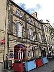 | |||
| 51-55 (Odd Nos) High Street, Moubray House | 55°57′02″N 3°11′07″W | Category A | 29034 |  | |||
| 123 High Street | 55°57′02″N 3°11′12″W | Category B | 29040 | | |||
| High Street, 3 Advocate's Close ('Adam Bothwell's House') | 55°57′00″N 3°11′30″W | Category A | 29053 | | |||
| 2-8 (Even Nos) High Street | 55°57′02″N 3°11′04″W | Category B | 29055 | 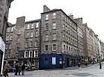 | |||
| 142 And 144 High Street | 55°56′59″N 3°11′19″W | Category B | 29068 | | |||
| High Street, New Assembly Close, Lord Reid Building | 55°56′58″N 3°11′19″W | Category A | 29069 | | |||
| 186 And 188 High Street | 55°56′58″N 3°11′22″W | Category B | 29074 | | |||
| Hill Place 1, 2, 2A | 55°56′46″N 3°11′04″W | Category C(S) | 29075 | | |||
| Hamilton Place 12-16 | 55°57′29″N 3°12′29″W | Category B | 28994 | | |||
| Henderson Row 62-70 | 55°57′36″N 3°12′21″W | Category B | 29024 | | |||
| 7 South Gray Street, Including Gatepiers, Boundary Walls And Pedestrian Gate | 55°56′03″N 3°10′37″W | Category B | 28947 | | |||
| 23 And 25 Upper Gray Street, Including Boundary Walls | 55°56′10″N 3°10′42″W | Category C(S) | 28954 | | |||
| 48-52 (Even Nos) George Street | 55°57′11″N 3°11′54″W | Category B | 28869 | | |||
| 32 Gillespie Road, Huntly With Greenhouse, Gatepiers And Boundary Wall | 55°54′28″N 3°16′14″W | Category B | 28900 | | |||
| 48 Gilmore Place And 3 Lower Gilmore Place Including Boundary Wall | 55°56′29″N 3°12′30″W | Category C(S) | 28916 | | |||
| 89-95 (Odd Nos) Fountainbridge, 1 Thornybauk And 1 Ponton Street | 55°56′39″N 3°12′22″W | Category B | 28776 | 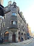 | |||
| 52-56 (Even Nos) Frederick Street With Railings | 55°57′13″N 3°12′04″W | Category B | 28795 | | |||
| George Square 23 | 55°56′36″N 3°11′26″W | Category A | 28816 |  | |||
| George Square 27 | 55°56′35″N 3°11′25″W | Category A | 28820 |  | |||
| George Square 29 | 55°56′34″N 3°11′25″W | Category A | 28822 |  | |||
| George Square 56 | 55°56′39″N 3°11′14″W | Category A | 28824 | | |||
| George Square 57 And 58 | 55°56′39″N 3°11′14″W | Category A | 28825 | | |||
| 12-22 (Even Nos) Dundonald Street(Includes 12,19A,19B, And 20B West Scotland Street Lane), Including Railings And Lamps | 55°57′34″N 3°11′48″W | Category B | 28726 | | |||
| 30-34 (Even Nos) Elder Street, Including Railings | 55°57′21″N 3°11′27″W | Category A | 28731 | | |||
| 142A And 144 Ferry Road And 27, 28 And 29 Summerside Place Including Boundary Wall And Railings | 55°58′28″N 3°11′11″W | Category B | 28745 | | |||
| Ferry Road, Former Trinity Cottage, Boundary Walls, Gates And Lodge | 55°58′17″N 3°12′33″W | Category C(S) | 28749 | |
Key
The scheme for classifying buildings in Scotland is:
- Category A: "buildings of national or international importance, either architectural or historic; or fine, little-altered examples of some particular period, style or building type."[1]
- Category B: "buildings of regional or more than local importance; or major examples of some particular period, style or building type, which may have been altered."[1]
- Category C: "buildings of local importance; lesser examples of any period, style, or building type, as originally constructed or moderately altered; and simple traditional buildings which group well with other listed buildings."[1]
In March 2016 there were 47,288 listed buildings in Scotland. Of these, 8 per cent were Category A, and 50 per cent were Category B, with the rest listed at Category C.[2]
Notes
- Sometimes known as OSGB36, the grid reference (where provided) is based on the British national grid reference system used by the Ordnance Survey.
• "Guide to National Grid". Ordnance Survey. Retrieved 12 December 2007.
• "Get-a-map". Ordnance Survey. Retrieved 17 December 2007. - Historic Environment Scotland assign a unique alphanumeric identifier to each designated site in Scotland, for listed buildings this always begins with "LB", for example "LB12345".
References
- All entries, addresses and coordinates are based on data from Historic Scotland. This data falls under the Open Government Licence
- "What is Listing?". Historic Environment Scotland. Retrieved 29 May 2018.
- Scotland's Historic Environment Audit 2016 (PDF). Historic Environment Scotland and the Built Environment Forum Scotland. pp. 15–16. Retrieved 29 May 2018.
This article is issued from Wikipedia. The text is licensed under Creative Commons - Attribution - Sharealike. Additional terms may apply for the media files.