List of listed buildings in Edinburgh/26
List
| Name | Location | Date Listed | Grid Ref. [note 1] | Geo-coordinates | Notes | LB Number [note 2] | Image |
|---|---|---|---|---|---|---|---|
| 76-78 Buchleuch Street | 55°56′31″N 3°11′03″W | Category B | 28400 |  | |||
| 16 And 18 Calton Hill Including Railings And Boundary Walls | 55°57′16″N 3°11′09″W | Category B | 28407 |  | |||
| 46 And 48 Candlemaker Row | 55°56′50″N 3°11′31″W | Category B | 28417 | | |||
| 14 And 16 Blacket Place, Including Boundary Walls | 55°56′14″N 3°10′28″W | Category B | 28311 | | |||
| 18 Blacket Place, Including Boundary Wall | 55°56′14″N 3°10′29″W | Category B | 28312 | | |||
| 2-4 (Even Nos) New Skinner's Close (Former Skinner's Hall) Including 3 And 4 South Gray's Close | 55°56′59″N 3°11′07″W | Category A | 28325 | | |||
| 50 Blackfriars Street | 55°56′57″N 3°11′10″W | Category B | 28327 | | |||
| 4 Barnshot Road With Boundary Wall And Gate | 55°54′21″N 3°15′25″W | Category C(S) | 28270 | | |||
| 15 Blacket Avenue, Including Boundary Walls And Pedestrian Gateway | 55°56′14″N 3°10′19″W | Category B | 28296 | | |||
| Abbey Strand, Western Building, 'Thompson's Court' | 55°57′10″N 3°10′27″W | Category A | 28208 | 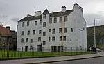 | |||
| 3, 3B Albany Street, Including Railings | 55°57′24″N 3°11′34″W | Category A | 28218 | | |||
| Stenhouse Mill(House) Stenhouse Mill Lane And Crescent | 55°55′46″N 3°15′20″W | Category A | 28125 |  | |||
| Nether Liberton, 7 Old Mill Lane, Old Mill Cottage And Outbuildings | 55°55′28″N 3°09′55″W | Category C(S) | 28194 | | |||
| Craig House (Old) Off Craighouse Road, Napier University | 55°55′22″N 3°13′35″W | Category A | 28046 | | |||
| Craigroyston House Marine Drive | 55°58′44″N 3°15′21″W | Category B | 28048 | | |||
| Drylaw House Off Groathill Road North | 55°57′52″N 3°15′11″W | Category A | 28060 | | |||
| Duddingston House (105 Milton Road West), Former Stables And Office (115-127 (Odd Numbers) Milton Road West) | 55°56′21″N 3°08′13″W | Category A | 28065 |  | |||
| 32 Manor Place Easter Coates House, (Formerly Old Coates House), Including Walls To N | 55°56′56″N 3°13′00″W | Category A | 28070 |  | |||
| 19 Winton Loan, Morton House Pavilions, Entrance Gateway And Boundary Wall | 55°53′50″N 3°11′41″W | Category B | 28093 | | |||
| Muirhouse, 36 Marine Drive | 55°58′42″N 3°15′57″W | Category A | 28099 | | |||
| University Of Edinburgh Reid School Of Music Teviot Row | 55°56′42″N 3°11′21″W | Category A | 27995 | 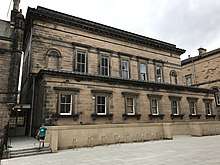 | |||
| Mayfield Road And West Mains Road, University Of Edinburgh, King's Buildings, Geology | 55°55′26″N 3°10′27″W | Category B | 28004 | | |||
| Craigmillar Castle And Dovevot, Craigmillar Castle Road | 55°55′32″N 3°08′27″W | Category A | 28016 | 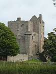 | |||
| Lauriston Castle Cramond Road South | 55°58′16″N 3°16′43″W | Category A | 28019 | | |||
| Lauriston Castle-Sundial Cramond Road South | 55°58′16″N 3°16′43″W | Category B | 28020 | | |||
| Holyrood Road And Queen's Drive, Holyrood Lodge | 55°57′06″N 3°10′23″W | Category B | 28023 | 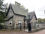 | |||
| Holyroodhouse, 28 And 30 Croft-An-Righ (Croft And Righ House) Including Boundary Walls And Gates | 55°57′15″N 3°10′17″W | Category A | 28029 |  | |||
| 122 Corstorphine Road, Beechwood House (Murrayfield Hospital), Including 112-114 (Even Nos), Boundary Wall, Section Of Garden Wall And Out-Building, Corstorphine Road | 55°56′38″N 3°15′52″W | Category A | 28031 |  | |||
| 31-33 (Inclusive Nos) Water Street | 55°58′30″N 3°10′10″W | Category B | 27917 | | |||
| Meadows Park - Middle Meadow Walk Gatepiers | 55°56′43″N 3°11′28″W | Category B | 27928 |  | |||
| Rosebank Cemetery, Pilrig Street | 55°58′03″N 3°11′07″W | Category C(S) | 27935 |  | |||
| Saughton Public Park, Rose Garden, Sundial | 55°56′04″N 3°14′56″W | Category C(S) | 27936 | | |||
| Redford Road, Old Bridge | 55°54′18″N 3°14′25″W | Category B | 27944 | | |||
| Warriston Road Railway Bridge Carrying Railway Over Warriston Road | 55°57′56″N 3°11′56″W | Category B | 27954 | | |||
| 555 Castlehill, Former Reservoir, With Retaining Wall, Steps, Railings And Balustrade To N And Drinking Fountain On W Wall | 55°56′57″N 3°11′46″W | Category B | 27962 |  | |||
| Donaldson's School For The Deaf 54 Henderson Row | 55°57′39″N 3°12′23″W | Category B | 27972 | | |||
| Lauriston Place, George Heriot's School, Science Block | 55°56′48″N 3°11′43″W | Category B | 27979 | | |||
| 19 And 21 Pilrig Street With Boundary Walls And Railings | 55°57′54″N 3°10′46″W | Category B | 27850 | | |||
| 27 Pilrig Street With Boundary Walls And Railings | 55°57′55″N 3°10′46″W | Category B | 27853 | | |||
| Edinburgh Castle Esplanade, Statue Of Earl Haig | 55°56′56″N 3°11′50″W | Category B | 27860 | .jpg) | |||
| Princes Street Gardens, Royal Scots Greys Monument | 55°57′05″N 3°11′58″W | Category B | 27872 | .jpg) | |||
| St Andrew Place, Leith Academy Primary School, Former Leith Academy, And Gatepiers | 55°58′14″N 3°10′07″W | Category B | 27877 | | |||
| St Andrew Place, St Andrew's Up Church (Formerly Secession) | 55°58′14″N 3°10′09″W | Category B | 27878 | | |||
| Shore, Police Box | 55°55′51″N 3°12′52″W | Category B | 27882 | | |||
| 58 Shore | 55°58′31″N 3°10′13″W | Category B | 27894 | | |||
| George Iv Bridge, Greyfriars Bobby Fountain | 55°56′49″N 3°11′29″W | Category A | 27899 |  | |||
| 50, 51 Timberbush | 55°58′35″N 3°10′07″W | Category C(S) | 27906 | | |||
| St George's Well, Off St Bernard's Bridge | 55°57′13″N 3°12′44″W | Category B | 27907 | .jpg) | |||
| 306 Leith Walk With Boundary Wall | 55°57′55″N 3°10′37″W | Category C(S) | 27739 | | |||
| 5 Windsor Place | 55°57′07″N 3°06′47″W | Category C(S) | 27799 | | |||
| 27-29 (Inclusive Nos) Maritime Street | 55°58′31″N 3°10′04″W | Category B | 27804 | | |||
| Redford Road, Covenanters' Monument | 55°54′17″N 3°14′19″W | Category B | 27809 | | |||
| 35-45 (Odd Nos) Windsor Place | 55°57′04″N 3°06′48″W | Category B | 27814 | | |||
| Calton Hill, Off Regent Road, Nelson's Monument | 55°57′15″N 3°10′58″W | Category A | 27823 |  | |||
| 20 And 22 Leith Walk And 3 Cassel's Lane With Boundary Walls And Railings | 55°58′13″N 3°10′21″W | Category B | 27663 | | |||
| 59-63 George Iv Bridge, Lothian Chambers, Including Boundary Balustrade | 55°56′57″N 3°11′32″W | Category B | 27674 |  | |||
| 42 Leith Walk With Boundary Walls And Railings | 55°58′12″N 3°10′22″W | Category B | 27677 | | |||
| 1 The Mound, National Gallery Of Scotland With Railings | 55°57′03″N 3°11′44″W | Category A | 27679 |  | |||
| 52 Leith Walk With Boundary Walls And Railings | 55°58′11″N 3°10′23″W | Category B | 27682 | | |||
| Ratho Village, Baird Road, War Memorial | 55°55′27″N 3°22′48″W | Category B | 27690 | | |||
| 9 Rosefield Place | 55°57′07″N 3°07′04″W | Category C(S) | 27696 | | |||
| 80-90 (Even Nos) Leith Walk | 55°58′09″N 3°10′24″W | Category B | 27697 | | |||
| Parliament Square, Parliament Hall | 55°56′56″N 3°11′27″W | Category A | 27704 |  | |||
| 214 Leith Walk With Railings | 55°58′01″N 3°10′31″W | Category C(S) | 27707 | | |||
| 11 Tipperlinn Road With Boundary Wall, Gates And Railings | 55°55′49″N 3°12′56″W | Category B | 27708 | | |||
| 276, 278 Leith Walk And 1, 3 Balfour Street | 55°57′56″N 3°10′35″W | Category C(S) | 27722 | | |||
| Ratho Village, Main Street, Lodge To The Lodge And Gatepiers | 55°55′20″N 3°22′41″W | Category C(S) | 27733 | | |||
| 163 Canongate, Canongate Tolbooth | 55°57′06″N 3°10′48″W | Category A | 27582 |  | |||
| Leith Docks, Albert Dock With Swing Bridge | 55°58′45″N 3°09′55″W | Category B | 27590 | | |||
| 20-26 (Even Nos) Morningside Road | 55°56′00″N 3°12′38″W | Category C(S) | 27591 | | |||
| 26 Regent Street | 55°57′11″N 3°06′44″W | Category C(S) | 27605 | | |||
| Newliston House, Sundial | 55°56′43″N 3°25′36″W | Category B | 27623 | | |||
| Newmills Road, Gowanhill Farm | 55°53′55″N 3°20′38″W | Category C(S) | 27632 | | |||
| Leith Docks, Prince Of Wales Dry Dock, Hydraulic Station | 55°58′46″N 3°10′07″W | Category B | 27634 | | |||
| Leith Walk And Pilrig Street, Pilrig Dalmeny Church And Halls (C Of S) | 55°57′50″N 3°10′41″W | Category A | 27649 | | |||
| 18 (Formerly 18 And 19) Jordan Lane | 55°55′38″N 3°12′19″W | Category C(S) | 27502 | | |||
| The King's Hall, (Formerly St Paul's Newington Church Of Scotland) 41A South Clerk Street | 55°56′26″N 3°10′49″W | Category B | 27504 |  | |||
| 294-300 (Even Nos) Portobello High Street | 55°57′06″N 3°06′33″W | Category C(S) | 27511 | | |||
| 73-81 (Odd Nos) Henderson Street | 55°58′29″N 3°10′20″W | Category C(S) | 27521 | | |||
| 11 Morningside Place With Boundary Walls And Gatepiers | 55°55′50″N 3°12′44″W | Category B | 27531 | | |||
| Kirkliston Village, Queensferry Road/Main Street, War Memorial | 55°57′23″N 3°24′06″W | Category B | 27538 | | |||
| 12 And 12A John's Place | 55°58′19″N 3°10′04″W | Category B | 27555 | | |||
| 7 Hampton Terrace, National Bible Society Of Scotland Building (Formerly Roseburn Free Church, Latterly Wester Coates Parish Church) | 55°56′44″N 3°13′46″W | Category C(S) | 27557 | | |||
| Long Dalmahoy Road, Hagg's Farm With Steading | 55°53′36″N 3°23′02″W | Category C(S) | 27558 | | |||
| 67 And 69 Morningside | 55°55′53″N 3°12′35″W | Category C(S) | 27566 | | |||
| 69B Morningside Road, Napier University Morningside Campus (Former Morningside Parish Church) With Boundary Walls, Gatepiers And Railings | 55°55′52″N 3°12′34″W | Category B | 27571 | | |||
| 51 Regent Street | 55°57′14″N 3°06′37″W | Category C(S) | 27573 | | |||
| 8 And 10 Regent Street | 55°57′10″N 3°06′45″W | Category C(S) | 27579 | | |||
| West Bowling Green Street, Bridge | 55°58′22″N 3°10′47″W | Category B | 27456 | | |||
| 13 Bellevue Crescent, St Mary's Church (Church Of Scotland), Including Railings | 55°57′37″N 3°11′37″W | Category A | 27461 |  | |||
| 1-5 (Odd Nos) Great Junction Street, 2 And 4 Leith Walk And 2, 4 Kirk Street | 55°58′14″N 3°10′21″W | Category B | 27464 | | |||
| 11 Jordan Lane | 55°55′38″N 3°12′24″W | Category C(S) | 27470 | | |||
| 12 Jordan Lane | 55°55′38″N 3°12′23″W | Category C(S) | 27474 | | |||
| 16 Jordan Lane | 55°55′38″N 3°12′21″W | Category B | 27493 | | |||
| Heriot-Watt University, Riccarton Estate, South Strip, Gatepiers | 55°54′19″N 3°19′03″W | Category B | 27376 | | |||
| 37 Spylaw Road, Craigard | 55°55′55″N 3°13′12″W | Category B | 27397 | | |||
| 3 And 3A South Fort Street And 95 Ferry Road With Steps And Railings; Eh6 4Dl | 55°58′29″N 3°10′59″W | Category B | 27402 | | |||
| 71-77 (Odd Nos) Duke Street | 55°58′11″N 3°10′08″W | Category B | 27412 | | |||
| Hermitage Of Braid, Off Braid Road, Dovecot With Wall | 55°55′12″N 3°12′15″W | Category B | 27413 |  | |||
| Humbie Dovecot | 55°57′56″N 3°25′08″W | Category C(S) | 27416 | | |||
| Humbie Farmhouse | 55°57′48″N 3°25′10″W | Category C(S) | 27422 | | |||
| 16 South Fort Street (The Village Inn) And 1-3 (Odd Nos) Trafalgar Lane | 55°58′27″N 3°11′00″W | Category C(S) | 27428 | | |||
| 16 Hermitage Drive, Drumearn, With Boundary Walls And Gatepiers | 55°55′13″N 3°12′18″W | Category B | 27433 | | |||
| 143 Grange Loan Astley Ainslie Hospital, St Roque With Garden Fountain And Dragon Bench | 55°55′47″N 3°11′44″W | Category B | 27324 | | |||
| Oa Johnston Terrace, St Columba's (Free) Church, With Railings | 55°56′56″N 3°11′39″W | Category B | 27325 |  | |||
| 21 And 22 (1F & 2F) Portland Place And 1 (1-9) Portland Street With Steps And Railings; Eh6 6La And Eh6 4Sx Respectively | 55°58′41″N 3°10′52″W | Category B | 27326 | | |||
| Harvest Road, Hillwood House With Former Coach House And Stables | 55°56′04″N 3°23′26″W | Category C(S) | 27327 | | |||
| 8-12 (Even Nos) North Fort Street With Front Walls; Eh6 4Ex | 55°58′30″N 3°11′01″W | Category C(S) | 27235 | | |||
| 8 Glasgow Road, Middle Norton | 55°56′16″N 3°22′06″W | Category C(S) | 27252 | | |||
| 25 Falcon Gardens, St Peter's Primary School | 55°55′47″N 3°12′16″W | Category C(S) | 27265 | | |||
| 5 Napier Road With Boundary Wall And Gatepiers | 55°56′00″N 3°13′03″W | Category B | 27270 | | |||
| Gogar Station Road, Gogar Bank House, North Lodge | 55°55′30″N 3°19′22″W | Category C(S) | 27285 | | |||
| 90-102(Even Nos) Inchview Terrace, Portobello Road, Former Wm Ramsay Technical Institute With Gatepiers, Gates And Railings | 55°57′26″N 3°07′28″W | Category A | 27288 | | |||
| Mansfield Road, Harmeny House, (Now School) | 55°52′40″N 3°20′03″W | Category B | 27181 | | |||
| 31 And 33 Pittville Street | 55°57′08″N 3°06′23″W | Category C(S) | 27188 | | |||
| Glasgow Road, Norton House Hotel, Railway Bridge | 55°56′04″N 3°22′33″W | Category B | 27196 | | |||
| Glasgow Road, Norton House Hotel, Former Stables, The Norton Tavern | 55°56′01″N 3°23′09″W | Category B | 27205 | | |||
| 3 And 4 East Brighton Crescent | 55°57′02″N 3°06′54″W | Category B | 27209 | | |||
| 91 And 93 Constitution Street | 55°58′23″N 3°10′04″W | Category C(S) | 27210 | | |||
| Gilmore Place Viewforth Church With Boundary Walls Gatepiers And Railings | 55°56′23″N 3°12′45″W | Category B | 27104 |  | |||
| 41 Cowgate, Magdalene Chapel | 55°56′53″N 3°11′33″W | Category A | 27110 |  | |||
| 26 And 28 Brighton Place | 55°57′07″N 3°06′59″W | Category B | 27116 | | |||
| 6 Casselbank Street | 55°58′13″N 3°10′27″W | Category B | 27133 | | |||
| 63-69 (Odd Nos) Madeira Street With Garden Walls And Railings; Eh6 4Ax | 55°58′35″N 3°11′00″W | Category C(S) | 27142 | | |||
| Greyfriars Place, Greyfriars Church (Church Of Scotland) | 55°56′48″N 3°11′32″W | Category A | 27018 |  | |||
| 3 Ettrick Road | 55°56′00″N 3°13′09″W | Category B | 27033 | | |||
| Catchpell House, Carpet Lane (Adjoining Donaldson's Warehouse) | 55°58′33″N 3°10′08″W | Category C(S) | 27068 | | |||
| 47, 49, 51-53 Milton Road East, Queen's Bay Lodge (Eventide Home) And Outbuilding | 55°56′42″N 3°05′48″W | Category B | 27083 | | |||
| 3, 5 And 7 Lochend Road With Boundary Wall And Railings | 55°58′08″N 3°09′59″W | Category C(S) | 26943 | | |||
| 54 Canaan Lane, Woodburn House | 55°55′39″N 3°12′08″W | Category B | 26948 | | |||
| 12-16 (Even Nos) Smith's Place | 55°58′01″N 3°10′25″W | Category B | 26970 | | |||
| Dalmahoy Estate, North Lodge | 55°54′29″N 3°22′05″W | Category C(S) | 26976 | | |||
| 17 And 19 John Street | 55°57′07″N 3°06′15″W | Category C(S) | 26977 | | |||
| 16 Prospect Bank Road, Prospect Bank House, With Boundary Wall And Railings | 55°58′05″N 3°09′16″W | Category B | 26979 | | |||
| Ladycroft Cottage And Boundary Wall | 55°53′04″N 3°20′17″W | Category C(S) | 26980 | | |||
| 221 Ferry Road, Victoria Park Hotel With Boundary Walls; Eh6 4Nn | 55°58′24″N 3°11′29″W | Category C(S) | 26986 | | |||
| 13A Murrayfield Avenue, Church Of The Good Shepherd (Scottish Episcopal Church) | 55°56′50″N 3°14′12″W | Category B | 26995 | | |||
| 223 (G1, 1F1, 1F2, 1F3 & 1F4) Ferry Road, Agra Lodge, With Boundary Wall, Gatepiers And Gates; Eh6 4Sp | 55°58′23″N 3°11′35″W | Category B | 26998 | | |||
| Bonnington Bond, Bonnington Road, 15-21 Breadalbane Street And Anderson Place | 55°58′18″N 3°10′53″W | Category B | 27016 | | |||
| 26 George Iv Bridge, Frankenstein Pub (Former Elim Pentecostal Church) | 55°56′50″N 3°11′30″W | Category B | 26862 |  | |||
| 49-57 Bernard Street | 55°58′34″N 3°10′09″W | Category B | 26872 | | |||
| Dell Road, St Cuthbert's Parish Church (Church Of Scotland) And Churchyard With Boundary Wall, Offertory House, And Gates | 55°54′32″N 3°15′22″W | Category B | 26874 |  | |||
| Commercial Wharf, 3, 4, And 5/1-31 (Inclusive Nos) The Cooperage; Eh6 6Lf | 55°58′34″N 3°10′15″W | Category B | 26878 | | |||
| Haymarket, Heart Of Midlothian War Memorial | 55°56′47″N 3°12′59″W | Category C(S) | 26889 | | |||
| 1 John Street And 2 Abercorn Terrace With Boundary Walls | 55°57′03″N 3°06′18″W | Category B | 26904 | | |||
| 82-84 Even Nos Slateford Road | 55°56′00″N 3°14′09″W | Category B | 26795 | | |||
| Buccleuch And Greyfriars Church (Free Church) West Crosscauseway | 55°56′39″N 3°11′05″W | Category B | 26798 | | |||
| Ashley House, Walled Garden With Pavilion And Stores | 55°55′38″N 3°21′31″W | Category B | 26801 | | |||
| Glenbrook Road, The Boathouse With Gatepiers | 55°52′50″N 3°21′42″W | Category C(S) | 26805 | | |||
| Birdsmill Railway Viaduct, River Almond (Off M8) | 55°55′35″N 3°25′44″W | Category B | 26813 | |
Key
The scheme for classifying buildings in Scotland is:
- Category A: "buildings of national or international importance, either architectural or historic; or fine, little-altered examples of some particular period, style or building type."[1]
- Category B: "buildings of regional or more than local importance; or major examples of some particular period, style or building type, which may have been altered."[1]
- Category C: "buildings of local importance; lesser examples of any period, style, or building type, as originally constructed or moderately altered; and simple traditional buildings which group well with other listed buildings."[1]
In March 2016 there were 47,288 listed buildings in Scotland. Of these, 8 per cent were Category A, and 50 per cent were Category B, with the rest listed at Category C.[2]
Notes
- Sometimes known as OSGB36, the grid reference (where provided) is based on the British national grid reference system used by the Ordnance Survey.
• "Guide to National Grid". Ordnance Survey. Retrieved 12 December 2007.
• "Get-a-map". Ordnance Survey. Retrieved 17 December 2007. - Historic Environment Scotland assign a unique alphanumeric identifier to each designated site in Scotland, for listed buildings this always begins with "LB", for example "LB12345".
References
- All entries, addresses and coordinates are based on data from Historic Scotland. This data falls under the Open Government Licence
- "What is Listing?". Historic Environment Scotland. Retrieved 29 May 2018.
- Scotland's Historic Environment Audit 2016 (PDF). Historic Environment Scotland and the Built Environment Forum Scotland. pp. 15–16. Retrieved 29 May 2018.
This article is issued from Wikipedia. The text is licensed under Creative Commons - Attribution - Sharealike. Additional terms may apply for the media files.