List of listed buildings in Edinburgh/22
List
| Name | Location | Date Listed | Grid Ref. [note 1] | Geo-coordinates | Notes | LB Number [note 2] | Image |
|---|---|---|---|---|---|---|---|
| Inverleith Row, 20 | 55°58′00″N 3°12′18″W | Category B | 29166 |  | |||
| Inverleith Row, 23 And 24 | 55°58′02″N 3°12′20″W | Category B | 29168 | | |||
| 39 Jamaica Street, Kay's Bar | 55°57′21″N 3°12′18″W | Category B | 29188 | | |||
| Hill Place 3, 5 | 55°56′46″N 3°11′04″W | Category C(S) | 29076 | | |||
| 11 Hillside Crescent Including Railings | 55°57′30″N 3°10′44″W | Category A | 29085 | | |||
| 26-37 (Inclusive Nos) Hillside Crescent | 55°57′28″N 3°10′31″W | Category B | 29088 | | |||
| Hope Park Square 6-9 And Annfield House | 55°56′31″N 3°11′09″W | Category B | 29097 |  | |||
| Howden Street 28-30 And Simon Square, Simon Square Centre (Buildings Of 1887 Fronting Howden Street Only) | 55°56′40″N 3°10′56″W | Category C(S) | 29106 | | |||
| 63-67 (Odd Nos) High Street And 1 Chalmer's Close, Carrubber's Close Mission | 55°57′03″N 3°11′08″W | Category B | 29036 | | |||
| 197-207 (Odd Nos) High Street Including 1-14 Fleshmarket Close | 55°57′01″N 3°11′19″W | Category A | 29045 |  | |||
| 221-231 (Odd Nos) High Street | 55°57′00″N 3°11′21″W | Category A | 29048 | | |||
| 367-381 (Odd Nos) High Street | 55°56′59″N 3°11′30″W | Category A | 29052 |  | |||
| 40 And 42 High Street | 55°57′01″N 3°11′07″W | Category C(S) | 29061 | | |||
| 17A-27A (Inclusive Nos) Haddington Place With 26 And 28 Annandale Street Lane | 55°57′37″N 3°10′58″W | Category A | 28984 |  | |||
| 28 And 30 Hanover Street | 55°57′10″N 3°11′51″W | Category A | 29007 | | |||
| 12 Hawthornbank Lane | 55°57′07″N 3°13′00″W | Category C(S) | 29019 | 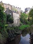 | |||
| 1-5 (Odd Nos) Great Stuart Street, Including Railings And Lamps | 55°57′14″N 3°12′36″W | Category A | 28966 | 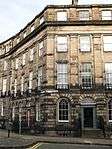 | |||
| 3 Upper Gray Street, Including Boundary Wall | 55°56′13″N 3°10′45″W | Category C(S) | 28951 | | |||
| 19 And 21 Upper Gray Street Including Boundary Walls | 55°56′10″N 3°10′42″W | Category C(S) | 28953 | | |||
| 81-85 (Odd Nos) George Street | 55°57′11″N 3°12′07″W | Category B | 28846 | | |||
| 88 And 88A George Street | 55°57′09″N 3°12′07″W | Category B | 28880 | | |||
| 17-19 (Inclusive Nos) George Iv Bridge And 5 Merchant Street | 55°56′52″N 3°11′31″W | Category B | 28888 | | |||
| Gillespie Road, 33 East And West Muirend House Colinton | 55°54′25″N 3°16′17″W | Category C(S) | 28895 | | |||
| 25-29B (Odd Nos) Gilmore Place Including Boundary Walls | 55°56′30″N 3°12′18″W | Category C(S) | 28905 | | |||
| 7-13 (Odd Nos) Upper Gilmore Place Including Boundary Walls | 55°56′25″N 3°12′31″W | Category B | 28918 | | |||
| 158-164 (Even Nos) Fountainbridge And 90-92 (Even Nos) Grove Street | 55°56′34″N 3°12′40″W | Category A | 28778 | | |||
| 27-31 (Odd Nos) Frederick Street | 55°57′09″N 3°11′59″W | Category B | 28783 | | |||
| 43-49 (Odd Nos) Frederick Street With Railings And 49 Sw Thistle Street Lane | 55°57′13″N 3°12′02″W | Category A | 28785 | | |||
| 51-55 (Odd Nos) And 55A Frederick Street With Railings | 55°57′14″N 3°12′02″W | Category B | 28786 | | |||
| 24-28 (Even Nos) And 24A Frederick Street | 55°57′09″N 3°12′02″W | Category B | 28792 | | |||
| 23A And B George Square | 55°56′36″N 3°11′26″W | Category A | 28815 | 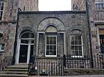 | |||
| George Square 26 | 55°56′35″N 3°11′25″W | Category A | 28819 |  | |||
| 35A, 37 And 37A George Street | 55°57′13″N 3°11′53″W | Category B | 28833 | | |||
| 45 George Street | 55°57′13″N 3°11′55″W | Category A | 28836 | | |||
| 9-13B (Odd Nos) Dundonald Street, And 2 And 2A Cumberland Street, Including Railings And Lamp | 55°57′33″N 3°11′50″W | Category B | 28724 | | |||
| 40-44 (Inclusive Nos) Elm Row, Gateway Theatre | 55°57′35″N 3°10′56″W | Category C(S) | 28736 | | |||
| Eton Terrace 14 And 1 Lennox Street | 55°57′19″N 3°12′48″W | Category A | 28738 | | |||
| Eyre Place 9-11 | 55°57′39″N 3°12′01″W | Category C(S) | 28740 | | |||
| Eyre Place 25-31 | 55°57′41″N 3°11′54″W | Category C(S) | 28741 | | |||
| 27-35 (Inclusive Nos) Drummond Street | 55°56′51″N 3°11′03″W | Category B | 28672 | | |||
| 19, 20, 21, 22 Drumsheugh Gardens | 55°57′05″N 3°12′49″W | Category B | 28675 | | |||
| 17 And 17A Dublin Street, Including Railings | 55°57′23″N 3°11′34″W | Category B | 28681 | | |||
| 19 And 19A Dublin Street, Including Railings | 55°57′24″N 3°11′34″W | Category B | 28682 | | |||
| 63-69 (Odd Nos) Dublin Street, Including Railings With 1B Dublin Street Lane North | 55°57′29″N 3°11′36″W | Category B | 28686 | | |||
| 18 And 18A Dublin Street, Including Railings | 55°57′23″N 3°11′37″W | Category B | 28691 | | |||
| 64-68 (Even Nos) Dublin Street, Including Railings | 55°57′28″N 3°11′40″W | Category B | 28697 | | |||
| 23-23C Dundas Street, And 35 Northumberland Street Including Railings | 55°57′25″N 3°11′56″W | Category A | 28706 | | |||
| 61 Dreghorn Loan, Dunalistair | 55°54′11″N 3°15′01″W | Category B | 28660 | | |||
| 30 Cramond Glebe Road, The Cramond Inn, Including Outbuilding | 55°58′47″N 3°18′00″W | Category B | 28603 | | |||
| 60 Dalkeith Road, Arthur Lodge, Including Gatepiers And Boundary Walls | 55°56′17″N 3°10′23″W | Category A | 28622 | | |||
| 82 And 82A Dalkeith Road, Including Boundary Walls, Gatepiers And Carriage And Pedestrian Gates | 55°56′13″N 3°10′17″W | Category B | 28627 | | |||
| 27, 29 Dean Path | 55°57′09″N 3°13′07″W | Category B | 28635 | 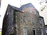 | |||
| 302 Colinton Road With Boundary Wall And Railings | 55°54′28″N 3°15′18″W | Category C(S) | 28580 | | |||
| 139 Cowgate, Former Tailor's Hall | 55°56′53″N 3°11′24″W | Category A | 28595 | | |||
| 43-49 (Odd Nos) East Claremont Street | 55°57′44″N 3°11′33″W | Category A | 28534 | | |||
| Clarence Street 3-19B | 55°57′34″N 3°12′21″W | Category B | 28537 | | |||
| Clerk Street 2-18 | 55°56′35″N 3°10′58″W | Category B | 28547 | | |||
| 352 Castlehill, Boswell's Court | 55°56′56″N 3°11′44″W | Category A | 28489 | %2C_352_Castlehill%2C_The_Royal_Mile%2C_Edinburgh.jpg) | |||
| Duddingston Village, 46 The Causeway Including Gates, Gatepiers And Boundary Walls | 55°56′34″N 3°08′51″W | Category C(S) | 28494 | | |||
| Causeway, The 58, 60 Poplar Bank And Dairy, Duddingston | 55°56′32″N 3°08′55″W | Category B | 28495 | | |||
| 5-9 (Odd Nos) South Charlotte Street With Railings | 55°57′03″N 3°12′21″W | Category A | 28512 | | |||
| 4 Castle Street | 55°57′04″N 3°12′12″W | Category B | 28469 | | |||
| 16-20 (Even Nos) And 20A Castle Street With Railings And Connery's Bar, Rose Street | 55°57′06″N 3°12′13″W | Category A | 28472 | | |||
| 118-124 Buccleuch Street | 55°56′29″N 3°11′01″W | Category B | 28403 |  | |||
| 11, 13 And 15 Blackfriars Street | 55°57′00″N 3°11′09″W | Category B | 28322 | | |||
| 23-29 (Odd Nos) Blackfriars Street | 55°56′59″N 3°11′09″W | Category B | 28324 | | |||
| 45-51 (Odd Nos) Blackfriars Street | 55°56′59″N 3°11′08″W | Category B | 28326 | | |||
| Boroughloch Lane & Square Boroughloch Buildings | 55°56′31″N 3°11′04″W | Category B | 28336 | 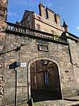 | |||
| 19 Boswall Road, Boswall House With Boundary Walls, Railings, Gates And Gateposts | 55°58′47″N 3°12′41″W | Category A | 28338 | | |||
| 6, 8 And 10 Brighton Street | 55°56′48″N 3°11′21″W | Category B | 28351 | | |||
| 39 And 41 Broughton Street | 55°57′27″N 3°11′18″W | Category B | 28362 | | |||
| 2 Barnshot Road, Thirlestane With Boundary Wall, Railings, Gate Piers And Gate | 55°54′23″N 3°15′27″W | Category B | 28269 | | |||
| 1, 3 Alva Street, 12,13,14 Queensferry Street Including Boundary Walls To Rear | 55°57′02″N 3°12′35″W | Category A | 28235 | | |||
| 27, 29, 31 Alva Street, Including Railings | 55°56′59″N 3°12′39″W | Category A | 28237 | | |||
| Ann Street 43 | 55°57′21″N 3°12′46″W | Category A | 28243 | | |||
| 6-10A (Even Nos) Annandale Street | 55°57′36″N 3°11′00″W | Category A | 28254 | | |||
| 18-22A (Even Nos) Annandale Street | 55°57′37″N 3°11′02″W | Category A | 28255 | | |||
| 120, 122 And 124 (Even Nos) Swanston Road, Swanston Old Farm, Including Boundary Wall | 55°53′35″N 3°13′00″W | Category B | 28202 | | |||
| 1 And 1A Albany Street, And 23-27 (Odd Nos) Dublin Street, Including Railings | 55°57′24″N 3°11′35″W | Category B | 28217 | | |||
| 5-7B (Odd Nos) Albany Street, Including Railings And 23 Dublin Street Lane South | 55°57′25″N 3°11′33″W | Category A | 28219 | | |||
| St Catherine's Balm Well Howdenhall Road | 55°54′10″N 3°09′50″W | Category B | 28122 | | |||
| 163 Newhaven Road, Victoria Park Lodge And Gatepiers | 55°58′34″N 3°11′31″W | Category C(S) | 28127 | | |||
| Woodhall House Lodge Colinton | 55°54′06″N 3°16′59″W | Category C(S) | 28132 | | |||
| 91 Ravelston Dykes Road, Dovecot | 55°57′09″N 3°15′19″W | Category B | 28144 | | |||
| Dreghorn Mains Farmhouse And Steading With Boundary Wall | 55°53′54″N 3°14′35″W | Category C(S) | 28168 | | |||
| 49 Ellen's Glen Road, Greenend House With Garden Walls | 55°54′51″N 3°08′56″W | Category B | 28175 | | |||
| 6 Lasswade Road, Kirk Farmhouse, Including Ancillary Structures And Boundary Wall | 55°54′46″N 3°09′35″W | Category C(S) | 28184 | | |||
| Liberton Drive, Meadowhead Farmhouse And Steading | 55°54′30″N 3°11′01″W | Category B | 28190 | | |||
| Peffermill House Mill, Peffermill Road | 55°55′57″N 3°08′48″W | Category B | 28195 | | |||
| Spylaw Farm House Off Gillespie Road Colinton | 55°54′22″N 3°16′17″W | Category B | 28199 | | |||
| 3/1 And 3/2 Kirk Cramond, Cramond House | 55°58′42″N 3°17′51″W | Category B | 28049 | | |||
| Gilmerton, The Drum With Sundial | 55°54′31″N 3°07′13″W | Category A | 28052 | | |||
| Gilmerton, The Drum, Walled Garden | 55°54′27″N 3°07′26″W | Category C(S) | 28056 | | |||
| Gilmerton, The Drum, Icehouses | 55°54′34″N 3°07′12″W | Category C(S) | 28058 | | |||
| Drylaw House, Stables Courtyard | 55°57′53″N 3°15′10″W | Category B | 28064 | | |||
| Marchfield Hillhouse Road | 55°57′47″N 3°16′03″W | Category B | 28088 | | |||
| 232 Marionville Road, Marionville, Including Boundary Walls, Railings And Gates | 55°57′32″N 3°09′15″W | Category A | 28089 | | |||
| 71 Priestfield Road, Prestonfield House Hotel Including Gatepiers And Boundary Walls, Sundial, Garden Furniture And Memorial | 55°56′12″N 3°09′26″W | Category A | 28107 |  | |||
| 71 Priestfield Road, Prestonfield House, Former Stables | 55°56′14″N 3°09′31″W | Category A | 28108 | | |||
| 95 Ravelston Dykes Road, The Mary Erskine School (Formerly Ravelston House) | 55°57′10″N 3°15′15″W | Category A | 28110 | | |||
| Colinton Road, Merchiston Castle School, House At Walled Garden | 55°54′36″N 3°15′08″W | Category B | 27986 | | |||
| University Of Edinburgh Mcewan Hall Teviot Row And Teviot Place Including Railings Gates And Gatepiers Between Hall And Reid School Of Music | 55°56′43″N 3°11′23″W | Category A | 27993 |  | |||
| 18, 20 And 22 Chambers Street, University Of Edinburgh, Minto House, Including Railings, (Department Of Architecture And History Of Art) | 55°56′52″N 3°11′22″W | Category B | 27997 | | |||
| Craiglockhart Castle Glenlockhart Road | 55°55′10″N 3°14′18″W | Category B | 28015 | | |||
| Holyroodhouse, Abbey Court House | 55°57′10″N 3°10′25″W | Category B | 28027 |  | |||
| Holyroodhouse, Abbeyhill, Queen Mary's Bath House | 55°57′13″N 3°10′27″W | Category A | 28028 | | |||
| 65 Bonaly Road, Bonaly Tower, With Boundary Walls, Gates, Bridge, Garden Terraces And Steps And Garden Statuary | 55°53′51″N 3°15′34″W | Category A | 28033 |  | |||
| Cammo Road, Cammo Estate, Cammo House | 55°57′29″N 3°19′28″W | Category B | 28037 | | |||
| The Innocent Railway, Cast Iron Bridge Over Braid Burn | 55°56′11″N 3°08′39″W | Category B | 27949 | | |||
| Spylaw Street And Dell Road Bridge | 55°54′30″N 3°15′24″W | Category B | 27951 | | |||
| 3 Queensferry Road, Stewart's Melville College (Former Daniel Stewart's College), Art Room, North Gatelodge, Boundary Walls And Gates | 55°57′17″N 3°13′36″W | Category A | 27967 |  | |||
| Lauriston Place, George Heriot's School, Chemistry Block | 55°56′46″N 3°11′47″W | Category B | 27977 | | |||
| 75 Belford Road, Scottish National Gallery of Modern Art, (former John Watson's School), including N and S gate lodges, piers and gates | 55°57′04″N 3°13′31″W | Category A | 27982 |  | |||
| 1 Pilrig Street With Boundary Wall And Railing | 55°57′52″N 3°10′43″W | Category B | 27843 | | |||
| George Street And Hanover Street, Statue Of George Iv | 55°57′13″N 3°11′50″W | Category A | 27854 | _-_01.jpg) | |||
| 44 Queen Charlotte Street | 55°58′24″N 3°10′04″W | Category C(S) | 27873 | | |||
| 1 And 2 Shore And 2 Tower Street, Leith Signal Tower | 55°58′39″N 3°10′08″W | Category A | 27884 | | |||
| 45 And 46 Shore | 55°58′33″N 3°10′12″W | Category B | 27892 | | |||
| Dr Andrew Balfour Drinking Fountain Klondyke Street Newcraighall | 55°56′07″N 3°05′22″W | Category C(S) | 27896 | | |||
| 45, 46 Timberbush | 55°58′35″N 3°10′03″W | Category B | 27902 | | |||
| 1-4 (Inclusive Nos) Tower Place, Malmaison Hotel (Former Sailors' Home) | 55°58′40″N 3°10′06″W | Category B | 27912 | | |||
| Botanical Gardens Large Palm House Arboretum Road And Inverleith Row | 55°58′01″N 3°12′30″W | Category A | 27914 |  | |||
| Ratho Village, 49 Main Street And Boundary Wall | 55°55′19″N 3°22′46″W | Category C(S) | 27741 | | |||
| 44 Chambers Street, The Royal Museum Of Scotland | 55°56′49″N 3°11′22″W | Category A | 27748 | .jpg) | |||
| 3 West Brighton Crescent | 55°57′04″N 3°07′07″W | Category B | 27750 | | |||
| Ratho Village, 54 And 56 (Even Nos) Main Street | 55°55′19″N 3°22′48″W | Category C(S) | 27774 | | |||
| 10 Links Place, The Abbot's House With Boundary Wall And Railings | 55°58′23″N 3°09′50″W | Category B | 27779 | | |||
| Canongate, Burgh Cross | 55°57′06″N 3°10′45″W | Category B | 27796 | 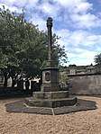 | |||
| 11, 13 And 14 (Inclusive Nos) Maritime Street | 55°58′29″N 3°10′08″W | Category B | 27800 | | |||
| Union Canal, West Hermiston Bridge, Bridge No 12 | 55°55′07″N 3°19′27″W | Category B | 27806 | | |||
| Union Canal, Gogar Moor Bridge, Bridge No 14 | 55°55′12″N 3°21′05″W | Category B | 27813 | | |||
| Ratho Mains Farmhouse With Boundary Wall And Steading | 55°54′59″N 3°23′01″W | Category B | 27657 | | |||
| 9 Rosefield Avenue | 55°57′10″N 3°07′00″W | Category B | 27658 | | |||
| 13 Rosefield Avenue | 55°57′10″N 3°07′01″W | Category B | 27666 | | |||
| 5 Rosefield Place | 55°57′07″N 3°07′03″W | Category C(S) | 27686 | | |||
| 9 Tipperlinn Road With Boundary Walls, Gatepiers And Gates | 55°55′50″N 3°12′55″W | Category C(S) | 27703 | | |||
| 23 Tipperlinn Road And Morningside Terrace, Royal Edinburgh Hospital, Mackinnon House (Formerly West House) With Boundary Wall To Kinnair Unit (Formerly Sinclair And Erskine Wards) | 55°55′38″N 3°12′57″W | Category B | 27718 | | |||
| Newliston House, Bastion And Retaining Walls | 55°57′02″N 3°25′41″W | Category B | 27583 | | |||
| Newliston House, Lawn Park Cottage | 55°56′37″N 3°25′19″W | Category B | 27613 | | |||
| 54 Regent Street | 55°57′14″N 3°06′39″W | Category C(S) | 27643 | | |||
| 2 Newbattle Terrace, Morningside Parish Church Hall | 55°55′50″N 3°12′34″W | Category C(S) | 27645 | | |||
| Off Regent Road, Former Governor's House, Including Curtain Walls | 55°57′11″N 3°11′07″W | Category A | 27646 | .jpg) | |||
| Leith Walk, Queen Victoria Statue | 55°58′15″N 3°10′18″W | Category B | 27654 | 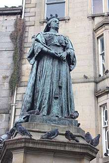 | |||
| Kirkliston Village, 1 Manse Road, Former Manse With Gig House And Stables, Gatepiers And Boundary Wall | 55°57′20″N 3°24′22″W | Category B | 27515 | | |||
| Kirkliston Village, Newliston Road, Breast Mill (Priest Mill) | 55°56′57″N 3°24′22″W | Category C(S) | 27519 | | |||
| 51 Promenade, 29 Straiton Place, Including Piers And Terrace Wall | 55°57′13″N 3°06′30″W | Category C(S) | 27520 | | |||
| 44 Promenade (Formerly At End Of Marlborough Street), Prince Of Wales Fountain | 55°57′15″N 3°06′31″W | Category B | 27529 |  | |||
| 3-9 (Odd Nos) Regent Street | 55°57′09″N 3°06′44″W | Category C(S) | 27534 | | |||
| 1, 3 Morningside Road, Morningside United Church (Former Congregational) With Boundary Walls | 55°56′04″N 3°12′34″W | Category B | 27541 |  | |||
| Kirkliston Village, 19 Station Road | 55°57′18″N 3°24′04″W | Category C(S) | 27548 | |
Key
The scheme for classifying buildings in Scotland is:
- Category A: "buildings of national or international importance, either architectural or historic; or fine, little-altered examples of some particular period, style or building type."[1]
- Category B: "buildings of regional or more than local importance; or major examples of some particular period, style or building type, which may have been altered."[1]
- Category C: "buildings of local importance; lesser examples of any period, style, or building type, as originally constructed or moderately altered; and simple traditional buildings which group well with other listed buildings."[1]
In March 2016 there were 47,288 listed buildings in Scotland. Of these, 8 per cent were Category A, and 50 per cent were Category B, with the rest listed at Category C.[2]
Notes
- Sometimes known as OSGB36, the grid reference (where provided) is based on the British national grid reference system used by the Ordnance Survey.
• "Guide to National Grid". Ordnance Survey. Retrieved 12 December 2007.
• "Get-a-map". Ordnance Survey. Retrieved 17 December 2007. - Historic Environment Scotland assign a unique alphanumeric identifier to each designated site in Scotland, for listed buildings this always begins with "LB", for example "LB12345".
References
- All entries, addresses and coordinates are based on data from Historic Scotland. This data falls under the Open Government Licence
- "What is Listing?". Historic Environment Scotland. Retrieved 29 May 2018.
- Scotland's Historic Environment Audit 2016 (PDF). Historic Environment Scotland and the Built Environment Forum Scotland. pp. 15–16. Retrieved 29 May 2018.
This article is issued from Wikipedia. The text is licensed under Creative Commons - Attribution - Sharealike. Additional terms may apply for the media files.