List of listed buildings in Edinburgh/19
List
| Name | Location | Date Listed | Grid Ref. [note 1] | Geo-coordinates | Notes | LB Number [note 2] | Image |
|---|---|---|---|---|---|---|---|
| Belford Road Windmill | 55°57′02″N 3°13′47″W | Category B | 28147 |  | |||
| 10 And 12 School Brae, Bonnington Cottage And Cockle Mill | 55°58′30″N 3°18′12″W | Category C(S) | 28164 | | |||
| 29 Dowie's Mill Lane, Primrose Cottage, Including Boundary Wall | 55°58′02″N 3°18′56″W | Category B | 28167 | | |||
| 338 Gilmerton Road | 55°54′55″N 3°09′00″W | Category C(S) | 28177 | | |||
| Duddingston House Gates | 55°56′33″N 3°07′49″W | Category B | 28066 | 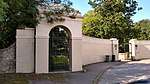 | |||
| Inverleith House (Gallery Of Modern Art) Arboretum Road And Inverleith Row | 55°57′54″N 3°12′37″W | Category B | 28081 | 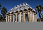 | |||
| 80-84 (Even Numbers) Kingston Avenue, Former Kingston Clinic | 55°55′10″N 3°09′04″W | Category A | 28082 | | |||
| 33 And 35 Lochend Road South, Lochend House, Including Boundary Walls, Gatepiers And Railings | 55°57′37″N 3°09′33″W | Category B | 28087 | | |||
| 19 Winton Loan, Morton House, Including Walled Courtyard, Garage And Well | 55°53′50″N 3°11′38″W | Category A | 28092 | | |||
| Nether Liberton, Old Mill Lane, Nether Liberton House | 55°55′25″N 3°09′52″W | Category B | 28101 | | |||
| Peffermill House Peffermill Road | 55°55′57″N 3°08′56″W | Category A | 28106 | | |||
| 195 Queensferry Road, Ravelston House Gatepiers And Gates | 55°57′25″N 3°14′53″W | Category C(S) | 28114 | | |||
| 133, 135 And 137 Redford Road, Redford House With Former Bleaching House, Other Outbuildings And Boundary Wall | 55°54′21″N 3°14′27″W | Category B | 28115 | | |||
| 5 And 6 Chambers Street, Adam House | 55°56′53″N 3°11′15″W | Category B | 27990 | | |||
| University Of Edinburgh New Building Teviot Place Teviot Row And Middle Meadow Walk | 55°56′41″N 3°11′26″W | Category A | 27992 |  | |||
| University Of Edinburgh Mcewan Lantern Pillar Teviot Row And Teviot Place | 55°56′43″N 3°11′20″W | Category B | 27994 |  | |||
| Edinburgh Castle, Esplanade | 55°56′55″N 3°11′51″W | Category A | 28011 |  | |||
| Holyroodhouse Palace, Forecourt, Fountain | 55°57′09″N 3°10′23″W | Category A | 28024 | .jpg) | |||
| 44 And 45 Water Street (Formerly 42 And 43 Water Street) | 55°58′29″N 3°10′11″W | Category B | 27919 | | |||
| 5, 6 And 7 Wellington Place With Boundary Walls And Railings | 55°58′16″N 3°10′11″W | Category B | 27922 | | |||
| Warriston Road, Warriston Cemetery, With All Monuments, Catacombs, Bridge, Boundary Walls, Gates And Gatepiers | 55°58′05″N 3°11′53″W | Category A | 27937 | 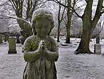 | |||
| 22-24 Warrender Park Crescent, Former Boroughmuir School, Including Boundary Wall, Railings And Gatepiers | 55°56′19″N 3°12′08″W | Category B | 27968 |  | |||
| Calton Hill, Off Regent Road, Playfair's Monument | 55°57′17″N 3°10′59″W | Category A | 27826 | 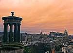 | |||
| 4 And 5 Mitchell Street | 55°58′28″N 3°10′00″W | Category B | 27828 | | |||
| High Street, Memorial To Walter Francis, 5Th Duke Of Buccleuch And 7Th Duke Of Queensberry | 55°56′58″N 3°11′30″W | Category A | 27844 |  | |||
| Parliament Square, Charles Ii Statue | 55°56′57″N 3°11′26″W | Category A | 27851 |  | |||
| High Street, City Chambers Courtyard, Alexander And Bucephalus Statue | 55°57′00″N 3°11′25″W | Category A | 27855 | 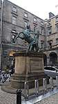 | |||
| 45 Queen Charlotte Street With Boundary Walls And Railings | 55°58′25″N 3°10′00″W | Category B | 27859 | | |||
| 53 Queen Charlotte Street With Boundary Walls Gatepiers And Railings | 55°58′25″N 3°09′59″W | Category B | 27863 | | |||
| West Princes Street Gardens, Allan Ramsay Monument | 55°57′06″N 3°11′50″W | Category A | 27870 |  | |||
| West Princes Street Gardens, Scottish American Memorial | 55°57′04″N 3°12′04″W | Category B | 27874 |  | |||
| St Anthony Place, Trafalgar Masonic Lodge | 55°58′19″N 3°10′21″W | Category C(S) | 27880 | | |||
| High Street, Netherbow Wellhead | 55°57′02″N 3°11′07″W | Category A | 27901 |  | |||
| West Princes Street Gardens, Ross Fountain | 55°57′00″N 3°12′11″W | Category A | 27911 | 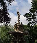 | |||
| Royal Victoria Hospital, Gateway, Craigleith Road | 55°57′29″N 3°13′45″W | Category B | 27752 | | |||
| 328 Leith Walk | 55°57′53″N 3°10′39″W | Category C(S) | 27759 | | |||
| Niddry Street And Cowgate, St Cecilia's Hall | 55°56′56″N 3°11′11″W | Category A | 27760 |  | |||
| 9 And 11 West Brighton Crescent | 55°57′05″N 3°07′09″W | Category B | 27762 | | |||
| Queen Street, Scottish National Portrait Gallery With Lamp Standards | 55°57′20″N 3°11′37″W | Category A | 27764 | .jpg) | |||
| 6 West Brighton Crescent | 55°57′05″N 3°07′06″W | Category B | 27782 | | |||
| 7, 8 Maritime Street | 55°58′28″N 3°10′08″W | Category B | 27795 | | |||
| 42 Maritime Street | 55°58′28″N 3°10′06″W | Category C(S) | 27812 | | |||
| 45-46A Maritime Street | 55°58′28″N 3°10′07″W | Category C(S) | 27815 | | |||
| Union Canal, Bridge No 15 (Ratho Village, Baird Road) | 55°55′24″N 3°22′44″W | Category B | 27817 | | |||
| 8 Mill Lane, Taylor Gardens And King Street, Leith Hospital With Stalk, Gates And Railings | 55°58′27″N 3°10′33″W | Category B | 27822 | | |||
| 12 Leith Walk 3 And 5 Kirk Street And 1 Cassel's Lane With Boundary Walls And Railings | 55°58′13″N 3°10′22″W | Category B | 27659 | | |||
| Ratho Park With Terrace Walls And Gates | 55°55′24″N 3°21′41″W | Category A | 27661 | | |||
| 11 Rosefield Avenue | 55°57′10″N 3°07′01″W | Category B | 27662 | | |||
| 25 And 27 Nile Grove | 55°55′35″N 3°12′23″W | Category B | 27664 | | |||
| 23 Tipperlinn Road, Royal Edinburgh Hospital, Church Centre | 55°55′35″N 3°13′05″W | Category B | 27713 | | |||
| 3 And 4 Sandford Gardens | 55°57′06″N 3°06′54″W | Category B | 27716 | | |||
| Ratho Village, 12 And 14 (Even Nos) Baird Road With Wall And Gatepiers | 55°55′22″N 3°22′41″W | Category B | 27720 | | |||
| 12 Tipperlinn Road, Viewfield House, With Boundary Walls Gatepiers And Gates | 55°55′51″N 3°12′52″W | Category C(S) | 27723 | | |||
| 149 Rose Street, Former Telephone Exchange | 55°57′06″N 3°12′17″W | Category B | 27724 | | |||
| 9 And 10 Queen Street, Royal College Of Physicians, With Front Wall And Lamp Standards | 55°57′18″N 3°11′47″W | Category A | 27732 | | |||
| Leith Docks, Edinburgh Dry Dock | 55°58′38″N 3°09′33″W | Category B | 27611 | | |||
| Morningside Terrace, Tipperlinn Cottage (Royal Edinburgh Hospital) | 55°55′41″N 3°12′47″W | Category C(S) | 27626 | | |||
| Leith Docks, Prince Of Wales Dry Dock | 55°58′46″N 3°10′07″W | Category B | 27629 | | |||
| 11 West Harbour Road, Former Custom House | 55°58′52″N 3°13′34″W | Category B | 27651 | | |||
| Kirkliston Village, 76-82 (Even Nos), Main Street, Newliston Arms Hotel | 55°57′22″N 3°24′08″W | Category C(S) | 27510 | | |||
| St Stephen's Church (C Of S) St Stephen Street And St Vincent Street | 55°57′31″N 3°12′13″W | Category A | 27527 | 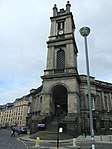 | |||
| 2 Rutland Place And Rutland Street At Rear, Berkeley Casino, (Former St Thomas's Church, Latterly Scottish Tourist Board), Including Railings, Piers And Lamp Standards | 55°56′59″N 3°12′30″W | Category B | 27532 | | |||
| Kirkliston Village, 5A Newliston Road, Smithy And Boundary Wall | 55°57′07″N 3°24′18″W | Category B | 27533 | | |||
| 11 John's Place, Former St James's Church Rectory | 55°58′21″N 3°10′02″W | Category B | 27545 | | |||
| 41-45 (Odd Nos) Morningside Road And 1-5 (Odd Nos) Church Hill Place | 55°55′56″N 3°12′35″W | Category B | 27556 | | |||
| Newbridge At River Almond, Newbridge Village | 55°56′24″N 3°24′41″W | Category B | 27572 | | |||
| 6 And 6B Kirk Street | 55°58′14″N 3°10′21″W | Category C(S) | 27574 | | |||
| Chester Street And Palmerston Place, St Mary's Cathedral (Episcopal), Walpole Hall And Song School | 55°56′57″N 3°13′01″W | Category A | 27448 | 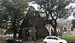 | |||
| 4 Broughton Street, St James Place, And Chapel Lane, St Mary's (Roman Catholic) Cathedral, With St Andrew's Hall, Terrace, Steps And Railings | 55°57′21″N 3°11′18″W | Category B | 27449 | | |||
| 88, 89, 90, 91 Giles Street | 55°58′24″N 3°10′21″W | Category C(S) | 27453 | | |||
| 98-99A Giles Street | 55°58′23″N 3°10′19″W | Category B | 27459 | | |||
| 5 Jordan Lane, Ainslie Cottage, And Boundary Wall | 55°55′38″N 3°12′29″W | Category C(S) | 27460 | | |||
| 118 Portobello High Street, Police Station | 55°57′14″N 3°06′55″W | Category B | 27463 | | |||
| 158-162 (Even Nos) Portobello High Street, 2 And 4 Bath Street And Public Lavatories | 55°57′11″N 3°06′51″W | Category C(S) | 27468 | | |||
| 174-184 (Even Nos) Portobello High Street | 55°57′10″N 3°06′49″W | Category C(S) | 27477 | | |||
| 28 Brougham Street, St Michael And All Saints Church (Episcopal) | 55°56′36″N 3°12′05″W | Category A | 27489 | | |||
| 45 And 45B Portland Street With Front Walls Steps And Railings; Eh6 4Az | 55°58′37″N 3°10′57″W | Category B | 27361 | | |||
| 76 And 78 Polwarth Terrace With Boundary Walls Gatepiers And Railings | 55°55′53″N 3°13′34″W | Category B | 27370 | | |||
| 147 Portobello High Street, Town Hall, Including Lamp Standards | 55°57′11″N 3°06′55″W | Category B | 27391 | | |||
| 6 Greenhill Park | 55°55′59″N 3°12′30″W | Category B | 27393 | | |||
| 54 Hermiston, Hermiston Old Farmhouse | 55°55′06″N 3°19′10″W | Category B | 27396 | | |||
| 177 Portobello High Street, Royal Bank Of Scotland, (Formerly National Bank Of Scotland) | 55°57′09″N 3°06′50″W | Category B | 27398 | | |||
| Lothian Road, St John's Church (Episcopal), Hall, Churchyard, Boundary Walls, Steps, Railings, Gatepiers, Vaults And Monuments | 55°57′00″N 3°12′22″W | Category A | 27401 | 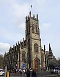 | |||
| 2 Spylaw Road Teviot House With Stable Block | 55°55′59″N 3°13′06″W | Category B | 27410 | 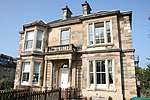 | |||
| 42-44/1,2,3,4(Even Numbers) Spylaw Road | 55°55′56″N 3°13′15″W | Category B | 27423 | | |||
| 14 Hermitage Drive And 20 Corrennie Gardens | 55°55′13″N 3°12′24″W | Category C(S) | 27426 | | |||
| 2 And 4A, 4B,4C And 4/1-4/22 (Inclusive Nos) Lochend Road (Former Leith Academy Secondary School) With Boundary Wall, Gatepiers And Railings | 55°58′10″N 3°10′03″W | Category B | 27432 | | |||
| Tolbooth Wynd Bridge | 55°58′31″N 3°10′20″W | Category B | 27435 | | |||
| 67 Giles Street, St Mary's Workshops, Former Yardheads School | 55°58′21″N 3°10′21″W | Category C(S) | 27439 | | |||
| 24 Hermitage Drive, Shieldaig | 55°55′14″N 3°12′05″W | Category A | 27440 | | |||
| 44, 44A, 46 And 46A Constitution Street | 55°58′29″N 3°10′03″W | Category B | 27295 | | |||
| 1-7 Odd Nos Polwarth Gardens And 1 And 3 Polwarth Crescent | 55°56′15″N 3°13′02″W | Category B | 27307 | | |||
| 143 Grange Loan, Astley Ainslie Hospital, North And South Lodges, Gatepiers And Gates | 55°55′43″N 3°12′04″W | Category A | 27310 | | |||
| St Columba's Church (C Of S) Queensferry Road And Columba Road Blackhall | 55°57′30″N 3°15′08″W | Category B | 27318 | | |||
| 27 Polwarth Terrace | 55°56′03″N 3°13′21″W | Category B | 27328 | | |||
| Polwarth Terrace Polwarth Parish Church And Hall Former Free Church With Gatepiers And Railings | 55°56′02″N 3°13′25″W | Category B | 27335 | 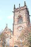 | |||
| Hatton Estate, Garden Temple | 55°54′14″N 3°23′52″W | Category B | 27348 | | |||
| 106 Constitution Street, St Mary Star Of The Sea (Rc) Church With Boundary Walls, Gatepiers And Gates | 55°58′24″N 3°10′09″W | Category B | 27358 | | |||
| Glasgow Road, Norton House Hotel, Former West Lodge, Demijohn Cottage With Boundary Wall And Gatepiers | 55°56′00″N 3°23′21″W | Category C(S) | 27222 | | |||
| 17-19 (Odd Nos) Montpelier And 22-26 (Even Nos) Bruntsfield Avenue | 55°56′14″N 3°12′35″W | Category B | 27246 | | |||
| 141-147 (Odd Nos) Constitution Street | 55°58′27″N 3°11′01″W | Category B | 27248 | | |||
| Montpelier Park Boroughmuir High School Annexe Formerly St Oswald's Church And Church Halls | 55°56′13″N 3°12′41″W | Category B | 27254 |  | |||
| 13 East Brighton Crescent | 55°57′02″N 3°07′02″W | Category B | 27255 | | |||
| 28 Lauriston Street, Sacred Heart Church (Roman Catholic), With Boundary Wall, Gatepiers, Gates And Railings | 55°56′42″N 3°12′05″W | Category A | 27266 | | |||
| 194 Glasgow Road, Former Gogar Parish Church And Graveyard | 55°56′19″N 3°19′59″W | Category B | 27268 | | |||
| 76 Promenade, 20 And 21 Bedford Terrace Including Gatepiers And Boundary Walls | 55°57′02″N 3°06′02″W | Category B | 27269 | | |||
| Malleny Estate, Dovecot | 55°53′05″N 3°20′11″W | Category A | 27153 | | |||
| Glasgow Road, Gogar Mount House, West Lodge, Boundary Wall, Gatepiers And Railings | 55°56′05″N 3°21′03″W | Category C(S) | 27159 | | |||
| 1 Willowbrae Road, New Restalrig Parish Church (Church Of Scotland), With Hall And Retaining Wall | 55°57′17″N 3°08′55″W | Category B | 27166 | | |||
| 1 Brighton Public Park, Sundial | 55°57′04″N 3°07′00″W | Category B | 27173 | | |||
| 108 (Gf And 1F) And 110 Newhaven Road With Front Wall; Eh6 4Br | 55°58′24″N 3°11′18″W | Category C(S) | 27186 | | |||
| 67 Colinton Road, George Watson's College, Main School, Lodge And Gatepiers, War Memorial And Rifle Range | 55°55′51″N 3°13′10″W | Category B | 27193 | | |||
| 2 Mansfield Road, Dean Park House With Gatepiers And Boundary Wall | 55°52′53″N 3°20′24″W | Category B | 27199 | | |||
| 1-7 (Odd Nos) Merchiston Place And 2, 4 Montpelier Park | 55°56′09″N 3°12′38″W | Category B | 27216 | | |||
| 5 And 6 East Brighton Crescent | 55°57′02″N 3°06′55″W | Category B | 27217 | | |||
| 12 And 13 Casselbank Street, Destiny Church | 55°58′12″N 3°10′24″W | Category B | 27098 | | |||
| 15 Main Street, Malleny Arms Hotel | 55°53′02″N 3°20′19″W | Category C(S) | 27106 | | |||
| Glasgow Road, Castle Gogar Lodge And Gates And Gatepiers | 55°56′19″N 3°19′45″W | Category B | 27112 | | |||
| Glasgow Road, Gogar Mount House | 55°56′05″N 3°20′56″W | Category B | 27129 | | |||
| 11 Church Hill With Coach House | 55°55′57″N 3°12′23″W | Category C(S) | 27028 | | |||
| 527, Lanark Road West, Ravelrig Estate, Stables, Steading And Steading House | 55°53′12″N 3°20′43″W | Category B | 27035 | | |||
| 527, Lanark Road West, Ravelrig Estate, Walled Garden | 55°53′11″N 3°20′33″W | Category B | 27045 | | |||
| 37 Brighton Place | 55°57′02″N 3°07′03″W | Category B | 27056 | | |||
| Hope Park & Buccleuch Congregational Church Hope Park Terrace | 55°56′26″N 3°10′53″W | Category B | 27060 | | |||
| Leith Docks, Former Old East Dock Entrance, With Locks, Swing Bridge, Winches, Boundary Wall, Gatepiers And 1C Dock Place, Waterfront Wine Bar (Former Lock Keeper's Lodge) | 55°58′39″N 3°10′17″W | Category B | 27061 | | |||
| Foxhall Dovecot | 55°57′08″N 3°23′28″W | Category B | 27062 | | |||
| 13 Duncan Street, Duncan Street Baptist Church | 55°56′07″N 3°10′42″W | Category B | 26937 | | |||
| 16-20 (Inclusive Nos) Mcleod Street | 55°56′24″N 3°13′51″W | Category B | 26938 |  | |||
| 10 And 12 Bellfield Street | 55°57′06″N 3°06′32″W | Category B | 26945 | | |||
| 4 Smith's Place | 55°58′02″N 3°10′27″W | Category B | 26946 | | |||
| 11 And 13 John Street | 55°57′06″N 3°06′16″W | Category C(S) | 26953 | | |||
| 9 Lochend Road With Boundary Wall And Railings | 55°58′07″N 3°09′59″W | Category C(S) | 26955 | | |||
| 6-10 (Even Nos) Smith's Place | 55°58′01″N 3°10′26″W | Category B | 26958 | | |||
| 15 Morningside Road, Eric Liddell Centre, Formerly North Morningside Church | 55°56′02″N 3°12′35″W | Category B | 26983 | .jpg) | |||
| 2 Charterhall Road, Blackford Hill Lodge | 55°55′33″N 3°11′37″W | Category B | 26994 | | |||
| 3-5 Dalmahoy, St Mary's Episcopal Rectory, Church Hall And Rectory Cottage (Off A71) | 55°54′34″N 3°21′59″W | Category C(S) | 26999 | | |||
| 69 And 71 Restalrig Road With Boundary Wall | 55°58′04″N 3°09′28″W | Category C(S) | 27002 | | |||
| 22 Bellfield Street | 55°57′09″N 3°06′29″W | Category C(S) | 27004 | | |||
| 6, 6B And 6C Bruntsfield Terrace, Bruntsfield House | 55°56′12″N 3°12′23″W | Category C(S) | 26873 | | |||
| 20 Colinton Road Redholme With Boundary Walls And Gatepiers | 55°55′54″N 3°13′06″W | Category B | 26881 | | |||
| 2 Bernard Street And 28 Constitution Street | 55°58′32″N 3°10′00″W | Category B | 26886 | | |||
| 4 And 5 Hermitage Place With Boundary Walls | 55°58′09″N 3°09′51″W | Category B | 26894 | | |||
| 13-15 (Odd Nos) Smith's Place | 55°58′02″N 3°10′24″W | Category B | 26909 | | |||
| 17 Smith's Place, Former Chemical Works | 55°58′02″N 3°10′22″W | Category B | 26921 | | |||
| 1 Lochend Road With Boundary Wall | 55°58′08″N 3°10′00″W | Category B | 26931 | | |||
| 15 Braid Road Cluny Church Centre With Boundary Wall And Railings (Former South Morningside Free Church And Morningisde South Church) | 55°55′25″N 3°12′32″W | Category A | 26810 |  | |||
| Colinton Road Merchiston Castle Now Part Of Napier University | 55°56′00″N 3°12′50″W | Category A | 26828 |  | |||
| 16 Bath Street, 1-5 (Inclusive) Mentone Avenue | 55°57′14″N 3°06′46″W | Category C(S) | 26831 | | |||
| 37 Bernard Street | 55°58′33″N 3°10′07″W | Category B | 26847 | | |||
| 118 Trinity Road, Former Christchurch Episcopal Church | 55°58′44″N 3°12′22″W | Category C(S) | 26850 | |
Key
The scheme for classifying buildings in Scotland is:
- Category A: "buildings of national or international importance, either architectural or historic; or fine, little-altered examples of some particular period, style or building type."[1]
- Category B: "buildings of regional or more than local importance; or major examples of some particular period, style or building type, which may have been altered."[1]
- Category C: "buildings of local importance; lesser examples of any period, style, or building type, as originally constructed or moderately altered; and simple traditional buildings which group well with other listed buildings."[1]
In March 2016 there were 47,288 listed buildings in Scotland. Of these, 8 per cent were Category A, and 50 per cent were Category B, with the rest listed at Category C.[2]
Notes
- Sometimes known as OSGB36, the grid reference (where provided) is based on the British national grid reference system used by the Ordnance Survey.
• "Guide to National Grid". Ordnance Survey. Retrieved 12 December 2007.
• "Get-a-map". Ordnance Survey. Retrieved 17 December 2007. - Historic Environment Scotland assign a unique alphanumeric identifier to each designated site in Scotland, for listed buildings this always begins with "LB", for example "LB12345".
References
- All entries, addresses and coordinates are based on data from Historic Scotland. This data falls under the Open Government Licence
- "What is Listing?". Historic Environment Scotland. Retrieved 29 May 2018.
- Scotland's Historic Environment Audit 2016 (PDF). Historic Environment Scotland and the Built Environment Forum Scotland. pp. 15–16. Retrieved 29 May 2018.
This article is issued from Wikipedia. The text is licensed under Creative Commons - Attribution - Sharealike. Additional terms may apply for the media files.