List of listed buildings in Edinburgh/18
List
| Name | Location | Date Listed | Grid Ref. [note 1] | Geo-coordinates | Notes | LB Number [note 2] | Image |
|---|---|---|---|---|---|---|---|
| Former James Clark School, 1-9 (Inclusive Nos) St Leonard's Crag (Note Modern Additions Of 1961 In Court And Annexe On St Leonard's Hill Are Excluded) | 55°56′39″N 3°10′40″W | Category B | 30046 |  | |||
| 1 West Coates, Including Boundary Walls And Obelisk | 55°56′46″N 3°13′40″W | Category C(S) | 29917 | | |||
| 2 Woodhall Road, The Old Schoolhouse, With Steps, Railings And Retaining Wall | 55°54′26″N 3°15′23″W | Category C(S) | 29953 | | |||
| Wardie Road, 1 Inverleith | 55°58′16″N 3°12′43″W | Category C(S) | 29892 | | |||
| Summerhall Place, 1-15, 1-2 West Preston Street And 1 Summerhall Square | 55°56′22″N 3°10′55″W | Category B | 29834 |  | |||
| 33 Thistle Street | 55°57′15″N 3°11′59″W | Category B | 29838 | | |||
| 16-20 (Inclusive Nos) Trinity Crescent, With Boundary Wall And Railings | 55°58′47″N 3°12′16″W | Category B | 29854 | | |||
| 11-15 (Odd Nos) Victoria Street | 55°56′55″N 3°11′36″W | Category C(S) | 29877 | | |||
| 16-18A (Even Nos) Scotland Streetand 24 West Scotland Street Lane, Including Railings | 55°57′35″N 3°11′43″W | Category B | 29782 | | |||
| 7-9 (Inclusive Nos) South Bridge And 9-13 Niddry Street | 55°56′59″N 3°11′14″W | Category C(S) | 29789 | | |||
| 35 Spylaw Street | 55°54′28″N 3°15′27″W | Category C(S) | 29824 | | |||
| St Patrick Square 22 And 1-5 Clerk Street | 55°56′34″N 3°10′59″W | Category B | 29735 | | |||
| 7 And 9 St Patrick Street | 55°56′37″N 3°11′00″W | Category C(S) | 29742 | | |||
| 21 And 21A Salisbury Road, Southwick House, Including Boundary Walls, Gatepiers And Pedestrian Gate | 55°56′18″N 3°10′31″W | Category B | 29754 | | |||
| 10 Salisbury Road, Including Boundary Walls, Gatepiers And Pedestrian Gate | 55°56′15″N 3°10′36″W | Category B | 29761 | | |||
| 2-4 (Inclusive Nos) Rutland Square, Including Railings And Lamp Standard | 55°56′56″N 3°12′30″W | Category A | 29687 |  | |||
| 8 And 10 South St Andrew Street | 55°57′12″N 3°11′31″W | Category B | 29710 | | |||
| St Bernard's Crescent 1 And 12 Leslie Place | 55°57′28″N 3°12′41″W | Category B | 29711 | | |||
| St Bernard's Crescent 2 And 18 Carlton Street | 55°57′26″N 3°12′41″W | Category A | 29713 | | |||
| St. Bernard's Crescent, 14 And 36 And 38 Danube Street | 55°57′26″N 3°12′46″W | Category A | 29716 | | |||
| 9-11 St Bernard's Row | 55°57′35″N 3°12′37″W | Category B | 29719 | | |||
| St Bernard's Row 20 | 55°57′35″N 3°12′40″W | Category B | 29722 | | |||
| 17, 18 Rothesay Place | 55°57′00″N 3°13′06″W | Category B | 29666 | | |||
| 10-13 (Inclusive Nos) Randolph Place | 55°57′05″N 3°12′36″W | Category B | 29603 | | |||
| 28 Redford Road, Sherwood, With Gatepiers, Boundary Wall And Railings | 55°54′25″N 3°14′55″W | Category B | 29615 | | |||
| 202 Rose Street And 150 Rose Street South Lane | 55°57′04″N 3°12′19″W | Category B | 29655 | 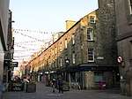 | |||
| 39 And 39A Queen Street And 64 And 66 Frederick Street With Railings | 55°57′15″N 3°12′05″W | Category A | 29554 | | |||
| 40-42 (Inclusive), With 40A And 42A, Queen Street With Railings | 55°57′15″N 3°12′06″W | Category A | 29555 | | |||
| 54 Queen Street With Railings | 55°57′14″N 3°12′12″W | Category A | 29562 | | |||
| 55-57 (Inclusive Nos) Queen Street With Railings And Lamp Standards | 55°57′14″N 3°12′13″W | Category A | 29563 | | |||
| 21 Pentland Avenue, The Rowans With Boundary Wall | 55°54′27″N 3°15′50″W | Category B | 29481 | | |||
| 46 And 48 Pilrig Street And Boundary Walls | 55°57′54″N 3°10′49″W | Category B | 29496 | | |||
| 61-2 Princes Street, Romanes And Paterson | 55°57′10″N 3°11′43″W | Category A | 29506 | | |||
| 99B, 100 And 100A Princes Street, Incorporating Royal Overseas House | 55°57′06″N 3°12′01″W | Category B | 29510 | | |||
| 104 And 105 Princes Street | 55°57′06″N 3°12′03″W | Category B | 29511 | | |||
| Nicolson Street West, 34 And 36 | 55°56′40″N 3°11′07″W | Category B | 29440 | | |||
| 63 And 65 Northumberland Street, Including Railings And Lamp | 55°57′24″N 3°12′06″W | Category A | 29452 | | |||
| Old Church Lane, 12, Duddingston Lodge, Duddingston | 55°56′30″N 3°08′50″W | Category B | 29465 | | |||
| Old Church Lane, 16, Dunerne, Duddingston | 55°56′30″N 3°08′52″W | Category B | 29467 | | |||
| 27, 29, 31, 33, 35, 37, 39 Palmerston Place, Including Railings | 55°56′58″N 3°13′06″W | Category B | 29473 | | |||
| 16 And 18 Nelson Street, And 2, And 4 Northumberland Street, Including Railings And Lamps | 55°57′26″N 3°11′49″W | Category A | 29391 | | |||
| 172 And 174 Newhaven Road Including Gatepiers And Boundary Walls | 55°58′36″N 3°11′30″W | Category B | 29395 | | |||
| 37 And 38 Minto Street, Including Boundary Walls And Pedestrian Gates | 55°56′07″N 3°10′35″W | Category B | 29358 | | |||
| 85-89 (Odd Nos) Morrison Street | 55°56′44″N 3°12′35″W | Category B | 29373 | | |||
| 1 Mound Place, Patrick Geddes Hall (Part) | 55°56′59″N 3°11′45″W | Category A | 29379 | %2C_1_Mound_Place%2C_Edinburgh.jpg) | |||
| 1-3 (Inclusive Nos) Middlefield And 15 Spey Street And Boundary Walls And Gatepier | 55°57′48″N 3°10′46″W | Category A | 29335 | | |||
| 37 And 39 Newhaven Main Street, Including Iron Railings And Boundary Walls | 55°58′49″N 3°11′51″W | Category C(S) | 29288 | | |||
| 15-30 (Inclusive Nos) West Maitland Street | 55°56′49″N 3°12′57″W | Category B | 29292 | | |||
| 5-11 (Odd Nos) Leith Street | 55°57′14″N 3°11′17″W | Category B | 29249 | | |||
| 17-25 (Odd Nos) Leith Street | 55°57′14″N 3°11′16″W | Category B | 29251 | | |||
| 71 And 73 Lothian Road And 44-48 (Even Nos) Grindlay Street | 55°56′48″N 3°12′19″W | Category C(S) | 29266 | | |||
| 75-83 (Odd Nos) Lothian Road | 55°56′48″N 3°12′20″W | Category C(S) | 29267 | | |||
| 16 And 18 Lauriston Place, Including Boundary Wall Gate And Railings | 55°56′42″N 3°11′45″W | Category B | 29218 | 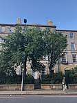 | |||
| 4-8 (Inclusive Numbers) Learmonth Terrace, Including Boundary Walls And Railings | 55°57′20″N 3°13′03″W | Category B | 29246 | | |||
| 25 Learmonth Terrace, Learmonth House | 55°57′20″N 3°13′15″W | Category A | 29248 | | |||
| 20-24 (Even Nos) India Street, Including Railings And Lamps | 55°57′20″N 3°12′22″W | Category A | 29136 | | |||
| 36-42 (Even Nos) India Street, Including Railings And Lamps | 55°57′22″N 3°12′23″W | Category A | 29140 | | |||
| Inverleith Place 13-19 | 55°58′05″N 3°12′28″W | Category C(S) | 29148 | | |||
| Inverleith Row, 5 And 6 | 55°57′53″N 3°12′11″W | Category A | 29155 | | |||
| Inverleith Row, 17 | 55°57′58″N 3°12′16″W | Category B | 29163 | | |||
| Inverleith Row, 19 And 19A | 55°57′59″N 3°12′17″W | Category B | 29165 | | |||
| Inverleith Row 30, 31 | 55°58′05″N 3°12′23″W | Category C(S) | 29172 | | |||
| Inverleith Row 35 | 55°58′06″N 3°12′24″W | Category C(S) | 29173 | | |||
| Inverleith Row, 38, 39 And 39A | 55°58′08″N 3°12′26″W | Category B | 29175 | | |||
| 4-18 (Even Nos) Jeffrey Street And 3-9 (Odd Nos) Cranston Street | 55°57′03″N 3°11′03″W | Category B | 29192 | | |||
| 1-4 (Inclusive Nos) Howard Place And 51 And 53 Warriston Crescent, With Railings And Elevation Of Northern Bar | 55°57′49″N 3°12′03″W | Category B | 29102 | | |||
| 25-29 (Odd Nos) Howe Street, Including Railings | 55°57′24″N 3°12′08″W | Category A | 29113 | | |||
| 18-22 (Even Nos) Howe Street | 55°57′22″N 3°12′09″W | Category B | 29117 | | |||
| 1-5 (Odd Nos) High Street And 1 Jeffrey Street | 55°57′03″N 3°11′04″W | Category B | 29031 | | |||
| 137-141 (Odd Nos) High Street And 29-31 North Bridge, Royal Bank Building | 55°57′01″N 3°11′14″W | Category B | 29037 | 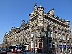 | |||
| 127 And 129 High Street | 55°57′02″N 3°11′13″W | Category B | 29043 | 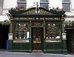 | |||
| 233-243 (Odd Nos) High Street | 55°57′00″N 3°11′22″W | Category A | 29049 | | |||
| 343-363 (Odd Nos) High Street And 2-8 (Even Nos) Advocate's Close | 55°56′59″N 3°11′29″W | Category A | 29050 | | |||
| 14 High Street, 'sedan Chair House' | 55°57′01″N 3°11′05″W | Category B | 29059 | | |||
| 146-154 (Even Nos) High Street | 55°56′59″N 3°11′20″W | Category B | 29070 | | |||
| 172 High Street, Old Assembly Close, The Mackenzie Building (Former George Heriots Hospital School) | 55°56′58″N 3°11′21″W | Category B | 29073 | | |||
| 1-8 (Inclusive Nos) Haddington Place Including Railings | 55°57′34″N 3°11′02″W | Category A | 28983 |  | |||
| 28-32A (Inclusive Nos) Haddington Place With 30 And 32 Annandale Street Lane | 55°57′38″N 3°10′56″W | Category A | 28985 |  | |||
| Hamilton Place 70-88 | 55°57′34″N 3°12′24″W | Category B | 28996 | | |||
| 35-43 (Odd Nos) Hanover Street And 25-27 (Odd Nos) Rose Street With Railings And Lamp Standards | 55°57′11″N 3°11′48″W | Category B | 28998 | | |||
| 104-112 (Even Nos) Hanover Street And 4 North West Thistle Street Lane | 55°57′16″N 3°11′54″W | Category B | 29014 | | |||
| 7-13 (Odd Nos) Hart Street | 55°57′30″N 3°11′16″W | Category B | 29016 | | |||
| 2,4,12, And 14 Hart Street | 55°57′30″N 3°11′18″W | Category B | 29017 | | |||
| Henderson Row 32-42A And 1, 1A Perth Street | 55°57′38″N 3°12′12″W | Category B | 29022 | | |||
| 1-4 (Inclusive Nos) Granton Square, Including Railings | 55°58′52″N 3°13′30″W | Category B | 28930 | | |||
| 70 And 72 Grassmarket | 55°56′52″N 3°11′44″W | Category B | 28941 | 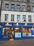 | |||
| 5 South Gray Street, Including Boundary Walls, Gatepiers And Pedestrian Gates | 55°56′04″N 3°10′38″W | Category B | 28945 | | |||
| 131, 133 And 133A George Street | 55°57′08″N 3°12′21″W | Category B | 28858 | | |||
| 56 And 58 George Street With Railings | 55°57′11″N 3°11′57″W | Category A | 28870 | | |||
| 126 And 128 George Street | 55°57′06″N 3°12′18″W | Category B | 28886 | | |||
| 5-15 (Odd Nos) Gilmore Place Including Boundary Walls | 55°56′30″N 3°12′14″W | Category B | 28902 | | |||
| 26 And 28 Gilmore Place, Including Boundary Wall And Railings | 55°56′30″N 3°12′24″W | Category B | 28913 | | |||
| 17 And 19 Frederick Street And 104A Rose Street | 55°57′08″N 3°11′58″W | Category B | 28781 | | |||
| 18 And 18A Frederick Street And 106 Rose Street | 55°57′08″N 3°12′01″W | Category B | 28790 | | |||
| 58-62 (Even Nos) And 62A Frederick Street With Railings And Lamp Standards | 55°57′14″N 3°12′05″W | Category A | 28796 | | |||
| 1 And 3 Gayfield Square And 1 Gayfield Close Including Boundary Wall, Gatepiers And Railings | 55°57′32″N 3°11′09″W | Category B | 28799 | | |||
| 37-39 (Odd Nos) Broughton Place And 1 And 2 Gayfield Street | 55°57′32″N 3°11′14″W | Category B | 28808 | | |||
| 45 Inverleith Gardens | 55°58′14″N 3°12′53″W | Category B | 28743 | | |||
| 150 Ferry Road Including Boundary Wall | 55°58′28″N 3°11′13″W | Category B | 28747 | | |||
| 40 Newhaven Main Street | 55°58′50″N 3°11′41″W | Category B | 28767 | | |||
| 35-49 (Odd Nos) Dublin Street, Including Railings | 55°57′26″N 3°11′36″W | Category B | 28684 | | |||
| 51-59 (Odd Nos) Dublin Street, Including Railings | 55°57′27″N 3°11′36″W | Category B | 28685 | | |||
| 12-16A (Even Nos) Dublin Street, Including Railings | 55°57′23″N 3°11′37″W | Category B | 28690 | | |||
| 62 Dublin Street, Including Railings | 55°57′28″N 3°11′40″W | Category B | 28696 | | |||
| 19 And 21 Dundas Street, And 32-34 (Even Nos) Northumberland Street, Including Railings | 55°57′24″N 3°11′55″W | Category B | 28705 |  | |||
| Deanhaugh Street 12-36 And 1 And 1A Leslie Place | 55°57′30″N 3°12′35″W | Category A | 28651 | | |||
| 78 Craighall Road Including Gatepiers | 55°58′27″N 3°11′46″W | Category B | 28601 | | |||
| 7-33 (Odd Nos) Cumberland Street, Including Railings | 55°57′32″N 3°11′52″W | Category B | 28605 | | |||
| 43-57 (Odd Nos) Cumberland Street, Including Railings | 55°57′30″N 3°12′03″W | Category B | 28610 | | |||
| 75-79 (Odd Nos) Cumberland Street | 55°57′29″N 3°12′09″W | Category B | 28612 | | |||
| 66 Dalkeith Road, Including Boundary Walls | 55°56′15″N 3°10′19″W | Category C(S) | 28624 | | |||
| 122 Dalkeith Road, Mayfield Terrace Lodge And Gatepiers | 55°56′08″N 3°10′10″W | Category B | 28628 | | |||
| 1-7 (Inclusive Numbers) Coates Place, 1 Palmerston Place, 2 Manor Place, Including Railings | 55°56′51″N 3°12′54″W | Category C(S) | 28568 | | |||
| 1 Cockburn Street, With Railings | 55°57′03″N 3°11′27″W | Category B | 28569 | 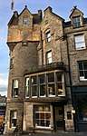 | |||
| 23 Cockburn Street | 55°57′03″N 3°11′25″W | Category B | 28575 | | |||
| 102 Corstorphine Road, Beechmount House, Including Coach House, Gate Lodge, Boundary Wall, Gatepiers And Lamp Columns | 55°56′43″N 3°15′30″W | Category B | 28589 | | |||
| Clerk Street South 31-41 | 55°56′27″N 3°10′50″W | Category C(S) | 28551 | | |||
| 549 Castlehill, Outlook Tower | 55°57′00″N 3°11′38″W | Category A | 28488 | .jpg) | |||
| 195 And 197 Canongate, Shoemakers Land | 55°57′04″N 3°10′53″W | Category B | 28437 | 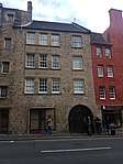 | |||
| 246-248 (Even Nos) Canongate | 55°57′02″N 3°10′59″W | Category B | 28455 | | |||
| Carlton Street 15 And 15, 15A (Whalen Only) Leslie Place | 55°57′27″N 3°12′40″W | Category B | 28458 | | |||
| 10, 10A-14 (Even Nos) Castle Street With Railings | 55°57′05″N 3°12′12″W | Category B | 28471 | | |||
| 30 And 32 Castle Street With Railing | 55°57′07″N 3°12′13″W | Category B | 28475 | | |||
| 1 And 2 Castle Terrace And 11-17 (Odd Nos) Lothian Road, Including Boundary Wall And Railings | 55°56′55″N 3°12′22″W | Category B | 28480 | | |||
| 5-7 (Inclusive Nos) Castle Terrace, Including Boundary Wall And Railings | 55°56′55″N 3°12′21″W | Category B | 28482 | | |||
| Buccleuch Place 7 | 55°56′34″N 3°11′09″W | Category B | 28382 | | |||
| Buccleuch Place 8 | 55°56′34″N 3°11′10″W | Category B | 28383 | | |||
| Buccleuch Place 14-16 | 55°56′33″N 3°11′13″W | Category B | 28386 | | |||
| Canon Street 9, 10 | 55°57′44″N 3°11′56″W | Category C(S) | 28424 | | |||
| Canon Street 11 | 55°57′44″N 3°11′56″W | Category C(S) | 28425 | | |||
| 3 Canongate, Russell House | 55°57′10″N 3°10′30″W | Category A | 28426 | 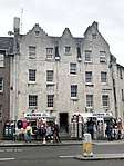 | |||
| 26 And 28 Blacket Place, Including Boundary Walls | 55°56′13″N 3°10′32″W | Category B | 28315 | | |||
| 2 Bonaly Road With Retaining Wall And Gate | 55°54′15″N 3°15′42″W | Category C(S) | 28333 | | |||
| 42 Bridge Road With Gate | 55°54′26″N 3°15′25″W | Category C(S) | 28349 | | |||
| 44 And 46 Bridge Road With Gate And Boundary Wall | 55°54′26″N 3°15′26″W | Category C(S) | 28350 | | |||
| 3 And 5 East Broughton Place Including Boundary Wall And Railings | 55°57′31″N 3°11′14″W | Category B | 28357 | | |||
| 10-12 (Even Nos) Broughton Street, Including Railings | 55°57′25″N 3°11′18″W | Category A | 28366 | | |||
| The Vennel, 1 And 3 Brown's Place With Retaining Wall, Railings And Gate | 55°56′48″N 3°11′50″W | Category B | 28369 | | |||
| 54-58 (Even Nos) Montgomery Street And 23 Brunswick Street | 55°57′33″N 3°10′47″W | Category C(S) | 28372 | | |||
| 7-11 (Odd Nos) Bellevue Place Including Boundary Walls And Railings | 55°57′38″N 3°11′31″W | Category B | 28288 | | |||
| 15 Blacket Place, Including Boundary Walls | 55°56′10″N 3°10′26″W | Category B | 28302 | | |||
| Ann Street 45-47 | 55°57′21″N 3°12′45″W | Category A | 28244 | 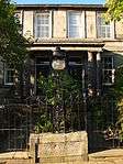 | |||
| Ann Street 44 | 55°57′22″N 3°12′44″W | Category A | 28248 | | |||
| 1-3 (Odd Nos) Annandale Street Including Railings | 55°57′34″N 3°11′02″W | Category A | 28252 | | |||
| 1-6 (Inclusive Nos) Antigua Street And 1-3 (Odd Numbers) Union Street Including Railings And Garden Wall | 55°57′28″N 3°11′07″W | Category B | 28257 | | |||
| 7 Redhall House Drive, Redhall House | 55°55′06″N 3°15′05″W | Category B | 28117 | | |||
| 68 Roseburn Street, Roseburn House, Including Boundary Walls And Gatepiers | 55°56′35″N 3°14′13″W | Category A | 28120 | | |||
| Colinton Road, Merchiston Castle School, Dovecot | 55°54′31″N 3°15′13″W | Category B | 28133 | | |||
| Redhall House - Dovecote Craiglockhart Drive South | 55°55′11″N 3°14′56″W | Category A | 28145 | | |||
| Howdenhall Road, St Catherine's Outbuildings And Walled Garden | 55°54′10″N 3°09′44″W | Category B | 28146 | |
Key
The scheme for classifying buildings in Scotland is:
- Category A: "buildings of national or international importance, either architectural or historic; or fine, little-altered examples of some particular period, style or building type."[1]
- Category B: "buildings of regional or more than local importance; or major examples of some particular period, style or building type, which may have been altered."[1]
- Category C: "buildings of local importance; lesser examples of any period, style, or building type, as originally constructed or moderately altered; and simple traditional buildings which group well with other listed buildings."[1]
In March 2016 there were 47,288 listed buildings in Scotland. Of these, 8 per cent were Category A, and 50 per cent were Category B, with the rest listed at Category C.[2]
Notes
- Sometimes known as OSGB36, the grid reference (where provided) is based on the British national grid reference system used by the Ordnance Survey.
• "Guide to National Grid". Ordnance Survey. Retrieved 12 December 2007.
• "Get-a-map". Ordnance Survey. Retrieved 17 December 2007. - Historic Environment Scotland assign a unique alphanumeric identifier to each designated site in Scotland, for listed buildings this always begins with "LB", for example "LB12345".
References
- All entries, addresses and coordinates are based on data from Historic Scotland. This data falls under the Open Government Licence
- "What is Listing?". Historic Environment Scotland. Retrieved 29 May 2018.
- Scotland's Historic Environment Audit 2016 (PDF). Historic Environment Scotland and the Built Environment Forum Scotland. pp. 15–16. Retrieved 29 May 2018.
This article is issued from Wikipedia. The text is licensed under Creative Commons - Attribution - Sharealike. Additional terms may apply for the media files.