List of listed buildings in Edinburgh/14
List
| Name | Location | Date Listed | Grid Ref. [note 1] | Geo-coordinates | Notes | LB Number [note 2] | Image |
|---|---|---|---|---|---|---|---|
| 100-104 (Even Nos) Rose Street | 55°57′08″N 3°11′58″W | Category B | 29646 | 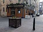 | |||
| 144-150 (Even Nos) Rose Street, Debenhams | 55°57′07″N 3°12′07″W | Category C(S) | 29650 |  | |||
| 32 And 33 Queen Street With Railings | 55°57′16″N 3°12′01″W | Category A | 29550 | | |||
| 34 Queen Street With Railings | 55°57′16″N 3°12′01″W | Category A | 29551 | | |||
| 74-77 (Inclusive) Queen Street | 55°57′11″N 3°12′23″W | Category A | 29571 | | |||
| Raeburn Place, 44, 46 | 55°57′34″N 3°12′44″W | Category B | 29589 | | |||
| 1 Ramsay Lane, Former Ragged School With Gate | 55°56′57″N 3°11′45″W | Category B | 29596 | .jpg) | |||
| 30, 32, 34 Palmerston Place, Palmerston Court, Including Railings | 55°56′55″N 3°13′04″W | Category B | 29476 | | |||
| 36-48 (Even Nos) Palmerston Place, Including Railings | 55°56′55″N 3°13′05″W | Category B | 29477 | | |||
| 23 Pentland Avenue, Colinton Cottage, With Boundary Wall | 55°54′26″N 3°15′54″W | Category B | 29482 | | |||
| 4 Pier Place Including Barometer | 55°58′50″N 3°11′44″W | Category B | 29491 | | |||
| 30 Princes Street And South St Andrew's Street, Formerly Forsyth's | 55°57′11″N 3°11′31″W | Category A | 29503 | 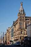 | |||
| 131-133 (Inclusive Nos) Princes Street | 55°57′03″N 3°12′19″W | Category B | 29518 | | |||
| 2, 2A And 3 Queen Street And 12 North St David Street, Scottish Life, With Railings And Lamps | 55°57′19″N 3°11′42″W | Category C(S) | 29530 | | |||
| 4-6 (Inclusive Nos) Queen Street, Bbc Scotland (Known As No 5) | 55°57′18″N 3°11′44″W | Category A | 29532 | | |||
| 7 Queen Street | 55°57′18″N 3°11′46″W | Category B | 29534 | | |||
| 21 Queen Street With Railings | 55°57′17″N 3°11′55″W | Category A | 29543 | | |||
| 28-30A (Even Nos) Northumberland Street, Including Railings And Lamps | 55°57′25″N 3°11′55″W | Category A | 29456 | 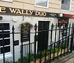 | |||
| Old Church Lane, Home House, Duddingston | 55°56′31″N 3°08′46″W | Category B | 29462 | | |||
| Oxford Terrace, 2-12 (Including Odd Nos) | 55°57′20″N 3°12′57″W | Category A | 29471 | | |||
| 4-10 (Even Nos) Palmerston Place, Including Railings | 55°56′50″N 3°12′57″W | Category B | 29474 | | |||
| 186 Newhaven Road, St Clair's, Including Coach House, Gatepiers And Boundary Wall | 55°58′38″N 3°11′32″W | Category B | 29398 | | |||
| 208 Newhaven Road Including Boundary Wall And Gatepier | 55°58′42″N 3°11′34″W | Category B | 29401 | | |||
| 1, 2 And 3 Nicolson Square And 43 And 45 Nicolson Street | 55°56′47″N 3°11′08″W | Category B | 29411 | | |||
| 8-16 (Even Nos) Nicolson Street | 55°56′49″N 3°11′08″W | Category B | 29417 | | |||
| 22-26 (Even Nos) Nicolson Street | 55°56′47″N 3°11′06″W | Category C(S) | 29419 | | |||
| 112A Nicolson Street, Haddon's Court | 55°56′40″N 3°10′59″W | Category B | 29428 | | |||
| Nicolson Street West 3-9 | 55°56′42″N 3°11′05″W | Category B | 29432 | | |||
| 49 Minto Street, Including Boundary Wall And Pedestrian Gates | 55°56′12″N 3°10′40″W | Category B | 29363 |  | |||
| 25-27 (Odd Numbers) Montrose Terrace | 55°57′26″N 3°10′17″W | Category B | 29367 | | |||
| 79-83 (Odd Nos) Morrison Street | 55°56′44″N 3°12′34″W | Category C(S) | 29372 | | |||
| Melville Crescent, 4-6 And 43 Melville Street And 19 Walker Street | 55°57′00″N 3°12′49″W | Category A | 29320 | | |||
| 10, 11, 12 Melville Crescent, 44 Melville Street And, Walker Street Including Railings And Arched Lamp Holders | 55°56′57″N 3°12′50″W | Category A | 29322 | | |||
| 46-60 (Even Numbers) Melville Street, 31 Manor Place, Including Railings And Arched Lamp Holders | 55°56′57″N 3°12′52″W | Category A | 29328 | 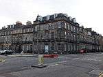 | |||
| 5 Minto Street, Including Boundary Walls, Piers And Carriage Gate | 55°56′12″N 3°10′37″W | Category C(S) | 29340 | | |||
| 2 Malta Terrace And 7 St Bernard's Row | 55°57′34″N 3°12′36″W | Category B | 29294 | | |||
| 48, 50, 52, 54, 56, 58 Manor Place, 12 Rothesay Place | 55°57′00″N 3°13′03″W | Category B | 29301 | | |||
| Marchhall Crescent, Abden House Including Gatepiers And Boundary Walls | 55°56′14″N 3°10′11″W | Category B | 29303 | 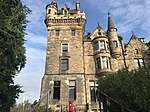 | |||
| Mary's Place 2 | 55°57′32″N 3°12′49″W | Category B | 29306 | | |||
| 5 South Maybury, Maybury Roadhouse | 55°57′33″N 3°18′52″W | Category B | 29309 | | |||
| 1-11 (Inclusive Nos) Leopold Place And 2-4 (Even Nos) Windsor Street Including Railings | 55°57′29″N 3°11′02″W | Category A | 29257 |  | |||
| 57-65 (Odd Nos) Lothian Road | 55°56′52″N 3°12′21″W | Category B | 29265 |  | |||
| 86, 88 And 90 Kirkbrae, The Liberton Inn | 55°54′49″N 3°09′37″W | Category C(S) | 29202 | | |||
| 20 Laverockbank Road, Woodville, With Boundary Walls And Gatepiers | 55°58′37″N 3°12′06″W | Category B | 29226 | | |||
| Lawnmarket, Lady Stair's Close, Lady Stair's House | 55°56′59″N 3°11′37″W | Category A | 29231 | 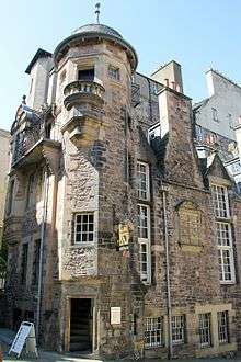 | |||
| 497-499 Lawnmarket And 7 And 11 James Court | 55°56′58″N 3°11′39″W | Category B | 29235 | | |||
| 11, 12 And 13 North Bank Street And 8 James Court | 55°56′59″N 3°11′38″W | Category A | 29236 | | |||
| 312-320 (Even Nos) Lawnmarket, Including Fisher's Close | 55°56′57″N 3°11′37″W | Category A | 29240 | | |||
| 322-328 (Even Nos) Lawnmarket, Including Riddles Court, Riddles Close And 5 And 6 Victoria Terrace | 55°56′56″N 3°11′37″W | Category A | 29242 | 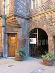 | |||
| 332-340 (Even Nos) Lawnmarket | 55°56′57″N 3°11′39″W | Category B | 29244 | | |||
| 5-9A (Odd Nos) India Street, Including Railings And Lamps | 55°57′19″N 3°12′18″W | Category A | 29127 | | |||
| 4-10 (Even Nos) India Street, Including Railings And Lamps | 55°57′18″N 3°12′21″W | Category A | 29131 | | |||
| 2 Gloucester Place And 46-52 (Even Nos) India Street, Including Railings And Lamps | 55°57′25″N 3°12′24″W | Category A | 29142 | | |||
| Inverleith Gardens 22, 23 | 55°58′15″N 3°12′42″W | Category C(S) | 29146 | | |||
| Inverleith Row 9 And 10 | 55°57′55″N 3°12′13″W | Category B | 29158 | | |||
| Inverleith Row, 13 And 14 | 55°57′56″N 3°12′15″W | Category B | 29160 | | |||
| Inverleith Row, 18 | 55°57′59″N 3°12′17″W | Category B | 29164 | | |||
| Inverleith Row, 40 And 41 | 55°58′09″N 3°12′27″W | Category B | 29176 | | |||
| 3-37 (Odd Nos) Jeffrey Street, Including Boundary Wall To Rear | 55°57′03″N 3°11′05″W | Category B | 29189 | | |||
| 55-61 (Odd Nos) Jeffrey Street | 55°57′04″N 3°11′13″W | Category C(S) | 29191 | | |||
| 16 Johnston Terrace And 3 Castle Wynd North | 55°56′55″N 3°11′46″W | Category B | 29194 | _(2).jpg) | |||
| 17, 19 And 19A Hill Street, Edinburgh Lodge No 1 | 55°57′13″N 3°12′10″W | Category A | 29081 | | |||
| 31-37 (Odd Nos) Howe Street, Including Railings | 55°57′25″N 3°12′08″W | Category A | 29114 | | |||
| 12-16 (Even Nos) Howe Street, Including Railings | 55°57′21″N 3°12′09″W | Category B | 29116 | | |||
| 24 Howe Street, Including Railings And Mews | 55°57′23″N 3°12′10″W | Category B | 29118 | | |||
| 43-47 (Inclusive Nos) Heriot Row, And 2 And 2A India Street, Including Railings And Lamps | 55°57′18″N 3°12′20″W | Category A | 29027 | | |||
| 7, 9 And 11 High Street | 55°57′03″N 3°11′05″W | Category B | 29032 | | |||
| 133 And 135 High Street, Including Range To Rear And 4 Carrubber's Close | 55°57′02″N 3°11′13″W | Category B | 29044 | 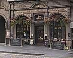 | |||
| 215-219 (Odd Nos) High Street | 55°57′01″N 3°11′20″W | Category A | 29047 | | |||
| 16 High Street | 55°57′02″N 3°11′05″W | Category B | 29060 | 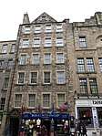 | |||
| 19-25 (Odd Nos) Grove Street, Including Railings | 55°56′44″N 3°12′45″W | Category B | 28979 | | |||
| 2 Grove Street And 181 Morrison Street, Including Railings | 55°56′46″N 3°12′48″W | Category B | 28980 | | |||
| 2 Mcdonald Road Library Including Nelson Hall | 55°57′41″N 3°10′53″W | Category B | 28986 | | |||
| 101-109 (Odd Nos) Hanover Street With Railings | 55°57′17″N 3°11′51″W | Category B | 29003 | | |||
| 20 And 22 Hanover Street With Railings, Incorporating The Merchants Hall And 39 Rose Street South Lane | 55°57′10″N 3°11′50″W | Category B | 29006 | 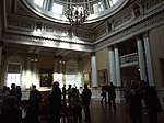 | |||
| 34-52 (Even Nos) Hanover Street With Railings | 55°57′11″N 3°11′50″W | Category B | 29008 | | |||
| 84-90 (Even Nos) Hanover Street And 18-24 (Even Nos) Thistle Street | 55°57′15″N 3°11′52″W | Category B | 29012 | | |||
| 7-19 (Odd Nos) Great Stuart Street, Including Railings | 55°57′10″N 3°12′40″W | Category A | 28967 | | |||
| 8-10 (Even Nos) Gloucester Street & 4 India Place, Duncan's Land | 55°57′26″N 3°12′28″W | Category B | 28927 | | |||
| 1 Grant Avenue With Gate | 55°56′25″N 3°12′31″W | Category B | 28928 | | |||
| 30-40 (Even Nos) Grassmarket, Including White Hart Inn | 55°56′51″N 3°11′49″W | Category B | 28938 |  | |||
| 22 Upper Gray Street, Including Boundary Wall | 55°56′10″N 3°10′44″W | Category B | 28958 | | |||
| 77 And 79 George Street | 55°57′11″N 3°12′05″W | Category B | 28845 | | |||
| 91 And 91A George Street With Railings And Lamp Standards | 55°57′10″N 3°12′08″W | Category A | 28847 | | |||
| 97-105 (Odd Nos) George Street, Bank Of Scotland | 55°57′10″N 3°12′10″W | Category A | 28850 | | |||
| 125 George Street With Railings And Lamp Standards | 55°57′09″N 3°12′19″W | Category A | 28856 | | |||
| 34-38 (Even Nos) And 38A George Street | 55°57′11″N 3°11′52″W | Category B | 28867 | | |||
| 44, 46 And 46A George Street With Railings And Lamp Standards | 55°57′11″N 3°11′53″W | Category B | 28868 | | |||
| 72-76 (Even Nos), And 72A George Street And 34 Frederick Street With Railings | 55°57′10″N 3°12′03″W | Category B | 28874 | | |||
| 106-110 (Even Nos) George Street And 32A Castle Street | 55°57′08″N 3°12′14″W | Category B | 28881 | | |||
| 46-55 George Iv Bridge, 69-71 Cowgate And 7 Merchant Street | 55°56′53″N 3°11′30″W | Category C(S) | 28893 | | |||
| Gillespie Road, 39 Colinton | 55°54′28″N 3°16′21″W | Category C(S) | 28896 | | |||
| 90-98 (Even Nos) Fountainbridge, Scottish Midland Co-Operative Society, Formerly St Cuthbert's Co-Operative Association, Including Boundary Walls | 55°56′37″N 3°12′29″W | Category B | 28777 |  | |||
| 21-25 (Odd Nos) Frederick Street | 55°57′09″N 3°11′59″W | Category B | 28782 |  | |||
| 12-16 (Even Nos) Frederick Street | 55°57′07″N 3°12′01″W | Category B | 28789 | | |||
| 1-5 (Inclusive Nos) Gayfield Place And 33-33A Gayfield Square Including Railings | 55°57′32″N 3°11′04″W | Category A | 28798 | 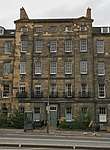 | |||
| 6 And 6A Gayfield Square Including Railings And Boundary Wall | 55°57′33″N 3°11′11″W | Category B | 28802 | | |||
| 7 And 7A Gayfield Square Including Railings And Garden Wall | 55°57′34″N 3°11′12″W | Category B | 28803 | | |||
| 12-17A (Inclusive Nos) Gayfield Square Including Railings | 55°57′35″N 3°11′08″W | Category A | 28805 | | |||
| George Square 22 | 55°56′37″N 3°11′26″W | Category A | 28814 | 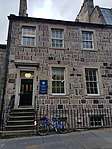 | |||
| George Square 24 | 55°56′36″N 3°11′26″W | Category A | 28817 |  | |||
| 19-25 (Odd Nos) George Street, George Hotel | 55°57′14″N 3°11′48″W | Category A | 28830 | | |||
| 47 George Street And 25A South West Thistle Street Lane | 55°57′14″N 3°11′56″W | Category B | 28837 | | |||
| 63 George Street | 55°57′12″N 3°11′59″W | Category B | 28841 | | |||
| 1-23 (Inclusive Nos) Elm Row And 2 Montgomery Street | 55°57′30″N 3°11′01″W | Category A | 28734 | 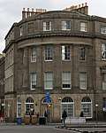 | |||
| 43 Inverleith Gardens | 55°58′14″N 3°12′52″W | Category C(S) | 28742 | | |||
| 122 Ferry Road, Baynefield House | 55°58′29″N 3°11′06″W | Category B | 28744 | | |||
| 2-10 (Even Nos) Forres Street, Including Railings | 55°57′13″N 3°12′29″W | Category A | 28769 | | |||
| 1, 3 And 5 Forrest Road | 55°56′47″N 3°11′28″W | Category B | 28770 | .jpg) | |||
| 1-13 (Inclusive Numbers) Drumsheugh Place | 55°57′05″N 3°12′44″W | Category B | 28678 | | |||
| 11 Dublin Street, Including Railings | 55°57′22″N 3°11′34″W | Category B | 28679 | | |||
| 21 And 21A Dublin Street, Including Railings | 55°57′24″N 3°11′35″W | Category B | 28683 | | |||
| 48-60 (Even Nos) Dublin Street, Including Railings | 55°57′28″N 3°11′40″W | Category B | 28695 | | |||
| 9-13C (Odd Nos) Dundas Street, Including Railings | 55°57′23″N 3°11′55″W | Category B | 28703 | | |||
| 53-65 (Odd Nos) Dundas Street, Including Railings | 55°57′30″N 3°11′58″W | Category A | 28709 | | |||
| 4-10 (Even Nos) Dundas Street, Including Railings And Lamps | 55°57′23″N 3°11′57″W | Category B | 28713 | | |||
| 18-20 (Even Nos) Dundas Street, And 36 Northumberland Street, Including Railings | 55°57′24″N 3°11′57″W | Category B | 28715 | | |||
| 56-66A (Even Nos) Dundas Street, Including Railings | 55°57′29″N 3°12′00″W | Category B | 28719 | | |||
| 68-76 (Even Nos) Dundas Street And 39-41 (Odd Nos) Cumberland Street, Including Railings | 55°57′30″N 3°12′01″W | Category A | 28720 | | |||
| 78-86A (Even Nos) Dundas Street, And 36A Cumberland Street, Including Railings | 55°57′31″N 3°12′02″W | Category A | 28721 | | |||
| 5 Dell Road, St Cuthbert's Manse | 55°54′33″N 3°15′20″W | Category B | 28652 | | |||
| 14-21 (Inclusive Nos) Douglas Crescent, Including Railings | 55°56′58″N 3°13′17″W | Category B | 28655 | | |||
| 94-114 Cowgate, Library For Solicitors In The Supreme Courts Of Scotland | 55°56′55″N 3°11′26″W | Category A | 28600 | 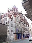 | |||
| 36-62B (Even Nos) Cumberland Streetand 1,2,4,6,7, 7 A And 8 North West Cumberland Street Lane , Including Railings | 55°57′31″N 3°12′05″W | Category A | 28614 | | |||
| Dalkeith Road, Salisbury Green Including Boundary Walls | 55°56′17″N 3°10′17″W | Category A | 28620 | | |||
| 2-12 (Even Nos) Darnaway Street, Including Railings And Lamps, With 8-10 (Inclusive Nos) Wemyss Place Mews | 55°57′16″N 3°12′23″W | Category A | 28633 | | |||
| Dean Street 1-9 | 55°57′31″N 3°12′38″W | Category B | 28639 | | |||
| 26-30 (Even Nos) Cockburn Street | 55°57′01″N 3°11′23″W | Category B | 28578 | | |||
| 5 And 7 Corstorphine High Street Including Boundary Walls, Gatepiers And Gates | 55°56′26″N 3°16′58″W | Category B | 28591 | | |||
| Clarence Street 1 And 109-119 Henderson Row | 55°57′35″N 3°12′21″W | Category B | 28536 | | |||
| Clarence Street 4-20A | 55°57′34″N 3°12′23″W | Category B | 28540 | | |||
| 22-26 Clarence Street, Even Numbers | 55°57′32″N 3°12′21″W | Category C(S) | 28541 | | |||
| Clerk Street 20-44 & 2-6 Rankeillor Street | 55°56′33″N 3°10′56″W | Category B | 28548 | | |||
| Clerk Street South 43-47 | 55°56′25″N 3°10′48″W | Category B | 28552 |  | |||
| Clerk Street South 86-94 | 55°56′22″N 3°10′48″W | Category B | 28558 | | |||
| Clerk Street South 96-102 | 55°56′21″N 3°10′48″W | Category B | 28559 | | |||
| 354 Castlehill And 17 Johnston Terrace, Former Castlehill School With Janitor's House, Ancillary Buildings, Railings And Retaining Wall | 55°56′55″N 3°11′46″W | Category B | 28490 | 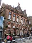 | |||
| Causeway, The Lochside Cottage Duddingston | 55°56′31″N 3°08′56″W | Category B | 28496 | | |||
| 4-12 Chapel Street | 55°56′41″N 3°11′09″W | Category B | 28499 | | |||
| 24-32 (Inclusive Nos) Charlotte Square, 13-19 (Odd Nos) Hope Street And 14 And 16 South Charlotte Street With Railings, Lamp Standards And Boundary Walls | 55°57′03″N 3°12′29″W | Category A | 28505 | 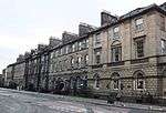 | |||
| 33-39 (Inclusive Nos) Charlotte Square And 142-146 George Street With Railings And Lamp Standards | 55°57′05″N 3°12′22″W | Category A | 28506 |  | |||
| 12 South Charlotte Street With Railings | 55°57′04″N 3°12′24″W | Category A | 28516 | 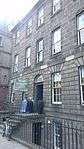 | |||
| 11-22 (Inclusive Nos) North West Circus Place, Including Railings | 55°57′27″N 3°12′24″W | Category B | 28521 | | |||
| 25-29 Inclusive Nos) North West Circus Place, And 2 Gloucester Street | 55°57′26″N 3°12′28″W | Category B | 28523 | | |||
| 189 Canongate And 191 (Flats 2, 4 And 6) Canongate | 55°57′05″N 3°10′52″W | Category B | 28435 | | |||
| 265 And 267 Canongate, Morocco Land | 55°57′03″N 3°11′00″W | Category B | 28438 | | |||
| 124 Canongate | 55°57′05″N 3°10′44″W | Category B | 28443 | 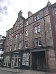 | |||
| 142 And 146 Canongate, Huntly House (Museum Of Edinburgh) | 55°57′05″N 3°10′46″W | Category A | 28445 | .jpg) | |||
| 154-166 (Even Nos) Canongate | 55°57′05″N 3°10′47″W | Category B | 28447 |  | |||
| 194-198 (Even Nos) Canongate, Old Playhouse Close | 55°57′03″N 3°10′55″W | Category B | 28452 |  |
Key
The scheme for classifying buildings in Scotland is:
- Category A: "buildings of national or international importance, either architectural or historic; or fine, little-altered examples of some particular period, style or building type."[1]
- Category B: "buildings of regional or more than local importance; or major examples of some particular period, style or building type, which may have been altered."[1]
- Category C: "buildings of local importance; lesser examples of any period, style, or building type, as originally constructed or moderately altered; and simple traditional buildings which group well with other listed buildings."[1]
In March 2016 there were 47,288 listed buildings in Scotland. Of these, 8 per cent were Category A, and 50 per cent were Category B, with the rest listed at Category C.[2]
Notes
- Sometimes known as OSGB36, the grid reference (where provided) is based on the British national grid reference system used by the Ordnance Survey.
• "Guide to National Grid". Ordnance Survey. Retrieved 12 December 2007.
• "Get-a-map". Ordnance Survey. Retrieved 17 December 2007. - Historic Environment Scotland assign a unique alphanumeric identifier to each designated site in Scotland, for listed buildings this always begins with "LB", for example "LB12345".
References
- All entries, addresses and coordinates are based on data from Historic Scotland. This data falls under the Open Government Licence
- "What is Listing?". Historic Environment Scotland. Retrieved 29 May 2018.
- Scotland's Historic Environment Audit 2016 (PDF). Historic Environment Scotland and the Built Environment Forum Scotland. pp. 15–16. Retrieved 29 May 2018.
This article is issued from Wikipedia. The text is licensed under Creative Commons - Attribution - Sharealike. Additional terms may apply for the media files.