List of listed buildings in Edinburgh/13
List
| Name | Location | Date Listed | Grid Ref. [note 1] | Geo-coordinates | Notes | LB Number [note 2] | Image |
|---|---|---|---|---|---|---|---|
| 1 Priestfield Road North | 55°56′11″N 3°10′02″W | Category B | 43170 |  | |||
| 3 Stoneycroft Road, Lodge St Margaret | 55°59′21″N 3°23′43″W | Category B | 40402 | | |||
| Echline Farmhouse, Echline | 55°59′09″N 3°25′07″W | Category B | 40350 | | |||
| 22/1 -22/7 (Inclusive Numbers) Newhalls Road , Bridge House, Including Boundary Walls | 55°59′24″N 3°23′11″W | Category C(S) | 40356 | | |||
| 8 And 10 Edinburgh Road, Anchor Inn | 55°59′23″N 3°23′33″W | Category C(S) | 40364 | | |||
| 12 Edinburgh Road | 55°59′23″N 3°23′33″W | Category C(S) | 40365 | | |||
| 14 Edinburgh Road | 55°59′23″N 3°23′32″W | Category C(S) | 40366 | | |||
| 16 Edinburgh Road | 55°59′23″N 3°23′32″W | Category C(S) | 40367 | | |||
| 3 High Street | 55°59′26″N 3°23′50″W | Category C(S) | 40373 | | |||
| 147 Whitehouse Loan (Formerly No 17) The White House Incl Carriage House,Gates,Gatepiers And Boundary Walls | 55°55′58″N 3°12′01″W | Category B | 30668 | | |||
| 102 And 102B Whitehouse Loan 1B Greenhill Terrace Former Warrender Church Including Church Hall And Gatepiers | 55°56′08″N 3°12′07″W | Category B | 30670 | | |||
| 5 And 5A Whitehouse Terrace Including Gatepiers Pedestrians Gateway And Boundary Walls | 55°55′54″N 3°11′48″W | Category C(S) | 30674 | | |||
| 6 Whitehouse Terr Incl Gatepiers And Boundary Walls | 55°55′54″N 3°11′45″W | Category C(S) | 30675 | | |||
| 2 & 4 South Oswald Rd (Formerly 6 Blackford Ave St Raphaels)Including Chapel,Gatepiers And Boundary Walls | 55°55′45″N 3°11′22″W | Category B | 30592 | | |||
| 8 Spottiswoode Street | 55°56′20″N 3°11′52″W | Category B | 30600 | | |||
| 19A & 19B Strathearn Road Incl Gatepiers And Boundary Wall | 55°56′04″N 3°11′41″W | Category B | 30604 | | |||
| 6 7 8 And 8A Warrender Park Crescent Including Railings | 55°56′17″N 3°12′07″W | Category B | 30610 | | |||
| 15-17 (Inclusive Nos) Warrender Park Crescent | 55°56′18″N 3°12′05″W | Category B | 30613 | | |||
| 85-89(Odd Nos) Warrender Park Road | 55°56′18″N 3°11′54″W | Category B | 30628 | | |||
| 129-133 (Odd Nos) Warrender Park Road | 55°56′16″N 3°12′04″W | Category B | 30637 | | |||
| 135-139 (Odd Nos) Warrender Park Road | 55°56′16″N 3°12′05″W | Category B | 30638 | | |||
| 17-19 (Incl Nos) Warrender Park Terrace Including Railings | 55°56′21″N 3°11′50″W | Category B | 30650 | | |||
| 113 & 113A Whitehouse Loan Gillis College (Formerly St Margaret's Convent) Conventual Buildings Including Former Dairy, Sundial, Gatepiers, And Boundary Walls | 55°56′05″N 3°12′04″W | Category B | 30665 | | |||
| 131 Grange Loan Tyne Lodge | 55°55′51″N 3°11′38″W | Category B | 30510 | | |||
| 15 Hope Terrace | 55°56′00″N 3°11′52″W | Category C(S) | 30526 | | |||
| 37-41 (Odd Nos) Marchmont Road | 55°56′17″N 3°11′40″W | Category B | 30545 | | |||
| 18 Marchmont Road | 55°56′20″N 3°11′44″W | Category B | 30555 | | |||
| 32-38 (Even Nos) Marchmont Road & 56-60 Warrender Park Road | 55°56′17″N 3°11′43″W | Category B | 30557 | | |||
| 104-110 (Even Nos) Marchmont Road & 1-5 Odd Spottiswoode Rd | 55°56′10″N 3°11′41″W | Category B | 30562 | | |||
| 3 Marchmont Street | 55°56′18″N 3°12′03″W | Category B | 30570 | | |||
| 10 And 11 Marchmont Street | 55°56′19″N 3°12′01″W | Category B | 30574 | | |||
| 20 Mortonhall Road Blackford Mount Gatepiers And Boundary Wall | 55°55′40″N 3°11′35″W | Category B | 30582 | | |||
| 2 Oswald Rd Incl Boundary Walls Pedestrian Gate And Railings | 55°55′49″N 3°11′36″W | Category B | 30587 | | |||
| 117-121 (Odd Nos) Marchmont Road | 55°56′07″N 3°11′38″W | Category B | 30449 |  | |||
| 48-54 (Even Nos) Mayfield Road | 55°55′53″N 3°10′37″W | Category C(S) | 30451 | | |||
| 1-3 (Odd Nos) Roseneath Terrace And 31-34 (Inclusive Nos) Argyle Place | 55°56′21″N 3°11′30″W | Category B | 30465 | 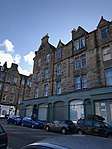 | |||
| Sciennes House Place, Jewish Burial Ground With Graveyard Walls, Gates And Railings | 55°56′15″N 3°10′54″W | Category B | 30476 |  | |||
| 2 And 3 Sylvan Place | 55°56′21″N 3°11′26″W | Category B | 30483 | | |||
| 11 And 13 Tantallon Place With Gateways And Boundary Walls | 55°56′14″N 3°11′09″W | Category B | 30486 | | |||
| 26-30 (Even Nos) Warrender Park Road And 22-30 (Even Nos) Marchmont Crescent | 55°56′17″N 3°11′34″W | Category B | 30491 | 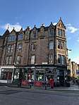 | |||
| 34 Grange Loan | 55°56′02″N 3°10′46″W | Category C(S) | 30382 | | |||
| 46 Grange Road | 55°56′09″N 3°11′13″W | Category C(S) | 30394 | | |||
| 19 Grange Terrace "South Park" Including Boundary Walls And Gatepiers | 55°55′47″N 3°11′20″W | Category B | 30398 | | |||
| 7 And 7B Kilgraston Road Including Boundary Walls And Pedestrian Gateway | 55°55′59″N 3°11′34″W | Category B | 30402 | | |||
| 37A, 37B, 37C And 39 Lauder Road | 55°56′11″N 3°11′15″W | Category C(S) | 30407 | | |||
| 2 Lauder Road, Douglas House Including Gatepiers And Boundary Wall | 55°55′57″N 3°11′03″W | Category B | 30411 | | |||
| 40 Lauder Road | 55°56′11″N 3°11′18″W | Category C(S) | 30416 | | |||
| 68-72 (Even Nos) Marchmont Crescent | 55°56′13″N 3°11′36″W | Category B | 30438 | 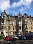 | |||
| 86-90 (Even Nos) Marchmont Crescent | 55°56′11″N 3°11′38″W | Category B | 30441 | | |||
| 105-109 (Odd Nos) Marchmont Road | 55°56′08″N 3°11′38″W | Category B | 30447 | 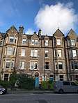 | |||
| 1 Lauriston Place, Royal Infirmary, Former Ear Nose And Throat And Ophthalmological Pavilions | 55°56′39″N 3°11′40″W | Category B | 30308 |  | |||
| 57 And 59 Lochend Road And 1,2,3,17 Qnd 18 Upper Hermitage, Telford College Lochend Annexe With Gates, Railings, Gatepiers And Overthrow | 55°58′01″N 3°09′51″W | Category C(S) | 30330 | | |||
| 1-3 (Inclusive Argyle Park Terrace | 55°56′22″N 3°11′33″W | Category B | 30331 | | |||
| 18-21 (Inclusive Nos) Argyle Place | 55°56′18″N 3°11′30″W | Category B | 30338 |  | |||
| 22-27 (Inclusive Nos) Argyle Place | 55°56′19″N 3°11′30″W | Category B | 30339 |  | |||
| 11 Dalrymple Crescent Including Boundary Wall | 55°56′03″N 3°10′53″W | Category C(S) | 30351 | | |||
| 10 Dalrymple Crescent Including Boundary Wall | 55°56′02″N 3°10′54″W | Category C(S) | 30352 | | |||
| 57 Fountainhall Road Including Boundary Walls And Gatepiers | 55°55′50″N 3°11′04″W | Category C(S) | 30374 | | |||
| Dean Path, K6 Telephone Kiosk | 55°57′09″N 3°13′01″W | Category B | 30229 | | |||
| Corstorphine Road, K6 Telephone Kiosk At Gates To Edinburgh Zoo (Royal Zoological Society Of Scotland) | 55°56′32″N 3°16′09″W | Category B | 30230 | .jpg) | |||
| Princes Street At Royal Scottish Academy, Police Box | 55°57′07″N 3°11′44″W | Category B | 30243 | | |||
| Register Place, Police Box Opposite Cafe Royal | 55°57′14″N 3°11′26″W | Category B | 30247 | | |||
| 117 Fountainbridge, Tollcross Primary School, Including Boundary Wall, Gatepiers And Railings | 55°56′36″N 3°12′23″W | Category B | 30253 | | |||
| 11 Ellersly Road, Westerlea House (Capability Scotland), Including Gardens | 55°56′47″N 3°14′55″W | Category B | 30275 | | |||
| 5 Easter Belmont Road, Brucehill | 55°56′53″N 3°15′15″W | Category B | 30293 | | |||
| 4 Essex Road, Almondale, Including Gatepiers And Boundary Walls | 55°58′04″N 3°18′36″W | Category B | 30298 | | |||
| 141 Princes Street | 55°57′02″N 3°12′25″W | Category B | 30300 | | |||
| 21 And 23 Thistle Street | 55°57′16″N 3°11′49″W | Category B | 30301 | | |||
| 85 Lasswade Road And 1-8 (Inclusive Nos) "Mount Alvernia", Former Convent Of The Poor Clares Colettines, Including Gatepiers And Boundary Walls | 55°54′34″N 3°09′22″W | Category B | 30303 | | |||
| 3-29 (Odd Nos) North Bridge, Carlton Hotel | 55°57′04″N 3°11′16″W | Category B | 30142 | | |||
| 139 And 140 Princes Street And 5 Hope Street Lane | 55°57′02″N 3°12′25″W | Category A | 30149 | | |||
| 24 Russell Place, Gothic Cottage, With Boundary Wall | 55°58′42″N 3°12′19″W | Category A | 30157 | | |||
| 2-10 (Even Nos) St Giles Street | 55°56′59″N 3°11′31″W | Category B | 30161 | | |||
| 30-68 (Even Nos) St Mary's Street, 1-7 (Odd Nos) Holyrood Road And 2 And 4 Boyd's Entry Including Boundary Wall To Gullane's Close | 55°56′58″N 3°10′59″W | Category B | 30168 |  | |||
| St Stephen Place, 13 | 55°57′28″N 3°12′27″W | Category B | 30169 | | |||
| St Stephen Street 63-73 | 55°57′30″N 3°12′23″W | Category B | 30170 | | |||
| St Stephen Street 75, 77 | 55°57′30″N 3°12′22″W | Category B | 30171 | | |||
| 110 St Stephen Street | 55°57′30″N 3°12′18″W | Category C(S) | 30173 | | |||
| 32, 34, 36 Shandwick Place | 55°57′00″N 3°12′35″W | Category B | 30182 | | |||
| 52, 54, 56 Shandwick Place | 55°56′59″N 3°12′37″W | Category C(S) | 30183 | | |||
| 108 West Bow | 55°56′53″N 3°11′39″W | Category B | 30192 | | |||
| West Port, Former Salvation Army Women's Hostel | 55°56′48″N 3°11′52″W | Category C(S) | 30196 |  | |||
| 100 Spring Gardens, Elsie Inglis Nursing Home (Former Elsie Inglis Memorial Hospital) | 55°57′16″N 3°09′58″W | Category C(S) | 30198 | | |||
| Gorgie Road, Stenhouse-Saughton Church (Church Of Scotland), Halls, Boundary Walls And Railings | 55°55′51″N 3°15′09″W | Category B | 30211 | | |||
| 158A Lower Granton Road | 55°58′50″N 3°13′20″W | Category C(S) | 30214 | | |||
| Granton Harbour, Mid Pier, Stone-Built Warehouse | 55°59′06″N 3°13′22″W | Category B | 30217 | | |||
| Barnton Avenue West, Barnton House (Formerly) West Lodge Gatepiers | 55°57′58″N 3°18′26″W | Category B | 30052 | | |||
| The Causeway, 43-47 (Odd Nos) Sheep Heid Inn, Duddingston | 55°56′31″N 3°08′55″W | Category B | 30077 |  | |||
| 31 And 33 Cockburn Street | 55°57′03″N 3°11′24″W | Category B | 30079 | | |||
| Comely Bank 1, 3 | 55°57′35″N 3°13′09″W | Category B | 30095 | | |||
| 123 George Street With Railings | 55°57′09″N 3°12′18″W | Category B | 30104 | | |||
| 92 George Street And 80 Rose Street Lane North | 55°57′08″N 3°12′08″W | Category B | 30108 | | |||
| 9-16 (Inclusive Nos) George Iv Bridge | 55°56′53″N 3°11′32″W | Category B | 30110 |  | |||
| 92 Grassmarket | 55°56′53″N 3°11′43″W | Category B | 30113 | | |||
| 4 High Riggs, Main Point | 55°56′45″N 3°12′08″W | Category B | 30116 |  | |||
| 6 Lennox Row, Grecian Cottage, With Gatepiers And Boundary Wall | 55°58′42″N 3°12′17″W | Category B | 30132 | | |||
| 1 - 2 Royal Terrace Gardens | 55°57′27″N 3°10′50″W | Category B | 30133 | | |||
| 29-39 (Odd Nos) Lothian Street | 55°56′47″N 3°11′20″W | Category B | 30134 | | |||
| 49-53 (Odd Nos) Lothian Street | 55°56′46″N 3°11′22″W | Category B | 30137 | | |||
| 69-73 (Odd Nos) York Place, Including Railings | 55°57′23″N 3°11′17″W | Category A | 29974 | 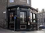 | |||
| 6 York Place, Including Railings | 55°57′22″N 3°11′33″W | Category A | 29976 | | |||
| 12 York Place, Including Railings And Lamps | 55°57′22″N 3°11′31″W | Category A | 29979 | | |||
| 14 York Place, Including Railings And Lamps | 55°57′22″N 3°11′31″W | Category A | 29980 | | |||
| Apostolic Church Davie St And West Richmond Street | 55°56′44″N 3°10′59″W | Category B | 30009 | | |||
| 2 Roxburgh Place, Former Roxy Arts Centre And Lady Glenorchy Parish Church | 55°56′50″N 3°11′03″W | Category B | 30012 | | |||
| Forrest Road And Bristo Place, Bedlam Theatre (Former New North Free Church), Including Boundary Walls | 55°56′46″N 3°11′27″W | Category B | 30020 |  | |||
| 96 George Street, Freemasons' Hall | 55°57′08″N 3°12′09″W | Category A | 30024 | | |||
| Slateford Railway Viaduct Over Inglis Green Road, Gray's Mill Lade, And Water Of Leith | 55°55′25″N 3°14′59″W | Category B | 30038 | 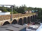 | |||
| Union Canal Calder Road Bridge | 55°55′14″N 3°18′07″W | Category B | 30039 | | |||
| Flora Stevenson Primary School And Schoolhouse, Comely Bank | 55°57′30″N 3°13′30″W | Category B | 30045 | | |||
| High School Yards, Chisholm House, Including Railings | 55°56′56″N 3°11′02″W | Category B | 30049 | | |||
| Whitehill Street 32-44 Newcraighall | 55°56′08″N 3°05′18″W | Category C(S) | 29915 | | |||
| Whitehill Street 46-58 Newcraighall | 55°56′10″N 3°05′15″W | Category C(S) | 29916 | | |||
| 1-5 (Inclusive Numbers) Duddingston Mills With Boundary Wall | 55°56′47″N 3°08′07″W | Category C(S) | 29940 | | |||
| 15-19A (Odd Nos) York Place, Including Railings And Lamps | 55°57′21″N 3°11′28″W | Category A | 29962 | | |||
| 21-23 (Consecutive Nos) Wardie Square | 55°58′47″N 3°13′04″W | Category C(S) | 29885 | | |||
| 6-14 (Even Nos) Waterloo Place | 55°57′12″N 3°11′15″W | Category A | 29898 |  | |||
| 18-30 (Even Numbers) Stafford Street, 3, 5 William Street | 55°57′00″N 3°12′43″W | Category B | 29831 | | |||
| Starbank Road, 3 And 3A Newhaven | 55°58′49″N 3°11′55″W | Category B | 29833 | | |||
| 63-67 (Odd Nos) Thistle Street | 55°57′14″N 3°12′00″W | Category B | 29839 | | |||
| 32-38 (Even Nos) Thistle Street | 55°57′14″N 3°11′56″W | Category C(S) | 29841 | | |||
| 46 And 48 Thistle Street | 55°57′14″N 3°11′57″W | Category B | 29843 | | |||
| 3-25 (Odd Nos) Torphichen Street, Including Railings | 55°56′50″N 3°12′46″W | Category B | 29848 | | |||
| 14-22 (Even Nos) Torphichen Street And 1, 1A Torphichen Place, Including Railings | 55°56′49″N 3°12′49″W | Category B | 29850 | | |||
| 6, 7 And 8 Trinity Crescent, With Boundary Wall | 55°58′48″N 3°12′20″W | Category B | 29852 | | |||
| 40 East Trinity Road, Laverockbank Cottage, With Boundary Wall | 55°58′38″N 3°12′00″W | Category C(S) | 29858 | | |||
| 1-6 (Inclusive Nos) India Buildings, Victoria Street | 55°56′55″N 3°11′35″W | Category A | 29868 | | |||
| 22-36 (Even Nos) Victoria Street | 55°56′55″N 3°11′38″W | Category B | 29872 |  | |||
| 4, 6, 8, 10 Walker Street | 55°56′55″N 3°12′47″W | Category A | 29881 | | |||
| 39-43 (Odd Nos) Scotland Street, Including Railings | 55°57′38″N 3°11′42″W | Category B | 29779 | | |||
| 2 Spylaw Avenue, Splyaw Bank House, With Boundary Wall, Gate Piers And Outbuildings | 55°54′32″N 3°16′07″W | Category C(S) | 29805 | | |||
| 4 Spylaw Avenue, With Boundary Wall, Gates, Gatepiers And Garage | 55°54′30″N 3°16′03″W | Category B | 29806 | | |||
| 6 And 6B Spylaw Park, Talgarth, With Garage, Boundary Wall, Gates And Gatepiers | 55°54′29″N 3°16′07″W | Category B | 29807 | | |||
| 10 Spylaw Park, Hartfell, With Former Stable, Outbuilding, Boundary Wall And Gatepiers | 55°54′28″N 3°16′04″W | Category B | 29808 | | |||
| 25A Spylaw Street With Gate Piers And Gates | 55°54′27″N 3°15′30″W | Category C(S) | 29823 | | |||
| St John Street, Moray House Reception, (Former Moray House Nursery School) | 55°57′02″N 3°10′50″W | Category B | 29729 |  | |||
| 1 And 2 St Patrick Street And 23 West Crosscauseway | 55°56′37″N 3°11′01″W | Category C(S) | 29739 | | |||
| St Stephen Street 5-13 And 6-10 Baker's Place | 55°57′27″N 3°12′27″W | Category B | 29743 | | |||
| St Stephen Street 31-39 And 2-12 St Stephen Place | 55°57′29″N 3°12′25″W | Category B | 29745 | | |||
| 8, 8A And 8B Salisbury Road, Including Gatepiers And Boundary Walls | 55°56′16″N 3°10′35″W | Category B | 29760 | | |||
| Saxe Coburg Street 3-7A | 55°57′36″N 3°12′24″W | Category B | 29769 | | |||
| 29-31A (Odd Nos) Scotland Street, Including Railings | 55°57′37″N 3°11′42″W | Category B | 29777 | | |||
| 1 And 2 Rustic Cottages With Boundary Wall And Gates | 55°54′29″N 3°15′10″W | Category B | 29682 | | |||
| 1 Rutland Square And 28 Rutland Street, Including Railings | 55°56′56″N 3°12′30″W | Category A | 29686 | 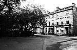 | |||
| 5-9 (Odd Nos) South St Andrew Street | 55°57′12″N 3°11′29″W | Category B | 29709 | | |||
| St Bernard's Crescent 4-10A | 55°57′26″N 3°12′43″W | Category A | 29714 |  | |||
| 13, 14, 15, 16 Rothesay Place | 55°57′00″N 3°13′06″W | Category B | 29665 | | |||
| 4, 5, 6 Rothesay Terrace | 55°57′04″N 3°13′00″W | Category B | 29669 | | |||
| 65 And 67 Rose Street And 45 And 47 Rose Street North Lane | 55°57′09″N 3°11′57″W | Category B | 29635 | | |||
| 71 And 73 Rose Street | 55°57′09″N 3°11′58″W | Category B | 29636 | |
Key
The scheme for classifying buildings in Scotland is:
- Category A: "buildings of national or international importance, either architectural or historic; or fine, little-altered examples of some particular period, style or building type."[1]
- Category B: "buildings of regional or more than local importance; or major examples of some particular period, style or building type, which may have been altered."[1]
- Category C: "buildings of local importance; lesser examples of any period, style, or building type, as originally constructed or moderately altered; and simple traditional buildings which group well with other listed buildings."[1]
In March 2016 there were 47,288 listed buildings in Scotland. Of these, 8 per cent were Category A, and 50 per cent were Category B, with the rest listed at Category C.[2]
Notes
- Sometimes known as OSGB36, the grid reference (where provided) is based on the British national grid reference system used by the Ordnance Survey.
• "Guide to National Grid". Ordnance Survey. Retrieved 12 December 2007.
• "Get-a-map". Ordnance Survey. Retrieved 17 December 2007. - Historic Environment Scotland assign a unique alphanumeric identifier to each designated site in Scotland, for listed buildings this always begins with "LB", for example "LB12345".
References
- All entries, addresses and coordinates are based on data from Historic Scotland. This data falls under the Open Government Licence
- "What is Listing?". Historic Environment Scotland. Retrieved 29 May 2018.
- Scotland's Historic Environment Audit 2016 (PDF). Historic Environment Scotland and the Built Environment Forum Scotland. pp. 15–16. Retrieved 29 May 2018.
This article is issued from Wikipedia. The text is licensed under Creative Commons - Attribution - Sharealike. Additional terms may apply for the media files.