List of listed buildings in Edinburgh/11
List
| Name | Location | Date Listed | Grid Ref. [note 1] | Geo-coordinates | Notes | LB Number [note 2] | Image |
|---|---|---|---|---|---|---|---|
| 41-53 (Odd Nos) Nile Grove | 55°55′36″N 3°12′19″W | Category B | 27673 |  | |||
| George Iv Bridge, National Library Of Scotland | 55°56′55″N 3°11′31″W | Category B | 27684 |  | |||
| Ratho Village, Baird Road, Ratho Kirk, St Mary's Church With Session House, Graveyard, Walls And Gatepiers | 55°55′28″N 3°22′49″W | Category A | 27685 | 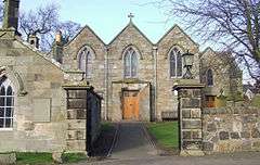 | |||
| 3 And 3A Tipperlinn Road | 55°55′53″N 3°12′58″W | Category B | 27693 | | |||
| 2-11 Parliament Square, The Supreme Courts Of Scotland | 55°56′56″N 3°11′25″W | Category A | 27699 | 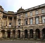 | |||
| 11 Rosefield Place | 55°57′07″N 3°07′05″W | Category C(S) | 27701 | | |||
| 192A High Street, 1 And 1A Parliament Square, Including District Courts (Formerly Police Chambers) And Including Boundary Wall And Railings | 55°56′58″N 3°11′23″W | Category A | 27714 | | |||
| 15 Johnston Terrace | 55°56′53″N 3°11′46″W | Category B | 27719 |  | |||
| 302 Leith Walk | 55°57′55″N 3°10′37″W | Category C(S) | 27735 | | |||
| Newliston House, Coach House And Stables And Home Farm | 55°56′43″N 3°25′31″W | Category A | 27588 | | |||
| 16-20 (Even Nos) Regent Street | 55°57′10″N 3°06′45″W | Category C(S) | 27589 | | |||
| 120-130 (Even Nos) Morningside Road | 55°55′52″N 3°12′37″W | Category B | 27607 | | |||
| Calton Hill, Off Regent Road , Observatory House (Old Observatory), City Observatory | 55°57′17″N 3°11′03″W | Category A | 27608 | 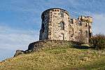 | |||
| 28 Regent Street | 55°57′11″N 3°06′43″W | Category C(S) | 27610 | | |||
| 140 Morningside Road, Old Morningside School, Gospel Hall | 55°55′48″N 3°12′36″W | Category B | 27612 | | |||
| 30 And 32 Regent Street | 55°57′11″N 3°06′43″W | Category C(S) | 27614 | | |||
| 184 And 186 Morningside Road, Morningside Public Library | 55°55′44″N 3°12′35″W | Category B | 27616 | | |||
| 404-420 (Even Nos) Morningside Road | 55°55′32″N 3°12′35″W | Category B | 27620 | | |||
| Leith Docks, Martello Tower | 55°59′14″N 3°10′25″W | Category B | 27625 | | |||
| 50 And 52 Regent Street | 55°57′14″N 3°06′40″W | Category C(S) | 27638 | | |||
| West Register Street And Gabriel's Road, New Register House With Boundary Walls, Gatepiers, Gates, Railings And Lamp Standards | 55°57′15″N 3°11′25″W | Category A | 27641 | | |||
| Ratho Hall With Walled Garden And Stables | 55°55′27″N 3°23′09″W | Category A | 27647 | | |||
| 58 Regent Street | 55°57′15″N 3°06′38″W | Category C(S) | 27648 | | |||
| Ratho Hall, Garden House (Dovecot) | 55°55′26″N 3°23′08″W | Category B | 27652 | | |||
| 7 Rosefield Avenue | 55°57′11″N 3°07′00″W | Category B | 27653 | | |||
| Kirkliston Village, 36 Main Street | 55°57′22″N 3°24′16″W | Category C(S) | 27505 | | |||
| 124 Great Junction Street And 13-16(Inclusive Nos) Yardheads (Formerly John Crabbie And Co) | 55°58′23″N 3°10′31″W | Category B | 27507 | | |||
| 24 Midmar Gardens | 55°55′19″N 3°12′08″W | Category C(S) | 27513 | | |||
| 16-18 (Inclusive Nos) Promenade | 55°57′18″N 3°06′43″W | Category B | 27524 | | |||
| 5 Morningside Place And 1B-D Albert Terrace, Strowan Lodge, With Boundary Wall And Gatepiers | 55°55′52″N 3°12′41″W | Category B | 27526 | | |||
| Kirkliston Village, 11 Newliston Road, The Manse | 55°57′03″N 3°24′21″W | Category B | 27528 | | |||
| 2 John's Place | 55°58′23″N 3°10′00″W | Category B | 27535 | | |||
| 230 Marionville Road, Church Of Ss Ninian And Triduana (Roman Catholic) Including Boundary Walls And Gates | 55°57′32″N 3°09′17″W | Category B | 27537 | | |||
| Kirkliston Village, 17 Station Road, Station Cottage | 55°57′19″N 3°24′04″W | Category C(S) | 27543 | | |||
| Unit 1, 33 Morningside Road, Church Hill Theatre (Former Morningside Free Church) | 55°55′58″N 3°12′35″W | Category B | 27546 | | |||
| Milrig Farm And Farmhouse And Garden Walls | 55°56′46″N 3°24′55″W | Category B | 27568 | | |||
| Newliston House With Forecourt And Terrace Walls And Garden Furniture | 55°56′48″N 3°25′31″W | Category A | 27578 | 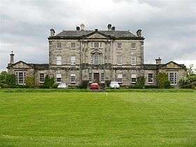 | |||
| 85 And 86 And 2 And 4 Giles Street With Boundary Walls And Gatepiers, Also Known As The Vaults | 55°58′26″N 3°10′21″W | Category A | 27446 | | |||
| 1-10 (Inclusive Nos) Hermitage Terrace, 1 Cluny Avenue And 2_Nile Grove | 55°55′34″N 3°12′30″W | Category B | 27454 | | |||
| 13 Jordan Lane With Railings | 55°55′38″N 3°12′23″W | Category C(S) | 27479 | | |||
| 186 And 188 Portobello High Street | 55°57′10″N 3°06′48″W | Category C(S) | 27482 | | |||
| 18-46 (Even Nos) Great Junction Street | 55°58′17″N 3°10′23″W | Category C(S) | 27492 | | |||
| Heriot-Watt University, Riccarton Estate, Icehouse | 55°54′34″N 3°19′18″W | Category C(S) | 27362 | | |||
| 106A Constitution Street, St Mary Star Of The Sea, Convent And Presbytery | 55°58′24″N 3°10′11″W | Category B | 27365 | | |||
| Shandwick Place St. Georges West Church, (Church Of Scotland) | 55°56′58″N 3°12′38″W | Category A | 27367 | 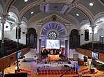 | |||
| 49, 51 (1-3) And 53 Portland Street With Front Walls, Steps And Railings; Eh6 4Az | 55°58′36″N 3°10′58″W | Category C(S) | 27368 | | |||
| 104 And 106 Even Nos Polwarth Terrace | 55°55′48″N 3°13′38″W | Category C(S) | 27377 | | |||
| Hermiston House With West Lodge Gate Towers, Gig-House And Boundary Walls | 55°55′04″N 3°19′22″W | Category B | 27389 | | |||
| 3-9 Quayside Street, Quayside Mills (Mcgregor & Co) Incorporating Former Manse, Remains Of St Ninian's Church, Tenement, Granary And Mill; Eh6 6Ej | 55°58′32″N 3°10′27″W | Category A | 27395 | | |||
| Humbie Cottages | 55°57′55″N 3°24′56″W | Category C(S) | 27409 | | |||
| Hermitage Of Braid, Off Braid Road, Ice House | 55°55′10″N 3°12′03″W | Category C(S) | 27420 | 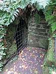 | |||
| 8 And 10 South Fort Street With Front Steps And Railings; Eh6 4Dn | 55°58′28″N 3°11′01″W | Category B | 27421 | | |||
| Humbie Steading | 55°57′53″N 3°25′14″W | Category B | 27429 | | |||
| 60 Spylaw Road With Stables | 55°55′53″N 3°13′22″W | Category C(S) | 27437 | | |||
| 66 Spylaw Road, Redwood, With Conservatory, Greenhouse, Stables And Boundary Walls And Gatepiers | 55°55′52″N 3°13′30″W | Category B | 27444 | | |||
| 21-29 (Odd Nos) Pitt Street With Railings; Eh6 4By | 55°58′24″N 3°11′15″W | Category B | 27305 | | |||
| Gogar Station Road, Millburn Tower With Garden Store, Walled Garden And Gatepiers | 55°55′53″N 3°19′40″W | Category B | 27306 | | |||
| 68 Constitution Street With Gatepiers And Railings | 55°58′27″N 3°10′04″W | Category B | 27309 | | |||
| 37A And 39 Marlborough Street | 55°57′12″N 3°06′37″W | Category C(S) | 27315 | | |||
| 143 Grange Loan, Astley Ainslie Hospital, Sentry Pavilions, Gateposts, Gates And Railings | 55°55′52″N 3°11′59″W | Category B | 27317 | | |||
| 6-8 (Inclusive Nos) Portland Place And 4 Portland Terrace With Railings; Eh6 6La And Eh6 6Je Respectively | 55°58′40″N 3°10′50″W | Category B | 27319 |  | |||
| 78 And 80 Constitution Street | 55°58′27″N 3°10′05″W | Category C(S) | 27323 | | |||
| King's Stables Road And Lothian Road, St Cuthbert's Churchyard, Watch Tower | 55°56′57″N 3°12′23″W | Category B | 27346 |  | |||
| North Fort Street, Leith Fort Lodges, Gateway And Boundary Wall | 55°58′37″N 3°11′08″W | Category B | 27221 |  | |||
| 19 Merchiston Place | 55°56′07″N 3°12′45″W | Category C(S) | 27224 | | |||
| 2-6 (Even Nos) North Fort Street And 92, 92A And 94 Ferry Road With Front Walls; Eh6 4Ex And Eh6 4Aq Respectively | 55°58′30″N 3°11′01″W | Category C(S) | 27228 | | |||
| 7 Glasgow Road, Middle Norton | 55°55′43″N 3°22′04″W | Category C(S) | 27244 | | |||
| 20-24 (Even Nos) North Fort Street And 6 Madeira Place With Garden Walls; Eh6 4Ad And Eh6 4Aw Respectively | 55°58′32″N 3°11′03″W | Category C(S) | 27251 | | |||
| 328-332 (Even Nos) Portobello High Street, 1 Pittville Street | 55°57′04″N 3°06′27″W | Category C(S) | 27253 | | |||
| 149, 149A Constitution Street | 55°58′17″N 3°10′12″W | Category B | 27256 | | |||
| 26 And 28 (Gf And 1F) North Fort Street With Front Walls; Eh6 4Hd | 55°58′33″N 3°11′03″W | Category C(S) | 27259 | | |||
| 57 Promenade, Bellfield Street, Portobello Public Swimming Baths, With Stalk And Boundary Walls, Including Post Box | 55°57′11″N 3°06′25″W | Category B | 27261 |  | |||
| 30 North Fort Street And 91 To 105 (Odd Nos) Portland Street With Front Walls And Railings; Eh6 4Ad And Eh6 4Ay Respectively | 55°58′33″N 3°11′04″W | Category C(S) | 27267 | | |||
| 47 Figgate Lane, The Tower | 55°57′20″N 3°06′46″W | Category B | 27271 |  | |||
| 25 And 27 North Junction Street, Leith Art College (Former Scandinavian Lutheran Church) With Offices, Gatepiers, Railings And Boundary Walls; Eh6 6Hw | 55°58′34″N 3°10′47″W | Category C(S) | 27276 | | |||
| Gogar Station Road, Gogar Bank House With Greenhouse | 55°55′28″N 3°19′19″W | Category B | 27277 | | |||
| 36-42 (Even Nos) Constitution Street | 55°58′30″N 3°10′02″W | Category B | 27289 | | |||
| 68 And 68A Madeira Street With Steps And Railings; Eh6 4Au | 55°58′36″N 3°10′58″W | Category C(S) | 27158 | | |||
| 50 And 52 Brighton Place | 55°57′02″N 3°07′06″W | Category B | 27163 | | |||
| 3 Merchiston Park | 55°56′09″N 3°12′42″W | Category C(S) | 27180 | | |||
| Nicolson Square Methodist Chapel (Methodist) Nicolson Square | 55°56′44″N 3°11′10″W | Category A | 27185 | | |||
| Glasgow Road, Norton House Hotel, North Lodge, Gatepiers And Policy Walls | 55°56′17″N 3°22′33″W | Category C(S) | 27187 | | |||
| Mansfield Road Harmeny House Lodge, (Originally Stables/Coachhouse) With Gatepiers | 55°52′36″N 3°20′10″W | Category B | 27190 | | |||
| 39-45 (Odd Nos) Pittville Street (Osbourne Terrace) | 55°57′09″N 3°06′23″W | Category C(S) | 27197 | | |||
| 120 (1F And 2F) And 122 Newhaven Road With Front Wall And Railings; Eh6 4Br | 55°58′25″N 3°11′18″W | Category C(S) | 27213 | | |||
| Glasgow Road, Norton House Hotel, Walled Garden | 55°56′00″N 3°23′06″W | Category B | 27214 | | |||
| 12 And 14 Pittville Street | 55°57′09″N 3°06′20″W | Category C(S) | 27215 | | |||
| 1-5 (Inclusive Nos) Madeira Place With Front Walls And Railings; Eh6 4Aw | 55°58′33″N 3°11′00″W | Category C(S) | 27091 | | |||
| 81, 83 And 85 Milton Road East, Queen's Bay Cottages And Boundary Walls | 55°56′42″N 3°05′43″W | Category C(S) | 27093 | | |||
| 200 Milton Road East, Portobello Cemetery And Lodge House With Gates, Railings, Gatepiers, Boundary Walls And Pavilion | 55°56′41″N 3°05′26″W | Category B | 27103 | | |||
| 22 And 24 Brighton Place | 55°57′07″N 3°06′58″W | Category B | 27107 | | |||
| 29 Madeira Street, Leith Baptist Church With Front Wall And Railings; Eh6 4Aj | 55°58′31″N 3°10′56″W | Category C(S) | 27111 | | |||
| 201-203 Gilmore Place | 55°56′19″N 3°12′50″W | Category C(S) | 27114 | | |||
| 1, 1A Cluny Gardens, Red House With Boundary Wall, Gate And Railings | 55°55′30″N 3°12′32″W | Category B | 27118 | | |||
| 41-47 (Odd Nos) Madeira Street With Front And Garden Walls, Steps And Railings; Eh6 4Aj | 55°58′33″N 3°10′57″W | Category C(S) | 27128 | | |||
| 38 And 40 Brighton Place | 55°57′05″N 3°07′02″W | Category B | 27139 | | |||
| 34 Main Street | 55°53′01″N 3°20′20″W | Category B | 27145 | | |||
| 37-43 (Odd Nos) Constitution Street And 49 Assembly Street, Exchange Buildings | 55°58′30″N 3°10′00″W | Category A | 27147 | | |||
| 5-25 Odd Nos Lockharton Gardens | 55°55′34″N 3°13′52″W | Category C(S) | 27152 | | |||
| Russell Road Railway Bridge With Retaining Walls | 55°56′35″N 3°13′46″W | Category B | 27019 | | |||
| Easter Hatton With Boundary Wall And Gates | 55°54′24″N 3°22′37″W | Category C(S) | 27031 | | |||
| Easter Hatton Mains, Fairview Cottages And Gates | 55°54′24″N 3°22′32″W | Category B | 27041 | | |||
| Foxhall North Lodge | 55°57′15″N 3°23′42″W | Category B | 27072 | | |||
| 27 Milton Road East, Milton Road East Lodge, Gates And Scaliger Railing | 55°56′41″N 3°05′53″W | Category B | 27073 | | |||
| 550, Lanark Road West, Northfield With Gardener's Cottage, Garden, Gatepiers And Boundary Wall | 55°53′15″N 3°21′00″W | Category B | 27076 | | |||
| 4, 5, 5A Cluny Avenue | 55°55′32″N 3°12′26″W | Category C(S) | 27089 | | |||
| 211 (Gf And 1F) Ferry Road With Boundary Walls; Eh6 4Nn | 55°58′24″N 3°11′26″W | Category C(S) | 26951 | | |||
| Dalmahoy Estate, East Gate, Gatepiers And Railings | 55°54′51″N 3°20′17″W | Category C(S) | 26952 | | |||
| 36 Johnsburn Road Balerno Lodge With Walled Garden, Boundary Wall And Gatepiers | 55°52′59″N 3°20′46″W | Category B | 26956 | | |||
| 14 And 16 Bellfield Street | 55°57′07″N 3°06′31″W | Category B | 26957 | | |||
| 15 John Street | 55°57′06″N 3°06′15″W | Category B | 26965 | | |||
| 1-26 (Inclusive Nos) Richmond Terrace And 51-55 (Odd Nos) Dalry Road With Garden Walls | 55°56′40″N 3°13′04″W | Category C(S) | 26985 | | |||
| 46 And 48 Bernard Street | 55°58′34″N 3°10′08″W | Category B | 26993 | | |||
| Murieston Crescent, Railway Bridge And Associated Quadrant Wall And Gates | 55°56′27″N 3°13′41″W | Category C(S) | 27008 | | |||
| 73 Restalrig Road With Boundary Wall | 55°58′04″N 3°09′28″W | Category C(S) | 27013 | | |||
| 24 Bellfield Street | 55°57′10″N 3°06′29″W | Category C(S) | 27015 | | |||
| 155-195 (Odd Nos) Bruntsfield Place And 1 Bruntsfield Gardens | 55°56′08″N 3°12′35″W | Category B | 26861 | | |||
| 110-150 Commercial Street, Macdonald And Muir Warehouses Incorporating Cooperage And Walled Yard, Quality House (Queen's Dock), Bond 13, Former Rose's Lime Juice Stores, Boundary Wall And Gatepiers | 55°58′42″N 3°10′47″W | Category B | 26864 | | |||
| 3-6 (Inclusive Nos) James Street With Boundary Walls | 55°57′03″N 3°06′14″W | Category B | 26866 | | |||
| 7 And 8 James Street With Boundary Walls | 55°57′04″N 3°06′13″W | Category B | 26880 | | |||
| 42 And 44 Bath Street | 55°57′16″N 3°06′41″W | Category B | 26884 | | |||
| 7 Bruntsfield Terrace | 55°56′11″N 3°12′22″W | Category B | 26887 | | |||
| 1A And 2-11 (Inclusive Nos) Dock Place; Eh6 6Lu | 55°58′38″N 3°10′19″W | Category B | 26890 | | |||
| 9 And 10 James Street With Boundary Walls | 55°57′04″N 3°06′13″W | Category C(S) | 26892 | | |||
| Haymarket Terrace, Haymarket Inn | 55°56′45″N 3°13′06″W | Category C(S) | 26913 | | |||
| 12-18 (Even Nos) Bernard Street | 55°58′33″N 3°10′02″W | Category B | 26922 | | |||
| Johnsburn Road, Larch Grove With Stables And Gatepiers | 55°52′56″N 3°21′05″W | Category B | 26932 | | |||
| 8 Bellfield Street | 55°57′06″N 3°06′32″W | Category C(S) | 26933 | | |||
| 19 Smith's Place With Kitchen Garden, Walls, Gates And Gatepiers | 55°58′01″N 3°10′23″W | Category A | 26934 |  | |||
| 157 And 159 Colinton Road | 55°55′31″N 3°14′02″W | Category B | 26815 | | |||
| Distillery Lane Easter Dalry House And Boundary Wall | 55°56′42″N 3°13′08″W | Category B | 26824 | | |||
| 72-98 (Inclusive Nos) Commercial Street, (Incorporates Bond 42 And 63/1X2 And 64/1, 2, Gf And 1F), And 13-15 (Inclusive Nos) Dock Place With Gatepiers And Railings; Eh6 6Nf, 6Lx And 6Jd | 55°58′38″N 3°10′26″W | Category A | 26825 |  | |||
| Bonnington House With Balustraded Wall | 55°54′24″N 3°25′23″W | Category A | 26826 | | |||
| 6 And 8 Gorgie Road, Royal Bank Of Scotland | 55°56′21″N 3°13′37″W | Category C(S) | 26837 | | |||
| 18 And 20 Bath Street | 55°57′14″N 3°06′45″W | Category B | 26844 | | |||
| 131-151 (Odd Nos) Bruntsfield Place, 42 Forbes Road And 2 Bruntsfield Gardens | 55°56′11″N 3°12′29″W | Category B | 26848 | | |||
| 22 And 24 Bath Street | 55°57′15″N 3°06′45″W | Category C(S) | 26858 | | |||
| Almondhill Steading | 55°57′36″N 3°23′42″W | Category B | 26748 | | |||
| 17, Bridge Road, Deanpark Primary School, School Master's House With Boundary Walls | 55°53′06″N 3°20′24″W | Category C(S) | 26752 | | |||
| 11 Bath Street | 55°57′11″N 3°06′48″W | Category B | 26753 | | |||
| Dalry Road, Dalry Primary School With Caretaker's Lodge, Boundary Walls And Gatepiers | 55°56′32″N 3°13′22″W | Category C(S) | 26759 | | |||
| 33 And 35 Bellfield Street | 55°57′09″N 3°06′27″W | Category B | 26762 | | |||
| 410 And 412 Easter Road And Lochend Road, Leith St Andrew's Church Of Scotland And Church Hall | 55°58′07″N 3°10′02″W | Category B | 26767 | | |||
| 208-210 Even Nos Bruntsfield Place And 2 And 4 Merchiston Place | 55°56′08″N 3°12′37″W | Category B | 26777 | | |||
| Buteland Farm | 55°52′00″N 3°22′55″W | Category B | 26779 | | |||
| 39-77 Odd Nos Slateford Road 2 Merchiston Grove 3-7 Odd Nos Shandon Place | 55°56′06″N 3°13′53″W | Category C(S) | 26782 | | |||
| 39-47 (Odd Nos) Bellfield Street (Vernon Villas) | 55°57′10″N 3°06′26″W | Category C(S) | 26789 | | |||
| 55-59 Leith Walk, Tsb And 61 Leith Walk And Crown Street, Bank Of Scotland | 55°58′10″N 3°10′21″W | Category C(S) | 26794 | | |||
| 5-13A (Odd Nos) Academy Street With Railings | 55°58′14″N 3°10′14″W | Category B | 26705 | | |||
| 4 Claremont Park With Boundary Walls, Gatepiers And Lamp Brackets | 55°58′11″N 3°09′27″W | Category B | 26713 | |
Key
The scheme for classifying buildings in Scotland is:
- Category A: "buildings of national or international importance, either architectural or historic; or fine, little-altered examples of some particular period, style or building type."[1]
- Category B: "buildings of regional or more than local importance; or major examples of some particular period, style or building type, which may have been altered."[1]
- Category C: "buildings of local importance; lesser examples of any period, style, or building type, as originally constructed or moderately altered; and simple traditional buildings which group well with other listed buildings."[1]
In March 2016 there were 47,288 listed buildings in Scotland. Of these, 8 per cent were Category A, and 50 per cent were Category B, with the rest listed at Category C.[2]
Notes
- Sometimes known as OSGB36, the grid reference (where provided) is based on the British national grid reference system used by the Ordnance Survey.
• "Guide to National Grid". Ordnance Survey. Retrieved 12 December 2007.
• "Get-a-map". Ordnance Survey. Retrieved 17 December 2007. - Historic Environment Scotland assign a unique alphanumeric identifier to each designated site in Scotland, for listed buildings this always begins with "LB", for example "LB12345".
References
- All entries, addresses and coordinates are based on data from Historic Scotland. This data falls under the Open Government Licence
- "What is Listing?". Historic Environment Scotland. Retrieved 29 May 2018.
- Scotland's Historic Environment Audit 2016 (PDF). Historic Environment Scotland and the Built Environment Forum Scotland. pp. 15–16. Retrieved 29 May 2018.
This article is issued from Wikipedia. The text is licensed under Creative Commons - Attribution - Sharealike. Additional terms may apply for the media files.