List of listed buildings in Edinburgh/10
List
| Name | Location | Date Listed | Grid Ref. [note 1] | Geo-coordinates | Notes | LB Number [note 2] | Image |
|---|---|---|---|---|---|---|---|
| 12 Duncan Street, Former Geographical Institute, Including Boundary Wall | 55°56′07″N 3°10′38″W | Category B | 28701 |  | |||
| 3-7 (Odd Nos) Dundas Street, Including Railings | 55°57′23″N 3°11′54″W | Category B | 28702 |  | |||
| 25-29 (Odd Nos) Dundas Street, Including Railings | 55°57′26″N 3°11′56″W | Category B | 28707 | | |||
| 31-37 (Odd Nos) Dundas Street, Including Railings | 55°57′27″N 3°11′57″W | Category B | 28708 | | |||
| 67-77 (Odd Nos) Dundas Street And 35-37(Odd Nos) Cumberland Street, Including Railings | 55°57′31″N 3°11′59″W | Category A | 28710 | | |||
| 87-97A (Odd Nos) Dundas Street, Including Railings | 55°57′33″N 3°12′00″W | Category B | 28712 | | |||
| 30-36 (Even Nos) Dundas Street, Including Railings | 55°57′26″N 3°11′59″W | Category B | 28718 | | |||
| 1-10 (Inclusive Nos) Douglas Crescent, Including Railings | 55°56′56″N 3°13′19″W | Category B | 28653 | | |||
| 11-13 (Inclusive Nos) Douglas Crescent, Including Railings | 55°56′57″N 3°13′18″W | Category B | 28654 | | |||
| 22 Douglas Crescent, Including Railings | 55°56′59″N 3°13′14″W | Category B | 28656 | | |||
| 23-31 (Inclusive Nos) Douglas Crescent, Including Railings | 55°56′59″N 3°13′14″W | Category B | 28657 | | |||
| 1, 2, 3, 4, 5 Douglas Gardens, Including Railings | 55°57′03″N 3°13′13″W | Category B | 28658 | | |||
| Gilmerton 36 Drum Street, The Mechanic Arms | 55°54′19″N 3°07′56″W | Category C(S) | 28664 | | |||
| 11-15 (Inclusive Nos) Drummond Place Including Railings And Lamps | 55°57′28″N 3°11′48″W | Category A | 28666 | | |||
| 16-20 (Inclusive Nos) Drummond Place Including Lamps And Railings | 55°57′31″N 3°11′49″W | Category A | 28667 | | |||
| 31-36A (Inclusive Nos) Drummond Place, And 1- 3A (Odd Nos) Scotland Street And 2 And 4 London Street, Including Railings And Lamps | 55°57′33″N 3°11′38″W | Category A | 28669 | | |||
| 1, 2, 3 ,4 And 5 Cramond Village | 55°58′46″N 3°18′03″W | Category B | 28604 | | |||
| 64-70B Cumberland Street, Including Railings | 55°57′30″N 3°12′10″W | Category B | 28615 | | |||
| 62 Dalkeith Road, Blacket Place Lodge, Including Gatepiers To Blacket Place | 55°56′16″N 3°10′20″W | Category B | 28623 | | |||
| 2-10 (Even Numbers) Dean Path | 55°57′10″N 3°13′04″W | Category B | 28638 | | |||
| 12-22 (Consecutive Numbers) Coates Crescent, 12 And 2 Walker Street, 22 And 1 Manor Place, Including Railings | 55°56′55″N 3°12′47″W | Category A | 28564 |  | |||
| 5 And 7 Cockburn Street | 55°57′03″N 3°11′28″W | Category B | 28570 | | |||
| 11 And 13 Cockburn Street | 55°57′03″N 3°11′26″W | Category B | 28572 | | |||
| 41 And 43 Corstorphine Road, Including Boundary Walls | 55°56′43″N 3°14′34″W | Category C(S) | 28588 | | |||
| 2-12 (Even Nos) Cowgate, Greyfriars Hostel | 55°56′53″N 3°11′37″W | Category B | 28597 | | |||
| 1-41 (Odd Nos) East Claremont Street | 55°57′41″N 3°11′35″W | Category A | 28533 | | |||
| Clarence Street 27-29A And 95-97A St Stephen Street | 55°57′32″N 3°12′19″W | Category B | 28538 | | |||
| Clarence Street 2-2B And 90-94 Hamilton Place | 55°57′34″N 3°12′24″W | Category B | 28539 | | |||
| 51-77 Clerk Street South | 55°56′22″N 3°10′46″W | Category B | 28553 | 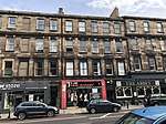 | |||
| Clerk Street South 2-10 | 55°56′27″N 3°10′53″W | Category B | 28554 | | |||
| 25 Castle Terrace And 17 Cornwall Street, Including Boundary Wall And Railings | 55°56′50″N 3°12′12″W | Category A | 28485 | 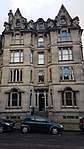 | |||
| 537 And 539 Castlehill, Jollie's Close, Semple's Close And Sempill House (Part) | 55°56′57″N 3°11′44″W | Category B | 28486 | _(1).jpg) | |||
| 356 Castlehill And 2 Castle Wynd North, Cannonball House | 55°56′56″N 3°11′46″W | Category A | 28491 | 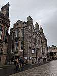 | |||
| 8-10 The Causeway, Duddingston, (Prince Charlie's House) | 55°56′33″N 3°08′43″W | Category B | 28492 | | |||
| 1-11 (Inclusive Nos) Charlotte Square With Railings, Lamp Standards And Boundary Walls | 55°57′09″N 3°12′28″W | Category A | 28502 | 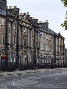 | |||
| 2-22 (Even Numbers) Chester Street, 30 Walker Street, Including Railings | 55°57′00″N 3°12′56″W | Category B | 28519 | | |||
| 23-33 (Odd Nos) Canongate And 1-12 (Inclusive) White Horse Close | 55°57′11″N 3°10′32″W | Category B | 28427 |  | |||
| 129 Canongate, Panmure Close Cadell House | 55°57′07″N 3°10′43″W | Category B | 28432 | | |||
| 183-187 (Odd Nos) Canongate, 'Bible Land' | 55°57′05″N 3°10′51″W | Category B | 28434 |  | |||
| 191 (Flats 1, 3 And 5) And 193 Canongate | 55°57′05″N 3°10′52″W | Category C(S) | 28436 | | |||
| 86 Canongate, Canongate Primary School Including Janitor's House, Gates, Gatepiers And Boundary Walls | 55°57′06″N 3°10′38″W | Category B | 28442 | 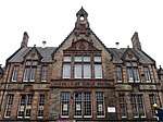 | |||
| 23 St John Street, Lodge Canongate Kilwinning | 55°57′03″N 3°10′54″W | Category B | 28453 |  | |||
| 9-13 (Odd Nos) And 13A Castle Street With Railings | 55°57′06″N 3°12′10″W | Category B | 28461 | | |||
| 45, 45A, 47, 49 And 49A North Castle Street With Railings | 55°57′11″N 3°12′12″W | Category A | 28465 | | |||
| 48-52 (Even Nos) North Castle Street With Railings And Block Facing Young Street Lane North | 55°57′12″N 3°12′16″W | Category A | 28478 | | |||
| 1-3 (Inclusive Nos) Brunton Place | 55°57′28″N 3°10′29″W | Category B | 28373 | | |||
| Buccleuch Place 1-3 And 30-34 Buccleuch Street | 55°56′34″N 3°11′06″W | Category B | 28379 | | |||
| Buccleuch Place 9, 10, 11 | 55°56′34″N 3°11′11″W | Category B | 28384 | | |||
| Buccleuch Place 20, 21 | 55°56′33″N 3°11′15″W | Category B | 28388 | | |||
| 93-97 Buccleuch Street | 55°56′31″N 3°11′02″W | Category C(S) | 28395 | | |||
| 130 Buccleuch Street, Hope Park End | 55°56′28″N 3°11′00″W | Category B | 28404 | 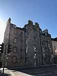 | |||
| 39-43 (Odd Nos) Candlemaker Row | 55°56′51″N 3°11′33″W | Category B | 28414 | .jpg) | |||
| 30-34 (Even Nos) Candlemaker Row, Greyfriars' Bobby's Bar | 55°56′49″N 3°11′30″W | Category B | 28415 |  | |||
| 36-42 (Even Nos) Candlemaker Row, Including Candlemakers' Hall | 55°56′49″N 3°11′30″W | Category A | 28416 | | |||
| 20 Blacket Place, Including Boundary Walls | 55°56′14″N 3°10′30″W | Category B | 28313 | | |||
| 8-18 (Even Nos) Blackfriars Street | 55°56′59″N 3°11′10″W | Category B | 28320 | | |||
| 1-7 (Odd Nos) Blair Street | 55°56′58″N 3°11′17″W | Category B | 28329 | | |||
| 27-31 (Odd Nos) Blair Street (Former Stationary Works) | 55°56′56″N 3°11′16″W | Category B | 28332 | | |||
| Brandon Street, Dundas House (1883 Frontage To Brandon Street Only, Modern Offices To Rear Excluded) | 55°57′41″N 3°12′07″W | Category B | 28342 | | |||
| Brandon Terrace 1-10 | 55°57′44″N 3°12′00″W | Category C(S) | 28343 | | |||
| 7-33 (Odd Nos) Bread Street | 55°56′46″N 3°12′18″W | Category C(S) | 28345 | | |||
| 65-71 (Odd Nos) Broughton Street | 55°57′29″N 3°11′21″W | Category B | 28364 | | |||
| 24 Broughton Street (Former Catholic Apostolic Church), Including Railings And Gate | 55°57′26″N 3°11′20″W | Category B | 28368 | | |||
| The Vennel, 2, 4 And 5 Brown's Place, Including Boundary Walls, Railings And Gate | 55°56′47″N 3°11′49″W | Category B | 28370 | | |||
| 1-19 (Inclusive Nos) Barclay Place | 55°56′25″N 3°12′14″W | Category B | 28268 | | |||
| 1 Easter Park House, Easter Park Drive | 55°58′06″N 3°16′54″W | Category B | 28274 | | |||
| 11-15 (Inclusive Numbers) Belgrave Place | 55°57′15″N 3°13′10″W | Category C(S) | 28284 | | |||
| 13-19 (Odd Nos) Bellevue Place Including Boundary Walls And Railings | 55°57′38″N 3°11′31″W | Category B | 28289 | | |||
| 4-11A (Inclusive Nos) Bellevue Terrace | 55°57′41″N 3°11′36″W | Category A | 28292 | | |||
| 7 And 7A Blacket Place, Including Gatepiers And Boundary Walls | 55°56′13″N 3°10′26″W | Category B | 28299 | | |||
| 9 And 11 Blacket Place, Including Boundary Walls | 55°56′13″N 3°10′29″W | Category B | 28300 | | |||
| 19 Blacket Place, Including Boundary Walls | 55°56′09″N 3°10′25″W | Category B | 28304 | | |||
| 21 And 21B Blacket Place, Including Boundary Walls | 55°56′09″N 3°10′25″W | Category B | 28305 | | |||
| 2 Blacket Place, Including Boundary Walls | 55°56′16″N 3°10′23″W | Category B | 28307 | | |||
| 5-25 (Odd Numbers) Alva Street, Including Railings | 55°57′02″N 3°12′36″W | Category A | 28236 | | |||
| Ann Street 3-13 | 55°57′24″N 3°12′50″W | Category A | 28241 | 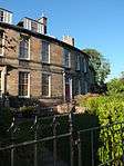 | |||
| Ann Street 15-41 | 55°57′22″N 3°12′48″W | Category A | 28242 | | |||
| 5-9 (Odd Nos) Annandale Street Including Railings | 55°57′35″N 3°11′03″W | Category A | 28253 | | |||
| 11 Bank Street, Bank Of Scotland With Retaining Wall, Gatepiers, Gates, Railings And Lamp Standards | 55°57′01″N 3°11′35″W | Category A | 28263 | .jpg) | |||
| 24 Dean Path And West Mill Lane, West Mill | 55°57′09″N 3°13′01″W | Category B | 28206 | | |||
| 1 And 1A Abercromby Place, And 20-24 (Even Nos) Dublin Street Including Railings And Lamp | 55°57′24″N 3°11′37″W | Category B | 28209 | | |||
| 21-25A (Inclusive Nos) Ainslie Place, Including Railings And Lamps | 55°57′12″N 3°12′33″W | Category A | 28215 | 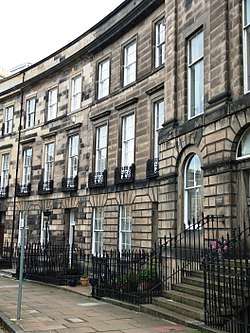 | |||
| Airlie Place 1-5 Brandon Street | 55°57′39″N 3°12′06″W | Category C(S) | 28216 | | |||
| 11-19 (Odd Nos) Albany Street, Including Railings | 55°57′25″N 3°11′31″W | Category A | 28221 | | |||
| 21-23A (Odd Nos) Albany Street, Including Railings | 55°57′25″N 3°11′29″W | Category A | 28222 | | |||
| 35, 37 Albany Street And 3 York Lane, Including Railings | 55°57′25″N 3°11′25″W | Category B | 28225 | | |||
| 39-43 (Odd Nos) Albany Street, Including Railings | 55°57′26″N 3°11′23″W | Category A | 28226 | | |||
| 2 And 4 Albany Street, And 27-33A (Odd Nos) Dublin Street, Including Railings | 55°57′26″N 3°11′36″W | Category B | 28227 | | |||
| Redhall Gardens Craiglockhart Drive South (Now Entered From Lanark Road) | 55°55′14″N 3°15′03″W | Category B | 28119 | | |||
| 25 Spylaw Street, Spylaw House | 55°54′25″N 3°15′37″W | Category B | 28124 | | |||
| Woodhall House-Sundials And Garden Wall Woodhall Road | 55°54′05″N 3°17′07″W | Category B | 28131 | | |||
| 2 Dovecot Road, Dovecot Including Boundary Walls, Gatepiers And Gates | 55°56′20″N 3°16′53″W | Category A | 28135 |  | |||
| Buriehouse Mains Farmhouse And Steading | 55°53′40″N 3°09′30″W | Category B | 28160 | | |||
| 265 Braid Road, Buckstane Farmhouse, Including Boundary Walls And Well | 55°54′37″N 3°12′32″W | Category B | 28161 | | |||
| Liberton Drive, Old White Cottage | 55°54′51″N 3°10′38″W | Category C(S) | 28186 | | |||
| 108 Swanston Road, Swanston Cottage, 108 Swanston Road, Swanston Cottage, Including Boundary Wall , Garden Terrace, Stone Trough And Ancillary Structure | 55°53′42″N 3°13′17″W | Category B | 28201 | | |||
| West Shore Road, Gatepiers To North East Of Caroline Park House | 55°58′58″N 3°14′23″W | Category B | 28041 | | |||
| 62-68 (Even Nos) Camus Avenue, Comiston House | 55°54′21″N 3°12′57″W | Category B | 28044 |  | |||
| Gilmerton, The Drum, Stables | 55°54′26″N 3°07′10″W | Category B | 28054 | | |||
| Old Dalkeith Road, The Drum, Drumbank With Stables, Cottages (Outbuildings) And Walled Garden | 55°54′44″N 3°06′58″W | Category B | 28059 | | |||
| Gracemount Off Lasswade Road | 55°54′19″N 3°09′26″W | Category B | 28076 | | |||
| Liberton Drive, Liberton House, With Walled Garden, Gates And Gatepiers | 55°54′41″N 3°10′22″W | Category A | 28086 | | |||
| Frogston Road East, Mortonhall House, Icehouse | 55°54′11″N 3°11′02″W | Category C(S) | 28098 | | |||
| 66 Murrayfield Avenue And Succoth Avenue, Murrayfield House, Including Wing | 55°56′57″N 3°14′25″W | Category A | 28100 |  | |||
| Drummond Street, Gatepiers And Flanking Walls, University Of Edinburgh | 55°56′53″N 3°11′01″W | Category B | 28001 | | |||
| High School Yards, Old Surgeon's Hall | 55°56′55″N 3°10′59″W | Category B | 28003 | | |||
| Craigcrook Castle Craigcrook Road | 55°57′18″N 3°15′57″W | Category B | 28014 | | |||
| Holyroodhouse, Palace Coach House | 55°57′08″N 3°10′24″W | Category B | 28026 |  | |||
| Cameron House Avenue, Cameron House | 55°55′51″N 3°09′37″W | Category B | 28036 | | |||
| Regent Road, Calton Old Burial Ground And Monuments, Including Screen Walls To Waterloo Place | 55°57′15″N 3°11′10″W | Category A | 27920 | 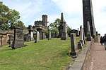 | |||
| Dean Path, Queensferry Road, Dean Cemetery Including Gate Lodge, Boundary Walls And Gates | 55°57′03″N 3°13′22″W | Category A | 27924 | 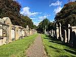 | |||
| Melville Drive, West Meadows Park, Masons' Pillars | 55°56′31″N 3°12′01″W | Category B | 27929 |  | |||
| 31 East Preston Street And Dalkeith Road, Newington Old Burial Ground, Including Boundary Walls And Watchtower | 55°56′20″N 3°10′33″W | Category B | 27934 | | |||
| Roseburn Terrace And Coltbridge Avenue, Roseburn Old Bridge (Old Colt Bridge), Over Water Of Leith | 55°56′46″N 3°14′08″W | Category B | 27947 | | |||
| Bell's Brae And Dean Path, Water Of Leith Bridge | 55°57′08″N 3°13′00″W | Category B | 27952 | | |||
| Newhaven Harbour | 55°58′53″N 3°11′49″W | Category B | 27956 | 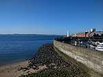 | |||
| Rosebery Crescent, St Mary's Music School, Formerly Coates Hall (Scottish Episcopal Church Theological College), Including Gate House, Chapel Gates, Gatepiers And Railings | 55°56′49″N 3°13′13″W | Category B | 27966 | | |||
| Warriston House And Boundary Wall | 55°54′20″N 3°20′31″W | Category B | 27830 | | |||
| 36 Newhaven Road | 55°58′13″N 3°11′10″W | Category C(S) | 27831 | | |||
| West Hermiston Road, Trefoil Centre, East Lodge And Boundary Wall | 55°55′19″N 3°19′54″W | Category B | 27833 | | |||
| 7 And 9 Pilrig Street With Boundary Wall And Railings | 55°57′53″N 3°10′44″W | Category B | 27846 | | |||
| George Street And Castle Street, Statue Of Dr Chalmers | 55°57′09″N 3°12′13″W | Category A | 27847 |  | |||
| 29-41 (Odd Nos) Queen Charlotte Street, Leith Police Station, Former Town Hall And Railings | 55°58′25″N 3°10′03″W | Category A | 27857 | %2C_Edinburgh.jpg) | |||
| 3 Shore | 55°58′39″N 3°10′08″W | Category B | 27886 | | |||
| 36 And 37 Shore And 59-61 (Odd Nos) Bernard Street | 55°58′34″N 3°10′10″W | Category A | 27890 | | |||
| High Street, The Lawnmarket Wellhead (At Lothian Chambers) | 55°56′58″N 3°11′32″W | Category B | 27903 |  | |||
| Ratho Village, 45 Main Street And Boundary Wall | 55°55′20″N 3°22′45″W | Category C(S) | 27737 | | |||
| Observatory Road, Blackford Hill, The Royal Observatory | 55°55′23″N 3°11′16″W | Category A | 27740 | | |||
| 308 And 312 Leith Walk | 55°57′55″N 3°10′37″W | Category C(S) | 27743 | | |||
| 77A Princes Street, Royal Scottish Academy | 55°57′07″N 3°11′47″W | Category A | 27744 | 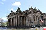 | |||
| 1 West Brighton Crescent | 55°57′04″N 3°07′07″W | Category B | 27746 | | |||
| 318, 320 And 322 Leith Walk With Boundary Wall | 55°57′54″N 3°10′38″W | Category C(S) | 27751 | | |||
| 5 West Brighton Crescent | 55°57′04″N 3°07′08″W | Category B | 27754 | | |||
| 324 And 326 Leith Walk With Boundary Wall | 55°57′53″N 3°10′38″W | Category B | 27755 | | |||
| Stockbridge Market St Stephen Place | 55°57′29″N 3°12′27″W | Category B | 27768 | | |||
| Ratho Village, 52 Main Street | 55°55′19″N 3°22′48″W | Category C(S) | 27769 | | |||
| 5-9 (Inclusive Nos) Links Place | 55°58′23″N 3°09′51″W | Category C(S) | 27776 | | |||
| 4 West Brighton Crescent | 55°57′05″N 3°07′06″W | Category B | 27778 | | |||
| 14 And 15 Links Place Former Scottish Wholesale Co-Operative Society Building | 55°58′22″N 3°09′48″W | Category B | 27783 | | |||
| 18-20 (Inclusive Nos) Maritime Lane And 40, 41 Maritime Street | 55°58′29″N 3°10′06″W | Category C(S) | 27787 | | |||
| Swineburn Road, Carmelhill | 55°57′59″N 3°25′51″W | Category C(S) | 27789 | | |||
| Union Canal, Almond Aqueduct, River Almond At Lin's Mill | 55°55′13″N 3°26′02″W | Category A | 27793 | 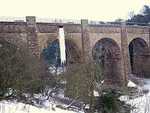 | |||
| 21 And 22 Wilson's Park | 55°57′16″N 3°06′45″W | Category C(S) | 27794 | | |||
| Corstorphine Hill, Clermiston Tower (Scott Centenary Memorial) | 55°57′04″N 3°16′20″W | Category B | 27805 | .jpg) | |||
| 4, 6A And 6B Mill Lane With Gatepiers And Railings | 55°58′29″N 3°10′34″W | Category C(S) | 27819 | | |||
| 9 Mill Lane, Guru Nanak Gurdawara Singh Sabha Sikh Temple And Manse, Former St Thomas Church (C Of S), With Railings | 55°58′29″N 3°10′33″W | Category B | 27825 | 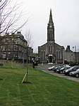 | |||
| 2 Leven Street, King's Theatre | 55°56′31″N 3°12′10″W | Category A | 27656 |  | |||
| Ratho Park Dovecot | 55°55′26″N 3°21′35″W | Category B | 27665 | | |||
| 56 And 58 Fountainbridge, Former Meat Market | 55°56′40″N 3°12′24″W | Category B | 27669 |  | |||
| 34, 36 And 38 Leith Walk With Boundary Walls And Railings | 55°58′12″N 3°10′22″W | Category B | 27672 | |
Key
The scheme for classifying buildings in Scotland is:
- Category A: "buildings of national or international importance, either architectural or historic; or fine, little-altered examples of some particular period, style or building type."[1]
- Category B: "buildings of regional or more than local importance; or major examples of some particular period, style or building type, which may have been altered."[1]
- Category C: "buildings of local importance; lesser examples of any period, style, or building type, as originally constructed or moderately altered; and simple traditional buildings which group well with other listed buildings."[1]
In March 2016 there were 47,288 listed buildings in Scotland. Of these, 8 per cent were Category A, and 50 per cent were Category B, with the rest listed at Category C.[2]
Notes
- Sometimes known as OSGB36, the grid reference (where provided) is based on the British national grid reference system used by the Ordnance Survey.
• "Guide to National Grid". Ordnance Survey. Retrieved 12 December 2007.
• "Get-a-map". Ordnance Survey. Retrieved 17 December 2007. - Historic Environment Scotland assign a unique alphanumeric identifier to each designated site in Scotland, for listed buildings this always begins with "LB", for example "LB12345".
References
- All entries, addresses and coordinates are based on data from Historic Scotland. This data falls under the Open Government Licence
- "What is Listing?". Historic Environment Scotland. Retrieved 29 May 2018.
- Scotland's Historic Environment Audit 2016 (PDF). Historic Environment Scotland and the Built Environment Forum Scotland. pp. 15–16. Retrieved 29 May 2018.
This article is issued from Wikipedia. The text is licensed under Creative Commons - Attribution - Sharealike. Additional terms may apply for the media files.