List of listed buildings in East Linton, East Lothian
List
| Name | Location | Date Listed | Grid Ref. [note 1] | Geo-coordinates | Notes | LB Number [note 2] | Image |
|---|---|---|---|---|---|---|---|
| 3-7 (Odd Nos) Bridge Street | 55°59′07″N 2°39′23″W | Category B | 26637 |  | |||
| 19 And 21 Bridge Street | 55°59′09″N 2°39′23″W | Category B | 26639 | | |||
| 25 Bridge Street, The Crown Hotel | 55°59′10″N 2°39′22″W | Category B | 26641 | | |||
| 4 Browns Place, With Retaining Wall | 55°59′20″N 2°39′32″W | Category C(S) | 26645 | | |||
| 45 High Street | 55°59′15″N 2°39′25″W | Category C(S) | 26666 | | |||
| 2 High Street | 55°59′11″N 2°39′21″W | Category C(S) | 26672 | | |||
| 32 High Street | 55°59′14″N 2°39′22″W | Category C(S) | 26675 | | |||
| 1 Lauder Place | 55°59′04″N 2°39′14″W | Category B | 26679 | | |||
| 1 Preston Road | 55°59′21″N 2°39′30″W | Category B | 26683 | | |||
| 5 Bridge End | 55°59′08″N 2°39′17″W | Category B | 26634 | | |||
| 23 Bridge Street | 55°59′09″N 2°39′22″W | Category B | 26640 | | |||
| 3 High Street | 55°59′11″N 2°39′22″W | Category C(S) | 26656 | | |||
| 15 High Street | 55°59′12″N 2°39′22″W | Category B | 26659 | | |||
| 21 And 23 High Street | 55°59′12″N 2°39′23″W | Category C(S) | 26661 | | |||
| 40 And 42 High Street | 55°59′17″N 2°39′23″W | Category C(S) | 26676 | | |||
| 44 And 46 High Street | 55°59′16″N 2°39′24″W | Category C(S) | 26677 | | |||
| 9 Brown's Place | 55°59′22″N 2°39′35″W | Category B | 26649 | | |||
| 11-13 (Inclusive Nos) Brown's Place | 55°59′22″N 2°39′36″W | Category C(S) | 26651 | | |||
| 7 And 9 High Street | 55°59′11″N 2°39′22″W | Category B | 26657 | | |||
| 47 And 49 High Street | 55°59′16″N 2°39′25″W | Category B | 26667 | | |||
| 65 High Street | 55°59′11″N 2°39′27″W | Category B | 26668 | | |||
| 71 High Street | 55°59′18″N 2°39′28″W | Category C(S) | 26671 | | |||
| Bank Road, The Royal Bank Of Scotland | 55°59′10″N 2°39′26″W | Category B | 26631 | | |||
| Bridge End, Old Bridge | 55°59′07″N 2°39′16″W | Category A | 26632 | 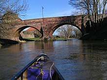 | |||
| 1 Bridge Street | 55°59′07″N 2°39′23″W | Category B | 26636 | | |||
| 16 And 17 Brown's Place | 55°59′23″N 2°39′39″W | Category C(S) | 26652 | | |||
| 69 High Street | 55°59′17″N 2°39′28″W | Category B | 26670 | | |||
| 8 High Street, Old Bankhouse | 55°59′12″N 2°39′20″W | Category B | 26674 | | |||
| 2 Preston Road | 55°59′21″N 2°39′29″W | Category B | 26684 | | |||
| 5-12 (Inclusive Nos) School Road | 55°59′15″N 2°39′30″W | Category B | 26686 | | |||
| 10-14 (Even Nos) Bridge Street | 55°59′09″N 2°39′21″W | Category C(S) | 26644 | | |||
| 6 And 7 Brown's Place, With Retaining Wall And Railings | 55°59′20″N 2°39′33″W | Category C(S) | 26647 | | |||
| 8 Brown's Place, Old North Manse | 55°59′21″N 2°39′34″W | Category B | 26648 | | |||
| 18-21 (Inclusive Nos) Brown's Place | 55°59′23″N 2°39′40″W | Category C(S) | 26653 | | |||
| 29 High Street | 55°59′13″N 2°39′23″W | Category C(S) | 26664 | | |||
| 4 And 6 High Street | 55°59′12″N 2°39′21″W | Category C(S) | 26673 | | |||
| 2 And 3 The Square | 55°59′10″N 2°39′21″W | Category C(S) | 26687 | | |||
| 7 The Square, Manor House | 55°59′11″N 2°39′20″W | Category B | 26689 | | |||
| The Square, St Andrews's Church, Church Of Scotland | 55°59′09″N 2°39′19″W | Category B | 26690 | | |||
| 4 Bridge End, Old Bakehouse | 55°59′08″N 2°39′18″W | Category C(S) | 26635 | | |||
| 5 Browns Place, With Retaining Wall | 55°59′20″N 2°39′32″W | Category B | 26646 | | |||
| 23 Brown's Place | 55°59′24″N 2°39′42″W | Category B | 26654 | | |||
| Station Road, Manseford | 55°59′05″N 2°39′22″W | Category C(S) | 26693 | | |||
| Station Road, Station House | 55°59′06″N 2°39′24″W | Category B | 26694 | | |||
| 2 Bridge Street Old Polling Station | 55°59′08″N 2°39′21″W | Category B | 26642 | | |||
| 6 Bridge Street, Lynton Cottage | 55°59′08″N 2°39′21″W | Category C(S) | 26643 | | |||
| 10 Brown's Place | 55°59′22″N 2°39′36″W | Category B | 26650 | | |||
| 11 And 13 High Street | 55°59′12″N 2°39′22″W | Category B | 26658 | | |||
| 17 And 19 High Street | 55°59′12″N 2°39′22″W | Category B | 26660 | | |||
| High Street, Telephone Kiosk | 55°59′12″N 2°39′22″W | Category B | 26662 | | |||
| 43 High Street | 55°59′15″N 2°39′24″W | Category B | 26665 | | |||
| High Street, Prestonkirk House | 55°59′19″N 2°39′26″W | Category B | 26678 | | |||
| 6 Mill Wynd | 55°59′09″N 2°39′18″W | Category B | 26682 | | |||
| The Square Fountain | 55°59′10″N 2°39′21″W | Category B | 26691 | | |||
| Haddington Road, Old Auction Mart Sale Hall | 55°59′08″N 2°39′35″W | Category B | 48089 | | |||
| 1 Bridge End | 55°59′07″N 2°39′19″W | Category B | 26633 | | |||
| 9 And 11 Bridge Street | 55°59′08″N 2°39′23″W | Category C(S) | 26638 | | |||
| 1 High Street | 55°59′10″N 2°39′22″W | Category C(S) | 26655 | | |||
| 25 High Street | 56°00′17″N 2°39′24″W | Category C(S) | 26663 | | |||
| 67 High Street | 55°59′17″N 2°39′28″W | Category C(S) | 26669 | | |||
| 3 Mill Wynd | 55°59′11″N 2°39′17″W | Category B | 26680 | | |||
| 5 Mill Wynd | 55°59′10″N 2°39′18″W | Category C(S) | 26681 | | |||
| 5 Preston Road | 55°59′23″N 2°39′27″W | Category B | 26685 | | |||
| 4 The Square | 55°59′10″N 2°39′20″W | Category B | 26688 | | |||
| Station Road, Harvesters Hotel | 55°59′03″N 2°39′25″W | Category B | 26692 | |
Key
The scheme for classifying buildings in Scotland is:
- Category A: "buildings of national or international importance, either architectural or historic; or fine, little-altered examples of some particular period, style or building type."[1]
- Category B: "buildings of regional or more than local importance; or major examples of some particular period, style or building type, which may have been altered."[1]
- Category C: "buildings of local importance; lesser examples of any period, style, or building type, as originally constructed or moderately altered; and simple traditional buildings which group well with other listed buildings."[1]
In March 2016 there were 47,288 listed buildings in Scotland. Of these, 8 per cent were Category A, and 50 per cent were Category B, with the rest listed at Category C.[2]
Notes
- Sometimes known as OSGB36, the grid reference (where provided) is based on the British national grid reference system used by the Ordnance Survey.
• "Guide to National Grid". Ordnance Survey. Retrieved 2007-12-12.
• "Get-a-map". Ordnance Survey. Retrieved 2007-12-17. - Historic Environment Scotland assign a unique alphanumeric identifier to each designated site in Scotland, for listed buildings this always begins with "LB", for example "LB12345".
References
- All entries, addresses and coordinates are based on data from Historic Scotland. This data falls under the Open Government Licence
- "What is Listing?". Historic Environment Scotland. Retrieved 29 May 2018.
- Scotland's Historic Environment Audit 2016 (PDF). Historic Environment Scotland and the Built Environment Forum Scotland. pp. 15–16. Retrieved 29 May 2018.
This article is issued from Wikipedia. The text is licensed under Creative Commons - Attribution - Sharealike. Additional terms may apply for the media files.