List of listed buildings in Dunfermline, Fife
List
| Name | Location | Date Listed | Grid Ref. [note 1] | Geo-coordinates | Notes | LB Number [note 2] | Image |
|---|---|---|---|---|---|---|---|
| St Margaret's Drive, Dunfermline Public Park, Drinking Fountain | 56°04′20″N 3°27′05″W | Category C(S) | 45590 | 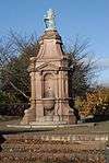 | |||
| 46-51 (Inclusive Numbers) Charlestown Village, (Double Row) | 56°02′12″N 3°29′55″W | Category B | 43647 |  | |||
| Leys Park Road, Former Fever Hospital (Mclean House) | 56°04′36″N 3°26′45″W | Category C(S) | 26030 | 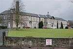 | |||
| Leys Park Road, Former Poorhouse Probationary Ward ('The Lodge'), Including Gatepiers And Boundary Wall | 56°04′32″N 3°26′51″W | Category C(S) | 26031 |  | |||
| Bothwell Street, The Rhodes, Including Gatepiers To Bothwell Street | 56°03′57″N 3°27′16″W | Category B | 26044 | | |||
| Garvock Hill (Corner Of Appin Crescent), Former North Lodge To Transy Estate, Including Railed Wall And Gatepiers To North And East | 56°04′26″N 3°26′42″W | Category C(S) | 26063 | | |||
| Kingseat Road, South Bellyeoman Farmhouse, Including Boundary Wall | 56°05′03″N 3°26′10″W | Category B | 26064 | | |||
| East Port, Carnegie Hall Including Boundary Wall And Steps To North | 56°04′19″N 3°27′13″W | Category B | 26066 |  | |||
| 80 Rose Street, Albany House Including Pavilions And Boundary And Garden Walls | 56°04′34″N 3°27′13″W | Category B | 26074 | | |||
| Dunfermline Abbey, Nave | 56°04′12″N 3°27′50″W | Category A | 25960 | .jpg) | |||
| Pittencrieff Park, Tower Bridge | 56°04′11″N 3°28′04″W | Category B | 25967 | | |||
| 21 Maygate And Abbot Street, Abbot House, Including Gateways And Decorative Ironwork To East And West | 56°04′14″N 3°27′46″W | Category A | 25978 |  | |||
| Abbot Street, Carnegie Library | 56°04′13″N 3°27′43″W | Category B | 25979 |  | |||
| 24-32 (Even Nos) Canmore Street | 56°04′13″N 3°27′32″W | Category C(S) | 25988 | | |||
| 5 Abbey Park Place, Including Boundary Walls | 56°04′11″N 3°27′40″W | Category B | 25995 | | |||
| 25-27 (Odd Nos) East Port | 56°04′17″N 3°27′28″W | Category B | 26012 | 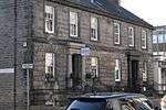 | |||
| Brucefield Avenue, St Leonard's Church (Church Of Scotland), Including Boundary Wall And Gatepiers And Church Hall To East | 56°04′00″N 3°27′15″W | Category B | 26024 |  | |||
| Limekilns, 3 Brucehaven Road, Viewforth Including Garden Wall | 56°02′01″N 3°28′48″W | Category B | 3727 | | |||
| Limekilns, 4 Academy Square, Academy Cottage Including Garden Wall | 56°02′05″N 3°29′01″W | Category B | 3736 | | |||
| Charlestown, Harbour Road, Limekilns | 56°02′09″N 3°30′12″W | Category A | 3741 | | |||
| Rosyth Old Kirk, Burial Ground, Mort House | 56°01′46″N 3°28′11″W | Category B | 3752 | | |||
| Limekilns, 8 The Wellheads, The Elms Including Boundary Wall, Outhouses And Hand Pump | 56°02′02″N 3°28′43″W | Category C(S) | 3753 | | |||
| Limekilns, Ramsay Lane, Murray House | 56°01′59″N 3°28′50″W | Category B | 3754 | | |||
| Pitliver House Including Estate Square, Tennis Pavilion, Polo Stables, Garden Walls And Gatepiers | 56°02′58″N 3°30′31″W | Category B | 3757 | | |||
| Pitfirrane Castle Including Gatepiers | 56°03′31″N 3°30′21″W | Category A | 3759 | .jpg) | |||
| Limekilns, 16 Halketshall, The Ship Inn | 56°02′06″N 3°29′22″W | Category C(S) | 3768 | | |||
| Dunfermline, Headwell Avenue, Headwell House Including Boundary Wall | 56°04′49″N 3°27′13″W | Category B | 3773 | | |||
| Logie House Including Garden Wall, Greenhouse And Gatepiers | 56°03′33″N 3°28′52″W | Category A | 3776 | | |||
| Limekilns, 9 Academy Square, Oriel House | 56°02′05″N 3°29′03″W | Category C(S) | 1644 | | |||
| Leckerstone Farmhouse Including Wall And Gatepiers | 56°02′53″N 3°28′05″W | Category C(S) | 1645 | | |||
| Charlestown, Rocks Road, Old School | 56°02′18″N 3°30′03″W | Category B | 172 | | |||
| Pitreavie Castle, Former East Lodge (The Laich) | 56°02′52″N 3°24′55″W | Category C(S) | 46407 | | |||
| 12 Abbey Park Place | 56°04′12″N 3°27′32″W | Category C(S) | 46877 | | |||
| 95-101 (Odd Nos) Appin Crescent And 2-6 (Even Nos) Couston Street, Former Dunfermline Co-Operative Building | 56°04′25″N 3°26′53″W | Category C(S) | 46879 | | |||
| Bothwell Street Railway Viaduct | 56°04′00″N 3°27′19″W | Category B | 46881 | | |||
| 14-18 (Even Nos) Buchanan Street, Including Outhouse To Nw | 56°04′08″N 3°27′38″W | Category C(S) | 46882 | | |||
| 1 Canmore Street, St Margaret's Hotel | 56°04′13″N 3°27′41″W | Category C(S) | 46886 | | |||
| 12 Chapel Street | 56°04′21″N 3°27′47″W | Category C(S) | 46889 | | |||
| Chisholm Street, Townhill Primary School, Including Gatepiers And Boundary Wall To N, S And W | 56°05′28″N 3°26′17″W | Category C(S) | 46890 | | |||
| Dunfermline Abbey, Entrance Gateways And Boundary Walls And Railings, Including Toolhouse, To Abbey Nave And New Church | 56°04′12″N 3°27′44″W | Category B | 46893 | | |||
| East Port, Pair Of Gatepiers To West Of Carnegie Hall At Nt 0952 8751 | 56°04′16″N 3°27′19″W | Category C(S) | 46902 | | |||
| Off Grange Road To West, Easter Gellet Farm, Original Courtyard-Plan Steading Including Farmhouse | 56°03′05″N 3°27′04″W | Category C(S) | 46908 | | |||
| 6-12 (Even Nos) New Row | 56°04′17″N 3°27′31″W | Category C(S) | 46924 | | |||
| Phoenix Lane, Footbridge Over Former Stirling And Dunfermline Railway | 56°04′32″N 3°28′14″W | Category C(S) | 46928 | | |||
| Pittencrieff Park, South East Gateway, West Nethertown Street | 56°03′59″N 3°27′42″W | Category C(S) | 46936 | | |||
| Pittencrieff Park, West Gateway, Coal Road | 56°04′08″N 3°28′16″W | Category C(S) | 46941 | | |||
| Queen Anne Street, Statue Of Ralph Erskine To South Of Former St Andrew's Erskine Church | 56°04′20″N 3°27′38″W | Category B | 46944 | | |||
| Queensferry Road, Rosyth Parish Church (Church Of Scotland), Including Gatepiers And Boundary Wall | 56°02′20″N 3°25′16″W | Category B | 46945 | | |||
| Woodmill Road, Southwood, Including Garage | 56°04′04″N 3°26′49″W | Category C(S) | 46955 | | |||
| Balmule Including Walled Garden, Coach House, Granary And Gatepiers | 56°06′26″N 3°26′44″W | Category C(S) | 47798 | | |||
| 7-12 (Inclusive Numbers) Charlestown Village, (North Row) | 56°02′14″N 3°29′59″W | Category B | 47808 | | |||
| 13-18 (Inclusive Numbers) Charlestown Village, (North Row) | 56°02′14″N 3°29′57″W | Category B | 47809 | | |||
| 31-33 (Inclusive Numbers) Charlestown Village (Cross Row) And 34-35 Charlestown Village, (Double Row) | 56°02′13″N 3°29′50″W | Category B | 47812 | | |||
| 40-45 (Inclusive Numbers) Charlestown Village, (Double Row) | 56°02′13″N 3°29′54″W | Category B | 47813 | | |||
| 73-78 (Inclusive Numbers) Charlestown Village, (South Row) | 56°02′10″N 3°29′53″W | Category B | 47818 | | |||
| 80-84 (Inclusive Numbers) Charlestown Village, South Row | 56°02′10″N 3°29′57″W | Category B | 47819 | | |||
| Crossford, Main Street, War Memorial | 56°03′50″N 3°29′43″W | Category C(S) | 47827 | | |||
| Priory Lane, Former High School Lodge, Including Gateposts And Boundary Wall To South/ South-East | 56°04′07″N 3°27′33″W | Category C(S) | 26027 | | |||
| Primrose Lane, Primrose Farm Cottage | 56°02′31″N 3°26′26″W | Category C(S) | 26055 | | |||
| Glen Bridge, Over Tower Burn | 56°04′31″N 3°28′08″W | Category B | 26072 | | |||
| 2-18 (Even Nos) Maygate | 56°04′15″N 3°27′48″W | Category B | 25977 | | |||
| 15 Abbey Park Place, Abbey Park House, Including Gateway, Boundary Wall, Railings And Lamp Standards | 56°04′10″N 3°27′33″W | Category B | 25994 | | |||
| 7-9 (Odd Nos) High Street | 56°04′16″N 3°27′49″W | Category C(S) | 26000 | | |||
| 15 East Port, Former Prudential Assurance Offices | 56°04′18″N 3°27′29″W | Category B | 26011 | | |||
| 44-46 (Even Nos) East Port, Robins Cinema | 56°04′19″N 3°27′26″W | Category B | 26015 | | |||
| 1-7 (Inclusive Nos) Queen's Court, Former Commercial School | 56°04′15″N 3°27′22″W | Category B | 26016 | | |||
| Broomhall Policies, Courthill Cottage | 56°02′34″N 3°30′03″W | Category B | 3734 | | |||
| Craigluscar Doocot Including Wall Flanking Driveway | 56°06′03″N 3°30′14″W | Category C(S) | 3739 | | |||
| Charlestown, Fiddler's Hall | 56°02′21″N 3°30′23″W | Category B | 3761 | | |||
| Limekilns, 11 And 13 Main Street | 56°02′04″N 3°29′02″W | Category C(S) | 3765 | | |||
| Limekilns, 13 Halketshall | 56°02′05″N 3°29′20″W | Category C(S) | 3770 | | |||
| 1-6 (Inclusive Numbers) Charlestown Village (North Row) | 56°02′15″N 3°30′04″W | Category B | 1637 | | |||
| 8-14 (Even Nos) Bruce Street, Including The Bruce Tavern | 56°04′17″N 3°27′50″W | Category C(S) | 46287 | | |||
| Baldridgeburn, Mclean Primary School, Including Gatepiers And Boundary Wall To South | 56°04′37″N 3°28′18″W | Category C(S) | 46880 | | |||
| 58 -62 (Even Nos) Buffies Brae | 56°04′30″N 3°28′03″W | Category C(S) | 46884 | | |||
| Comely Park, To North West Of Nos 13-15, Edward Viii Post Box | 56°04′06″N 3°27′16″W | Category B | 46891 |  | |||
| Dunfermline Abbey, Remains Of Dorter And Reredorter Ranges | 56°04′10″N 3°27′48″W | Category A | 46894 | | |||
| 26-28 (Even Nos) Maygate | 56°04′15″N 3°27′46″W | Category C(S) | 46920 | | |||
| Old Linburn Road To East, Entrance Gateway At No 43 (Formerly To Southfod House) | 56°04′25″N 3°25′03″W | Category C(S) | 46925 | | |||
| Park Place, Barum House | 56°04′15″N 3°26′49″W | Category C(S) | 46926 | | |||
| Pittencrieff Park, Summerhouse To North Of Tower Bridge | 56°04′12″N 3°28′05″W | Category C(S) | 46940 | | |||
| St Leonard's Street, St Leonard's Primary School, Including Gateways, Railings And Boundary Wall | 56°03′48″N 3°27′03″W | Category C(S) | 46949 | | |||
| Balmule Farm, Former Farmhouse | 56°06′28″N 3°27′08″W | Category B | 47799 | | |||
| 25-30 (Inclusive Numbers) Charlestown Village, (North Row) | 56°02′14″N 3°29′52″W | Category B | 47811 | | |||
| 62-66 (Inclusive Numbers) Charlestown Village, (Hall Row) | 56°02′11″N 3°29′48″W | Category B | 47816 | | |||
| 67-72 (Inclusive Numbers) Charlestown Village, (South Row) | 56°02′10″N 3°29′51″W | Category B | 47817 | | |||
| 85-90 (Inclusive Numbers) Charlestown Village, (South Row) | 56°02′11″N 3°29′59″W | Category B | 47823 | | |||
| Colton House, Stables Including Walled Garden | 56°05′38″N 3°27′46″W | Category C(S) | 47825 | | |||
| Limekilns, 12 Halketshall | 56°02′05″N 3°29′20″W | Category C(S) | 47833 | | |||
| Limekilns, War Memorial | 56°02′06″N 3°29′29″W | Category C(S) | 47837 | | |||
| 10 Forth Street To Rear, Former Nethertown Railway Bridge | 56°03′53″N 3°27′44″W | Category C(S) | 43674 | | |||
| Leys Park Road, Former Dunfermline Poorhouse And Northern Hospital (Ley's Park Nursing Home), Including Gatepiers And Boundary Wall | 56°04′34″N 3°26′48″W | Category B | 26029 | | |||
| 6-8 (Even Nos) Pilmuir Street, Former Women's Institute | 56°04′22″N 3°27′39″W | Category C(S) | 26038 | | |||
| Carnegie Drive, Dunfermline Fire Station | 56°04′23″N 3°27′45″W | Category B | 26042 | 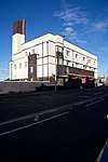 | |||
| Off Woodmill Road To North, Woodmill Bridge Over Lyne Burn | 56°04′17″N 3°25′42″W | Category C(S) | 26049 | | |||
| Pattiesmuir, East Thorne Cottage | 56°02′14″N 3°27′19″W | Category C(S) | 26054 | | |||
| 16-18 (Even Nos) Douglas Street | 56°04′19″N 3°27′39″W | Category C(S) | 26071 | | |||
| Pittencrieff Park, Dovecot | 56°04′18″N 3°28′04″W | Category B | 25971 | 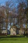 | |||
| Pittencrieff Park, Louise Carnegie Memorial Gateway, Including Detached Lamp Standards, Junction Of Bridge Street And Chalmers Street | 56°04′16″N 3°27′59″W | Category A | 25972 |  | |||
| 4 Canmore Street, Former Burgh Of Dunfermline Gas Department | 56°04′21″N 3°27′40″W | Category C(S) | 25983 | | |||
| 6 Canmore Street, Dunfermline Congregational Church, Including Boundary Wall | 56°04′14″N 3°27′38″W | Category B | 25984 | | |||
| 25 Canmore Street | 56°04′13″N 3°27′37″W | Category B | 25985 | | |||
| High Street, Market Cross To North Of Guildhall Street | 56°04′17″N 3°27′42″W | Category B | 26003 | | |||
| 100 And 102 High Street | 56°04′18″N 3°27′37″W | Category B | 26008 | | |||
| East Port, Holy Trinity Episcopal Church | 56°04′18″N 3°27′20″W | Category B | 26017 | | |||
| Viewfield Terrace, 3-8 (Inclusive Nos) Viewfield House | 56°04′16″N 3°27′18″W | Category B | 26019 | | |||
| Limekilns, 2 And 3 Halketshall | 56°02′05″N 3°29′11″W | Category C(S) | 3730 | | |||
| Limekilns, 8 Red Row, Seaview | 56°02′00″N 3°28′52″W | Category C(S) | 3748 | | |||
| Mid Mill Of Pitliver | 56°02′51″N 3°30′14″W | Category C(S) | 3760 | | |||
| Limekilns, 8 Academy Square, The King's Cellar | 56°02′06″N 3°29′02″W | Category A | 1643 |  | |||
| 7 Canmore Street | 56°04′13″N 3°27′40″W | Category C(S) | 46887 | | |||
| East Port, Viewfield Baptist Church, Including Hall | 56°04′18″N 3°27′22″W | Category B | 46903 | | |||
| Elgin Street, Grange Bridge Over Lyne Burn | 56°03′52″N 3°27′30″W | Category C(S) | 46904 | | |||
| Gardeners Street, Former Albany Works Office Building (Albany Business Centre), Including Gatepiers And Boundary Wall | 56°04′28″N 3°27′21″W | Category C(S) | 46906 | | |||
| 34 And 36 Garvock Hill | 56°04′24″N 3°26′20″W | Category C(S) | 46907 | | |||
| Off Grange Road To West, Wester Gellet Farmhouse, Including Boundary Wall | 56°02′55″N 3°27′28″W | Category C(S) | 46909 | | |||
| 23 Guildhall Street | 56°04′14″N 3°27′42″W | Category C(S) | 46911 | | |||
| Halbeath Road, Entrance Gateway To Dunfermline Cemetery, Including Cemetery Dividing Wall And Gateways To North West And Boundary Wall To Bellyeoman Road | 56°04′39″N 3°26′32″W | Category C(S) | 46912 | | |||
| Hilton Road, 1-4 (Inclusive Nos) Hilton Cottages | 56°02′05″N 3°27′19″W | Category C(S) | 46915 | | |||
| Pittencrieff Park, Bridge To West Of Tower Bridge | 56°04′10″N 3°28′07″W | Category C(S) | 46930 | | |||
| Pittencrieff Park, Footbridge Over Tower Burn At Nt 0884 8733 | 56°04′13″N 3°27′57″W | Category C(S) | 46933 | | |||
| Queensferry Road, Former St Leonard's Hill House, Including Entrance Gateway To South East | 56°03′38″N 3°26′42″W | Category C(S) | 46946 | | |||
| Broomhall Policies, East Lodge Including Gatepiers | 56°02′25″N 3°28′18″W | Category C(S) | 47803 | | |||
| 19-24 (Inclusive Numbers) Charlestown Village, (North Row) | 56°02′14″N 3°29′55″W | Category B | 47810 | | |||
| Colton House Including Sundial And Gatepiers | 56°05′36″N 3°27′49″W | Category C(S) | 47824 | | |||
| Keavil House Hotel | 56°03′31″N 3°30′05″W | Category C(S) | 47829 | | |||
| Leckerstone Farm | 56°02′54″N 3°28′04″W | Category C(S) | 47830 | | |||
| Lochhead | 56°05′59″N 3°28′36″W | Category C(S) | 47839 | | |||
| St Margaret's Drive, Dunfermline Public Park, Bandstand | 56°04′12″N 3°27′04″W | Category B | 45589 | | |||
| Milepost, A823, North West Of Outh | 56°08′18″N 3°31′01″W | Category C(S) | 45591 | | |||
| 33 East Port | 56°04′18″N 3°27′26″W | Category B | 43886 | | |||
| 34 Queen Anne Street | 56°04′19″N 3°27′42″W | Category B | 26033 | | |||
| 42-44 (Even Nos) Queen Anne Street, Head Post Office, Including Former Stable Yard And Boundary Wall | 56°04′20″N 3°27′41″W | Category B | 26034 | | |||
| Bothwell Street, Former St Leonard's Works Warehouse And Office Block (Erskine Beveridge Court), Including Entrance Piers To West | 56°03′55″N 3°27′09″W | Category B | 26045 | | |||
| Off Old Mill Court, Brucefield House | 56°03′56″N 3°26′44″W | Category B | 26046 | | |||
| Off Woodmill Road To North, Woodmill Farmhouse, Including Attached Outbuilding To West | 56°04′17″N 3°25′42″W | Category C(S) | 26047 | | |||
| Pittencrieff Park, Telephone Kiosk To West Of Pittencrieff House | 56°04′08″N 3°28′09″W | Category B | 26067 | | |||
| Pittencrieff Park, Statue Of Andrew Carnegie | 56°04′16″N 3°28′06″W | Category B | 25970 | | |||
| 5-7 (Odd Nos) Abbot Street | 56°04′13″N 3°27′44″W | Category B | 25980 | | |||
| 33 Canmore Street, Alhambra Bingo Hall | 56°04′11″N 3°27′29″W | Category B | 25991 | | |||
| 11 Abbey Park Place | 56°04′11″N 3°27′37″W | Category B | 25996 | | |||
| New Row, Comely Park House, Including Boundary Wall, Walled Garden And Outhouses To North | 56°04′10″N 3°27′25″W | Category C(S) | 26022 | | |||
| New Row, Comely Park House Sundial | 56°04′09″N 3°27′24″W | Category B | 26023 | | |||
| Limekilns, Kiln North Of 12 And 14 Main Street | 56°02′05″N 3°28′59″W | Category C(S) | 3728 | | |||
| Limekilns, 10 Halketshall | 56°02′06″N 3°29′19″W | Category B | 3737 | | |||
| Limekilns, 1 Brucehaven Road, The Gables Including Garden Wall | 56°02′02″N 3°28′47″W | Category B | 3738 | | |||
| Broomhall Including Garden Balustrade, Kitchen Court Walls Larder And Stables | 56°02′14″N 3°28′59″W | Category A | 3745 | | |||
| Broomhall, Ice-House And Summer-House | 56°02′10″N 3°29′06″W | Category B | 3746 | | |||
| Limekilns, 11 Halketshall | 56°02′05″N 3°29′19″W | Category B | 3747 | | |||
| Crossford, 57 And 59 Main Street | 56°03′48″N 3°29′53″W | Category C(S) | 3758 | | |||
| Limekilns, 26 Main Street Including Boundary Wall | 56°02′05″N 3°29′03″W | Category B | 3764 | | |||
| 2-8 (Even Nos) Abbot Street | 56°04′14″N 3°27′42″W | Category B | 46878 | | |||
| Monastery Street (South Side), World War I Memorial | 56°04′08″N 3°27′48″W | Category C(S) | 46921 | | |||
| 7 Nethertown Broad Street, Former Nethertown Institute (Dell Farquharson Community Leisure Centre) | 56°03′59″N 3°27′27″W | Category C(S) | 46923 | | |||
| Pittencrieff Park, Pittencrieff Lodge And Gateway (Pittencrieff Street) | 56°04′18″N 3°28′11″W | Category C(S) | 46935 | | |||
| 123 Rose Street, Including Walled Yard To North | 56°04′37″N 3°27′07″W | Category C(S) | 46947 | | |||
| Rumblingwell, Milesmark Primary School, Including Boundary Wall | 56°04′43″N 3°29′00″W | Category C(S) | 46948 | | |||
| Walmer Drive (East Side), Former Villa To South Of And Forming Part Of Fife Council Housing Service | 56°04′16″N 3°27′25″W | Category C(S) | 46953 | | |||
| 56-59 (Inclusive Numbers) Charlestown Village, (Lochaber) | 56°02′13″N 3°29′46″W | Category B | 47814 | | |||
| 1 Moodie Street, Old Kirk House (Former Abbey Church Manse), Including Gateway And Boundary Wall | 56°04′04″N 3°27′44″W | Category B | 26028 | | |||
| Queen Anne Street, Former Saint Andrew's Erskine Church, Including Boundary Wall | 56°04′21″N 3°27′37″W | Category B | 26035 | | |||
| Limekilns Road, Remains Of Windmill To East Of Hill House | 56°03′26″N 3°27′36″W | Category B | 26051 | | |||
| Off Grange Road To West, Blackhall Farmhouse | 56°02′37″N 3°27′06″W | Category B | 26052 | | |||
| Murray Road, Rosyth Castle | 56°01′24″N 3°25′54″W | Category A | 26060 | | |||
| 5-11 (Odd Nos) Douglas Street | 56°04′18″N 3°27′40″W | Category C(S) | 26070 | | |||
| Dunfermline Abbey, Gatehouse | 56°04′10″N 3°27′51″W | Category A | 25963 | | |||
| Pittencrieff Park, Pittencrieff House, Including Parapet Wall To North | 56°04′09″N 3°28′02″W | Category A | 25968 | | |||
| 11 Guildhall Street, Former Employment Exchange Building | 56°04′15″N 3°27′43″W | Category C(S) | 25998 | | |||
| 81-85 (Odd Nos) High Street And 4 Guildhall Street, Former Guildhall | 56°04′16″N 3°27′41″W | Category A | 25999 |  | |||
| 38 High Street | 56°04′17″N 3°27′45″W | Category C(S) | 26006 | | |||
| 1-3 (Odd Nos) East Port, Former Bank Of Scotland | 56°04′17″N 3°27′31″W | Category B | 26010 |  | |||
| East Port, St Margaret's Roman Catholic Church | 56°04′21″N 3°27′17″W | Category B | 26018 | | |||
| 2-4 (Even Nos) Moodie Street And 5 Priory Lane, Andrew Carnegie Birthplace Memorial, Including Boundary Walls And Railings | 56°04′05″N 3°27′40″W | Category B | 26026 | | |||
| Rosyth Old Kirk Including Burial Ground And Boundary Wall | 56°01′47″N 3°28′10″W | Category B | 3751 | | |||
| South Fod House Including Gatepiers | 56°04′30″N 3°24′31″W | Category B | 3774 | | |||
| Broomhall, Limekilns, 9 The Old Orchard Garden, Broomhall Doocot | 56°02′06″N 3°28′51″W | Category B | 1639 | | |||
| Limekilns, 10 Church Street, Manse And Boundary Wall | 56°02′04″N 3°28′50″W | Category B | 1641 | | |||
| Charlestown, Rocks Road, Former Estate Workshop, Scottish Lime Centre | 56°02′15″N 3°30′03″W | Category C(S) | 207 | | |||
| Golfdrum Street, North Parish Church (Church Of Scotland) | 56°04′31″N 3°28′08″W | Category C(S) | 45779 | | |||
| 13 Abbey Park Place | 56°04′11″N 3°27′36″W | Category C(S) | 46876 | | |||
| 5-7 (Odd Nos) East Port, Including East Port Bar | 56°04′17″N 3°27′31″W | Category C(S) | 46896 | | |||
| Monastery Street (North Side), World War Ii Memorial | 56°04′10″N 3°27′47″W | Category C(S) | 46922 | | |||
| Priory Lane, Dunfermline Bowling Club Pavilion, Including Boundary Wall | 56°04′06″N 3°27′35″W | Category C(S) | 46943 | | |||
| 60-61 Charlestown Village, (Hall Row) | 56°02′11″N 3°29′47″W | Category B | 47815 | | |||
| Limekilns, 6 Dunfermline Road, The Old School House Including Boundary Wall | 56°02′06″N 3°28′39″W | Category C(S) | 47831 | | |||
| Limekilns, Dunfermline Road, Limekilns Primary School Including Boundary Wall | 56°02′08″N 3°28′35″W | Category C(S) | 47832 | | |||
| Limekilns, 3 Warrington Court | 56°02′04″N 3°28′55″W | Category C(S) | 47838 | | |||
| Logie House, Lodge And Gatepiers | 56°03′52″N 3°29′23″W | Category C(S) | 47843 | | |||
| Milepost, A823, South Of Muirside | 56°05′57″N 3°27′56″W | Category C(S) | 47845 | | |||
| Wester Craigduckie Farmhouse Including Gatepiers And Wall | 56°06′26″N 3°26′20″W | Category C(S) | 47846 | | |||
| Pilmuir Street, Victoria Works (Castleblair Ltd), Including Boundary Wall To South And West | 56°04′32″N 3°27′37″W | Category B | 26041 | | |||
| Limekilns Road, Hill House, Including Walled Garden And Two Pairs Of Gatepiers To West | 56°03′29″N 3°27′37″W | Category A | 26050 | | |||
| Pattiesmuir, Ingleneuk And Ingleside | 56°02′14″N 3°27′17″W | Category C(S) | 26053 | | |||
| East Port, Carnegie Music Institute | 56°04′19″N 3°27′12″W | Category B | 26065 | | |||
| 3-13 (Odd Nos) Bruce Street | 56°04′17″N 3°27′51″W | Category C(S) | 26068 | | |||
| 28-34 (Even Nos) Bruce Street | 56°04′19″N 3°27′49″W | Category C(S) | 26069 | | |||
| Dunfermline Abbey, New Abbey Parish Church, Church Of Scotland | 56°04′12″N 3°27′50″W | Category A | 25961 | | |||
| 3 Bridge Street, City Chambers | 56°04′15″N 3°27′51″W | Category A | 25973 | .jpg) | |||
| 27 Canmore Street | 56°04′13″N 3°27′36″W | Category B | 25986 | | |||
| 29 Canmore Street | 56°04′13″N 3°27′34″W | Category B | 25987 | | |||
| 25 High Street | 56°04′16″N 3°27′47″W | Category B | 26001 |  | |||
| 125 High Street | 56°04′16″N 3°27′36″W | Category C(S) | 26002 | | |||
| 82 High Street And 1 Douglas Street | 56°04′18″N 3°27′40″W | Category B | 26007 | | |||
| 104-106 High Street | 56°04′18″N 3°27′36″W | Category B | 26009 | | |||
| 35-41 (Odd Nos) East Port, Including Railings | 56°04′18″N 3°27′25″W | Category B | 26013 | | |||
| 43-45 (Odd Nos) East Port, Century House | 56°04′18″N 3°27′24″W | Category B | 26014 | 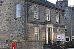 | |||
| 60 New Row, British Legion Club (Front Building) | 56°04′13″N 3°27′27″W | Category B | 26020 | | |||
| Limekilns, 7 Halketshall | 56°02′06″N 3°29′17″W | Category C(S) | 3731 | | |||
| Brucehaven Farmhouse Including Garden Wall | 56°02′07″N 3°27′41″W | Category C(S) | 3732 | | |||
| Charlestown, 8, 10, 14, The Sutlery, 16, 18 Rocks Road, Including Letterbox | 56°02′16″N 3°30′03″W | Category B | 3742 | | |||
| Limekilns, 11 Academy Square, Hope Cottage | 56°02′05″N 3°29′03″W | Category B | 3763 | | |||
| Limekilns, 5 Halketshall | 56°02′06″N 3°29′15″W | Category B | 3767 | | |||
| Limekilns, 14A, 14B Halketshall, Kingcraig, 15 Halketshall, Somervail Including Garden Wall | 56°02′06″N 3°29′21″W | Category B | 3769 | | |||
| Craigluscar House Including Garden Walls | 56°06′03″N 3°30′13″W | Category C(S) | 3772 | | |||
| 22-24 (Even Nos) Buchanan Street, Including Outhouse To Nw | 56°04′07″N 3°27′37″W | Category C(S) | 46883 | | |||
| 5 Guildhall Street, Somewhere Else | 56°04′16″N 3°27′42″W | Category C(S) | 46910 | | |||
| 53 And 55 High Street | 56°04′16″N 3°27′44″W | Category C(S) | 46913 | | |||
| Pittencrieff Park, East Gateway, St Catherine's Wynd, Including Boundary Wall | 56°04′12″N 3°27′53″W | Category B | 46932 | | |||
| Broomhall Policies, Former Brick Works, Drying Shed And Chimney | 56°02′29″N 3°29′24″W | Category C(S) | 47804 | | |||
| Craigduckie Cottage | 56°06′36″N 3°25′48″W | Category C(S) | 47826 | | |||
| Dunfermline, Broomhead Mews Including Gatepiers | 56°04′45″N 3°27′50″W | Category C(S) | 47828 | | |||
| Limekilns, Main Street, K6 Telephone Kiosk | 56°02′03″N 3°28′58″W | Category B | 47834 | | |||
| Rosyth Dockyard, Power Station (Building No 333) | 56°01′31″N 3°26′46″W | Category B | 50783 | | |||
| Rosyth Dockyard, Barham Road, Signal Box At Nt 10953 82170 | 56°01′27″N 3°25′49″W | Category C(S) | 50785 | | |||
| 30-32 (Even Nos) Queen Anne Street, Including Railings And Gatepiers To West | 56°04′19″N 3°27′43″W | Category B | 26032 | | |||
| Chapel Street, Gillespie Memorial Church, (Church Of Scotland), Including Boundary Wall And Gatepiers To West | 56°04′21″N 3°27′45″W | Category C(S) | 26037 | | |||
| 65 Inglis Street And Pilmuir Street, Carnegie Clinic | 56°04′26″N 3°27′37″W | Category B | 26040 | | |||
| Hilton Road, Hilton Farmhouse | 56°02′05″N 3°27′05″W | Category B | 26056 | | |||
| Off Queensferry Road, Pitreavie Castle | 56°02′54″N 3°25′06″W | Category A | 26058 | | |||
| Off Ferry Toll Road To South Rosyth Castle, Dovecot | 56°01′29″N 3°25′45″W | Category A | 26061 | | |||
| Pilmuir Street, And Returns To Foundry Street And Cousins Lane, Pilmuir Works, Including Gatepiers And Boundary Wall To West | 56°04′27″N 3°27′43″W | Category A | 26073 | 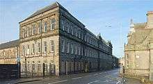 | |||
| Dunfermline Abbey, Remains Of Palace And Kitchen | 56°04′10″N 3°27′53″W | Category A | 25965 | | |||
| 32-36 (Even Nos) Bridge Street | 56°04′17″N 3°27′56″W | Category C(S) | 25974 | | |||
| 13-15 (Odd Nos) Kirkgate, The Old Inn | 56°04′15″N 3°27′52″W | Category C(S) | 25976 | 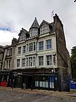 | |||
| 2 Canmore Street | 56°04′14″N 3°27′41″W | Category B | 25982 | | |||
| 66 High Street | 56°04′17″N 3°27′42″W | Category B | 26004 | | |||
| 60-64 High Street, Clydesdale Bank | 56°04′17″N 3°27′43″W | Category B | 26005 | | |||
| Off Reid Street To E, Priory House, Formerly Dunfermline And West Fife Hospital Nurses' Home | 56°04′00″N 3°27′26″W | Category B | 26025 | | |||
| Broomhall Policies, Hillock | 56°02′29″N 3°28′22″W | Category C(S) | 3735 | | |||
| Charlestown, Camsie House Including Ancillary Buildings And Garden Wall | 56°02′13″N 3°30′17″W | Category B | 3740 | | |||
| Charlestown Village, The Queen's Hall | 56°02′11″N 3°29′46″W | Category B | 3743 | | |||
| Charlestown, Saltpans, Easter Cottage Including Boundary Wall | 56°02′08″N 3°29′52″W | Category B | 3744 | | |||
| Limekilns, Brucehaven Road Forth Cruising Club, Club House Including Boundary Wall | 56°01′54″N 3°28′40″W | Category B | 3749 | | |||
| Charlestown, Bridge Of Former Elgin Railway | 56°02′13″N 3°30′25″W | Category B | 3755 | | |||
| Charlestown Harbour | 56°02′06″N 3°30′02″W | Category B | 3756 | | |||
| Dunfermline, Broomhead House Including Balustraded Wall | 56°04′45″N 3°27′50″W | Category B | 3775 | | |||
| Logie House, Steading | 56°03′41″N 3°29′06″W | Category A | 3777 | | |||
| Broomhall, Limekilns, 9 The Old Orchard Including Outhouse | 56°02′05″N 3°28′51″W | Category B | 1638 | | |||
| 31 Canmore Street | 56°04′12″N 3°27′29″W | Category C(S) | 46888 | | |||
| Dunfermline Abbey, Remains Of Frater Range | 56°04′10″N 3°27′50″W | Category A | 46895 | | |||
| 58-64 (Even Nos) East Port, Lorne House | 56°04′19″N 3°27′22″W | Category C(S) | 46901 | | |||
| Foundry Street, St Margaret's Works (Castleblair Ltd) | 56°04′31″N 3°27′44″W | Category B | 46905 | 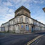 | |||
| 78-80 High Street | 56°04′18″N 3°27′40″W | Category C(S) | 46914 | | |||
| 6 Kirkgate, Tappie Toories | 56°04′15″N 3°27′49″W | Category C(S) | 46916 | | |||
| Parkgate, Former Rosyth Institute (Parkgate Community Leisure Centre) | 56°02′22″N 3°25′07″W | Category C(S) | 46927 | | |||
| 58-73 (Inclusive Nos) Skibo Court, Former High School, Including Gateway To Buchanan Street | 56°04′07″N 3°27′33″W | Category B | 46951 | 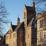 | |||
| Woodmill Road, Brucefield Manor Hotel | 56°04′08″N 3°26′28″W | Category C(S) | 46954 | | |||
| Charlestown, Iron Mill Road, Towers | 56°02′30″N 3°30′43″W | Category C(S) | 47805 | | |||
| Charlestown, 12 Rocks Road, The School House Including Boundary Wall | 56°02′17″N 3°30′00″W | Category C(S) | 47807 | | |||
| Limekilns, Sandilands Lane, Wellhead House Including The Neuk And Garden Wall | 56°02′03″N 3°28′44″W | Category C(S) | 47836 | | |||
| Milesmark, Elgin Cottage Including Greenhouse, Boundary Wall And Gatepiers | 56°04′53″N 3°29′46″W | Category C(S) | 47844 | | |||
| 19, 21, 23 Kirkgate | 56°04′14″N 3°27′51″W | Category B | 49094 | | |||
| Rosyth, Hms Caledonia, Figurehead Of Admiral Duncan | 56°01′56″N 3°26′53″W | Category C(S) | 50979 | | |||
| 42 Pilmuir Street, Carnegie Leisure Centre | 56°04′27″N 3°27′38″W | Category B | 26039 | | |||
| Pitreavie Castle, Dovecot To North East | 56°02′56″N 3°25′01″W | Category B | 26059 | | |||
| St John's Drive, Garvock House Hotel, Including Boundary Wall And Gatepiers | 56°04′17″N 3°26′36″W | Category B | 26062 | | |||
| 26-30 (Even Nos) Bridge Street | 56°04′17″N 3°27′55″W | Category C(S) | 25975 | | |||
| 26-28 (Inclusive Nos) Guildhall Street | 56°04′15″N 3°27′41″W | Category C(S) | 25997 | | |||
| 85 New Row, Wilson's Institution | 56°04′10″N 3°27′28″W | Category B | 26021 | | |||
| Limekilns, Sandilands, Forth Cottage | 56°02′02″N 3°28′47″W | Category C(S) | 3726 | | |||
| Limekilns Harbour, Limekilns Pier | 56°02′01″N 3°29′10″W | Category C(S) | 3729 | | |||
| Gallowridge Hill Farmhouse And Granary | 56°03′16″N 3°28′31″W | Category B | 3733 | | |||
| Limekilns, Brucehaven Harbour, Capernaum Pier | 56°01′51″N 3°28′43″W | Category C(S) | 3750 | | |||
| Limekilns, 16 Main Street, Green Island (Formerly Sunnyside), Including Garden Wall | 56°02′05″N 3°29′01″W | Category C(S) | 3762 | | |||
| Dunnygask Farmhouse | 56°07′12″N 3°30′51″W | Category C(S) | 3771 | | |||
| Limekilns, Church Street, Limekilns Parish Church (Church Of Scotland) And Boundary Wall | 56°02′03″N 3°28′51″W | Category B | 1640 | | |||
| Limekilns, 6 Main Street, Brewstead | 56°02′04″N 3°28′58″W | Category B | 1642 | | |||
| Former Viaduct To East Of Buffies Brae At Nt 0888 8786 | 56°04′31″N 3°28′02″W | Category C(S) | 46885 | | |||
| Douglas Street, The Commercial Inn | 56°04′19″N 3°27′40″W | Category C(S) | 46892 | | |||
| Pittencrieff Park, Music Pavilion And Cafeteria, Including Terraced Seating To North | 56°04′09″N 3°28′12″W | Category B | 46934 | | |||
| 39 Priory Lane, Former Masonic Lodge | 56°04′05″N 3°27′35″W | Category B | 46942 | | |||
| 1-57 (Inclusive Nos) Skibo Court, Former Lauder Technical College | 56°04′07″N 3°27′31″W | Category B | 46950 | 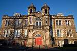 | |||
| 33 Townhill Road | 56°04′35″N 3°27′01″W | Category C(S) | 46952 | | |||
| Bowleys | 56°07′12″N 3°27′11″W | Category C(S) | 47800 | | |||
| Charlestown, K6 Telephone Kiosk | 56°02′12″N 3°30′03″W | Category B | 47806 | | |||
| Rosyth Dockyard, Pumping Station (Building No 500) | 56°01′27″N 3°26′48″W | Category B | 50784 | |
Key
The scheme for classifying buildings in Scotland is:
- Category A: "buildings of national or international importance, either architectural or historic; or fine, little-altered examples of some particular period, style or building type."[1]
- Category B: "buildings of regional or more than local importance; or major examples of some particular period, style or building type, which may have been altered."[1]
- Category C: "buildings of local importance; lesser examples of any period, style, or building type, as originally constructed or moderately altered; and simple traditional buildings which group well with other listed buildings."[1]
In March 2016 there were 47,288 listed buildings in Scotland. Of these, 8 per cent were Category A, and 50 per cent were Category B, with the rest listed at Category C.[2]
See also
Notes
- Sometimes known as OSGB36, the grid reference (where provided) is based on the British national grid reference system used by the Ordnance Survey.
• "Guide to National Grid". Ordnance Survey. Retrieved 2007-12-12.
• "Get-a-map". Ordnance Survey. Retrieved 2007-12-17. - Historic Environment Scotland assign a unique alphanumeric identifier to each designated site in Scotland, for listed buildings this always begins with "LB", for example "LB12345".
References
- All entries, addresses and coordinates are based on data from Historic Scotland. This data falls under the Open Government Licence
- "What is Listing?". Historic Environment Scotland. Retrieved 29 May 2018.
- Scotland's Historic Environment Audit 2016 (PDF). Historic Environment Scotland and the Built Environment Forum Scotland. pp. 15–16. Retrieved 29 May 2018.
This article is issued from Wikipedia. The text is licensed under Creative Commons - Attribution - Sharealike. Additional terms may apply for the media files.