List of listed buildings in Dundee/4
List
| Name | Location | Date Listed | Grid Ref. [note 1] | Geo-coordinates | Notes | LB Number [note 2] | Image |
|---|---|---|---|---|---|---|---|
| 5 Magdalen Place, Magdalen Hotel | 56°27′15″N 2°59′13″W | Category C(S) | 25459 |  | |||
| 43 Magdalen Yard Road, "The Vine", Including Garden Walls And Gatepiers | 56°27′12″N 2°59′13″W | Category A | 25469 | | |||
| 8 Salem Street, Salem Cottage | 56°27′51″N 2°58′32″W | Category C(S) | 25473 | | |||
| 55 Magdalen Yard Road And Garden Ornaments | 56°27′13″N 2°59′22″W | Category B | 25475 | | |||
| 1, 2 Somerville Place With Boundary Walls | 56°28′00″N 2°58′50″W | Category B | 25476 | | |||
| 3 And 4 Somerville Place And Detached Former Billiard Room At 2-6 (Even Nos) Upper Constitution Street And Boundary Walls To Upper Constitution Street And Somerville Place | 56°28′01″N 2°58′47″W | Category B | 25479 | | |||
| 67 Magdalen Yard Road, The Shrubbery | 56°27′13″N 2°59′33″W | Category B | 25487 | | |||
| 2-6 (Even Nos) Panmure Street, Meadowside, Former Union Bank Of Scotland | 56°27′48″N 2°58′13″W | Category B | 25498 | | |||
| Rattray Street, Former Baptist Church | 56°27′43″N 2°58′34″W | Category B | 25516 | | |||
| 1 South George Street, 15 And 15A Nelson Street | 56°28′02″N 2°58′04″W | Category B | 25333 | | |||
| Harestane Road, Bridge | 56°29′44″N 2°59′12″W | Category C(S) | 25334 | | |||
| 93, 95 High Street, Lochee And Return Elevation To Burnside Street, Clydesdale Bank Ltd | 56°28′19″N 3°00′33″W | Category B | 25353 | | |||
| 365 Blackness Road With Boundary Walls And Gatepiers | 56°27′36″N 3°00′54″W | Category B | 25380 | | |||
| Kingsway West Camperdown Van Leer Factory (Formerly Ncr) | 56°28′54″N 3°01′25″W | Category B | 25381 | | |||
| 430 Blackness Road, "Braeknowe" With Boundary Walls | 56°27′32″N 3°01′07″W | Category C(S) | 25388 | | |||
| 99-103 (Odd Nos) Nethergate, 1 Tay Street Lane | 56°27′29″N 2°58′30″W | Category C(S) | 25394 | | |||
| 8 Dudhope Street With Boundary Walls And Gatepiers | 56°27′54″N 2°58′32″W | Category C(S) | 25214 | | |||
| 5 Dudhope Terrace | 56°27′59″N 2°58′58″W | Category B | 25242 | | |||
| 113 Hilltown, And 1, 3 Ann Street, Including The Windmill Bar | 56°28′01″N 2°58′20″W | Category B | 25256 | | |||
| Park Place, Scrymgeour Building, University Of Dundee, Including Boundary Walls And Railings | 56°27′29″N 2°58′41″W | Category B | 25269 |  | |||
| 11-19 (Odd Nos) North Ellen Street, "The Faces Land" | 56°28′12″N 2°58′07″W | Category B | 25291 | | |||
| 13-19 (Odd Nos) Forfar Road | 56°28′34″N 2°57′13″W | Category C(S) | 25303 | | |||
| 5, 7, 9 Cowgate/75-79 (Odd Nos) Murraygate, Baldragon House | 56°27′48″N 2°58′06″W | Category B | 25117 | | |||
| 2 Wallace Street And 2 Broughty Ferry Road, Wallace Craigie Works | 56°27′59″N 2°57′28″W | Category B | 25132 | | |||
| West Henderson's Wynd, Douglas Court, Former Douglas Mill On Milne's East Wynd, Near Douglas Street | 56°27′44″N 2°59′09″W | Category B | 25156 | | |||
| Constitution Street, Rosebank Church With Boundary Walls And Gatepiers | 56°28′02″N 2°58′37″W | Category B | 25157 | | |||
| Arbroath Road, 60 Taybank Works, Tay Spinners Ltd | 56°28′10″N 2°57′18″W | Category B | 25175 | | |||
| 24 Euclid Crescent, High School, (Former Girls' School) | 56°27′45″N 2°58′27″W | Category A | 25189 | | |||
| 1 Drummond Street With Boundary Walls | 56°28′03″N 2°58′53″W | Category C(S) | 25192 | | |||
| Dudhope Castle, Well | 56°27′51″N 2°59′03″W | Category B | 25198 | | |||
| 1-5 (Odd Nos) Dudhope Street And 63-69 (Odd Nos) Constitution Road, Rustic Place | 56°27′52″N 2°58′34″W | Category B | 25202 | | |||
| 2 Lochee Road, Tay Works | 56°27′44″N 2°58′45″W | Category A | 25030 | | |||
| 12 Bright Street Lochee Baptist Church | 56°28′26″N 3°00′38″W | Category C(S) | 25035 | | |||
| 40 Castle Street, Former Stewart's Distillers' Office Entrance | 56°27′38″N 2°58′04″W | Category B | 25036 | | |||
| Methven Street, Camperdown Works, Calender Block | 56°28′24″N 3°00′32″W | Category B | 25048 | | |||
| 240 And 242 Broughty Ferry Road | 56°28′07″N 2°55′56″W | Category C(S) | 25051 | | |||
| Methven Street, Camperdown Works, Offices, Lodge And Gate | 56°28′23″N 3°00′28″W | Category B | 25053 | | |||
| Caird Park Mains Castle | 56°29′08″N 2°57′29″W | Category A | 25066 | 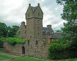 | |||
| Methven Street, Camperdown Works, Jute Warehouses Nos 1-4 (By Former Railway) | 56°28′19″N 3°00′19″W | Category B | 25069 | | |||
| Caird Park, Old Mains Churchyard With Graham Of Fintry Vault | 56°29′10″N 2°57′29″W | Category C(S) | 25070 | | |||
| 12 Milnbank Road (Aimer's Ltd) | 56°27′43″N 2°59′28″W | Category B | 25077 | | |||
| 20 Commercial Street, Iron Warehouse | 56°27′40″N 2°58′03″W | Category B | 25087 | | |||
| Camperdown Country Park Sawmill, Workshops, Formerly Stables | 56°29′04″N 3°02′46″W | Category B | 25090 | | |||
| 11-13 Princes Street And Return Elevation To Dens Street With Gate | 56°27′57″N 2°57′44″W | Category C(S) | 25097 | | |||
| Camperdown Country Park West Lodge And Gates | 56°29′03″N 3°03′02″W | Category B | 25098 | | |||
| Albert Square, Statue Of George Kinloch | 56°27′46″N 2°58′19″W | Category B | 24934 | .jpg) | |||
| 22 Albany Terrace With Boundary Walls And Gatepiers | 56°28′01″N 2°59′15″W | Category C(S) | 24938 | | |||
| 45 Ancrum Road Ancrum Rd Primary School & Janitors House | 56°28′09″N 3°00′31″W | Category B | 24953 | | |||
| 20 Brown Street, And Return Elevations To 8 Guthrie Street, And Session Street, South Mills | 56°27′38″N 2°58′47″W | Category A | 24965 | | |||
| 3 Bell Street, Abertay University, Former James Church | 56°27′46″N 2°58′27″W | Category B | 24968 | | |||
| Victoria Dock, South Shed (Consortium Conservation Ltd) | 56°27′46″N 2°57′25″W | Category B | 24976 | | |||
| 40 Bell Street, Abertay University, Including Former Boiler House And North Wing | 56°27′49″N 2°58′26″W | Category B | 24983 | | |||
| Victoria Dock, East Graving Or Dry Dock And Pump House | 56°27′44″N 2°57′24″W | Category B | 24986 | | |||
| Castle Hill, South West Corner Of Commercial Street And High Street, Castle Hill House, Including Boundary Wall | 56°27′40″N 2°58′04″W | Category A | 24993 | | |||
| Castle Hill, St Paul's Episcopal Cathedral, Including Steps And Boundary Wall | 56°27′39″N 2°58′05″W | Category A | 24997 | | |||
| 23, 25 Castle Street | 56°27′38″N 2°58′07″W | Category C(S) | 25005 | | |||
| 2, 3 Albany Terrace With Boundary Walls And Gatepiers | 56°28′03″N 2°58′57″W | Category C(S) | 24929 | | |||
| Brook Street, St Aidan's Church Hall, Former East School | 56°27′58″N 2°52′11″W | Category C(S) | 50904 | | |||
| West Ferry, 87 And 89 Dundee Road, Bryans, Including Boundary Wall And Gatepiers | 56°28′13″N 2°53′45″W | Category B | 25925 | | |||
| West Ferry, 17 Fairfield Road, Red Court Including Sundial, Lamp Standard, Gatepiers, Boundary And Garden Walls | 56°28′19″N 2°54′02″W | Category A | 25938 | | |||
| West Ferry, 17 Fairfield Road, Red Court Laundry | 56°28′19″N 2°54′07″W | Category C(S) | 25941 | | |||
| West Ferry, 26 Victoria Road, Aystree, Including Conservatory, Wall And Gatepiers | 56°28′16″N 2°53′10″W | Category A | 25950 | | |||
| 1 Hazel Drive | 56°27′33″N 3°01′35″W | Category B | 25958 | | |||
| Broughty Ferry, 81 Monifieth Road, Bartley Lodge, Including Boundary Wall, Gatepiers And Entrance Gateway | 56°28′10″N 2°51′37″W | Category B | 25856 | | |||
| Broughty Ferry, 51 Queen Street, (Formerly) Kingsway Bingo, Regal Cinema And Volunteer Hall | 56°28′09″N 2°52′45″W | Category B | 25866 | | |||
| Broughty Ferry, 9 West Queen Street, Falcon Lodge, Including Boundary Wall | 56°28′10″N 2°52′55″W | Category B | 25886 | | |||
| Pitkerro, Pitkerro House, Including Garden Walls And Ruined Dovecot | 56°29′33″N 2°53′22″W | Category A | 25895 | | |||
| Broughty Ferry, 383 Brook Street | 56°28′00″N 2°52′12″W | Category C(S) | 25768 | | |||
| Broughty Ferry, 35 Camperdown Street, Including Wall And Gatepiers, Cyandy | 56°28′11″N 2°52′35″W | Category B | 25776 | | |||
| Broughty Ferry, 4, 6 Dundas Street, Braehead House | 56°27′56″N 2°52′43″W | Category B | 25791 | | |||
| Broughty Ferry, 10 Fort Street And 4 Bell's Lane Fisherman's Tavern | 56°27′55″N 2°52′37″W | Category C(S) | 25811 | | |||
| Broughty Ferry, 4 Forthill Road, Hillside, And 1B Hill Street, Hillfoot, Including Boundary Wall And Gatepiers | 56°28′12″N 2°52′30″W | Category C(S) | 25818 | | |||
| Broughty Ferry, 4 Hill Street, With Wall And Gatepiers | 56°28′10″N 2°52′27″W | Category C(S) | 25840 | | |||
| St Peter's Street And Perth Road, St Peter's Churchyard Including Mccheyne Monument | 56°27′22″N 2°59′27″W | Category C(S) | 25676 | | |||
| 8 Tait's Lane | 56°27′26″N 2°59′39″W | Category B | 25680 | | |||
| Tay Railway Bridge | 56°26′20″N 2°59′19″W | Category A | 25681 | | |||
| Balmossie, Road Bridge Over Dichty Water | 56°28′53″N 2°51′04″W | Category B | 25738 | 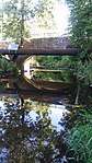 | |||
| Broughty Ferry, 6 Bath Street, Gowan Lea | 56°27′55″N 2°52′28″W | Category C(S) | 25756 | | |||
| Broughty Ferry, 8 Bath Street | 56°27′55″N 2°52′28″W | Category C(S) | 25757 | | |||
| 30, 32, 34 Union Street | 56°27′33″N 2°58′14″W | Category B | 25592 | | |||
| 140 Perth Road | 56°27′22″N 2°58′59″W | Category B | 25593 | | |||
| 152-4 Perth Road (Formerly Valentine's) | 56°27′22″N 2°59′05″W | Category C(S) | 25597 | | |||
| 15, 17, 19 Ward Road, Former Methodist Church And Adjoining Offices, Including Steps And Railings | 56°27′42″N 2°58′33″W | Category C(S) | 25602 | | |||
| 328 Perth Road, Mccheyne Memorial Church | 56°27′22″N 2°59′44″W | Category A | 25603 | 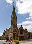 | |||
| 444, 446 Perth Road, Taygrove And Riversdale, With Boundary Walls And Gatepiers | 56°27′23″N 3°00′12″W | Category B | 25615 | | |||
| 17, 19 And 21 Whitehall Crescent | 56°27′32″N 2°58′13″W | Category B | 25643 | | |||
| 11 Rockfield Crescent With Boundary Walls | 56°27′32″N 3°00′15″W | Category B | 25648 | | |||
| 5 And 7 Whitehall Street, Palace Buildings | 56°27′34″N 2°58′14″W | Category B | 25659 | | |||
| 4, 6 Roseangle With Railings And Boundary Walls | 56°27′22″N 2°58′54″W | Category C(S) | 25662 | | |||
| 2 And 4 Whitehall Street, 4 And 6 Nethergate | 56°27′35″N 2°58′15″W | Category B | 25663 | | |||
| 8 Roseangle With Railings And Boundary Walls | 56°27′21″N 2°58′55″W | Category C(S) | 25664 | | |||
| 6-12 (Even Nos) Whitehall Street | 56°27′35″N 2°58′14″W | Category B | 25665 | | |||
| 28 Roseangle Including Front Railings And Rear Garden Sea Wall | 56°27′17″N 2°59′03″W | Category C(S) | 25670 | | |||
| 36 Roseangle Including Front Railings And Rear Sea Wall (Excluding Large Addition At Ne) | 56°27′16″N 2°59′05″W | Category C(S) | 25672 | | |||
| 11 Perth Road | 56°27′24″N 2°58′53″W | Category C(S) | 25523 | | |||
| 276 Clepington Road, Former Dundee, And Newtyle Railway Station, Or Laing's Cottage | 56°28′42″N 2°59′18″W | Category C(S) | 25540 | | |||
| 45, 47 South Tay Street | 56°27′32″N 2°58′36″W | Category C(S) | 25556 | | |||
| 20, 22 South Tay Street | 56°27′30″N 2°58′35″W | Category B | 25564 | | |||
| 329 Perth Road Fernbrae, House And Lodge, Boundary Walls And Gatepiers | 56°27′27″N 3°00′50″W | Category C(S) | 25567 | | |||
| 34, 36 South Tay Street Hermon Evangelical Church | 56°27′31″N 2°58′37″W | Category C(S) | 25568 | | |||
| 385 Perth Road, 4 Hazel Avenue, Inniscarra Including Boundary Walls | 56°27′31″N 3°01′45″W | Category B | 25575 | | |||
| 4, 6 Prospect Place, With Gatepiers And Boundary Walls | 56°27′57″N 2°58′38″W | Category B | 25463 | | |||
| 166 Nethergate, Including Boundary Walls And Garden Terracing | 56°27′24″N 2°58′37″W | Category B | 25471 | | |||
| 61 Magdalen Yard Road | 56°27′12″N 2°59′29″W | Category B | 25481 | | |||
| 38 North Lindsay Street, 8-12 (Even Nos) South Ward Road, Former Halley Brothers' Works | 56°27′37″N 2°58′32″W | Category B | 25489 | | |||
| 69 Magdalen Yard Road | 56°27′13″N 2°59′35″W | Category C(S) | 25490 | | |||
| Magdalen Yard Road, Magdalen Green Bandstand | 56°27′11″N 2°59′41″W | Category A | 25499 |  | |||
| Panmure Street, Royal Exchange Lane, Royal Exchange | 56°27′48″N 2°58′15″W | Category A | 25507 | 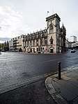 | |||
| Panmure Street, Guardian Royal Exchange | 56°27′47″N 2°58′17″W | Category B | 25510 |  | |||
| 21 Meadowside Or Albert Square | 56°27′45″N 2°58′12″W | Category B | 25320 | | |||
| Graham Street St Teresa's Formerly St Michael's Rc Church | 56°28′43″N 2°58′06″W | Category B | 25322 | | |||
| 31 Meadowside Or Albert Square | 56°27′46″N 2°58′12″W | Category B | 25323 | | |||
| 138, 140 Seagate And Return Elevation To Queen Street, Magnum House, Former Scws Store | 56°27′51″N 2°57′54″W | Category B | 25329 | | |||
| 49 Meadowside | 56°27′49″N 2°58′13″W | Category B | 25331 | | |||
| Balgay Park, Footbridge Between Balgay Hill And The Western Necropolis | 56°27′53″N 3°00′52″W | Category B | 25356 | | |||
| Blackness Road, Harris Academy Annexe, Former Logie Central School, And Janitor's House And Gate Piers | 56°27′40″N 2°59′49″W | Category B | 25372 | | |||
| Blackness Road, Parkview School, Lodge, Boundary Walls And Railings | 56°27′39″N 3°00′28″W | Category B | 25376 | | |||
| 7 Farington Terrace Farington | 56°27′29″N 3°00′59″W | Category B | 25408 | | |||
| 36 Nethergate | 56°27′34″N 2°58′16″W | Category B | 25418 | | |||
| 80, 82 Nethergate | 56°27′32″N 2°58′20″W | Category B | 25421 | | |||
| 66, 67 High Street | 56°27′39″N 2°58′12″W | Category B | 25230 | | |||
| 26 East Dock Maritime House, Dundee, Perth And London Shipping Co | 56°27′44″N 2°57′49″W | Category B | 25232 | | |||
| 42 East Dock Street, Retail Park, Unit 7, Former Dundee Foundry Engine Shop | 56°27′50″N 2°57′40″W | Category B | 25236 | | |||
| 7 Dudhope Terrace And 1 Law Street | 56°27′59″N 2°59′01″W | Category C(S) | 25246 | | |||
| 1, 3 King Street And Return To Cowgate | 56°27′51″N 2°58′02″W | Category B | 25267 | | |||
| Forfar Road, Morgan Academy, Main Block And Janitor's House, With Terrace, Boundary Walls And Gatepiers | 56°28′28″N 2°57′15″W | Category A | 25288 |  | |||
| Off Perth Road, Geddes Quadrangle, Sundial, University Of Dundee | 56°27′27″N 2°58′49″W | Category B | 25293 |  | |||
| Claverhouse Road Mains Of Claverhouse With Railings | 56°29′29″N 2°57′49″W | Category C(S) | 25119 | | |||
| 15-19 (Odd Nos) Crichton Street | 56°27′35″N 2°58′12″W | Category C(S) | 25131 | | |||
| 92-98 (Even Nos) Clepington Road, Including The Clep Public House | 56°28′38″N 2°58′07″W | Category B | 25145 | | |||
| 14 Dock Street, Lampstandard | 56°27′33″N 2°58′08″W | Category C(S) | 25146 | | |||
| 50, 52 Albert Street, 2-6 (Even Nos) Arthurstone Terrace | 56°28′09″N 2°57′29″W | Category B | 25164 | | |||
| Constitution Terrace 6, 8, 10 And 76, 78, 80 Constitution Street Including Boundary Walls And Gatepiers | 56°28′00″N 2°58′42″W | Category B | 25165 | | |||
| 54, 55 Dock Street/1, 3 Gellatly Street | 56°27′41″N 2°57′54″W | Category B | 25166 | | |||
| Albert Street Ogilvie Church (Church Of Scotland) | 56°28′20″N 2°57′25″W | Category B | 25171 | | |||
| 56, 58 Arbroath Road, 1 Kemback Street | 56°28′06″N 2°57′19″W | Category B | 25179 | | |||
| 3 Arthurstone Terrace And 1, 3, 5 Maitland Street, St Patrick's Rc Church, Presbytery And Hall | 56°28′11″N 2°57′31″W | Category B | 25183 | | |||
| 80 North Lindsay Street, 29, 31 South Ward Road And Return Elevation To Johnston Street, Lindsay Street Mill | 56°27′39″N 2°58′37″W | Category B | 25085 | | |||
| 29 Paterson Street And Return Elevation To Milton Street, Lawside Works (2-Storey And Attic Former Mill At Corner Of Paterson And Milton Streets Only) | 56°28′26″N 2°58′55″W | Category B | 25089 | | |||
| Albert Square, Statue Of Queen Victoria | 56°27′46″N 2°58′17″W | Category B | 24944 | .jpg) | |||
| 17 Ancrum Road St Margarets Episcopal Church | 56°28′09″N 3°00′19″W | Category B | 24948 | | |||
| 56 Barrack Street, Willison House | 56°27′39″N 2°58′25″W | Category B | 24963 | | |||
| 27, 29 Castle Street | 56°27′38″N 2°58′06″W | Category C(S) | 25009 | | |||
| Barnhill, 15 Panmure Terrace, Rowanlee Including Boundary Wall | 56°28′28″N 2°51′02″W | Category C(S) | 51133 | | |||
| 60 Dock Street, Including 1/L, 2/L And Top Floor Flats (Accessed From And Known As 59 Dock Street) | 56°27′42″N 2°57′53″W | Category C(S) | 51353 | | |||
| West Ferry, 26 Dundee Road, Harecraig House, Including Wall At Dundee Road | 56°28′10″N 2°53′44″W | Category B | 25927 | | |||
| West Ferry, 47 Grove Road, Claremont Lodge, Including Wall And Gatepiers | 56°28′20″N 2°53′29″W | Category B | 25943 | | |||
| West Ferry,1 Ralston Road, Sunningdale, Including Enclosing Walls And Garage | 56°28′07″N 2°54′26″W | Category B | 25946 | | |||
| 5 Annfield Street And 10 Blackness Street, Annfield House With Boundary Wall | 56°27′35″N 2°59′35″W | Category B | 25955 | | |||
| Broughty Ferry, 63, 65, 67 And 69 Monifieth Road And 1 And 3 Norrie Street | 56°28′06″N 2°51′52″W | Category C(S) | 25854 | |
Key
The scheme for classifying buildings in Scotland is:
- Category A: "buildings of national or international importance, either architectural or historic; or fine, little-altered examples of some particular period, style or building type."[1]
- Category B: "buildings of regional or more than local importance; or major examples of some particular period, style or building type, which may have been altered."[1]
- Category C: "buildings of local importance; lesser examples of any period, style, or building type, as originally constructed or moderately altered; and simple traditional buildings which group well with other listed buildings."[1]
In March 2016 there were 47,288 listed buildings in Scotland. Of these, 8 per cent were Category A, and 50 per cent were Category B, with the rest listed at Category C.[2]
See also
Notes
- Sometimes known as OSGB36, the grid reference (where provided) is based on the British national grid reference system used by the Ordnance Survey.
• "Guide to National Grid". Ordnance Survey. Retrieved 12 December 2007.
• "Get-a-map". Ordnance Survey. Retrieved 17 December 2007. - Historic Environment Scotland assign a unique alphanumeric identifier to each designated site in Scotland, for listed buildings this always begins with "LB", for example "LB12345".
References
- All entries, addresses and coordinates are based on data from Historic Scotland. This data falls under the Open Government Licence
- "What is Listing?". Historic Environment Scotland. Retrieved 29 May 2018.
- Scotland's Historic Environment Audit 2016 (PDF). Historic Environment Scotland and the Built Environment Forum Scotland. pp. 15–16. Retrieved 29 May 2018.
This article is issued from Wikipedia. The text is licensed under Creative Commons - Attribution - Sharealike. Additional terms may apply for the media files.