List of listed buildings in Dalry, North Ayrshire
List
| Name | Location | Date Listed | Grid Ref. [note 1] | Geo-coordinates | Notes | LB Number [note 2] | Image |
|---|---|---|---|---|---|---|---|
| Ryefield House Stables | 55°42′59″N 4°43′37″W | Category C(S) | 1252 |  | |||
| Ryefield House and Garden Walls | 55°42′54″N 4°43′45″W | Category B | 1253 | | |||
| 83 New Street Dalry | 55°42′26″N 4°43′00″W | Category C(S) | 1259 | | |||
| 31, 33 Sharon Street Dalry | 55°42′32″N 4°43′24″W | Category C(S) | 1266 | | |||
| 5, 7 Blair Road Dalry | 55°42′21″N 4°42′29″W | Category B | 1186 | | |||
| 81 New Street Dalry | 55°42′26″N 4°43′01″W | Category C(S) | 1194 | | |||
| Blair Estate North Bridge Over Bombo Burn | 55°42′06″N 4°41′36″W | Category C(S) | 1199 | | |||
| Blair Estate South Lodge | 55°41′20″N 4°41′49″W | Category C(S) | 1202 | | |||
| 7 Aitken Street Dalry | 55°42′25″N 4°43′08″W | Category B | 1209 | | |||
| 4 Kilwinning Road, Dalry | 55°42′12″N 4°43′29″W | Category C(S) | 1218 | | |||
| 6 Townend Street Dalry | 55°42′26″N 4°43′11″W | Category B | 1237 | | |||
| Pitcon House and Walled Garden | 55°43′10″N 4°42′33″W | Category B | 1251 | | |||
| Swindridgemuir | 55°42′46″N 4°40′35″W | Category A | 1254 | | |||
| Aitken Street, St Palladius' RC Church & Presbytery Dalry | 55°42′25″N 4°43′05″W | Category C(S) | 1184 | .jpg) | |||
| Baidland Manor | 55°42′56″N 4°45′29″W | Category C(S) | 1195 | | |||
| Brownhill House | 55°43′37″N 4°41′15″W | Category B | 1204 | | |||
| 9 Aitken Street, Chapelhill, Dalry | 55°42′24″N 4°43′07″W | Category B | 1210 | | |||
| 14-16 The Cross Former Town House (Now Dalry Co-Operative Society Ltd Showrooms), Dalry | 55°42′31″N 4°43′10″W | Category B | 1214 | | |||
| 10 Garnock Street, Dalry | 55°42′24″N 4°43′04″W | Category C(S) | 1215 | | |||
| 12 Garnock Street, Dalry | 55°42′24″N 4°43′04″W | Category C(S) | 1216 | | |||
| 31, 33, 35, 37 Main Street Dalry | 55°42′31″N 4°43′17″W | Category C(S) | 1222 | | |||
| 18, 20, 22 Main Street | 55°42′31″N 4°43′16″W | Category C(S) | 1227 | | |||
| 28, 30, 32 Main Street/Corner Kirk Close | 55°42′30″N 4°43′17″W | Category C(S) | 1229 | | |||
| 1, 3, 5, 7 New Street Dalry | 55°42′29″N 4°43′11″W | Category C(S) | 1231 | | |||
| Hillside Cottages Mr Macdonald (Building to Left) | 55°42′18″N 4°42′10″W | Category C(S) | 1245 | | |||
| Munnoch Farm | 55°41′53″N 4°46′56″W | Category B | 1250 | | |||
| 69 New Street, Dalry | 55°42′26″N 4°43′02″W | Category B | 1193 | | |||
| Blair Estate Forester's Cottage | 55°42′03″N 4°41′37″W | Category C(S) | 1197 | | |||
| Blair Estate Garden Walls | 55°41′46″N 4°42′05″W | Category B | 1198 | | |||
| Blair Estate North Lodge & Gatepiers | 55°42′11″N 4°41′55″W | Category C(S) | 1200 | | |||
| The Cross Trinity Church, Dalry | 55°42′31″N 4°43′12″W | Category B | 1211 | .jpg) | |||
| 17, 19, 21 Main Street (Corner North Street), Dalry | 55°42′32″N 4°43′16″W | Category B | 1220 | | |||
| 43, 45 New Street, Dalry | 55°42′27″N 4°43′08″W | Category B | 1233 | | |||
| Dykes Farm | 55°43′57″N 4°44′06″W | Category C(S) | 1240 | | |||
| Hillside Cottages Mr Macewan (left) Mrs Craig (centre) Mr Harkins (right) | 55°42′17″N 4°42′11″W | Category C(S) | 1246 | | |||
| 2, 4, 6 North Street, Dalry | 55°42′32″N 4°43′17″W | Category C(S) | 131 | | |||
| 2 Townend Street, Dalry | 55°42′26″N 4°43′10″W | Category C(S) | 119 | | |||
| Swindridgemuir Stables | 55°42′48″N 4°40′35″W | Category B | 1255 | | |||
| Courthill, The Old Tavern, Dalry | 55°42′32″N 4°43′10″W | Category C(S) | 1257 | | |||
| The Cross St Margaret's Church and Halls, Dalry | 55°42′30″N 4°43′15″W | Category B | 1258 | | |||
| 24, 26, 28 New Street, Dalry | 55°42′29″N 4°43′09″W | Category C(S) | 1263 | | |||
| Braehead Templand, Dalry | 55°42′41″N 4°43′24″W | Category B | 1188 | | |||
| Blair Estate Smithy | 55°41′27″N 4°41′32″W | Category C(S) | 1201 | | |||
| 3 Aitken Street, Public Halls, Dalry | 55°42′26″N 4°43′08″W | Category C(S) | 1207 | | |||
| 47-51 (Odd) New Street, Dalry | 55°42′27″N 4°43′07″W | Category C(S) | 1234 | | |||
| Hillside Cottages, Mr Macdonald (Building to Right) | 55°42′18″N 4°42′10″W | Category C(S) | 1244 | | |||
| Giffen House | 55°42′43″N 4°38′19″W | Category B | 120 | 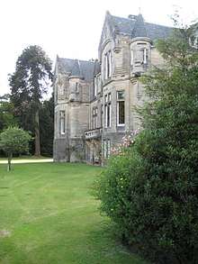 | |||
| 43 Sharon Street Dalry | 55°42′32″N 4°43′26″W | Category C(S) | 1267 | | |||
| 12, 14, 16 Main Street | 55°42′31″N 4°43′16″W | Category C(S) | 1226 | | |||
| 34, 36, 38 Main Street Dalry | 55°42′29″N 4°43′18″W | Category C(S) | 1230 | | |||
| 33, 35, 37 New Street Dalry | 55°42′28″N 4°43′10″W | Category C(S) | 1232 | | |||
| Doggartland House And Bridge | 55°42′59″N 4°43′29″W | Category C(S) | 1239 | | |||
| 28, 30 North Street Dalry | 55°42′33″N 4°43′17″W | Category C(S) | 1265 | | |||
| Blair Road Garnock Bridge, Dalry | 55°42′27″N 4°42′50″W | Category C(S) | 1185 | | |||
| Bridgend Textile Mills And Millhouse, Dalry | 55°42′29″N 4°42′43″W | Category B | 1189 | | |||
| Courthill Dalry Mission Halls Dalry | 55°42′32″N 4°43′11″W | Category B | 1191 | | |||
| Blair House | 55°41′46″N 4°41′57″W | Category A | 1196 | | |||
| Blair Estate Stables | 55°41′41″N 4°41′55″W | Category B | 1203 | | |||
| 1 Aitken Street Dalry | 55°42′27″N 4°43′09″W | Category C(S) | 1206 | | |||
| 5 Aitken Street Dalry | 55°42′25″N 4°43′09″W | Category B | 1208 | | |||
| 9,10,11 The Cross Dalry | 55°42′31″N 4°43′11″W | Category C(S) | 1212 | | |||
| 13 The Cross Clydesdale Bank Building Dalry | 55°42′31″N 4°43′11″W | Category C(S) | 1213 | | |||
| 4, 6 Main Street Dalry | 55°42′31″N 4°43′15″W | Category C(S) | 1223 | | |||
| 8 Main Street | 55°42′31″N 4°43′15″W | Category C(S) | 1224 | | |||
| 10 Main Street | 55°42′31″N 4°43′15″W | Category C(S) | 1225 | | |||
| Muirhouse Farm | 55°43′32″N 4°40′00″W | Category C(S) | 1249 | | |||
| Swinlees | 55°44′17″N 4°43′06″W | Category B | 1256 | | |||
| 85 New Street Dalry | 55°42′26″N 4°42′59″W | Category C(S) | 1260 | | |||
| 16, 18 New Street Dalry | 55°42′30″N 4°43′09″W | Category B | 1262 | | |||
| 62 New Street Dalry | 55°42′27″N 4°43′05″W | Category C(S) | 1264 | | |||
| Bleeze Farm Dalry | 55°42′40″N 4°43′27″W | Category C(S) | 1187 | | |||
| Carsehead Bridge | 55°42′40″N 4°42′23″W | Category B | 1205 | | |||
| 24 Main Street | 55°42′30″N 4°43′16″W | Category C(S) | 1228 | | |||
| 4 Townend Street Dalry | 55°42′26″N 4°43′11″W | Category B | 1236 | | |||
| Giffen Stables | 55°42′42″N 4°38′33″W | Category C(S) | 1241 | | |||
| Hillend House | 55°43′09″N 4°43′10″W | Category B | 1243 | | |||
| 11, 13,15 Main Street Dalry | 55°42′32″N 4°43′15″W | Category C(S) | 118 | | |||
| Dalry, Courthill Street, Hotel De Croft | 55°42′37″N 4°42′50″W | Category C(S) | 6407 | | |||
| 10, 12 New Street Dalry | 55°42′30″N 4°43′10″W | Category C(S) | 1261 | | |||
| Courthill Fountain Dalry | 55°42′33″N 4°43′10″W | Category C(S) | 1190 | | |||
| 67 New Street Royal Hotel Dalry | 55°42′26″N 4°43′04″W | Category B | 1192 | | |||
| 16 Garnock Street Amulree, Dalry | 55°42′23″N 4°43′04″W | Category C(S) | 1217 | | |||
| 9 Main Street "The Auld Hoose Bar" Dalry | 55°42′32″N 4°43′15″W | Category B | 1219 | | |||
| 23, 25, 27, 29 Main Street Dalry | 55°42′31″N 4°43′16″W | Category B | 1221 | | |||
| Townend Street Post Office Annexe Dalry | 55°42′27″N 4°43′11″W | Category C(S) | 1235 | | |||
| West Kilbride Road Cemetery Lodge And Gatepiers | 55°42′31″N 4°43′48″W | Category C(S) | 1238 | | |||
| Giffordland | 55°42′10″N 4°45′38″W | Category C(S) | 1242 | | |||
| Kersland Farm | 55°43′07″N 4°41′57″W | Category B | 1247 | | |||
| Maulside Mains | 55°44′00″N 4°39′38″W | Category B | 1248 | | |||
| Courthill Parkhill House Dalry | 55°42′33″N 4°42′54″W | Category C(S) | 130 | |
Key
The scheme for classifying buildings in Scotland is:
- Category A: "buildings of national or international importance, either architectural or historic; or fine, little-altered examples of some particular period, style or building type."[1]
- Category B: "buildings of regional or more than local importance; or major examples of some particular period, style or building type, which may have been altered."[1]
- Category C: "buildings of local importance; lesser examples of any period, style, or building type, as originally constructed or moderately altered; and simple traditional buildings which group well with other listed buildings."[1]
In March 2016 there were 47,288 listed buildings in Scotland. Of these, 8 per cent were Category A, and 50 per cent were Category B, with the rest listed at Category C.[2]
Notes
- Sometimes known as OSGB36, the grid reference (where provided) is based on the British national grid reference system used by the Ordnance Survey.
• "Guide to National Grid". Ordnance Survey. Retrieved 12 December 2007.
• "Get-a-map". Ordnance Survey. Retrieved 17 December 2007. - Historic Environment Scotland assign a unique alphanumeric identifier to each designated site in Scotland, for listed buildings this always begins with "LB", for example "LB12345".
References
- All entries, addresses and coordinates are based on data from Historic Scotland. This data falls under the Open Government Licence
- "What is Listing?". Historic Environment Scotland. Retrieved 29 May 2018.
- Scotland's Historic Environment Audit 2016 (PDF). Historic Environment Scotland and the Built Environment Forum Scotland. pp. 15–16. Retrieved 29 May 2018.
This article is issued from Wikipedia. The text is licensed under Creative Commons - Attribution - Sharealike. Additional terms may apply for the media files.