List of listed buildings in Currie, Edinburgh
List
| Name | Location | Date Listed | Grid Ref. [note 1] | Geo-coordinates | Notes | LB Number [note 2] | Image |
|---|---|---|---|---|---|---|---|
| Currie Parish Church Manse Including Office Court At Rear And Garden Walls, Off Kirkgate, Currie | 55°53′43″N 3°18′26″W | Category B | 6113 |  | |||
| Currie Post Office, Lanark Road West And Riccarton Mains Road | 55°53′48″N 3°18′31″W | Category C(S) | 6118 | | |||
| Curriebank, 105 Lanark Road West | 55°53′51″N 3°18′10″W | Category C(S) | 6124 | | |||
| Fisherbank And Bathiebrae, 111, 113 Lanark Road West | 55°53′50″N 3°18′13″W | Category B | 6125 | | |||
| 375 -377 Lanark Road West | 55°53′33″N 3°19′16″W | Category C(S) | 6128 | | |||
| Currie Parish Church, Churchyard (Original Area Only) Kirkgate, Currie | 55°53′41″N 3°18′28″W | Category B | 6140 | 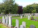 | |||
| Smiddy And Sseb Substation, 204 Lanark Road West | 55°53′47″N 3°18′37″W | Category C(S) | 6121 | | |||
| 99, 101, Lanark Road West | 55°53′52″N 3°18′08″W | Category C(S) | 6123 | | |||
| 200, 202 And 204 Lanark Road West | 55°53′47″N 3°18′37″W | Category C(S) | 6120 | | |||
| 209 Lanark Road West | 55°53′45″N 3°18′38″W | Category C(S) | 6127 | | |||
| Rosebery Cottages (Old School, Now Ellenvale And Sycamore Cottage) Including Garden Walls Kirkgate, Currie | 55°53′43″N 3°18′31″W | Category B | 6115 |  | |||
| Currie Farmhouse, Now 1, 2 Easter Currie Court, Lanark Road West | 55°53′48″N 3°18′29″W | Category B | 6117 | | |||
| Millbank, 33 Lanark Road West | 55°54′00″N 3°17′41″W | Category C(S) | 6122 | | |||
| Union Canal Bridge 9 East Hermiston | 55°55′17″N 3°18′30″W | Category C(S) | 6096 | | |||
| Schoolhouse, Kirkgate, Currie Including Garden Walls | 55°53′43″N 3°18′29″W | Category C(S) | 6114 | | |||
| 161-165 (No. 165 Eden Cottage) Lanark Road West | 55°53′48″N 3°18′24″W | Category B | 6126 | | |||
| Currie Village Currie Parish Church (St Kentigern's) | 55°53′42″N 3°18′29″W | Category A | 6139 | | |||
| 21-24 (Inclusive Numbers) Braeburn Drive | 55°53′35″N 3°17′58″W | Category B | 6093 | | |||
| 194 Lanark Road West | 55°53′48″N 3°18′32″W | Category C(S) | 6119 | | |||
| Kinleith Bridge Water Of Leith | 55°53′59″N 3°17′41″W | Category B | 5706 |  | |||
| Gibson Craig Memorial Hall, Lanark Road West | 55°53′49″N 3°18′22″W | Category C(S) | 6116 | |
Key
The scheme for classifying buildings in Scotland is:
- Category A: "buildings of national or international importance, either architectural or historic; or fine, little-altered examples of some particular period, style or building type."[1]
- Category B: "buildings of regional or more than local importance; or major examples of some particular period, style or building type, which may have been altered."[1]
- Category C: "buildings of local importance; lesser examples of any period, style, or building type, as originally constructed or moderately altered; and simple traditional buildings which group well with other listed buildings."[1]
In March 2016 there were 47,288 listed buildings in Scotland. Of these, 8 per cent were Category A, and 50 per cent were Category B, with the rest listed at Category C.[2]
Notes
- Sometimes known as OSGB36, the grid reference (where provided) is based on the British national grid reference system used by the Ordnance Survey.
• "Guide to National Grid". Ordnance Survey. Retrieved 12 December 2007.
• "Get-a-map". Ordnance Survey. Retrieved 17 December 2007. - Historic Environment Scotland assign a unique alphanumeric identifier to each designated site in Scotland, for listed buildings this always begins with "LB", for example "LB12345".
References
- All entries, addresses and coordinates are based on data from Historic Scotland. This data falls under the Open Government Licence
- "What is Listing?". Historic Environment Scotland. Retrieved 29 May 2018.
- Scotland's Historic Environment Audit 2016 (PDF). Historic Environment Scotland and the Built Environment Forum Scotland. pp. 15–16. Retrieved 29 May 2018.
This article is issued from Wikipedia. The text is licensed under Creative Commons - Attribution - Sharealike. Additional terms may apply for the media files.