List of highways in Webb County, Texas
The following is a list of all state highways in Webb County, Texas maintained by the Texas Department of Transportation. All state highways in Texas are paved. In the future Webb County will be the United States terminus of the North American Supercorridor (NASCO),[3] Interstate 69,[4] and The Ports to Plains Trade Corridor.[5] The Texas Department of Transportation Laredo District is preparing for future growth by turning Loop 20 into a freeway by building overpasses at major intersections and on / off ramps.[6] The Webb County - City of Laredo Regional Mobility Authority has responsibility for a comprehensive transport system in the region.
| State Highways in Webb County, Texas | |
|---|---|
| Statistics | |
| Linear Length | 435 miles (700.1 km)[1] |
| Lane Length | 1,110 miles (1,786.4 km)[2] |
| Population (2006) | 250,304 |
Interstates
| Route Name | Direction | Termini | Junctions | Length[7] | Population Area | Remarks |
|---|---|---|---|---|---|---|
| South North | Gateway to the Americas International Bridge I-35 | I-35 US 83 | 3.4 miles (5.5 km) | Laredo | ||
| South North | Juarez-Lincoln International Bridge La Salle County | US 83 Spur 400 UR 1472 I-69W US 59 LP 20 SH 255 | 37.5 miles (60.4 km) | Laredo Botines Webb | Texas Travel Center 27.759583°N 99.437186°W ICE Checkpoint 27.905138°N 99.3938577°W | |
| South North | World Trade International Bridge I-35 (current) Duval County (future) | UR 1472 I-35 US 83 LP 20 (future) FM 2895 (future) FM 2050 (future) | 1.4 miles (2.3 km) are complete from World Trade International Bridge to I-35/US 83; under construction from I-35/US 83 to Duval County | Laredo Las Lomas (future) | Co-signed with both US 59 and LP 20 from World Trade International Bridge to I-35/US 83; will be co-signed with LP 20 from I-35/US 83 to the junctions of Bus. US 59, LP 20, and US 59 in the future; will be co-signed with US 59 from I-35/US 83 to Duval County in the future; known locally as Bob Bullock Loop from World Trade International Bridge to I-35/US 83 |
U.S. Routes
| Route Name | Direction | Termini | Junctions | Length[7] | Population Area | Remarks |
|---|---|---|---|---|---|---|
| East West | US 59 I-35 | US 59(Future I-69W) LP 20 I-35 US 83 | Laredo | Known locally as Saunders Street | ||
| East West | Duval County World Trade International Bridge | FM 2050 FM 2895 I-69W (temporary) LP 20 I-35 US 83 UR 1472 | 49.4 miles (79.5 km) | Laredo Las Lomas | ICE Checkpoint 27.774241°N 98.84551°W Co-signed with I-69W from I-35/US 83 to World Trade International Bridge; co-signed with LP 20 from the junction of Bus. US 59 and LP 20 to World Trade International Bridge; will be co-signed with I-69W from Duval County to I-35/US 83 in the future; known locally as Bob Bullock Loop from the junction of Bus. US 59 and LP 20 to World Trade International Bridge; known locally as Lloyd Bentsen Highway from Duval County to the junction of Bus. US 59 and LP 20 | |
| South North | Zapata County Dimmit County | LP 20 SH 359 I-35 Spur 400 UR 1472 I-69W US 59 SH 255 SH 44 | 66 miles (106.2 km) | El Cenizo Rio Bravo La Presa Laredo Botines | ICE Checkpoint 28.005693°N 99.534465°W | |
Texas State Highways
| Route Name | Direction | Termini | Junctions | Length[7] | Population Area | Remarks |
|---|---|---|---|---|---|---|
| East West | Duval County US 83 | US 83 | 40 miles (64.4 km) | None | ||
| East West | I-35 Colombia-Solidarity Bridge | I-35 US 83 UR 1472 | 21.508 miles (34.6 km) | Laredo | 27.735608°N 99.684188°W | |
| East West | Duval County US 83 | US 83 LP 20 FM 2895 FM 649 FM 2050 | 50 miles (80.5 km) | Bruni Oilton Aguilares Laredo Ranchettes Larga Vista | ICE Checkpoint 27.443402°N 98.887349°W |
State Highway Loops and Spurs
| Route Name | Direction | Termini | Junctions | Length[7] | Population Area | Remarks |
|---|---|---|---|---|---|---|
| South North & East West | US 83 World Trade International Bridge | US 83 SH 359 Spur 400 US 59(Future I-69W) I-35 UR 1472 | 16.6 miles (26.7 km) | Laredo | Co-signed with I-69W from I-35/US 83 to World Trade International Bridge; co-signed with US 59 from the junction of Bus. US 59 and US 59 to World Trade International Bridge; known locally as Bob Bullock Loop | |
| South North | US 83 LP 20 | US 83 SH 359 LP 20 | 11.43 miles (18.4 km) | Laredo | Under construction 50% complete; designation not yet official | |
| East West | LP 20 I-35 | LP 20 I-35 | 1.174 miles (1.9 km) | Laredo |
Farm to Market Roads
| Route Name | Direction | Termini | Junctions | Length[7] | Population Area | Remarks |
|---|---|---|---|---|---|---|
| South North | Zapata County SH 359 | SH 359 | 15 miles (24.1 km) | Mirando City | ||
| South North | I-35 A point 14.7 miles (23.7 km) northwest of SH 255 | I-35 US 83 I-69W US 59 LP 20 FM 3338 SH 255 | 33.425 miles (53.8 km) | Laredo | Urban Road 1472 | |
| South North | Bruni, Texas US 59 | SH 359 US 59(Future I-69W) | 24.572 miles (39.5 km) | Bruni | ||
| South North | Aguilares, Texas US 59 | SH 359 US 59(Future I-69W) | 17.44 miles (28.1 km) | Aguilares | ||
| South North | FM 1472 SH 255 | UR 1472 SH 255 | 7.831 miles (12.6 km) | Laredo Ranchos Penitas West | ||
Decommissioned Highways
| Route Name | Direction | Termini | Junctions | Length[7] | Population Area | Remarks |
|---|---|---|---|---|---|---|
SH 2 [24] | South North | Laredo, Texas La Salle County | none | 37.5 miles (60.4 km) | Laredo Webb | Replaced by US 81 |
| South North | Zapata County Dimmit County | none | 66 miles (106.2 km) | Laredo Webb | Replaced by US 83 | |
| South North | Laredo, Texas La Salle County | none | 37.5 miles (60.4 km) | Laredo Webb | Replaced by I-35 | |
| South North | Gateway to the Americas Int'l Bridge I-35 | I-35 US 83 | 3.4 miles (5.5 km) | Laredo | Replaced by BSI-35 | |
| East West | Duval County Laredo | none | 49.4 miles (79.5 km) | Las Lomas Laredo | Replaced by US 59 | |
| East West | Duval County Laredo | none | 49.4 miles (79.5 km) | Las Lomas Laredo | Replaced by US 96 | |
| South North | Gateway to the Americas Int'l Bridge I-35 | I-35 US 83 | 3.4 miles (5.5 km) | Laredo | Replaced by US 83 Bus. | |
| East West | Duval County US 83 | US 83 | 40 miles (64.4 km) | None | Replaced by SH 44 | |
| East West | I-35 UR 1472 | I-35 UR 1472 | 1.594 miles (2.6 km) | Laredo | Replaced by LP 20 | |
Adjacent counties
- Maverick County (northwest)
- Dimmit County (north-northwest)
- La Salle County (north)
- McMullen County (northeast)
- Duval County (east)
- Jim Hogg County (southeast)
- Zapata County (south)
Adjacent Mexican States
- Coahuila, Mexico (northwest)
- Nuevo Leon, Mexico (west)
- Tamaulipas, Mexico (southwest)
Gallery
 I-35/US 83 and I-69W/US 59/Loop 20 intersection in Laredo
 Construction of the I-35 and Farm to Market Road 1472 intersection
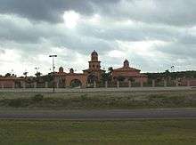 Texas Travel Information Center at I-35 in the Laredo district
References
- Texas Department of Transportation Laredo District, Lineal Road Miles in Webb County, Texas
- Texas Department of Transportation Laredo District, Lane Road Miles in Webb County, Texas
- North American SuperCorridor Coalition, Tri-National Corridor Archived 2007-06-02 at the Wayback Machine
- United States Department of Transportation, Interstate Highway No. 69 Federal Study
- Texas Department of Transportation, Ports to Plains Trade Corridor
- Texas Department of Transportation, TxDOT Laredo District Loop 20 Mobility Project Archived 2007-07-06 at the Wayback Machine
- Texas Department of Transportation, Texas County Highway Maps - Webb County Archived 2006-09-02 at the Wayback Machine
- Texas Department of Transportation, Highway Designation File - BI No. 35
- Transportation Planning and Programming Division (n.d.). "Interstate Highway No. 35". Highway Designation Files. Texas Department of Transportation.
- Transportation Planning and Programming Division (n.d.). "Interstate Highway No. 69-W". Highway Designation Files. Texas Department of Transportation.
- Transportation Planning and Programming Division (n.d.). "U.S. Highway No. 59". Highway Designation Files. Texas Department of Transportation.
- Transportation Planning and Programming Division (n.d.). "U.S. Highway No. 83". Highway Designation Files. Texas Department of Transportation.
- Transportation Planning and Programming Division (n.d.). "State Highway No. 44". Highway Designation Files. Texas Department of Transportation.
- Transportation Planning and Programming Division (n.d.). "State Highway No. 255". Highway Designation Files. Texas Department of Transportation.
- Transportation Planning and Programming Division (n.d.). "State Highway No. 359". Highway Designation Files. Texas Department of Transportation.
- Transportation Planning and Programming Division (n.d.). "State Highway Loop No. 20". Highway Designation Files. Texas Department of Transportation.
- Transportation Planning and Programming Division (n.d.). "State Highway Spur No. 260". Highway Designation Files. Texas Department of Transportation.
- Transportation Planning and Programming Division (n.d.). "State Highway Spur No. 400". Highway Designation Files. Texas Department of Transportation.
- Transportation Planning and Programming Division (n.d.). "Farm to Market Road No. 649". Highway Designation Files. Texas Department of Transportation.
- Transportation Planning and Programming Division (n.d.). "Farm to Market Road No. 1472". Highway Designation Files. Texas Department of Transportation.
- Transportation Planning and Programming Division (n.d.). "Farm to Market Road No. 2050". Highway Designation Files. Texas Department of Transportation.
- Transportation Planning and Programming Division (n.d.). "Farm to Market Road No. 2895". Highway Designation Files. Texas Department of Transportation.
- Transportation Planning and Programming Division (n.d.). "Farm to Market Road No. 3338". Highway Designation Files. Texas Department of Transportation.
- Transportation Planning and Programming Division (n.d.). "State Highway No. 2". Highway Designation Files. Texas Department of Transportation.
- Transportation Planning and Programming Division (n.d.). "State Highway No. 4". Highway Designation Files. Texas Department of Transportation.
- Transportation Planning and Programming Division (n.d.). "U.S. Highway No. 81". Highway Designation Files. Texas Department of Transportation.
- Texas Department of Transportation, Highway Designation File - BU No. 83K
- Transportation Planning and Programming Division (n.d.). "U.S. Highway No. 96". Highway Designation Files. Texas Department of Transportation.
- Transportation Planning and Programming Division (n.d.). "State Highway No. 202". Highway Designation Files. Texas Department of Transportation.
- Transportation Planning and Programming Division (n.d.). "State Highway Loop No. 420". Highway Designation Files. Texas Department of Transportation.
- Transportation Planning and Programming Division (n.d.). "Farm to Market Road No. 863". Highway Designation Files. Texas Department of Transportation.
- Transportation Planning and Programming Division (n.d.). "Farm to Market Road No. 3464". Highway Designation Files. Texas Department of Transportation.
This article is issued from Wikipedia. The text is licensed under Creative Commons - Attribution - Sharealike. Additional terms may apply for the media files.