List of crossings of the Rahway River
The Rahway River drainage basin encompasses approximately 41 square miles in Union, Essex, and Middlesex counties in the northeastern part of the U.S. state of New Jersey.
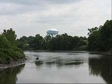

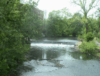
The Rahway River consists of four separate branches that converge in Rahway, from whence it flows as a single waterway to its mouth at the Arthur Kill. The longest, or West Branch, courses for 24 miles from Verona. The East Branch rises in West Orange/Montclair and joins the West Branch in Springfield, forming the main stem of the river. The South Branch, which originates in Woodbridge, and the Robinson's Branch, which begins in Scotch Plains, join the main stem in Rahway. The upper portion above Rahway consists of floodplains, woodlands and freshwater marshes; the lower portion includes saltwater marshes and tidal flats.[1] The river is tidal for approximately five mies upstream.[2]
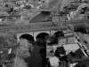
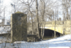
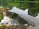
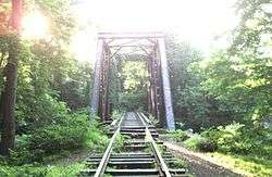
Many of the crossings of the river were built in the late 19th and early 20th century[3] and are part of the Rahway River Parkway, a greenway along the banks of the river.
Crossings (main stem)
Crossings West Branch
See also
- List of crossings of the Elizabeth River
- List of county routes in Union County, New Jersey
- List of county routes in Essex County, New Jersey
- List of county routes in Middlesex County, New Jersey
- List of bridges documented by the Historic American Engineering Record in New Jersey
- List of crossings of the Raritan River
References
- Edward J. Bloustein School of Planning and Public Policy, Rutgers University (February 2009). Rahway River Greenway Plan (PDF) (Report). Rahway River Greenway Plan. Retrieved 10 January 2018.
- New Jersey Coastal Management Program: Environmental Impact Statement, National Oceanic and Atmospheric Administration, 1980
- "Historic Bridge Survey Union County (1991-1994)" (PDF). NJDOT. 2001. Retrieved 10 January 2018.
- "CRCX - Rahway River Bridge". Bridgehunter.com. Retrieved 16 January 2019.
- http://www.conrail.com/wp-content/uploads/2014/01/Automation-of-Conrail-Moveable-Bridges.pdf
- Staff. "Route 700 Straight Line Diagram" (PDF). New Jersey Department of Transportation. Retrieved March 25, 2016.
- "Rahway River Bridge". Bridgehunter.com. Retrieved 11 January 2018.
- "US 1 straight line diagram" (PDF). New Jersey Department of Transportation. Retrieved 2009-11-25.
- "Rahway Bridge Permit Asked". timesmachine.nytimes.com. Retrieved 16 January 2019.
- "Amtrak - Rahway River Bridge". Bridgehunter.com. Retrieved 11 January 2018.
- "Rahway River Bridge". Bridgehunter.com. Retrieved 11 January 2018.
- "Whittier Street Bridge". Bridgehunter.com. Retrieved 11 January 2018.
- "Route 27 straight line diagram" (PDF). New Jersey Department of Transportation. Retrieved 2018-01-08.
- "Rahway River Bridge". Bridgehunter.com. Retrieved 11 January 2018.
- "Rahway River Parkway, NJ". gonehikin.blogspot.nl. Retrieved 11 January 2018.
- "Before and After: Valley Road Dam, Waterfall, Bridge and Jackson's Pond in Clark". 28 August 2011. Retrieved 21 January 2018.
- http://gardenstatelegacy.co/file/New_Jerseys_Oldest_Felt_Mill_DAndrea_Russo_GSL33.pdf
- "Garden State Parkway straight line diagram" (PDF). New Jersey Department of Transportation. Retrieved 2018-01-09.
- "Electronic Code of Federal Regulations Title 33 → Chapter I → Subchapter J → Part 117 117.743 Rahway River". January 18, 2018. Retrieved 21 January 2018.
- "Route 28 straight line diagram" (PDF). New Jersey Department of Transportation. Retrieved 2018-01-09.
- "North Union Avenue Bridge". Bridgehunter.com. Retrieved 11 January 2018.
- "County Route 509 (straight line diagram)" (PDF). New Jersey Department of Transportation. Retrieved 11 January 2018.
- http://www.nan.usace.army.mil/Portals/37/docs/civilworks/projects/nj/frm/Rahway/ArmyCorps_Rahway_Fluvial_NEPA-ScopingDocument.pdf
- "US 22 straight line diagram" (PDF). New Jersey Department of Transportation. Retrieved 2018-01-09.
- "Rahway River Bridge". Bridgehunter.com. Retrieved 11 January 2018.
- "RVRR - Rahway River Bridge". Bridgehunter.com. Retrieved 11 January 2018.
- "New Jersey Route 82 (straight line diagram)" (PDF). New Jersey Department of Transportation. Retrieved 11 January 2018.
- "Rahway River Bridge". Bridgehunter.com. Retrieved 11 January 2018.
- "Route 124 straight line diagram" (PDF). New Jersey Department of Transportation. Retrieved 2018-01-10.
- "I-78 Straight Line Diagram" (PDF). New Jersey Department of Transportation. Retrieved 2018-01-09.
- "West Branch Rahway River Bridge". Bridgehunter.com. Retrieved 21 January 2018.
- "Tulip Spring Bridge". Bridgehunter.com. Retrieved 21 January 2018.
External links
- "Bridgehunter.com - Rahway River". bridgehunter.com. Retrieved 11 January 2018.
- "Historic Bridge Survey Union County (1991-1994)" (PDF). NJDOT. 2001.
- "Historic Bridge Survey Essex County (1991-1994)" (PDF). NJDOT. 2001.
- The Rahway River Watershed (PDF) (Report). MAYOR’S COUNCIL RAHWAY RIVER. Retrieved 20 January 2018.
- Rahway River Basin Flood Risk Management Feasibility Study (Report). U.S. Army Corps of Engineers, New York District. January 2017. Retrieved 20 January 2018.