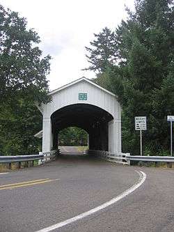
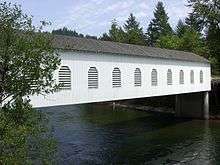
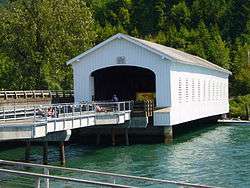
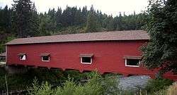
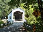
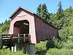
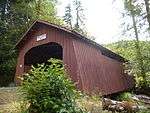
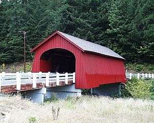
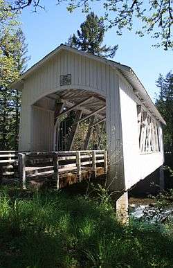
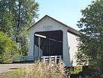
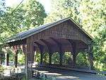
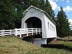
List of covered bridges in Oregon
This list of Oregon covered bridges contains 50 historic covered bridges remaining in the U.S. state of Oregon.
Most covered bridges in Oregon were built between 1905 and 1925. At its peak, there were an estimated 450 covered bridges, which by 1977, had dwindled to 56.[1] As of 2009, there were only 48 remaining.[2]
List
| Photo | Bridge | County | Location | Built | Length (ft) | Crosses | Coordinates | Notes |
|---|---|---|---|---|---|---|---|---|
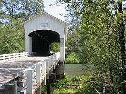
 | Harris | Benton | Wren | 1929 | 75 | Marys River | 44.5800°N 123.4602°W | NRHP |
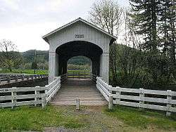
 | Hayden | Benton | Alsea | 1918 | 91 | Alsea River | 44.3831°N 123.6307°W[3] | NRHP |
 | Irish Bend | Benton | Corvallis | 1954 | 60 | Oak Creek | 44.566535°N 123.300802°W | NRHP |
 | Sandy Creek | Coos | Remote | 1921 | 60 | Sandy Creek | 43.00637°N 123.89177°W | NRHP, footbridge |
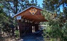 | Rock O' the Range | Deschutes | Bend | 1963 | 42 | Swalley Canal | 44.12236°N 121.28691°W | NRHP, only covered bridge east of the Cascades, some consider it not to be a true covered bridge since it lacks a truss[4] privately owned and maintained covered bridge open to the public[5] |
 | Cavitt Creek | Douglas | Peel | 1943 | 70 | Little River | 43.24410°N 123.02177°W | Raw log upper supports with a portal shape for log truck passage |
 | Horse Creek | Douglas | Myrtle Creek | 1930 | 105 | Myrtle Creek | 43.02335°N 123.29004°W | Closed in 1968, dismantled 1987 and moved from 44.16212°N 122.15508°W and reconstructed in 1990, open to foot traffic in city park |
 | Milo Academy | Douglas | Milo | 1962 | 100 | South Umpqua River | 42.93521°N 123.03890°W | NRHP, Current steel bridge with a wood housing and metal roof replaces a 1920 wooden truss covered bridge at same location.[6] |
.jpg) | Neal Lane | Douglas | Myrtle Creek | 1939 | 42 | South Myrtle Creek | 43.01696°N 123.27452°W | Built for only $1,000. One of the shortest covered bridges in Oregon and the only Oregon covered bridge with a king post truss.[7] |
.jpg) | Pass Creek | Douglas | Drain | 1925 | 61 | Pass Creek | 43.66064°N 123.31659°W | A covered bridge may date back to 1906 originally at 43.66036°N 123.31521°W, closed 1981 and rebuilt nearby in 1989.[8][9] |
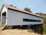
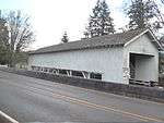
 | Rochester | Douglas | 3 miles (5 km) west of Sutherlin | 1933 | 80 | Calapooya Creek | 43.402062°N 123.363135°W[10] | Unusual bridge design includes eight side windows with curved tops and portals with flat arched openings.[11] |
 | Antelope Creek | Jackson | Eagle Point | 1922 | 58 | Little Butte Creek | 42.47209°N 122.80022°W | delisted from NRHP, formerly crossed Antelope Creek[12] relisted on NRHP 2012 after further restoration |
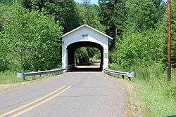
 | Lost Creek | Jackson | Lake Creek | 1919 | 39 | Lost Creek | 42.380139°N 122.579500°W | NRHP |
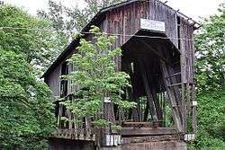
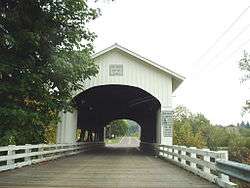
_(jacDA0033).jpg) | McKee | Jackson | Ruch | 1917 | 122 | Applegate River | 42.12580°N 123.07262°W[note 1] | NRHP; Howe truss, flying buttresses, open daylight windows at roofline, shingle roof; closed to vehicle traffic in 1956 due to structural concern, extensive restoration work in 1965, 1985, and 1989[13] |
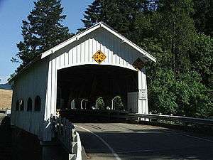
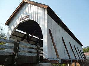 | Wimer | Jackson | Wimer | 1927 | 85 | Evans Creek | 42.53820°N 123.14978°W[note 2] | Rebuilt in 2008[14] after having collapsed July 6, 2003.[15] Queenpost truss, flying buttresses, open daylight windows at roofline, wood floor.[16] The 1927 Wimer bridge was a replacement for one originally built at the same site in 1892.[15] |
 | Grave Creek | Josephine | Sunny Valley | 1920 | 105 | Grave Creek | 42.636097°N 123.377638°W[17] | NRHP, Because of proximity to I-5, it is Oregon's most viewed covered bridge; also the only remaining covered bridge in Josephine County.[17] |
 | Belknap | Lane | Rainbow | 1966 | 120 | McKenzie River | 44.16803°N 122.22836°W | NRHP, fourth instance (information) |
 | Centennial | Lane | Cottage Grove | 1987 | 84 | Coast Fork Willamette River | 43.79744°N 123.06441°W |
Constructed from timbers salvaged from the Meadows and Brumbaugh bridges, which were dismantled in 1979;[18] Bicycle and foot traffic |
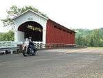
 | Chambers Railroad | Lane | Cottage Grove | 1925, replaced 2011[19] | 78 | Coast Fork Willamette River | 43.78937°N 123.06968°W | NRHP, no longer in service for rail traffic, Oregon's only remaining covered rail bridge.[20] |
 | Coyote Creek | Lane | Crow | 1922 | 60 | Coyote Creek | 43.970123°N 123.318983°W[21] | NRHP |
 | Currin | Lane | Cottage Grove | 1925 | 105 | Row River | 43.7930389°N 122.9964583°W[22] | NRHP |
.jpg) | Deadwood Creek | Lane | Swisshome | 1932 | 105 | Deadwood Creek | 44.14358°N 123.72042°W[note 3] | NRHP; the floor is banked for turning traffic; renovated in 1986[23] |
 | Dorena | Lane | Dorena | 1949 | 105 | Row River | 43.737623°N 122.883680°W[24] | NRHP |
 | Ernest | Lane | Marcola | 1938 | 75 | Mohawk River | 44.201515°N 122.836471°W[25] | NRHP (misspelled by the USGS as "Earnest Bridge") |
 | Goodpasture | Lane | Vida | 1938 | 165 | McKenzie River | 44°8′53″N 122°35′15″W | NRHP |
.jpg) | Lake Creek (Nelson Mountain) | Lane | Greenleaf | 1925 | 105 | Lake Creek | 44.104333°N 123.673639°W | NRHP; also called Nelson Mountain Bridge, rehabilitated 1984 with concrete floor[26] |
 | Lowell | Lane | Lowell | 1945 | 165 | Middle Fork Willamette River | 43.909570°N 122.779515°W[27] | NRHP, replacement for a bridge built in 1907 |
 | Mosby Creek | Lane | Cottage Grove | 1920 | 90 | Mosby Creek | 43.77817°N 123.00480°W[28] | NRHP, rehabilitated 2002[29] |
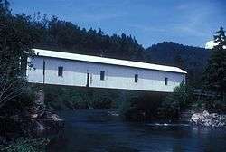
 | Office | Lane | Westfir | 1944 | 180 | North Fork Middle Fork Willamette River | 43.75847°N 122.49571°W | NRHP |
_1921.jpg) | Parvin Bridge | Lane | Dexter | 1921 | 75 | Lost Creek | 43°53′58.0″N 122°49′22.8″W[30] | NRHP |
 | Pengra Bridge | Lane | Jasper | 1938 | 120 | Fall Creek | 43.966515°N 122.842576°W[31] | NRHP |
 | Stewart | Lane | Walden | 1930 | 60 | Mosby Creek | 43.76601°N 122.99415°W[32] | NRHP |
 | Unity | Lane | Lowell | 1936 | 90 | Fall Creek | 43.945126°N 122.775627°W[33] | NRHP |
 | Wendling | Lane | Wendling | 1938 | 60 | Mill Creek | 44.19133°N 122.79879°W[note 4] | NRHP |
 | Wildcat Creek | Lane | Walton | 1925 | 75 | Wildcat Creek | 44°0′13″N 123°39′9″W | NRHP |
 | Chitwood | Lincoln | Chitwood | 1926 | 96 | Yaquina River | 44.65423°N 123.81767°W[note 5] | NRHP |
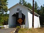
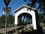
 | Drift Creek | Lincoln | Rose Lodge | 1914? | 66 | Bear Creek | 44.992888°N 123.887613°W[34] | The bridge housing included flared board-and-batten siding, arched portals, ribbon daylighting and wooden flooring; The bridge has long been closed to vehicular traffic but served pedestrian traffic up until quite recently when the approaches were removed; delisted from the NRHP; by tradition the oldest covered span in Oregon, thought its construction date is unknown. It was the covered bridge closest to the Oregon Coast, only 1.5 miles from the Pacific Ocean.[note 6] It may have been destroyed by a flood and rebuilt in 1933.[35] Lincoln County maintained the bridge as a historical exhibit-in-place since 1965. Because of severe structural problems, the bridge was dismantled and removed from its original location in the fall of 1997. The bridge was reconstructed on private property near Otis.[34] |
 | Fisher School | Lincoln | Fisher | 1919 | 72 | Five Rivers | 44.29164°N 123.84139°W[note 7] | NRHP, also known as Five Rivers Covered Bridge[36] |
 | North Fork Yachats | Lincoln | Yachats (vicinity) | 1938 | 42 | North Fork Yachats River | 44.31000°N 123.96972°W | NRHP |
 | Crawfordsville | Linn | Crawfordsville | 1932 | 105 | Calapooia River | 44.356791°N 122.860919°W[37] | NRHP, also known as Calapooia River Bridge[37] |
 | Gilkey | Linn | Crabtree | 1939 | 120 | Thomas Creek | 44.68786°N 122.90343°W[38] | NRHP, aka Thomas Creek Bridge, Thomas Creek-Gilkey Covered Bridge |
 | Hannah | Linn | Scio | 1936 | 105 | Thomas Creek | 44.712067°N 122.718420°W[39] | NRHP, Howe truss; also known as Thomas Creek Bridge[39] Named in honor of John Joseph Hannah, an early settler.[40] |
 | Hoffman | Linn | Crabtree | 1936 | 90 | Crabtree Creek | 44.653332°N 122.890419°W | NRHP, aka Crabtree Creek-Hoffman Covered Bridge |
 | Larwood | Linn | Crabtree | 1939 | 105 | Crabtree Creek | 44.630678°N 122.740921°W[41] | NRHP; located at the confluence of Roaring River and Crabtree Creek, carries the historical name of the community. The Larwood Bridge is one of three covered bridges across the Crabtree Creek in Linn County. The 105-foot housed Howe truss exhibits the common Linn County design of exposed truss side openings. The bridge is open to vehicular traffic and is adjacent to the Larwood Wayside Park.[41] |
| Shimanek | Linn | Scio | 1966 | 105 | Thomas Creek | 44.715673°N 122.804398°W | NRHP, aka Thomas Creek-Shimanek Covered Bridge | |
 | Short | Linn | Cascadia | 1945 | 105 | South Santiam River | 44.391792°N 122.510082°W[42] | NRHP; originally named Whiskey Butte Bridge for nearby Whiskey Butte, later renamed for long-term area resident, Gordon Short. Also known as South Fork Santiam River Bridge; Howe truss[42] |
 | Weddle | Linn | Sweet Home | 1937 | 120 | Ames Creek | 44.394602°N 122.726623°W[43] | placed in storage in 1987, rebuilt 1990 at the Cascade Forest Resource Center, in Sweet Home; originally located on Kelly County Road over Thomas Creek near Crabtree, possibly at 44°41′16″N 122°54′07″W |
 | Gallon House | Marion | 1917 | 84 | Abiqua Creek | 45.03215°N 122.79814°W | NRHP | |
 | Jordan | Marion (originally Linn) | Stayton | 1998 (1937) | 90 | Salem Power Canal off the North Santiam River | 44.797622°N 122.767033°W[44] | A housed Howe truss, originally located on Jordan County Road near Lyons. It was moved in 1988 to a city park in Stayton. The Jordan Bridge was one of Linn County's seven distinctive covered bridges with large side openings before its move to Marion County.[45] |
 | Cedar Crossing | Multnomah | Portland | 1982 | 60 | Johnson Creek | 45.47207°N 122.52381°W | Only covered bridge in Multnomah County, Oregon's most populous county |
 | Ritner Creek | Polk | Pedee | 1927 | 73 | Ritner Creek | 44.727897°N 123.442048°W[46] | NRHP, Removed from service in 1976 and was the last covered bridge on a state highway in Oregon. |
Preservation efforts
In 2008, The National Historic Covered Bridge Preservation Program, administered by the Federal Highway Administration, awarded grants for rehabilitation of seven covered bridges in Oregon.[47]
| Bridge | Grant |
|---|---|
| Chambers Railroad Bridge | $1,315,370 |
| Chitwood Covered Bridge | $1,076,760 |
| N. Fk. Yachats River Covered Bridge | $596,704 |
| Gallon House Covered Bridge | $51,147 |
| Nelson Mountain Covered Bridge | $17,946 |
| Mosby Creek (Layng) Covered Bridge | $17,946 |
| Pengra Covered Bridge | $17,946 |
| Total | $3,093,819 |
Gallery
 Chambers Bridge Howe truss
.jpg) Drift Creek Covered Bridge
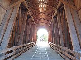
Drift Creek Covered Bridge Office Bridge interior
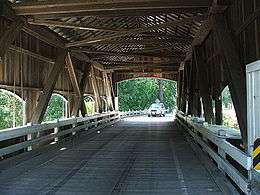 Rochester Bridge interior
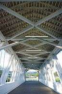 Weddle Bridge interior
See also
Footnotes
- Adjusted coordinate from "Archived copy". Archived from the original on 2009-06-08. Retrieved 2009-07-26.CS1 maint: archived copy as title (link) to center of bridge by Google Maps satellite view
- Adjusted coordinate from "Archived copy". Archived from the original on 2012-09-07. Retrieved 2009-06-10.CS1 maint: archived copy as title (link) to center of bridge by Google Maps satellite view
- Adjusted coordinate from "Archived copy". Archived from the original on 2009-06-11. Retrieved 2009-06-10.CS1 maint: archived copy as title (link) to center of bridge viewed by Google Maps satellite view
- Coordinate obtained from "Archived copy". Archived from the original on 2009-06-11. Retrieved 2009-06-09.CS1 maint: archived copy as title (link) and adjusted to center of bridge per Google satellite image
- Coordinate obtained from "Archived copy". Archived from the original on 2009-06-11. Retrieved 2009-06-09.CS1 maint: archived copy as title (link) and adjusted to center of bridge per Google satellite image
- Based on descriptions at http://www.oregon.gov/ODOT/HWY/GEOENVIRONMENTAL/historic_bridges_covered1.shtml and http://www.oregon.com/covered_bridges/bridges/bear_creek.cfm Archived 2009-02-07 at the Wayback Machine, the Drift Creek Covered Bridge was originally located at 44.91246°N 124.00453°W
- "Archived copy". Archived from the original on 2009-06-09. Retrieved 2009-06-09.CS1 maint: archived copy as title (link) adjusted to center Google satellite image
References
- General references
- Specific citations
- "Oregon's Covered Bridges". Oregon.com. Retrieved June 10, 2009.
- Wright, David W. (2009). World Guide to Covered Bridges (2009 ed.). Concord, New Hampshire: National Society for Preservation of Covered Bridges. p. lxii. ISBN 978-0-692-00617-7.
- "Alsea River (Hayden) Covered Bridge" (PDF). Oregon Department of Transportation. Retrieved 2014-09-26.
- "Archived copy". Archived from the original on 2012-10-25. Retrieved 2011-08-31.CS1 maint: archived copy as title (link)
- "Swalley Canal (Rock O' The Range) Covered Bridge" (PDF). Oregon Department of Transportation. Retrieved 2014-09-26.
- "South Umpqua River (Milo Academy) Covered Bridge" (PDF). Oregon Department of Transportation. Retrieved 2009-02-03.
- "Neal Lane Bridge". Geographic Names Information System. United States Geological Survey. Retrieved 2009-01-21.
- "Pass Creek Covered Bridge" (PDF). Oregon Department of Transportation. Retrieved 2009-02-03.
- "Pass Creek Covered Bridge". State of Oregon. Retrieved 2009-02-03.
- "Rochester Covered Bridge". Geographic Names Information System. United States Geological Survey. Retrieved 2009-01-20.
- Smith, Dwight A.; Norman, James B.; Dykman, Pieter T. (1989) [1986]. Historic Highway Bridges of Oregon (2nd ed.). Portland: Oregon Historical Society Press. p. 81. ISBN 0-87595-205-4.
- "Antelope Creek Bridge". Waymarking.com. Groundspeak, Inc. Retrieved 2009-05-15.
- "Applegate River (McKee) Covered Bridge". Oregon Covered Bridges. Oregon.com. Archived from the original on 2009-06-08. Retrieved 2009-06-10.
- Huntington, Howard. "Bridge celebration? Wimer's got it covered", Daily Courier, Grants Pass, Oregon, 07 July 2008.
- Dennis Rasmussen. "Wimer Covered Bridge Collapse Challenges Community". Citizens for Rebuilding the Wimer Covered Bridge. Retrieved 2009-06-10.
- "Evans Creek (Wimer) Covered Bridge". Oregon Covered Bridges. Oregon.com. Archived from the original on 2012-09-07. Retrieved 2009-06-10.
- "Grave Creek Bridge". Geographic Names Information System. United States Geological Survey. Retrieved 2009-01-21.
- "Centennial Bridge, Cottage Grove, Oregon". Archived from the original on 2011-07-16. Retrieved 2008-10-17.
- "Updates to the 2009 World Guide to Covered Bridges" (PDF). National Society for Preservation of Covered Bridges. 17 May 2020. Retrieved 31 May 2020.
- "Chambers Covered Bridge". Lane County, Oregon. Archived from the original on 2012-04-01. Retrieved 2013-09-06.
- "Coyote Creek Bridge". Geographic Names Information System. United States Geological Survey. Retrieved 2009-01-21.
- "Currin Bridge". Geographic Names Information System. United States Geological Survey. Retrieved 2009-01-21.
- "Deadwood Creek Covered Bridge". Oregon Covered Bridges. Oregon.com. Archived from the original on 2009-06-11. Retrieved 2009-06-10.
- "Dorena Bridge". Geographic Names Information System. United States Geological Survey. Retrieved 2009-01-21.
- "Earnest Bridge". Geographic Names Information System. United States Geological Survey. Retrieved 2009-01-21.
- "Lake Creek (Nelson Mountain) Covered Bridge" (PDF). Oregon Department of Transportation. Retrieved 2014-12-05.
- "Lowell Covered Bridge". Geographic Names Information System. United States Geological Survey. Retrieved 2009-01-20.
- "Archived copy". Archived from the original on 2009-06-11. Retrieved 2009-06-10.CS1 maint: archived copy as title (link)
- "Mosby Creek (Layng) Covered Bridge". Oregon Covered Bridges. Oregon.com. Archived from the original on 2009-06-11. Retrieved 2009-06-10.
- "Lost Creek (Parvin) Covered Bridge" (PDF). Oregon Department of Transportation. Retrieved 2009-06-10.
- "Pengra Covered Bridge". Geographic Names Information System. United States Geological Survey. Retrieved 2009-01-20.
- GNIS feature 1135668 "Stewart Bridge". Geographic Names Information System. United States Geological Survey. Retrieved 2009-09-04. is incorrect, using USGS topomap coordinate
- "Unity Covered Bridge". Geographic Names Information System. United States Geological Survey. Retrieved 2009-01-20.
- "Drift Creek Bridge (historical)". Geographic Names Information System. United States Geological Survey. Retrieved 2009-01-21.
- "Drift Creek Covered Bridge". Lincoln County Public Works. Archived from the original on 2008-08-17. Retrieved 2009-02-03.
- "Five Rivers (Fisher School) Covered Bridge". Oregon Covered Bridges. Oregon.com. Archived from the original on 2009-06-09. Retrieved 2009-06-08.
- "Crawfordsville Bridge". Geographic Names Information System. United States Geological Survey. Retrieved 2009-01-21.
- "Archived copy". Archived from the original on 2009-06-11. Retrieved 2009-06-09.CS1 maint: archived copy as title (link) and adjusted to center Google Satellite view
- "Hannah Bridge". Geographic Names Information System. United States Geological Survey. Retrieved 2009-01-21.
- Young, Amalie (July 8, 2001). "The bridges in our own back yard". Eugene Register-Guard. pp. 3H. Retrieved 30 April 2015.
- "Larwood Bridge". Geographic Names Information System. United States Geological Survey. Retrieved 2009-01-21.
- "Short Bridge". Geographic Names Information System. United States Geological Survey. Retrieved 2009-01-21.
- "Weddle Covered Bridge". Geographic Names Information System. United States Geological Survey. Retrieved 2009-01-20.
- "Jordan Bridge". Geographic Names Information System. United States Geological Survey. Retrieved 2009-01-21.
- Smith, Dwight A.; Norman, James B.; Dykman, Pieter T. (1989) [1986]. Historic Highway Bridges of Oregon (2nd ed.). Portland: Oregon Historical Society Press. p. 215. ISBN 0-87595-205-4.
- "Ritner Creek Bridge". Geographic Names Information System. United States Geological Survey. Retrieved 2009-01-21.
- "National Historic Covered Bridge Preservation Program". Retrieved 2009-01-28.
External links
| Wikimedia Commons has media related to Covered bridges in Oregon. |
This article is issued from Wikipedia. The text is licensed under Creative Commons - Attribution - Sharealike. Additional terms may apply for the media files.