List of North American cities by population
For the majority of cities in North America, the most recent official population census results, estimates or short-term projections date to 2015. This list compiles figures for all North American cities with a population within city limits exceeding 500,000 that year. These figures do not reflect the population of the urban agglomeration or metropolitan area which typically do not coincide with the administrative boundaries of the city. They refer to mid-2015 populations with the following exceptions:
- Mexican cities, whose figures derive from the 2015 Intercensal Survey conducted by INEGI with a reference date of 15 March 2015;[1]
- Calgary, whose 2015 municipal census had a reference date of April 1;[2]
- Edmonton, which conducted municipal censuses in April 2014 and April 2016 but has not reported an intercensal estimate of its 2015 population. The April 2016 census result is given instead.
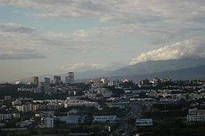
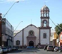
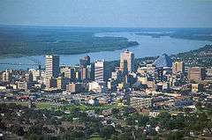
List


.jpg)


.jpg)


See also
Notes
- Population estimate is that of the federal entity known since 2016 as Ciudad de México and previously as the Distrito Federal.[1]
- Population estimate has a reference date of March 15, 2015.[1]
- Population estimate is that of the Toronto census division, which consists solely of the City of Toronto.[6]
- Population estimate is that of the entire municipio.
- Population estimate is that of the cabecera municipal (municipal seat).
- Population from municipal census based on a census date of April 1, 2015.[2] In April 2016 Calgary's annual municipal census reported a population of 1,235,171.[11]
- The administration of Naucalpan is divided between the municipalities of Naucalpan and Huixquilucan. The population projections for each portion of the city have been combined.
- Population estimate is that of the Ottawa census division, which consists solely of the City of Ottawa.[17]
- Population from municipal census based on a census date of April 1, 2016.[18]
- The City of Indianapolis, Indiana, and Marion County, Indiana, are separate entities with a single consolidated city–county government. The City of Indianapolis comprises all of Marion County except the other incorporated municipalities within the county. See Indianapolis (balance).
- The administration of Veracruz is divided between the municipalities of Veracruz and Boca del Río. The population estimates of the two municipalities have been combined.
- Nashville is a consolidated city-county. The population given is for the entire city-county, excluding other incorporated places lying within the city-county limits. See Nashville-Davidson (balance), Tennessee.
- The City of Louisville, Kentucky, and Jefferson County, Kentucky, are separate entities with a single consolidated city–county government. The City of Louisville comprises all of Jefferson County except the other incorporated municipalities within the county. See Louisville/Jefferson County metro government (balance), Kentucky.
- Population estimate is that of the Hamilton census division, which consists solely of the City of Hamilton.[24]
References
- "Encuesta Intercensal 2015: Presentación de resultados" (PDF). INEGI. p. 5. Retrieved 2016-11-08.
- "2015 Municipal Affairs Population List" (PDF). Alberta Municipal Affairs. ISBN 978-1-4601-2630-1. Retrieved July 17, 2016.
- "Encuesta Intercensal 2015: Tabulados - descarga". INEGI. Archived from the original on 2016-11-13. Retrieved 2016-11-08.
- Brinkhoff, Thomas. "Mexico: Administrative Division". City Population. Retrieved 2016-11-08.
- "Annual Estimates of the Resident Population for Incorporated Places of 50,000 or More, Ranked by July 1, 2015 Population: April 1, 2010 to July 1, 2015". United States Census Bureau, Population Division. May 2016. Archived from the original on 2020-02-13. Retrieved 2016-05-19.
- "Standard Geographical Classification (SGC) 2006: Economic Regions (3520 - Toronto, census subdivisions)". Statistics Canada. 2014-04-01. Archived from the original on 2015-05-30. Retrieved 2015-06-11.
- "Table 3.5: Population and demographic factors of growth by census division, provinces and territories". Statistics Canada. 2016-02-10. Retrieved 2016-04-24.
- "3. Población Proyectada al 30 de junio, por edades simples y años simples. AMBOS SEXOS. Período 2015 - 2050" (PDF). Proyecciones de la Población de Cuba 2015 - 2050. Oficina Nacional de Estadísticas. Archived from the original (PDF) on 2016-04-29. Retrieved 2016-04-24.
- Population des municipalités du Québec, décret 2016 (Report). Institut de la statistique du Québec. 2015-12-30. Retrieved 2016-04-24.
- "Mexico: Main cities". GeoHive. Archived from the original on 2016-10-28. Retrieved 2016-12-15.
- "2016 Civic Census Results" (PDF). City of Calgary. Retrieved August 6, 2016.
- "El INE te cuenta: principales resultados del censo a nivel departamental y municipios". Instituto Nacional de Estadística Honduras. Retrieved 2016-04-05.
- "7. POBLACION TOTAL ESTIMADA POR MUNICIPIO 2011-2015". BOLETIN ANUAL DE INDICADORES ESTADISTICOS DE TRANSPORTE 2011 (PDF) (Report). Ministerio de Transporte e Infraestructura. May 2012. p. 69. Retrieved 2015-11-20.
- "Distrito Nacional". Población total estimadas y proyectadas por año calendario y sexo, según región y provincia 2000 2030 (Report). Oficina Nacional de Estadística. 2014. Archived from the original on 2016-01-31. Retrieved 2016-04-24.
- Guatemala: Estimaciones de la Población total por municipio. Período 2008-2020. (al 30 de junio) (PDF) (Report). Instituto Nacional de Estadistica Guatemala. Archived from the original (PDF) on 2015-04-04. Retrieved 2015-06-03.
- POPULATION TOTALE, DE 18 ANS ET PLUS MENAGES ET DENSITES ESTIMES EN 2015 (PDF) (Report). Institut Haïtien de Statistique et d’Informatique (IHSI). March 2015. p. 23. Archived from the original (PDF) on 2015-11-06. Retrieved 2016-05-01.
- "Standard Geographical Classification (SGC) 2006: Economic Regions (3510 - Ottawa, census subdivisions)". Statistics Canada. 2014-04-01. Archived from the original on 2015-05-30. Retrieved 2016-05-01.
- "2016 Municipal Census Results". City of Edmonton. Retrieved 2016-11-08.
- "Population and Housing Estimates". Peel Data Centre. Retrieved 2015-05-01.
- Población total estimadas y proyectadas por año calendario, región, provincia y municipio según sexo y grupos quinquenales de edad, 2015-2020 (Report). Oficina Nacional de Estadística. 2015-05-09. Archived from the original on 2016-06-24. Retrieved 2016-06-16.
- "Population of Winnipeg" (PDF). City of Winnipeg. April 2016. Retrieved 2016-05-01.
- "Table 9. Population by Parish: 2011–2015". Demographic Statistics 2015 (Report). Statistical Institute of Jamaica. April 2016. p. 9. Archived from the original on 2015-09-24. Retrieved 2016-05-19.
- "2015 Sub-Provincial Population Estimates: A release from the Province of British Columbia's central statistical agency" (PDF). BC Stats. 2016-01-29. Retrieved 2016-05-01.
- "Standard Geographical Classification (SGC) 2006: Hamilton [Census division], geographical codes". Statistics Canada. 2014-04-01. Retrieved 2016-05-01.
This article is issued from Wikipedia. The text is licensed under Creative Commons - Attribution - Sharealike. Additional terms may apply for the media files.