List of Indiana state historical markers in Blackford County
This is a list of the Indiana state historical markers in Blackford County.
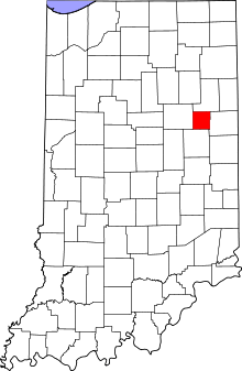
Location of Blackford County in Indiana
This is intended to be a complete list of the official state historical markers placed in Blackford County, Indiana, United States by the Indiana Historical Bureau. The locations of the historical markers and their latitude and longitude coordinates are included below when available, along with their names, years of placement, and topics as recorded by the Historical Bureau. There are 2 historical markers located in Blackford County.[1]
Historical markers
| Marker title | Image | Year placed | Location | Topics |
|---|---|---|---|---|
| Godfroy Reserve[2] | 1989 | Southeastern corner of the junction of Huntington (State Road 18) and Main Streets in Montpelier 40°33′14″N 85°16′40″W |
Early Settlement and Exploration, American Indian/Native American | |
| Blackford County Courthouse[3] | 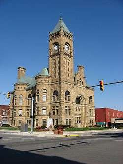 |
1994 | 110 W. Washington Street at the southern entrance to the courthouse in Hartford City 40°27′6″N 85°22′5″W |
Buildings and Architecture, Government Institutions |
See also
References
- "Indiana Historical Markers by County". State of Indiana. Retrieved 2012-03-15.
- Godfroy Reserve, Indiana Historical Bureau, n.d. Accessed 2012-03-14.
- Blackford County Courthouse, Indiana Historical Bureau, n.d. Accessed 2012-03-14.
External links
Municipalities and communities of Blackford County, Indiana, United States | ||
|---|---|---|
| Cities | Map of Indiana highlighting Blackford County | |
| Town | ||
| Townships | ||
| Unincorporated communities | ||
| Ghost town | ||
| Footnotes | ‡This populated place also has portions in an adjacent county or counties | |
This article is issued from Wikipedia. The text is licensed under Creative Commons - Attribution - Sharealike. Additional terms may apply for the media files.