Lick Creek (Shamokin Creek tributary)
Lick Creek is a tributary of Shamokin Creek in Northumberland County, Pennsylvania, in the United States. It is approximately 2.7 miles (4.3 km) long and flows through Shamokin Township.[1] The watershed of the creek has an area of 2.46 square miles (6.4 km2). The creek is not designated as impaired and its watershed is designated as a Coldwater Fishery and a Migratory Fishery. It supports some aquatic life.
| Lick Creek | |
|---|---|
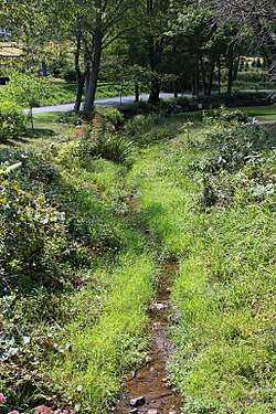 Lick Creek looking upstream | |
| Physical characteristics | |
| Source | |
| • location | valley on a ridge in Shamokin Township, Northumberland County, Pennsylvania |
| • elevation | between 960 and 980 feet (290 and 300 m) |
| Mouth | |
• location | Shamokin Creek in Shamokin Township, Northumberland County, Pennsylvania |
• coordinates | 40°50′58″N 76°35′14″W |
• elevation | 545 ft (166 m) |
| Length | 2.7 mi (4.3 km) |
| Basin size | 2.46 sq mi (6.4 km2) |
| Basin features | |
| Progression | Shamokin Creek → Susquehanna River → Chesapeake Bay |
| Tributaries | |
| • left | three unnamed tributaries |
| • right | one unnamed tributary |
Course

Lick Creek begins in a valley on a ridge in Shamokin Township. It flows east-northeast for several tenths of a mile before turning north and receiving an unnamed tributary from the right. The creek then turns north for a few tenths of a mile, entering a much broader valley and receiving an unnamed tributary from the left. The creek then turns east for more than a mile and receives two more unnamed tributaries from the left before turning north-northeast and then east. It then turns northeast for a short distance and crosses Pennsylvania Route 61 before reaching its confluence with Shamokin Creek.[1]
Lick Creek joins Shamokin Creek 16.03 miles (25.80 km) upstream of its mouth.[2]
Hydrology, geography and geology
The elevation near the mouth of Lick Creek is 545 feet (166 m) above sea level.[4] The elevation of the creek's source is between 960 and 980 feet (290 and 300 m) above sea level.[1]
Lick Creek is not impacted by mining.[5] The creek has a relatively high level of water quality. All streams in the creek's watershed meet at least one designated use and none are impaired.[6]
Watershed
The watershed of Lick Creek has an area of 2.46 square miles (6.4 km2).[2] The mouth of the creek is in the United States Geological Survey quadrangle of Shamokin. However, its source is in the quadrangle of Trevorton.[4]
The watershed of Lick Creek is in the lower part of the Shamokin Creek drainage basin and in the middle of the latter watershed's northern part.[5]
History
Lick Creek was entered into the Geographic Names Information System on August 2, 1979. Its identifier in the Geographic Names Information System is 1179280.[4]
Biology
The drainage basin of Lick Creek is designated as a Coldwater Fishery and a Migratory Fishery.[7] Some aquatic life exists in the creek and it historically contained a healthy aquatic community.[5][8]
See also
- Little Shamokin Creek, next tributary of Shamokin Creek going downstream
- Millers Run, next tributary of Shamokin Creek going upstream
- List of rivers of Pennsylvania
- List of tributaries of Shamokin Creek
References
- United States Geological Survey, The National Map Viewer, archived from the original on April 5, 2012, retrieved August 12, 2015
- Pennsylvania Gazetteer of Streams (PDF), November 2, 2001, p. 85, retrieved August 12, 2015
- "Table 2. Northumberland County Stream Crossing Specifics", Pennsylvania Bulletin, June 19, 2010, retrieved August 12, 2015
- Geographic Names Information System, Feature Detail Report for: Lick Creek, retrieved August 12, 2015
- United States Geological Survey, Effects of Abandoned Coal-Mine Drainage on Streamflow and Water Quality in the Shamokin Creek Basin, Northumberland and Columbia Counties, Pennsylvania, 1999-2001 (PDF), pp. 13, 37, retrieved August 12, 2015
- Watershed Restoration Action Strategy (WRAS) State Water Plan Subbasin 06B Mahanoy Creek and Shamokin Creek Watersheds (Susquehanna River) Northumberland and Schuylkill Counties, February 2004, pp. 7, 13, retrieved August 12, 2015
- "§ 93.9m. Drainage List M. Susquehanna River Basin in Pennsylvania Susquehanna River", Pennsylvania Code, retrieved August 12, 2015
- SECTION III-------SHAMOKIN CREEK WATERSHED: RESULTS OF INVESTIGATIONS (PDF), p. 3, retrieved August 12, 2015