Lengenfeld unterm Stein
Lengenfeld unterm Stein (or Lengenfeld/Stein) is a village and a former municipality in the Unstrut-Hainich-Kreis district of Thuringia, Germany. Since 1 December 2011, it is part of the municipality Südeichsfeld.
Lengenfeld unterm Stein | |
|---|---|
Ortsteil of Südeichsfeld | |
 Coat of arms | |
Location of Lengenfeld unterm Stein 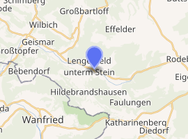
| |
 Lengenfeld unterm Stein  Lengenfeld unterm Stein | |
| Coordinates: 51°12′53″N 10°13′18″E | |
| Country | Germany |
| State | Thuringia |
| District | Unstrut-Hainich-Kreis |
| Municipality | Südeichsfeld |
| Area | |
| • Total | 13.34 km2 (5.15 sq mi) |
| Elevation | 260 m (850 ft) |
| Population (2010-12-31) | |
| • Total | 1,246 |
| • Density | 93/km2 (240/sq mi) |
| Time zone | CET/CEST (UTC+1/+2) |
| Postal codes | 99976 |
| Dialling codes | 036027 |
| Vehicle registration | UH |
| Website | l-u-st.de |
This article is issued from Wikipedia. The text is licensed under Creative Commons - Attribution - Sharealike. Additional terms may apply for the media files.