Lebanon Mountain Trail
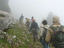
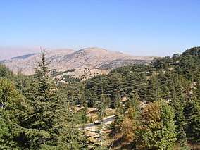
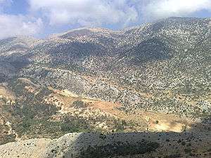
The Lebanon Mountain Trail (LMT) is a long-distance hiking trail in Lebanon. It extends from Andaket in north of Lebanon to Marjayoun in the south along a 470 km (290 mi) path that transects more than 75 towns and villages at altitudes ranging from 570 to 2,011 meters (about 1,870-6,598 feet) above sea level.
| Lebanon Mountain Trail | |
|---|---|
| Length | 440 km (273 mi) |
| Hiking details | |
| Trail difficulty | Easy to moderate |
| Season | All year round |


Background
ECODIT, a company providing environmental and development consulting services, implemented the LMT project with grant funding from the United States, under a two-year (2005-2007) Cooperative Agreement with USAID Lebanon. As part of the LMT project, ECODIT helped establish the Lebanon Mountain Trail Association to "ensure the long-term sustainability of the trail".
The following partners helped implement various activities under the LMT project:
Subcontractors:
- ECODIT Liban sarl
- The International Ecotourism Society (TIES)
- University Saint-Esprit de Kaslik (USEK)
Resource Groups
- Appalachian Trail Conservancy (ATC)
- US Forest Service (USFS)
- Club des Vieux Sentiers (CVS)
Partners
- About 50 municipalities
- Government Agencies (Ministry of Tourism, Ministry of Environment, Directorate of Geographic Affairs, Directorate General of Urban Planning, Litani River Authority)
- Lebanese Scout Organizations
- Tour Operators (Biladi, Cyclamen, Esprit Nomade, Lebanon Roots, Liban Trek, Lebanon Roots, Vamos Todos, Blue Carrot Adventure Club, Club Des Vieux Sentiers, Friends of Nature With No Boundaries, Gravity Trek, Ibex Ecotourism, La Réserve Afqa, Lebanese Adventure, The Club of Hidden Roads of Lebanon, Responsible Mobilities)
- NGOs (Ansar El Bi’a Sir Ed Dinniyeh, Friends of Bcharre Cedar Committee, Environment Council of Qobaiyat, SOIL Hasbaya, Friends of Tannourine Cedar Forest, Friends of Horsh Ehden, Wadi Al Zouhour Qmamine, Friends of Green Environment Association Al Barouk, Al Shouf Cedar Society, Al Beit Al Loubnani Lal Bi’a (Kfarhim), Al Khraibi Club, The Cultural and Social League of Niha, Social Development NGO Boqaatat Kanaan, Active Club Kfardebian, Social Cultural and Sporting Club of Aqoura)
Sections
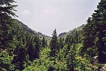
The LMT is divided into 27 sections, each of which is 9–24 km long and can be hiked in one day:
Section 0: Andaket–Qobaiyat
- Qobaiyat-Tachea
- Tachea–Qemmamine
- Qemmamine–Kfar Bnine
- Kfar Bnine–Sir Dinniyeh
- Sir Ed Dinnieh–Ehden
- Ehden–Qannoubine
- Qannoubine–Bsharri
- Bsharri–Hasroun
- Hasroun–Tannourine
- Tannourine El Faouqa–Aaqoura
- Aaqoura–Afqa
- Afqa–Hrajel
- Hrajel–Kfar Aaqab
- Kfar Aaqab–Baskinta
- Baskinta–Mtain
- Mtain–Falougha
- Falougha–Aain Zhalta
- Aain Zhalta–Barouk
- Barouk–Maasser
- Maasser–Niha
- Niha–Jezzine
- Jezzine-Aaytanit
- Aaytanit-Kawkaba Bou Aarab
- Kawkaba Bou Aarab–Rashaya
- Rachaya–Hasbaya
- Hasbaya–Marjayoun
Lodging
Lodging is available in many of the villages along the trail. Several bed and breakfasts operate in villages that are at the ends of the trail sections. The LMT Association maintains a list of available lodging along the trail on its website (see External links below).
Local guides
LMT Association encourages hikers to hire local guides when hiking the trail. The local guides know the trails and can add local color to the hike. The association's web site lists the local guides.