Le Toûno
Le Toûno (3,018 m) is a mountain of the Pennine Alps, overlooking Saint-Luc in the canton of Valais. It lies within the Val d'Anniviers, west of the Pointe de Tourtemagne.
| Le Toûno | |
|---|---|
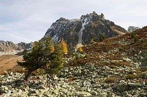 View from the north side | |
| Highest point | |
| Elevation | 3,018 m (9,902 ft) |
| Prominence | 119 m (390 ft) [1] |
| Parent peak | Pointe de Tourtemagne |
| Coordinates | 46°12′27″N 7°39′00″E |
| Geography | |
 Le Toûno Location in Switzerland | |
| Location | Valais, Switzerland |
| Parent range | Pennine Alps |
The summit can be accessed via a trail on the south side of the mountain from Saint-Luc.
References
- Retrieved from the Swisstopo topographic maps. The key col is located east of the summit at 2,899 metres.
This article is issued from Wikipedia. The text is licensed under Creative Commons - Attribution - Sharealike. Additional terms may apply for the media files.