Le Bleymard
Le Bleymard is a former commune in the Lozère department in southern France. On 1 January 2017, it was merged into the new commune Mont Lozère et Goulet.[2]
Le Bleymard | |
|---|---|
Part of Mont Lozère et Goulet | |
 The town hall of Le Bleymard | |
 Coat of arms | |
Location of Le Bleymard 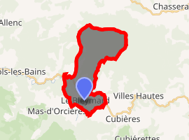
| |
 Le Bleymard  Le Bleymard | |
| Coordinates: 44°29′14″N 3°44′09″E | |
| Country | France |
| Region | Occitanie |
| Department | Lozère |
| Arrondissement | Mende |
| Canton | Saint-Étienne-du-Valdonnez |
| Commune | Mont Lozère et Goulet |
| Area 1 | 16.36 km2 (6.32 sq mi) |
| Population (2017-01-01)[1] | 380 |
| • Density | 23/km2 (60/sq mi) |
| Time zone | UTC+01:00 (CET) |
| • Summer (DST) | UTC+02:00 (CEST) |
| Postal code | 48190 |
| Elevation | 1,037–1,482 m (3,402–4,862 ft) (avg. 1,069 m or 3,507 ft) |
| 1 French Land Register data, which excludes lakes, ponds, glaciers > 1 km2 (0.386 sq mi or 247 acres) and river estuaries. | |
The Scottish author Robert Louis Stevenson ate in the village on the evening of 28 September 1878 before camping nearby, as recounted in his book Travels with a Donkey in the Cévennes.[3] The Robert Louis Stevenson Trail (GR 70), a popular long-distance path following Stevenson's approximate route, runs through the village, and a three-day "Festival Stevenson" is held in the area annually. The nearby Mont Lozère is a ski resort.[4]
Population
| Historical population | ||
|---|---|---|
| Year | Pop. | ±% |
| 1793 | 752 | — |
| 1800 | 748 | −0.5% |
| 1806 | 749 | +0.1% |
| 1821 | 486 | −35.1% |
| 1831 | 583 | +20.0% |
| 1836 | 597 | +2.4% |
| 1841 | 583 | −2.3% |
| 1846 | 596 | +2.2% |
| 1851 | 652 | +9.4% |
| 1856 | 610 | −6.4% |
| 1861 | 553 | −9.3% |
| 1866 | 540 | −2.4% |
| 1872 | 575 | +6.5% |
| 1876 | 600 | +4.3% |
| 1881 | 678 | +13.0% |
| 1886 | 665 | −1.9% |
| 1891 | 605 | −9.0% |
| 1896 | 649 | +7.3% |
| 1901 | 598 | −7.9% |
| 1906 | 621 | +3.8% |
| 1911 | 697 | +12.2% |
| 1921 | 553 | −20.7% |
| 1926 | 575 | +4.0% |
| 1931 | 549 | −4.5% |
| 1936 | 448 | −18.4% |
| 1946 | 493 | +10.0% |
| 1954 | 336 | −31.8% |
| 1962 | 324 | −3.6% |
| 1968 | 295 | −9.0% |
| 1975 | 358 | +21.4% |
| 1982 | 434 | +21.2% |
| 1990 | 440 | +1.4% |
| 1999 | 446 | +1.4% |
| 2006 | 367 | −17.7% |
| 2009 | 347 | −5.4% |
Personalities
- Alphonse Magnien (1837–1902), Catholic educator
- Henri Rouvière (1876–1952), Professor of anatomy
See also
References
- "Populations légales 2017". INSEE. Retrieved 6 January 2020.
- Arrêté préfectoral 23 May 2016 (in French)
- Stevenson, Robert Louis (1905) [1879]. . Travels with a Donkey in the Cevennes. New York: Charles Scribner's Sons. p. – via Wikisource.
From Bleymard after dinner, although it was already late, I set out to scale a portion of the Lozère.
- Castle, Alan (2007). The Robert Louis Stevenson Trail (2nd ed.). Cicerone. pp. 125–127. ISBN 978-1-85284-511-7.
External links
| Wikimedia Commons has media related to Le Bleymard. |
- Le Bleymard in Lozere (separate texts in French, Dutch and German; photographs)
| Authority control |
|
|---|
This article is issued from Wikipedia. The text is licensed under Creative Commons - Attribution - Sharealike. Additional terms may apply for the media files.