Lazarevo, Jewish Autonomous Oblast
Lazarevo (Russian: Лазарево) is a small town in Leninsky District in the Jewish Autonomous Oblast, Russia. It is the head of Lazarevskoye Rural Settlement.[1]
Lazarevo Лазарево | |
|---|---|
Town | |
Location of Lazarevo 
| |
 Lazarevo Location of Lazarevo 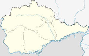 Lazarevo Lazarevo (Jewish Autonomous Oblast) | |
| Coordinates: 48°14′27″N 132°26′37″E | |
| Country | Russia |
| Federal subject | Jewish Autonomous Oblast |
| Administrative district | Leninsky District[1] |
| Population | |
| • Total | 751 |
| • Capital of | Lazarevskoye Rural Settlement[1] |
| Time zone | UTC+10 (MSK+7 |
| OKTMO ID | 99610455101 |
Geography
Lazarevo is located at an elevation of 140 meters (460 ft) by a small mountain range north of the Amur River.[4] The town lies 86 kilometers (53 mi) southwest of Birobidzhan, the administrative center of the autonomous oblast.[5] Its population is 751 (2010 Census);[2]
History
Lazarevo is the birthplace of Soviet Arctic explorer Georgy Ushakov (1901 - 1963) who fully surveyed and charted Severnaya Zemlya for the first time in history.[6]
References
- Закон Еврейской автономной области от 26 ноября 2003 года № 231-ОЗ «О статусе и границе Ленинского муниципального района»(Law of the Jewish Autonomous Region on November 26, 2003 № 231-OZ, "On the status of the border and Leninsky municipal district")
- Russian Federal State Statistics Service (2011). "Всероссийская перепись населения 2010 года. Том 1" [2010 All-Russian Population Census, vol. 1]. Всероссийская перепись населения 2010 года [2010 All-Russia Population Census] (in Russian). Federal State Statistics Service.
- "Об исчислении времени". Официальный интернет-портал правовой информации (in Russian). 3 June 2011. Retrieved 19 January 2019.
- GoogleEarth
- "Lazarevo". Mapcarta. Retrieved 23 November 2016.
- Biography of G. A. Ushakov Archived 2011-07-25 at the Wayback Machine at Polar World.
Administrative center: Birobidzhan • Rural localities | |||
| Districts | |||
| Towns | |||
| Urban-type settlements | |||
This article is issued from Wikipedia. The text is licensed under Creative Commons - Attribution - Sharealike. Additional terms may apply for the media files.