Laverstock and Ford
Laverstock and Ford is a parish council serving the civil parish of Laverstock, on the northeast and eastern outskirts of Salisbury, Wiltshire, England. The parish is shaped like a figure 7 and incorporates the villages of Laverstock and Ford, the eastern half of the former manor of Milford, the ancient settlement of Old Sarum, and part of the Hampton Park district on the edge of Salisbury.
| Laverstock and Ford | |
|---|---|
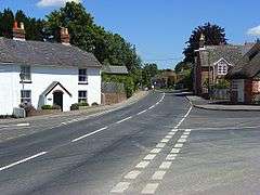 Riverside Road, Laverstock | |
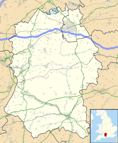 Laverstock and Ford Location within Wiltshire | |
| Population | 5,472 (in 2011)[1] |
| OS grid reference | SU159309 |
| Unitary authority | |
| Ceremonial county | |
| Region | |
| Country | England |
| Sovereign state | United Kingdom |
| Post town | Salisbury |
| Postcode district | SP1, SP4 |
| Dialling code | 01722 |
| Police | Wiltshire |
| Fire | Dorset and Wiltshire |
| Ambulance | South Western |
| UK Parliament | |
| Website | Parish Council |
Laverstock has been the site of a settlement since the 6th century and there is evidence that it was occupied much earlier. It lies on the east bank of the River Bourne with rising downland on its eastern boundary. To the southwest lies the Salisbury district of Hampton Park and to the northeast, Winterbourne Earls.
Laverstock, the parish's main settlement, is approximately 1 mile (1.6 km) east of Salisbury city centre, 33 miles (53 km) due south of Swindon and 77 miles (124 km) west-southwest of London.
History
Flint mines and signs of barrows have been discovered on Burrough's Hill, indicating settlement back to Neolithic time. There is also evidence of settlement during the Iron and Bronze Age. A Roman cemetery and settlement has been found on Cocky's Hill.[2] Laverstock has two entries in the Domesday Book which indicate the settlement was then owned by Wilton Abbey with some parts owned by officers of the king.[3]
Milford Mill Bridge, linking the parish with Salisbury over the Bourne, dates from the 14th century and is Grade I listed.[4]
St Thomas's Bridge to the north was named for Thomas Becket who walked an ancient route through the settlement. It was built around 1700 and widened in 1900.
Laverstock once boasted a number of large houses: Laverstock Hall, Laverstock House, Laverstock Hill and Burroughs Hill. Laverstock House was a large and noted private licensed madhouse from the 18th to the 20th century, owned by the Finch family. It closed in 1955 and has since been demolished as have Laverstock Hill and Laverstock Hall to provide modern residential development.[2]
Geography
The Laverstock and Ford parish incorporates all of Laverstock, Ford and Old Sarum as well as parts of Hampton Park and Milford. The parish is within Salisbury's Urban Area but is controlled by its own parish council rather than Salisbury's city council. This means it is outside Salisbury's city boundary but within the wider urban area.
Milford
Milford was an ancient manor, recorded in 1275 as belonging to the Bishop of Salisbury.[5]
In 1835 part of Milford which bordered the city of Salisbury became the civil parish of Milford Within. In 1904 the city became a single civil parish and more land, extending as far as the Bourne, was transferred to the city. The eastern part of Milford became the parish of Milford Without in 1894, then in 1904 was divided between Salisbury and Laverstock parish.[6] Milford is a suburb in eastern Salisbury and is situated on the A36, which is known locally as Southampton Road. The suburb is also the home of the large Southampton Road retail park and is near the Petersfinger Park and Ride site. The area remains divided between the Salisbury and Laverstock and Ford parishes. The eastern half of Milford is within the Laverstock parish; the western half is in the parish of Salisbury where the suburb is part of the St Edmund and Milford ward. Milford is bounded by the A36 road to the south and west, Laverstock to the north and the River Bourne to the east.
Laverstock
Laverstock is a suburban village on the eastern outskirts of Salisbury, 1.2 miles (2 km) east-northeast of the city centre. The village has a small number of businesses, mainly clustered around Church Road.[7] These include a fish and chip shop, a Chinese takeaway and a 'One Stop' convenience store. Also within the area is Laverstock and Ford sports club[8] which is home to Laverstock & Ford F.C. and a cricket team, among others.[9] There are three secondary schools on adjacent sites: Wyvern College, St Edmund's Girls' School and St Joseph's Catholic School. Laverstock borders Milford to the south, Hampton Park to the north, and across the River Bourne to the west is St Mark's. Laverstock is the largest settlement in the parish, having a population of around 3,000 in 2011.
Hampton Park
Hampton Park is a district on the north-eastern edge of Salisbury,[10] to the south of Ford and to the north of Bishopdown Farm. The area is mainly residential but is home to the Hampton Inn which is just north of the Hampton Park roundabout.[11] A Premier Inn branch can be found just off Pearce Way, which the area is centred on.[12] Hampton Park is separated from Ford by Spire View road and straddles the border between Salisbury and Laverstock & Ford. The area is the terminus of the Park and Ride 7 bus route.
Ford
Ford is the easternmost settlement in the parish, bordered by Old Sarum to the northwest and Hampton Park to the south.[13] The district has an SP4 postcode and is two miles north-northeast of Salisbury city centre.[14] The area is entirely residential, with the exception of a few farms surrounding it. Ford had a population of 402 in 2011.[15]
Governance
The parish falls within the Laverstock, Ford and Old Sarum electoral ward. The population of the ward taken at the 2011 census was 4,092.[16] Women in the ward had the fourth highest life expectancy at birth, 96.3 years, of any ward in England and Wales in 2016.[17]
Railways
In 1847 a railway between Eastleigh and Salisbury was built with a terminus at Milford. However, this station was damaged by fire in 1858 and it was decided to dig a tunnel to access Fisherton which was closer to the city. In 1857 the West of England line from London Waterloo via Andover was built, joining the older line at Laverstock Junction to access the station at Fisherton.[2]
Old Sarum Airfield
In 1917 part of Ford Farm in the north of the parish was bought by the government to provide a site for the developing Royal Flying Corps. Initially known as Ford Farm, it quickly adopted the name of Old Sarum Airfield from the nearby ancient fortification of Old Sarum. The airfield continues in use by civilian light aircraft.
Church of St. Andrew

It is unclear whether a Saxon church existed but there was a Norman church that was appropriated together with its income by Bishop Poore to provide offerings to priests in the new cathedral. In 1410 the church was completely destroyed together with the priest's house and nearby buildings. It was later rebuilt but by 1853 was reported to be in poor condition. The church was demolished and a new one, designed by TH Wyatt, was built from 1858 at a cost of £2,353. The south and west windows contain fragments of grisaille glass from Salisbury Cathedral, collected by Canon Stanley Baker from the street ditches in Salisbury where it had been thrown after its removal from the cathedral by James Wyatt in 1788. Canon Baker is buried in the churchyard. The church has no bells.[18]
Education
The parish has three primary schools. The first school in Laverstock village was established in the 1830s and moved into a new building in 1888; after expansion in the 20th century the school continues as St Andrew's CE VA Primary School.[19] Housing development in the early 21st century led to the building of Greentrees Primary School on two sites at Bishopdown, and Old Sarum Primary School.
There are three secondary schools, on adjacent sites and with wide catchment areas:
- St Joseph's Catholic School
- St Edmund's Girls' School
- Wyvern College, a Church of England college for boys[20]
Site of Special Scientific Interest
Cockey Down, a grassy hill to the east of Laverstock, is a Site of Special Scientific Interest, a protected area that has interesting flora and fauna.
References
- "Laverstock (Parish) – Population Density". 2011 Census. Office for National Statistics. Retrieved 21 February 2015.
- "Laverstock". Wiltshire Community History. Wiltshire Council. Retrieved 7 July 2016.
- Laverstock in the Domesday Book
- Historic England. "Milford Mill Bridge, Laverstock (1242884)". National Heritage List for England. Retrieved 21 February 2015.
- "Victoria County History – Wiltshire – Vol 6 pp69-72 – New Salisbury". British History Online. University of London. Retrieved 23 August 2015.
- "Victoria County History – Wiltshire – Vol 6 pp90-93 – Salisbury: The expansion of the city; Milford". British History Online. University of London. Retrieved 23 August 2015.
- "Church Rd". Church Rd. Retrieved 17 January 2019.
- "Google Maps". Google Maps. Retrieved 17 January 2019.
- "Laverstock & Ford Sports Club". Laverstockandfordsportsclub.co.uk. Retrieved 17 January 2019.
- "Map of district" (PDF). Assets.goaheadbus.com. Retrieved 17 January 2019.
- "Hampton Inn Table Table". Hampton Inn Table Table. Retrieved 17 January 2019.
- "Google Maps". Google Maps. Retrieved 17 January 2019.
- "Ford". Ford. Retrieved 17 January 2019.
- "Distance between Ford, Salisbury, United Kingdom and Salisbury, United Kingdom, (UK)". Distancecalculator.globefeed.com. Retrieved 17 January 2019.
- Services, Good Stuff IT. "Laverstock, Ford and Old Sarum E00163266 - UK Census Data 2011". UK Census Data. Retrieved 17 January 2019.
- "Laverstock, Ford and Old Sarum ward 2011". Ukcensusdata.com. Retrieved 13 March 2015.
- Bennett, James; et al. (22 November 2018). "Contributions of diseases and injuries to widening life expectancy inequalities in England from 2001 to 2016: a population-based analysis of vital registration data". Lancet public health. Retrieved 23 November 2018.
- "Church of St Andrew, Laverstock". Wiltshire Community History. Wiltshire Council. Retrieved 7 July 2016.
- "St. Andrew's Church of England VA Primary School". Wiltshire Community History. Wiltshire Council. Retrieved 13 January 2018.
- "Schools". Laverstock and Ford Parish Council. Retrieved 7 July 2016.