Langley Hill Doppler radar
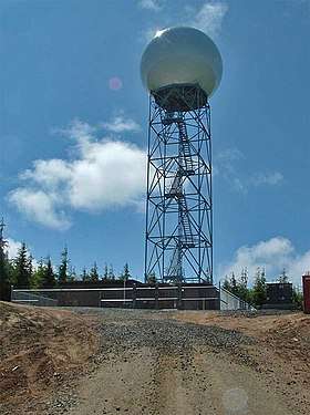
The Langley Hill Doppler radar (KLGX) is a National Weather Service NEXRAD Doppler weather radar station on the Pacific coast of Washington State, in the United States. Prior to its construction, Washington's Olympic Peninsula coast was the only portion of the U.S. coastline without weather radar coverage, and "virtually no radar coverage [is] available over the ocean, where the majority of western Washington's weather originates" according to a Weather Service report to the United States Congress.[1] Its location was announced in early 2011, construction started in March, and the unit was commissioned in September, 2011.[2][3][4] A major motivation for the station was early detection of Pacific Northwest windstorms; a proponent, Professor Cliff Mass of the University of Washington, said it would provide an additional 6 to 12 hour storm warning to residents of the Pacific Northwest.[4]
Location
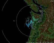
The radar dome, the first on Washington's coast, is on a 130-foot (40 m) steel tower atop a 249-foot (76 m) high hill between Copalis Beach and Copalis Crossing, off State Route 109.[5][6] Prior to its construction, coastal coverage from the nearest radar at Camano Island on Puget Sound was limited by the Olympic Mountains.[2] This radar (longitude 124.107° west) and KBHX at the Lost Coast near Eureka, California (40.499°N 124.292°W) were the westernmost weather radars in the continental United States as of 2013.[7]
Technology
The radar is a NEXRAD WSR‐88D, and was one of the first in the nation to be upgraded to dual polarization capability on September 21, 2011.[8][7] It is the only operational WSR-88D that scans as low as 0.2 degrees above the horizon, which sometimes causes image artifacts due to sea clutter.[9][10]
References
- Les Blumenthal (January 10, 2010), As storms intensify, Washington coast to get full radar coverage, McClatchy Newspapers
- Cliff Mass (February 6, 2011). "The Latest on the New Coastal Radar". Cliff Mass Weather Blog.
- Construction begins on high-tech Washington Coast radar site, Associated Press, March 18, 2011 – via KNKX
- Tom Banse (September 29, 2011), New Weather Radar Heralds More Accurate And Timely Storm Warnings, NPR
- Susan Gilmore (May 27, 2011), "New Doppler dome will help forecast coastal storms", The Seattle Times
- U.S. Geological Survey Geographic Names Information System: Langley Hill, Grays Harbor County, Washington
- WSR‐88D Dual Polarization Deployment Progress, National Weather Service, National radar coverage map, slide 2, dated June 24, 2013
- Cantwell Announces WA State's First Coastal Doppler Radar is Operational at Opening Celebration (press release), Office of Senator Maria Cantwell, September 29, 2011
- John Werth (March 17, 2014), "NEXRAD Coastal Radar Anomaly" (PDF), ZSE Weather Watch, Seattle ARTCC Center Weather Service Unit, National Weather Service, 4 (2), pp. 2–3
- Cliff Mass (February 23, 2013). "Radar, Wind, and Snow". Cliff Mass Weather Blog.
External links
| Wikimedia Commons has media related to Langley Hill NEXRAD. |
- Official website

- Langley Hill Coastal Radar: The Latest Addition to the National Weather Service Doppler Radar Network, University of Washington Department of Atmospheric Sciences
- Langley Hill Doppler radar on YouTube, video by The Oregonian newspaper (Portland)