La Yaya Dam
La Yaya Dam is an embankment dam on the Guantánamo River near the town of La Yaya in the municipality of Niceto Pérez in Guantánamo Province, Cuba. The dam was completed in 1973 for flood control, irrigation of up to 8,000 ha (20,000 acres), and water supply for municipal and industrial uses. The reservoir has a storage capacity of 160,000,000 m3 (130,000 acre⋅ft), the second largest in the eastern part of the country after Melones Dam.[1][2][3]
| La Yaya Dam | |
|---|---|
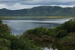 La Yaya Reservoir | |
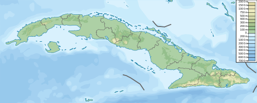 Location of La Yaya Dam in Cuba | |
| Country | Cuba |
| Location | Niceto Pérez, Guantánamo Province |
| Coordinates | 20°7′36.94″N 75°21′33.45″W |
| Purpose | Flood control, water supply |
| Status | Operational |
| Opening date | 1973 |
| Dam and spillways | |
| Type of dam | Embankment |
| Impounds | Guantánamo River |
| Elevation at crest | 85.7 m (281 ft) |
| Spillway type | Chute, free overflow |
| Spillway capacity | 3,900 m3/s (140,000 cu ft/s) |
| Reservoir | |
| Creates | La Yaya Reservoir |
| Total capacity | 160,000,000 m3 (130,000 acre⋅ft) |
| Active capacity | 146,000,000 m3 (118,000 acre⋅ft) |
| Catchment area | 555 km2 (214 sq mi) |
| Surface area | 13.3 km2 (5.1 sq mi) |
| Maximum length | 7.6 km (4.7 mi) |
| Normal elevation | 79.1 m (260 ft) |
References
- "Storage Capacity Lost in Cuban Reservoirs. An Effect of Sedimentation" (PDF) (in Spanish). UNESCO. September 2010. Retrieved 30 April 2014.
- "Deliver a Document Certifying The Seven Fundamental Engineering Works Guantanamo Province" (in Spanish). OBRAS. Archived from the original on 2 May 2014. Retrieved 30 April 2014.
- "Situacion actual y perspectivas de las energias" (PDF) (in Spanish). Empresa de Hidroenergia. Archived from the original (PDF) on 23 September 2015. Retrieved 30 April 2014.
This article is issued from Wikipedia. The text is licensed under Creative Commons - Attribution - Sharealike. Additional terms may apply for the media files.