Kume, Okayama
Kume (久米町, Kume-chō) was a town located in Kume District, Okayama Prefecture, Japan.
Kume 久米町 | |
|---|---|
Former municipality | |
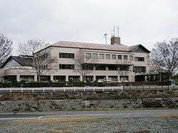 Former Kume town hall | |
 Kume Location in Japan | |
| Coordinates: 35°3′34″N 133°54′1″E | |
| Country | Japan |
| Region | Chūgoku |
| Prefecture | Okayama Prefecture |
| District | Kume |
| Merged | February 28, 2005 (now part of Tsuyama) |
| Area | |
| • Total | 74.39 km2 (28.72 sq mi) |
| Population (2003) | |
| • Total | 7,396 |
| • Density | 99.42/km2 (257.5/sq mi) |
| Symbols | |
| • Tree | Prunus mume |
| • Flower | Chrysanthemum |
| Time zone | UTC+9 (JST) |
As of 2003, the town had an estimated population of 7,396 and a density of 99.42 persons per km². The total area was 74.39 km².
On February 28, 2005, Kume, along with the town of Kamo, the village of Aba (both from Tomata District), and the town of Shōboku (from Katsuta District), was merged into the expanded city of Tsuyama and no longer exists as an independent municipality.
Education
- Kyōsyō Elementary School
- Chūsei Elementary School
- Seidō Elementary School
- Shūjitsu Elementary School
- Kume Junior High School
Transportation
Road
- Expressways:
- Chūgoku Expressway
- Kume Bus Stop
- Innoshō Interchange (Tsuyama)
- Chūgoku Expressway
- National highways:
- Prefectural roads:
- Okayama Prefectural Route 70 (Kume-Takebe)
- Okayama Prefectural Route 159 (Kume-Chūō)
- Okayama Prefectural Route 205 (Mimasaka-Sendai Station)
- Okayama Prefectural Route 335 (Yonokami-Kume)
- Okayama Prefectural Route 337 (Yamashiro-Miyao)
- Okayama Prefectural Route 339 (Nishiichinomiya-Nakagitakami)
- Okayama Prefectural Route 340 (Kōmoto-Kume)
- Okayama Prefectural Route 341 (Tsuboi-Shimotochibara)
- Okayama Prefectural Route 455 (Koyama-Kuwakami)
- Roadside Station
- Kume no Sato
External links
- Official website of Tsuyama in Japanese (some English content)
| Authority control |
|
|---|
This article is issued from Wikipedia. The text is licensed under Creative Commons - Attribution - Sharealike. Additional terms may apply for the media files.