Türkmenbaşy, Turkmenistan
Türkmenbaşy (Turkmen Cyrillic: Түркменбашы, Turkmen Arabic; توركمنباشی, also spelled Turkmenbashi, Түркменбаши), formerly known as Krasnovodsk (Russian: Красноводск) and Kyzyl-Su, is a city in Balkan Region in Turkmenistan, on the Krasnovodsk Gulf of the Caspian Sea. It sits at an elevation of 27 metres (89 feet). The population (est 2004) was 86,800, mostly ethnic Russians, Armenians and Azeris. As the terminus of the Trans-Caspian Railway, it was an important transportation center.
Türkmenbaşy Түркменбашы | |
|---|---|
.jpg) Entrance sign to Türkmenbaşy | |
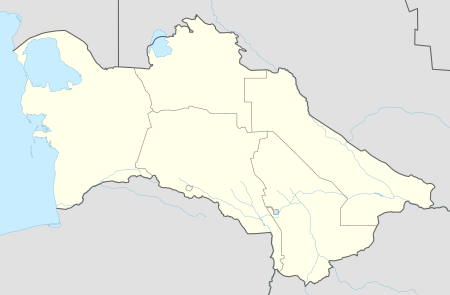 Türkmenbaşy Location in Turkmenistan | |
| Coordinates: 40°01′00″N 52°58′00″E | |
| Country | |
| Region | Balkan |
| Named for | Saparmurat Niyazov |
| Elevation | 27 m (89 ft) |
| Population (2010) | |
| • Total | 73 000 |
| Time zone | UTC+5 |
| Area code(s) | 993 243 XXXXX |
History
In 1717, Russian Prince Alexander Bekovich-Cherkassky landed and established a secret fortified settlement on this location, where the dry bed of a former mouth of the Amu-Darya River once emptied into the Caspian Sea. His intent was to march an army up this dry riverbed and conquer the Khanate of Khiva. The expedition failed, and the Russians abandoned the settlement for over 150 years.
Krasnovodsk
%2C_Turkmenistan_(1902).jpg)
In 1869, the Russians invaded a second time. Having captured it, they named their fort Krasnovodsk (Красноводск), which is the Russian version of the original name, Kyzyl-Su (Red Water). The fort, Krasnovodsk, served as Imperial Russia's base of operations against Khiva and Bukhara, and the nomadic Turkmen tribes.
The railway had originally begun from Uzun-Ada on the Caspian Sea, but the terminus was shifted north to the harbour at Krasnovodsk.[1]
It fell to the Red Army in February, 1920.
On November 21, 1939 was formed Krasnovodsk Oblast with the administrative center in Krasnovodsk. The oblast was repeatedly liquidated and restored (January 23, 1947 liquidated; April 4, 1952 restored; December 9, 1955 liquidated; December 27, 1973 restored; August 25, 1988 eliminated).
Türkmenbaşy
January 10, 1991 in the former Krasnovodsk region formed Balkan Region (May 18, 1992 - velayat) with the center in Balkanabat. In 1993, Krasnovodsk was renamed by President for Life Saparmurat Niyazov, after his self-proclaimed title Türkmenbaşy ("Leader of all Turkmen").
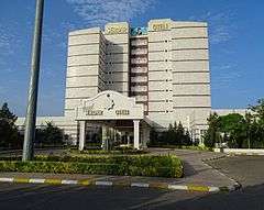
Second President of Turkmenistan Gurbanguly Berdimuhamedow pledged, in July 2007, to invest one billion dollars into a project slated to turn Türkmenbaşy into a major tourist resort – the center of the Awaza tourist zone with 60 modern hotels to be built along a 16 km (10 mi) stretch of the Caspian Sea shoreline.[2][3] The Türkmenbaşy city has two modern hotels - Türkmenbashi Hotel and Charlak Hotel and old soviet Hazar Hotel.
In recent years, the city made large-scale reconstruction historic district, entrance roads, vital infrastructure.[4] A new Turkish Park and the cascade of fountains.[5] By the end of 2012 Magtymguly Avenue had been completely renovated, the new route merged with the city's waterfront Bahry Hazar, providing the west motorway junction Balykçy double out of the city along the dike, paved across the Soymonov bay speed motorway Turkmenbashi Airport—Awaza.[6] In 2014, the Oilworkers Palace of Culture, which was built in 1951, was renovated.[7]
The city housed the State Service of Maritime and River Transport of Turkmenistan, part of the Government of Turkmenistan.[8]
Administrative divisions
In July 2013 as part of the city of Turkmenbashi was created two etraps - Avaza Etrap and Kenar Etrap.[9] In Avaza Etrap, an area of 9660 hectares and includes the national tourist zone Awaza, Turkmenbashi International Airport and a few small towns. In Kenar Etrap, an area of 7262 hectares, entered the main part of the city of Turkmenbashi and the territory of the village of Kenar.[10]
Geography
Climate
Türkmenbaşy has a cold desert climate (BWk, according to the Köppen climate classification), with hot summers and chilly winters. The average temperatures are 3 °C in January and 28 °C in July. The average annual precipitation is 125 mm (5 in).
| Climate data for Türkmenbaşy (1981–2010) | |||||||||||||
|---|---|---|---|---|---|---|---|---|---|---|---|---|---|
| Month | Jan | Feb | Mar | Apr | May | Jun | Jul | Aug | Sep | Oct | Nov | Dec | Year |
| Record high °C (°F) | 20.7 (69.3) |
23.3 (73.9) |
29.0 (84.2) |
36.0 (96.8) |
40.7 (105.3) |
43.3 (109.9) |
44.7 (112.5) |
44.5 (112.1) |
43.5 (110.3) |
33.4 (92.1) |
28.1 (82.6) |
24.6 (76.3) |
44.7 (112.5) |
| Average high °C (°F) | 7.5 (45.5) |
8.7 (47.7) |
13.1 (55.6) |
19.9 (67.8) |
25.8 (78.4) |
31.6 (88.9) |
34.6 (94.3) |
34.5 (94.1) |
29.3 (84.7) |
21.5 (70.7) |
14.2 (57.6) |
9.1 (48.4) |
20.8 (69.4) |
| Daily mean °C (°F) | 3.3 (37.9) |
3.9 (39.0) |
7.7 (45.9) |
13.7 (56.7) |
19.5 (67.1) |
25.1 (77.2) |
28.2 (82.8) |
28.0 (82.4) |
22.7 (72.9) |
15.4 (59.7) |
9.3 (48.7) |
4.9 (40.8) |
15.1 (59.2) |
| Average low °C (°F) | −0.3 (31.5) |
−0.2 (31.6) |
3.2 (37.8) |
8.5 (47.3) |
13.6 (56.5) |
18.9 (66.0) |
22.2 (72.0) |
22.0 (71.6) |
16.7 (62.1) |
10.0 (50.0) |
5.0 (41.0) |
1.2 (34.2) |
10.1 (50.2) |
| Record low °C (°F) | −21.5 (−6.7) |
−21.9 (−7.4) |
−12.6 (9.3) |
−2.6 (27.3) |
0.9 (33.6) |
6.6 (43.9) |
14.1 (57.4) |
10.2 (50.4) |
3.3 (37.9) |
−3.1 (26.4) |
−12.1 (10.2) |
−16.3 (2.7) |
−21.9 (−7.4) |
| Average precipitation mm (inches) | 12 (0.5) |
13 (0.5) |
17 (0.7) |
16 (0.6) |
9 (0.4) |
3 (0.1) |
2 (0.1) |
5 (0.2) |
5 (0.2) |
11 (0.4) |
19 (0.7) |
14 (0.6) |
126 (5.0) |
| Average rainy days | 8 | 7 | 8 | 8 | 6 | 3 | 2 | 3 | 3 | 6 | 8 | 8 | 70 |
| Average snowy days | 4 | 4 | 1 | 0.1 | 0 | 0 | 0 | 0 | 0 | 0 | 0 | 2 | 11 |
| Average relative humidity (%) | 76 | 72 | 68 | 63 | 56 | 50 | 49 | 44 | 46 | 58 | 72 | 75 | 61 |
| Mean monthly sunshine hours | 136.6 | 139.0 | 172.6 | 227.0 | 303.2 | 347.0 | 344.0 | 330.2 | 294.1 | 228.8 | 161.9 | 124.0 | 2,808.4 |
| Source 1: Pogoda.ru.net [11] | |||||||||||||
| Source 2: NOAA (sun, 1961–1990)[12] | |||||||||||||
Economy
Western Turkmenistan has major petroleum and natural gas reserves, and Turkmenistan's largest oil refinery is in Türkmenbaşy.
Sights
- Museum of Regional History
- Gate to former Krasnovodsk fort
- Beaches
- Khazar Nature Reserve
- Natural History Museum
Religion
Russian Orthodox Church
The Church of St. Michael the Archangel is a gift of the Astrakhan diocese of the Russian Orthodox Church.[13] In 1895 it was moved to Krasnovodsk from a flooded peninsula Uzun Ada by Russian soldiers.[14]
Armenian Apostolic Church
The church was built in 1903. Currently it does not function and needs a major renovation.[15]
Sport
The city has a Şagadam Stadium which is based on the professional football club Şagadam FK.[16]
Cellular
The city has two mobile operators : Altyn Asyr, which was implemented in 2007, and which has a 4G technology network with LTE since 2010. The 4G network covers all areas of the city and the Turkmenbashi International Airport. There is also cooperation with the Russian mobile operator MTS Turkmenistan.[17]
Transport
The city is important as transport junction, formed by sea port with ferry terminal, airport and railway station.[18] It runs through the city M37 highway linking Garabogaz, Ashgabat and Bukhara.
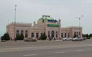
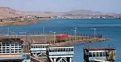
Türkmenbaşy is Turkmenistan's only port and sea link to the West. A ferry service connects Türkmenbaşy to Baku, Azerbaijan, which is about 260 kilometers across the Caspian Sea. It is the western terminus of the Trans-Caspian railway, which connects the city to Turkmenistan's capital Ashgabat and points further east, Turkmenbashi railway station was built in 1895. The city is also connected to Ashgabat by bus.
Turkmenbashi International Airport
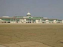
Initially Turkmenbashi Airport in 1940 was located at the bottom of the plateau, near Krasnovodsk hospital. During World War II he was transferred to the top plateaus and the airfield was co-location with the Soviet Air Force. As an independent unit exists since 1959, after the creation of the 225th separate united air-squadron. In 2010 Turkmenbashi airport was reconstructed and gained international status. It has two runways.[19] Turkmenistan Airlines provides direct flights from Turkmenbashi Airport to Ashgabat, Daşoguz, Mary, Istanbul and Türkmenabat. To the airport from the city can be reached by car or bus. Time to town by car takes 10–15 minutes.
International relations
Consulates
Two consulates general are found in Türkmenbaşy.

See also
References
- "The United Service Magazine". 1900.
- "Turkmenistan starts tourist drive". BBC News. 2007-07-23. Retrieved 2007-07-23.
- Avaza Tourist Zone around Turkmenbashi Archived 2011-06-06 at the Wayback Machine
- "Золотой век". www.turkmenistan.gov.tm.
- "В Туркменбаши появится новая достопримечательность | Общество | ИП "ТУРКМЕНинформ"". www.turkmeninform.com.
- "Золотой век". www.turkmenistan.gov.tm.
- "Золотой век".
- "Города с таким названием скоро не будет. Красноводск-Туркменбаши-Этрап Аваза города Туркменбаши+Этрап Кенар города Туркменбаши".
- "Золотой век".
- "Weather and Climate- The Climate of Turkmenbashi" (in Russian). Weather and Climate (Погода и климат). Archived from the original on December 6, 2016. Retrieved December 6, 2016.
- "Turkmenbashy Climate Normals 1961–1990". National Oceanic and Atmospheric Administration. Retrieved April 1, 2015.
- "Приходы".
- "ТУРКМЕНБАШИНСКИЙ МИХАИЛО-АРХАНГЕЛЬСКИЙ ХРАМ - Древо".
- "Президент Туркменистана поручил восстановить единственную уцелевшую в стране армянскую церковь - yerkramas.org". yerkramas.org.
- ""Шагадам" cделал весомую заявку на "бронзу" | Спорт".
- "Kompaniýa". www.company.mts.tm.
- "Турецкая Polimeks построит в Туркмении аэропорт стоимостью 125 млн. евро (АвиаПорт)".
- "Лента событий | Интернет-газета Turkmenistan.Ru".
- "Sadraudzības pilsētas". jurmala.lv. Retrieved 26 April 2014. (in Latvian and English)
External links
| Wikimedia Commons has media related to Türkmenbaşy, Turkmenistan. |
| Wikivoyage has a travel guide for Turkmenbashi. |
Capital: Ashgabat | |