Kongakut River
The Kongakut River flows through parts of North Slope Borough in the U.S. state of Alaska.[1] It begins in the Davidson Mountains of the Brooks Range in the northeastern corner of the state, near the border with Yukon Territory in Canada.[3] The Kongakut flows generally northeast and north through the Arctic National Wildlife Refuge to the Beaufort Sea northwest of Demarcation Point.[3] It was formerly sometimes called the Turner River but that name is now applied to a smaller stream in the vicinity due to confusion as to which was originally meant. The name Kongakut comes from the Inupiaq name for the river, meanining roughly "deer pond".[4]
| Kongakut River | |
|---|---|
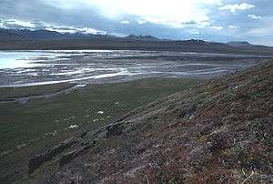 Kongakut River in summer | |
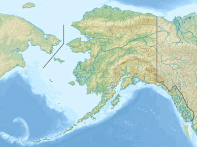 Location of the mouth of the Kongakut River in Alaska | |
| Location | |
| Country | United States |
| State | Alaska |
| Borough | North Slope |
| Physical characteristics | |
| Source | |
| ⁃ location | Davidson Mountains |
| ⁃ coordinates | 68°48′47″N 143°22′47″W[1] |
| ⁃ elevation | 5,521 ft (1,683 m)[2] |
| Mouth | Siku Lagoon |
⁃ location | Beaufort Sea |
⁃ coordinates | 69°46′35″N 141°42′16″W[1] |
⁃ elevation | 0 ft (0 m)[1] |
See also
- List of Alaska rivers
References
- "Kongakut River". Geographic Names Information System. United States Geological Survey. January 1, 2000. Retrieved September 2, 2013.
- Source elevation derived from Google Earth search using GNIS source coordinates.
- Alaska Atlas & Gazetteer (7th ed.). Yarmouth, Maine: DeLorme. 2010. p. 137. ISBN 978-0-89933-289-5.
- Orth, Donald (1967) Dictionary of Alaska Place Names Geological Survey professional paper, Volume 567. USGS. Government Printing Office, Washington. pp 539, 994
| Wikimedia Commons has media related to Kongakut River. |
This article is issued from Wikipedia. The text is licensed under Creative Commons - Attribution - Sharealike. Additional terms may apply for the media files.