Knaplundsøya
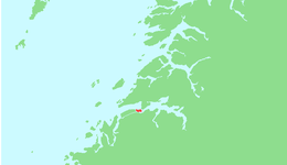
Knaplundsøya or Godøya is an island in Bodø Municipality in Nordland county, Norway. The 6.6-square-kilometre (2.5 sq mi) island lies just southeast of the town of Bodø, between the Saltfjorden and the Skjerstadfjorden. The island is connected to the mainland and to the neighboring island of Straumøya by the Norwegian County Road 17. The Saltstraumen strait and its famous maelstrom are located between Straumøya and Knaplundsøya. The island had 392 residents in 2016, mostly living on the north and west shores of the island.[1]
 View of the island on the left | |
 | |
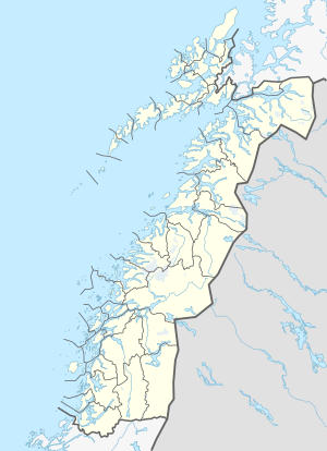 Knaplundsøya Location of the island  Knaplundsøya Knaplundsøya (Norway) | |
| Geography | |
|---|---|
| Location | Nordland, Norway |
| Coordinates | 67.2319°N 14.6742°E |
| Area | 6.6 km2 (2.5 sq mi) |
| Length | 4.7 km (2.92 mi) |
| Width | 1.9 km (1.18 mi) |
| Highest elevation | 178 m (584 ft) |
| Highest point | Storbranden |
| Administration | |
Norway | |
| County | Nordland |
| Municipality | Bodø Municipality |
See also
References
- Thorsnæs, Geir, ed. (2016-05-30). "Godøya – øy i Bodø". Store norske leksikon (in Norwegian). Kunnskapsforlaget. Retrieved 2019-01-28.
This article is issued from Wikipedia. The text is licensed under Creative Commons - Attribution - Sharealike. Additional terms may apply for the media files.