Kincardine Municipal Airport
Kincardine Airport (IATA: YKD, ICAO: CYKM) is located 1.5 nautical miles (2.8 km; 1.7 mi) north-northeast of Kincardine, Ontario, Canada.
Kincardine Municipal Airport | |||||||||||||||
|---|---|---|---|---|---|---|---|---|---|---|---|---|---|---|---|
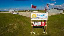 Aerial photo of runways, ramps, taxiways, apron, hangars and terminal building at CYKM | |||||||||||||||
| Summary | |||||||||||||||
| Airport type | Public | ||||||||||||||
| Operator | Municipality of Kincardine | ||||||||||||||
| Location | Kincardine, Ontario | ||||||||||||||
| Time zone | EST (UTC−05:00) | ||||||||||||||
| • Summer (DST) | EDT (UTC−04:00) | ||||||||||||||
| Elevation AMSL | 772 ft / 235 m | ||||||||||||||
| Coordinates | 44°12′05″N 081°36′20″W | ||||||||||||||
| Website | www.kincardineairport.ca | ||||||||||||||
| Map | |||||||||||||||
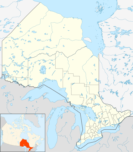 CYKM Location in Ontario | |||||||||||||||
| Runways | |||||||||||||||
| |||||||||||||||
Source: Canada Flight Supplement[1] | |||||||||||||||
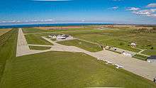
CYKM Aerial View
Kincardine Municipal Airport is a Transport Canada registered aerodrome north of the town of Kincardine on Highway 21.
The airport complex occupies 120 acres (49 ha), overlooking Lake Huron. It serves as a base for sightseeing, corporate jets, air ambulance services and recreational pilots, some of whom own private hangars on the airport grounds. There are two paved runways with a full ARCAL system along with NDB/DME and GPS LPV approaches.
References
- Canada Flight Supplement. Effective 0901Z 30 January 2020 to 0901Z 26 March 2020.
External links
- Kincardine Airport Website & Webcams
- NAVCANADA Weather Cameras for CYKM
- Kincardine Airport page on COPA's Places to Fly
| By name | |
|---|---|
| By location indicator | |
| By province/territory | |
| By area | |
| National Airports System | |
| Related | |
| |
This article is issued from Wikipedia. The text is licensed under Creative Commons - Attribution - Sharealike. Additional terms may apply for the media files.